Understanding the Laconia Phase III Ocean Bottom Node Survey
The latest breakthrough in TGS Viridien survey Gulf exploration has emerged through a technological collaboration that pushes the boundaries of deepwater subsurface imaging. This ultra-long offset ocean bottom node survey represents a significant advancement in how the industry innovation trends visualise complex geological structures beneath one of the world's most challenging deepwater basins.
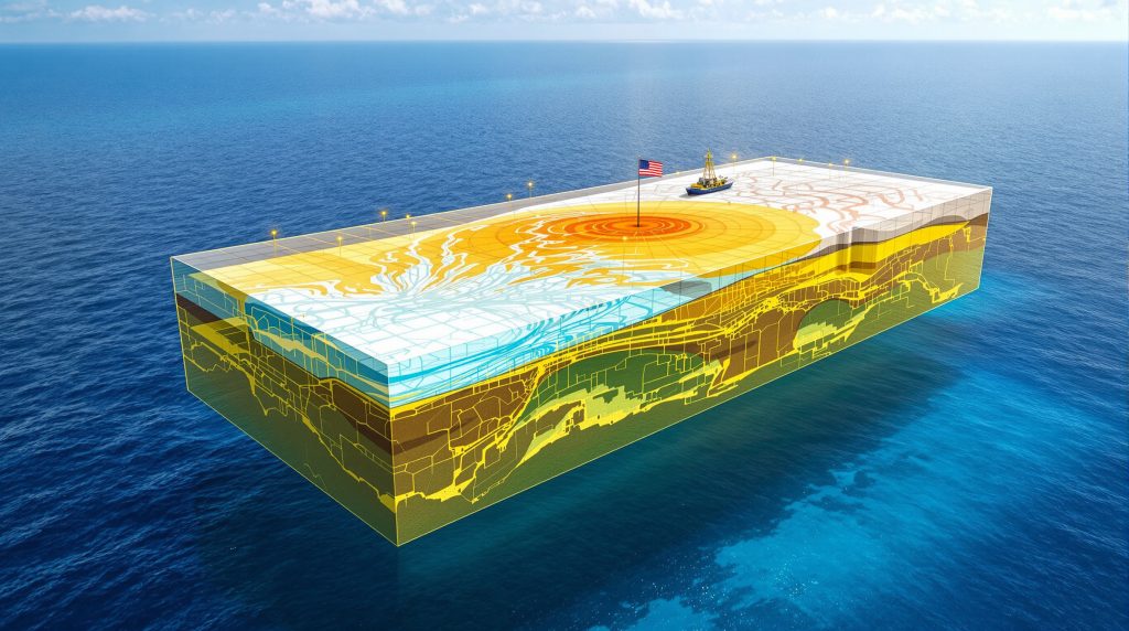
The Laconia Phase III survey covers 151 Outer Continental Shelf blocks across the Gulf of America, utilising cutting-edge ocean bottom node technology combined with advanced processing methodologies. Released in November 2025, the initial 5Hz Acoustic Time-Lag Full Waveform Inversion (AFWI) data products demonstrate substantial improvements in subsurface clarity compared to legacy seismic datasets.
Survey Specifications and Technical Parameters
The technical specifications of this TGS Viridien survey Gulf exploration represent a convergence of multiple advanced seismic technologies:
- Coverage Area: 151 Outer Continental Shelf blocks
- Technology Platform: Ultra-long offset ocean bottom node configuration
- Initial Processing: 5Hz Acoustic Time-Lag Full Waveform Inversion
- Source Configuration: Dual Tuned Pulsed Source low-frequency system
- Survey Designation: Laconia Phase III (building on previous phases)
The deployment of dual Tuned Pulsed Source systems represents a significant operational achievement in deepwater conditions. According to David Hajovsky, EVP Multi-Client at TGS, the successful and safe towing of the dual TPS low-frequency source reflects exceptional operational capabilities and precision in one of the Gulf's most technically demanding geological plays.
Key Performance Metrics and Capabilities
| Technical Aspect | Specification | Industry Impact |
|---|---|---|
| Frequency Range | 5Hz initial, 12Hz final | Enhanced subsalt penetration |
| Imaging Method | Elastic TLFWI processing | Superior reservoir characterisation |
| Coverage Scope | Complete OCS block area | Comprehensive basin analysis |
| Data Quality | Industry-leading resolution | Reduced exploration uncertainty |
The ultra-long offset configuration enables extended receiver arrays that capture diving waves – seismic rays that penetrate deep into the subsurface before returning to the surface. This capability proves particularly valuable for imaging through complex salt geometries that historically have obscured underlying Paleogene formations.
How Do These Survey Results Impact Paleogene Play Exploration?
The newly released imaging data reveals dramatic improvements in visualising the Gulf's most challenging geological formations. Paleogene plays represent massive untapped hydrocarbon resources within the region, yet their complex subsalt architecture has historically created significant exploration challenges and increased drilling risks.
Dechun Lin, EVP Earth Data at Viridien, emphasised that the early results demonstrate the impact of advanced imaging technologies in unlocking the potential of deepwater Paleogene formations. The enhanced visualisation capabilities reveal previously obscured geological details that could potentially access billions of barrels in undeveloped resources.
Imaging Enhancement Achievements
The TGS Viridien survey Gulf exploration delivers substantial improvements across multiple technical dimensions:
- Subsurface Clarity: Dramatic resolution improvement over legacy 15Hz RTM datasets
- Risk Reduction: Enhanced geological understanding supporting exploration decisions
- Structural Definition: Superior delineation of reservoir boundaries and fault systems
- Salt Body Mapping: Precise characterisation of complex salt geometries
Critical Breakthrough: The advanced ocean bottom node imaging reveals previously invisible geological structures beneath salt formations, potentially transforming how the industry approaches deepwater Paleogene exploration strategies.
Geological Target Advantages
The enhanced imaging capabilities provide specific advantages for Paleogene exploration. Furthermore, the mineral exploration importance extends beyond traditional mining sectors into offshore hydrocarbon exploration.
Structural Mapping Benefits:
- Salt Body Delineation: Precise mapping of complex salt structures and their boundaries
- Fault System Identification: Enhanced characterisation of fault networks and their impact on hydrocarbon migration
- Reservoir Quality Assessment: Improved evaluation of porosity and permeability variations through elastic properties
- Drilling Risk Mitigation: Accurate depth positioning and hazard identification for wellbore planning
The Paleogene geological sequence, deposited approximately 66 to 23 million years ago, contains clastic sediments laid down in deepwater environments. The complexity of imaging these formations arises from overlying salt structures that create velocity anomalies, causing seismic ray bending and shadowing effects that traditional imaging methods struggle to penetrate effectively.
What Timeline Governs the Survey Data Release Schedule?
The phased delivery approach ensures exploration companies receive progressively enhanced datasets aligned with critical industry decision-making cycles. This structured timeline strategically supports lease evaluation, post-acquisition planning, and detailed prospect development phases.
Delivery Milestones and Data Products
Current Phase (November 2025):
- 5Hz Acoustic TLFWI products available across entire 151-block survey area
- Complete coverage supporting initial prospect screening and regional interpretation
- Risk assessment capabilities for upcoming lease opportunities
- Structural mapping suitable for lease bidding decisions
First Quarter 2026:
- Fast Track 5Hz Elastic TLFWI (EFWI) delivery
- Enhanced reservoir characterisation through elastic parameter extraction
- Improved lithology discrimination capabilities
- Advanced fluid substitution modelling support
January 2027:
- Final 12Hz EFWI volumes representing maximum resolution processing
- Complete elastic parameter analysis including P-wave velocity, S-wave velocity, and density
- Highest quality subsurface imaging for detailed development planning
- Comprehensive elastic property characterisation
Strategic Timing Considerations
The data release schedule strategically aligns with major industry activities. In addition, the timeline synchronises with TGS Gulf of America survey milestones:
- December 10, 2025: US offshore lease sale BBG 1 (lease sale 262) decision support
- Early 2026: Enhanced datasets for post-lease exploration strategy refinement
- 2027: Final high-resolution products for detailed prospect evaluation and drilling program design
This progression enables companies to make informed lease bidding decisions with initial 5Hz data, then progressively refine their understanding as enhanced elastic products become available for detailed reservoir analysis and development planning.
Which Advanced Technologies Drive These Survey Capabilities?
The technological foundation of this TGS Viridien survey Gulf exploration represents a convergence of multiple cutting-edge seismic innovations working synergistically to overcome traditional limitations in deepwater imaging. These systems collectively address the specific challenges posed by complex salt-dominated geological environments.
Ocean Bottom Node Configuration Advantages
The ultra-long offset ocean bottom node deployment provides fundamental advantages over conventional towed streamer systems. Moreover, these data-driven operations utilise advanced sensor technologies:
Operational Benefits:
- Extended receiver arrays: Enable comprehensive subsurface illumination through diving wave capture
- Full-azimuth data acquisition: 360-degree source illumination for complete structural imaging
- Stationary receiver positioning: Eliminates motion-induced noise common in towed systems
- Superior signal-to-noise ratios: Fixed seafloor deployment reduces environmental interference
- Enhanced offset extension: Multiple source vessel passes extend total offset ranges significantly
Ocean bottom nodes represent an evolution from conventional streamer technology by placing hydrophone receivers directly on the seafloor in precise arrays. Unlike towed systems that move with survey vessels, OBN technology maintains exact receiver positions throughout data acquisition, enabling repeated measurements and improved data consistency.
Dual Source Technology Implementation
The deployment of dual Tuned Pulsed Source systems represents a significant operational achievement in deepwater conditions:
| Technical Feature | Operational Benefit | Exploration Impact |
|---|---|---|
| Low-frequency output | Deep penetration capability | Enhanced basement-level imaging |
| Dual source configuration | Increased data density | Improved structural resolution |
| Precise operational control | Consistent data quality | Reliable subsurface mapping |
| Broadband frequency range | Complete wavefield capture | Comprehensive reservoir analysis |
The low-frequency source characteristics enable enhanced penetration through complex velocity structures, particularly the high-velocity salt bodies that dominate Gulf of America geology. This capability proves essential for imaging underlying Paleogene formations that contain substantial hydrocarbon resources.
Full Waveform Inversion Processing Evolution
The survey employs advanced inversion methodologies that process complete seismic waveforms rather than simplified amplitude interpretations. Similarly, AI in drilling technology demonstrates how advanced algorithms transform subsurface exploration:
Time-Lag Full Waveform Inversion (TLFWI):
- Processes multiple arrival times within individual seismic traces
- Improves velocity model accuracy through iterative refinement algorithms
- Addresses complex transmission effects in heterogeneous media
- Provides superior subsalt velocity resolution compared to conventional processing
Elastic Full Waveform Inversion (EFWI):
- Inverts both compressional (P-wave) and shear (S-wave) seismic information
- Derives multiple elastic parameters: P-wave velocity, S-wave velocity, and density
- Enables advanced lithology discrimination and fluid substitution analysis
- Supports comprehensive reservoir characterisation beyond structural mapping
How Does This Survey Compare to Previous Gulf Exploration Efforts?
The Laconia Phase III initiative builds upon decades of seismic technology evolution in the Gulf of America, representing the latest advancement in a continuous progression toward increasingly sophisticated subsurface imaging capabilities. This survey establishes new benchmarks for deepwater seismic quality and exploration effectiveness.
Historical Context and Evolution
Previous Generation Limitations:
Traditional Gulf exploration faced significant technological constraints:
- Limited frequency bandwidth: Restricted resolution capabilities for detailed structural interpretation
- Conventional streamer acquisition: Coverage gaps and reduced data quality in challenging conditions
- Insufficient subsalt imaging: Poor visualisation of structures beneath complex salt geometries
- Higher exploration uncertainty: Increased drilling risk due to inadequate subsurface characterisation
Current Generation Advantages:
The Laconia Phase III survey addresses these historical limitations through:
- Full waveform inversion processing: Enhanced accuracy through complete wavefield utilisation
- Ocean bottom node deployment: Superior data quality and extended offset capability
- Advanced dual source technology: Improved penetration and resolution
- Comprehensive basin coverage: Reduced exploration blind spots across 151 OCS blocks
Competitive Positioning Analysis
Visual comparison data from the survey release demonstrates substantial improvement over legacy datasets. The comparison between legacy 15Hz Reverse Time Migration and the new 5Hz Acoustic TLFWI processing reveals that advanced inversion methodology can deliver superior imaging quality even at lower frequency content. However, the sensor technology advancement shows similar precision improvements across industries.
Industry Perspective: This technological advancement establishes new standards for deepwater seismic acquisition and processing, potentially influencing future exploration strategies across the Gulf basin and similar geological settings worldwide.
Processing Methodology Progression:
Legacy Reverse Time Migration (RTM):
- One-way wave equation solutions for image generation
- Amplitude-preserved imaging with limited velocity updating
- Computationally intensive but established technology
- Suitable for regional structural interpretation
Current Full Waveform Inversion:
- Two-way wave equation solutions with iterative model refinement
- Comprehensive velocity model building through waveform matching
- Advanced computational algorithms for complex media
- Detailed reservoir characterisation capabilities
What Are the Implications for Upcoming Lease Sale Activities?
The strategic timing of these TGS Viridien survey Gulf exploration results creates significant competitive advantages for companies participating in the December 2025 lease sale. Access to superior subsurface imaging data directly influences bidding strategies, risk assessment, and prospect evaluation processes across the Gulf exploration landscape.
Lease Sale BBG 1 Strategic Considerations
December 10, 2025 Lease Sale Impact:
The availability of enhanced imaging data provides multiple strategic advantages:
- Enhanced geological confidence: Superior subsalt imaging reduces uncertainty in prospect evaluation
- Improved prospect ranking: Better structural definition enables more accurate resource assessment
- Competitive bidding advantage: Companies with data access can make more informed economic decisions
- Reduced post-lease exploration risk: Advanced imaging supports more effective drilling program design
Companies participating in lease sale 262 can utilise the 5Hz Acoustic TLFWI products for initial prospect screening and risk assessment, providing a substantial information advantage over those relying on legacy seismic datasets. For instance, the US Gulf seismic survey insights reveal critical acreage opportunities ahead of the upcoming lease sale.
Exploration Risk Mitigation Factors
Key Risk Reduction Elements:
- Structural Clarity: Precise mapping of fault systems and salt body boundaries reduces drilling hazards
- Reservoir Definition: Enhanced identification of potential pay zones improves development planning
- Drilling Hazard Assessment: Superior imaging enables better wellbore path optimisation
- Economic Evaluation: More accurate resource estimation supports improved investment decisions
The Bureau of Ocean Energy Management lease sale process typically requires companies to submit competitive bids based on their geological assessment of each block's hydrocarbon potential. Access to advanced seismic data significantly improves the accuracy of these evaluations and reduces the uncertainty inherent in deepwater exploration investments.
Frequently Asked Questions About the TGS Viridien Gulf Survey
What distinguishes this survey from conventional seismic programs?
The Laconia Phase III survey combines ultra-long offset ocean bottom node technology with dual low-frequency sources and advanced full waveform inversion processing. This integration provides unprecedented subsurface illumination capabilities that overcome traditional limitations in salt-dominated basins by capturing diving waves that penetrate complex geological structures more effectively than conventional methods.
How does the phased data delivery benefit exploration companies?
The structured release schedule enables companies to progressively refine their geological understanding in alignment with industry decision cycles. Initial 5Hz acoustic products support lease evaluation and bidding decisions, while subsequent elastic products delivered in 2026 and 2027 enable detailed reservoir characterisation and drilling program optimisation.
Which geological targets benefit most from this advanced imaging?
Deepwater Paleogene formations beneath complex salt structures represent the primary beneficiaries of this technology. These geological sequences contain substantial undeveloped hydrocarbon resources but historically required superior imaging capabilities to reduce exploration risk and optimise drilling locations due to the challenging subsalt environment.
What technical specifications define the survey coverage?
The survey encompasses 151 Outer Continental Shelf blocks using ultra-long offset ocean bottom node arrays with dual Tuned Pulsed Source low-frequency systems. Processing includes initial 5Hz Acoustic Time-Lag Full Waveform Inversion, progressing to 5Hz Elastic TLFWI in Q1 2026, and final 12Hz Elastic TLFWI delivery in January 2027.
How does ocean bottom node technology improve data quality?
Ocean bottom nodes eliminate motion-induced noise by placing receivers in fixed positions on the seafloor, enabling extended offset acquisition through multiple source vessel passes. This configuration provides full-azimuth data coverage, superior signal-to-noise ratios, and enhanced diving wave capture for improved subsalt imaging compared to conventional towed streamer systems.
Future Implications for Gulf of America Exploration Strategy
The successful deployment and early results from this advanced survey program signal a transformation in deepwater exploration capabilities across the Gulf of America. The enhanced subsurface understanding demonstrated by this technology could unlock previously inaccessible resources and fundamentally reshape industry approaches to complex geological challenges.
Long-term Industry Impact Assessment
Technological Advancement Trajectory:
The Laconia Phase III results establish several important precedents for future Gulf exploration:
- New industry standards: Advanced imaging quality benchmarks for deepwater seismic programs
- Global technology transfer: Potential replication of these methods in other challenging basins worldwide
- Digital integration opportunities: Enhanced datasets supporting artificial intelligence and machine learning applications
- Real-time monitoring evolution: Foundation for future 4D seismic and reservoir surveillance programs
The integration of ultra-long offset ocean bottom node technology with advanced full waveform inversion processing creates a new paradigm for subsalt exploration. This approach may influence industry standards for seismic acquisition in complex geological environments beyond the Gulf of America.
Resource Development Implications
The improved imaging capabilities demonstrated by this survey may catalyse renewed exploration interest in previously marginal Paleogene prospects. Enhanced subsurface visualisation reduces drilling risk and improves prospect evaluation accuracy, potentially extending the productive life of Gulf basins through more effective resource recovery.
Strategic Considerations for Future Development:
- Prospect portfolio optimisation: Better imaging enables more selective drilling programs focused on highest-confidence targets
- Infrastructure planning: Enhanced structural understanding supports more effective field development strategies
- Technology integration: Advanced datasets provide foundation for incorporating emerging digital technologies
- Risk management enhancement: Superior subsurface characterisation reduces exploration and development uncertainties
The convergence of ocean bottom node acquisition, dual source technology, and full waveform inversion processing represents a significant step forward in addressing the technical challenges that have historically limited deepwater exploration success rates in complex salt-dominated environments.
Economic and Strategic Outlook
The enhanced exploration capabilities demonstrated through this survey could support long-term energy security objectives by improving access to domestic hydrocarbon resources. The technological advancement creates opportunities for more efficient exploration capital deployment and potentially extends the economic life of Gulf of America hydrocarbon resources through improved recovery techniques.
Market Implications:
- Exploration efficiency improvements: Better success rates through enhanced geological understanding
- Investment risk reduction: Superior imaging supports more confident capital allocation decisions
- Technology service evolution: Advancement of specialised seismic acquisition and processing capabilities
- Competitive landscape changes: Companies with access to advanced imaging gain strategic advantages
The successful integration of these advanced technologies establishes a foundation for continued innovation in deepwater exploration, potentially maintaining the Gulf of America's position as a premier global hydrocarbon province through enhanced resource accessibility and development efficiency.
Ready to Capitalise on Advanced Exploration Technologies?
Discovery Alert's proprietary Discovery IQ model delivers real-time alerts on significant ASX mineral discoveries, instantly empowering subscribers to identify actionable opportunities ahead of the broader market. Understand why major mineral discoveries can lead to significant market returns by exploring Discovery Alert's dedicated discoveries page, showcasing historic examples of exceptional outcomes, and begin your 30-day free trial today to position yourself ahead of the market.