Understanding the Columbia River Flood Basalts
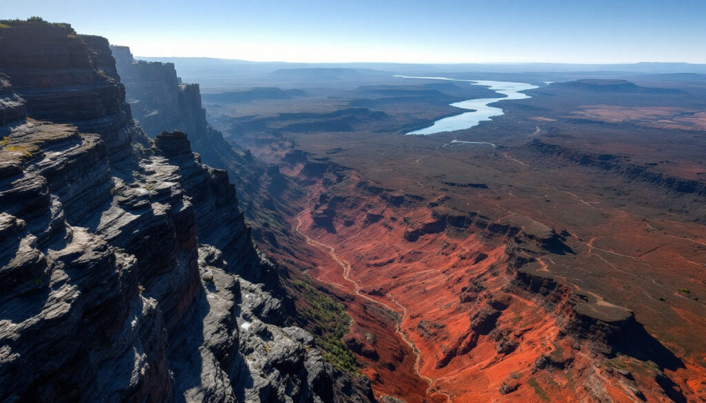
The Columbia River Flood Basalts (CRBG) represent one of Earth's most significant large igneous provinces, covering vast portions of the Pacific Northwest. Despite being smaller than other famous flood basalt provinces like the Deccan Traps and Siberian Traps (approximately one-fifth the size of the Deccan Traps), the CRBG stands out as one of the most recent and extensively studied flood basalt events in geological history.
Within this impressive formation, the Grand Ronde Basalt dominates, comprising over 70% of the total volume. This concentration of volcanic material in a single formation highlights the extraordinary intensity of volcanic activity during the formation period.
The CRBG presents an interesting geological context due to its proximity to the Cascade subduction zone. Unlike typical subduction-related volcanism that produces more silica-rich magmas, the Columbia River flood basalts represent a fundamentally different type of volcanic activity occurring simultaneously in the region, originating from mantle upwelling rather than subduction processes.
Formation and Structure of Flood Basalts
The Columbia River Flood Basalts exhibit diverse flow morphologies throughout the province. Geologists have identified multiple lava flow styles, including thinner sheet flows that spread rapidly across the landscape and thicker flows formed through a process called inflation.
These thicker, inflated flows likely developed when the core remained molten during extended eruption periods. As lava continued to flow beneath a solidified crust, the flows could expand and thicken substantially. This inflation process created distinctive flow structures that provide critical plate tectonics insights into eruption dynamics.
Recent field studies have revealed that CRBG lava flows could travel remarkable distances, with some extending hundreds of kilometers from their source vents. This extraordinary mobility results from the low-viscosity nature of basaltic magma, allowing it to flow like water across the landscape when erupted at high temperatures.
Geological Timeline and High-Precision Dating
The quest to accurately date the Columbia River Flood Basalts has presented significant challenges to geologists for decades. Traditional dating methods often yielded inconsistent results, leading to uncertainty about the exact timing and duration of these massive eruptions.
The Challenge of Dating Flood Basalts
Basaltic lava flows present a fundamental challenge for direct dating using zircon geochronology. Due to their mafic composition (low silica, high magnesium and iron), these basalts lack the necessary chemistry to crystallize zircon minerals, which are essential for high-precision uranium-lead dating. Zircons typically form in more silica-rich (felsic) magmas, making direct dating of the basalt flows impossible.
Instead, researchers must employ creative strategies, targeting interbedded sedimentary layers that occasionally separate the massive lava flows. These interbeds represent periods between eruptions when sediments accumulated on the landscape, sometimes containing volcanic material from more felsic eruptions that do contain datable zircon crystals.
Breakthrough Dating Techniques
Recent advances in high-precision dating rely on identifying and analyzing zircon crystals found in volcanic ash layers and sedimentary interbeds within the CRBG sequence. Researchers have developed sophisticated sampling strategies, collecting material from "red boles" (weathered horizons between flows) and white ash layers that represent periods between major eruptions.
The Vantage interbed near the Ginkgo Museum has proven particularly valuable for dating efforts. This distinctive layer has yielded critical dating material, including pumice clasts with rounded transport textures (possibly from lahars or volcanic mudflows), fine-grained sparkly mudstone directly above the Museum Flow (the highest Grand Ronde flow), and various grades of volcaniclastic material.
Trace element analysis of zircons extracted from these interbeds indicates a continental arc origin for many of the volcanic materials, providing additional insights into the ore deposit geology and regional volcanic systems active during CRBG formation.
Revised Timeline of Eruptions
The application of these high-precision dating techniques has dramatically revised our understanding of the CRBG timeline. Previous estimates suggested the entire sequence erupted over approximately 2 million years, painting a picture of relatively gradual activity.
However, new high-precision dating reveals a much shorter, more intense timeline of just 750,000-800,000 years for the bulk of the eruptions. Even more remarkably, the Grand Ronde Basalt—representing over 70% of the total volume—erupted in an even shorter timeframe, suggesting periods of extraordinarily intense volcanic activity.
This compressed timeline has profound implications for understanding the environmental impacts of the CRBG eruptions, suggesting more intense rates of gas emissions than previously thought.
Environmental Impacts and Climate Connections
The revised chronology of the Columbia River Flood Basalts has sparked renewed interest in their potential environmental impacts, particularly their connection to ancient climate change events.
Connection to the Miocene Climate Optimum
One of the most intriguing discoveries from high-precision dating is the temporal correlation between CRBG eruptions and the Miocene Climate Optimum (MCO), a period of elevated global temperatures approximately 15-17 million years ago. During this period, global temperatures were significantly warmer than today, and carbon dioxide levels possibly exceeded present-day levels.
Surprisingly, high-precision dating has revealed that Miocene warming actually began before the first dated surface volcanism of the CRBG. This temporal offset presents an interesting puzzle for researchers trying to understand the relationship between these massive eruptions and climate change.
Investigating Climatic Effects
Current research is exploring whether subsurface magma movement through the crust may have released significant quantities of carbon dioxide before surface eruptions became visible. This hypothesis suggests that the thermal effects of magma intruding into carbon-rich crustal rocks could have liberated greenhouse gases prior to actual eruptions reaching the surface.
Scientists are using multiple proxy records to investigate this possibility. Osmium isotope records from marine sediments worldwide may indicate volcanic activity during this period, as osmium is typically enriched during major volcanic episodes. Additionally, boron isotopes in foraminifera (microscopic marine organisms) provide a method for estimating past atmospheric CO₂ levels, helping researchers quantify potential volcanic contributions to ancient greenhouse conditions.
Recent studies have identified distinct carbon isotope excursions coinciding with the CRBG eruption timeline, suggesting significant perturbations to the global carbon cycle during this period. These isotopic shifts align with the revised, compressed eruption chronology, strengthening the case for a causal connection between the Columbia River flood basalts and climate change during the Miocene.
Geological Field Evidence and Sampling
Field investigations have yielded crucial evidence for understanding the Columbia River Flood Basalts, with certain locations providing particularly valuable stratigraphic information.
Key Sampling Locations
The Vantage interbed represents one of the most important stratigraphic markers within the CRBG sequence. Located between the Grande Ronde and Wanapum formations, this distinctive layer has yielded a wealth of dating material and paleoenvironmental information.
Field researchers have documented multiple distinctive components within the Vantage interbed, including fine-grained, sparkly mudstone directly above the Museum Flow (the highest Grande Ronde flow), medium-grained volcaniclastic material, pumice clasts with rounded transport textures, and additional volcaniclastic material below the Ginkgo Flow (the lowest Wanapum flow).
These diverse components represent different depositional environments and sediment sources, providing a detailed record of the landscape during pauses between major eruptions. The preservation of these delicate sedimentary features between massive lava flows represents a remarkable stroke of geological fortune for researchers.
Sediment Source Mystery
Perhaps one of the most unexpected discoveries from interbed analysis is that not all sedimentary material originated from the Cascade volcanoes as previously assumed. The presence of muscovite mica in some interbeds suggests non-Cascade sources, as muscovite is not commonly found in Cascade volcanic rocks.
Additionally, some interbeds contain quartzite cobbles, which are atypical of Cascade geology. These findings indicate sediment contributions from diverse geographic sources, suggesting rivers flowing from different directions transported material into the region between eruptions.
This evidence has forced geologists to reconsider paleogeographic models for the Pacific Northwest during the Miocene, suggesting a more complex drainage pattern than previously recognized. The discovery highlights how flood basalt studies can yield unexpected insights into regional geography and sediment transport systems operating millions of years ago.
Advancements in Geochronology Techniques
The remarkable precision now possible in dating the Columbia River Flood Basalts results from decades of methodological refinement by generations of geochronologists.
The Geochronology Family Tree
A distinguished lineage of researchers specializing in high-precision zircon dating connects the current work on the CRBG to broader advances in geochronology. Sam Bowring of MIT pioneered high-precision zircon dating techniques that revolutionized our understanding of major geological events, from mass extinctions to ancient volcanic episodes.
Blair Schoene at Princeton University continued this tradition, refining methods and training graduate students like Jennifer Kasbohm, who applied these techniques to the CRBG. Michael Eddy and other researchers have further developed these approaches, achieving unprecedented precision in dating volcanic events.
This scientific lineage represents a remarkable example of knowledge transfer and methodological refinement across academic generations, ultimately enabling the dramatic revision of the CRBG timeline.
Laboratory Analysis Methods
Modern geochronological techniques employ sophisticated laboratory procedures to extract maximum information from minimal sample material. Zircon dissolution techniques carefully separate uranium and lead for age determination, while advanced mass spectrometry enables precise measurement of isotope ratios.
Trace element analysis of zircons provides crucial information about their volcanic source, helping researchers distinguish between different magmatic systems that may have contributed material to the interbeds. This geochemical fingerprinting has proven essential for interpreting the complex volcanic landscape of the Miocene Pacific Northwest.
These high-precision techniques can now achieve age determinations with uncertainties under 50,000 years for events occurring over 15 million years ago—a remarkable precision of approximately 0.3%. This temporal resolution has revolutionized our understanding of the timing of geological events, enabling correlations between volcanic episodes and climate changes that were previously impossible to establish.
Research Implications and Future Directions
The revised chronology of the Columbia River Flood Basalts has significant implications for understanding the relationship between large igneous provinces and global environmental change. The compressed timeline suggests that volcanic gas emissions may have occurred at rates much higher than previously estimated, potentially explaining the correlation with Miocene climate perturbations.
Future research will likely focus on integrating high-resolution climate records with the refined CRBG chronology, particularly exploring the apparent lead of climate warming before surface eruptions. This temporal offset raises intriguing questions about magma-crust interactions and greenhouse gas release mechanisms that may apply to other flood basalt provinces as well.
Additionally, the unexpected findings regarding sediment sources in the interbeds open new avenues for reconstructing Miocene paleogeography in the Pacific Northwest. Further analysis of interbed materials may yield additional insights into regional drainage patterns and landscape evolution during this dynamic period of Earth history.
The methodological advances demonstrated in CRBG dating also have broader applications for other flood basalt provinces worldwide. Similar approaches could potentially refine chronologies for the Deccan Traps, Siberian Traps, and other large igneous provinces, improving our understanding of their potential roles in past climate changes and mass extinction events. Furthermore, these advanced techniques provide valuable insights for mineral exploration strategies in regions affected by such massive volcanic events.
The detailed study of epithermal systems associated with volcanic provinces like the CRBG has also enhanced our understanding of porphyry and epithermal deposits that often form in association with large-scale volcanic activity. The timing and mechanisms of epithermal deposit formation may be better understood through the precise dating techniques developed for the CRBG.
Conclusion
The Columbia River Flood Basalts represent a remarkable natural laboratory for understanding rapid-onset, large-scale volcanism and its environmental consequences. Through innovative dating approaches targeting interbedded materials, researchers have established a much more precise chronology that reveals these eruptions occurred over a surprisingly brief geological interval.
This refined timeline, coupled with evidence for diverse sediment sources and connections to Miocene climate change, demonstrates how integrated geochronological, sedimentological, and geochemical approaches can transform our understanding of Earth's dynamic history. As analytical techniques continue to improve, the CRBG will likely yield additional insights into the complex relationships between massive volcanism, crustal processes, and global climate systems.
Want to Stay Ahead of Major Mineral Discoveries?
Discovery Alert's proprietary Discovery IQ model provides real-time notifications of significant ASX mineral discoveries, transforming complex geological data into actionable investment opportunities. Explore our dedicated discoveries page to understand how historic mineral discoveries have generated substantial returns for early investors.


