What Makes the Sierra Buttes Geologically Significant?
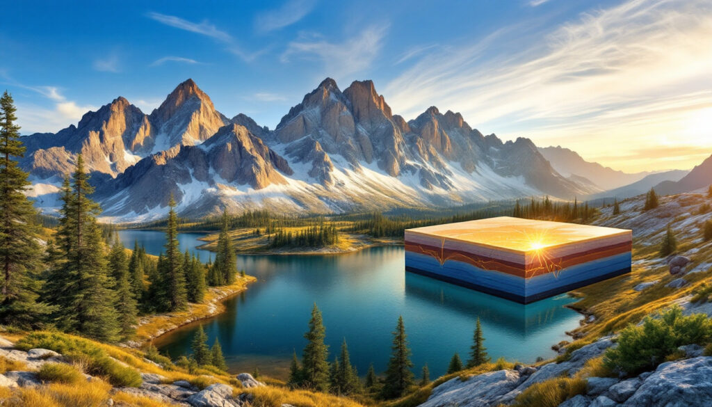
Standing majestically at 8,591 feet above sea level, the Sierra Buttes represent one of California's most fascinating geological wonders. These peaks in the northern Sierra Nevada aren't just visually impressive—they tell an extraordinary story of continental development spanning hundreds of millions of years.
The Sierra Buttes' geological significance begins with their origins in ancient oceanic environments. Composed primarily of the Northern Sierra Terrain, these mountains feature metamorphic rocks that began their journey far from their current location. According to recent detrital zircon analysis, the rocks that form the Sierra Buttes originated in northwestern Canada and traveled over 1,000 miles south through plate tectonics influence to reach their current position.
At the core of the Sierra Buttes' geological makeup are two key formations: the Shoofly Complex and the Sierra Buttes Formation. The Shoofly Complex, dating from 540-390 million years ago (Cambrian through Devonian periods), consists of slate, schist, serpentinite, chert, and peridotite. These rocks represent ancient oceanic seafloor that was later metamorphosed under intense pressure and heat. Geologists have established a direct connection between this complex and Nevada's Roberts Mountain Allochthon, revealing how these separate geographical features share a common geological history.
The Sierra Buttes Formation itself formed approximately 363 ±7 million years ago during the Late Devonian period. This formation contains metamorphosed andesite and dacite—volcanic rocks that originated from an active volcanic arc similar to modern-day Japan. This arc formed during the Antler Orogeny, a major mountain-building event that reshaped western North America's coastline.
What makes the Sierra Buttes particularly valuable to geologists is how they preserve evidence of ancient plate tectonic processes. The presence of Ediacaran tonalite blocks in both the Shoofly Complex and Klamath Mountains with identical geochemical signatures provides compelling evidence of their shared origin before tectonic displacement separated them.
How Did the Sierra Buttes Become California's Golden Mountain?
The Sierra Buttes have earned their reputation as "California's Mountain of Gold" through their extraordinary mineral wealth, having yielded over $1 billion worth of gold throughout history. Their gold-bearing capabilities stem from a fascinating geological process that transformed ordinary rock into one of the world's richest ore deposits geology.
The gold deposits of the Sierra Buttes represent textbook examples of orogenic gold deposits—gold formed during mountain-building events. What's particularly interesting is that these deposits concentrated primarily in the Western Metamorphic Belt rather than the Sierra granodiorite that makes up much of the Sierra Nevada range. This concentration pattern provides crucial insights into how gold deposits form in mountain chains worldwide.
The journey from ocean floor to gold veins began hundreds of millions of years ago when gold was originally deposited by "black smokers"—hydrothermal vents on the ancient ocean floor. These vents released mineral-rich fluids that precipitated gold and other metals in the surrounding oceanic crust. As tectonic processes accreted this oceanic crust onto North America, the embedded gold underwent a transformation.
During metamorphism, hydrothermal fluids at temperatures between 200-400°C mobilized this disseminated gold, concentrating it into quartz veins that formed along fractures, cracks, and faults in the rock. These fluid pathways served as natural plumbing systems that collected gold from large volumes of rock and deposited it in concentrated veins. The exceptional fluid flow conditions in the Sierra Buttes fault system created ideal conditions for forming substantial gold deposits.
Famous mining operations throughout the Sierra Buttes region capitalize on these geological processes. The Sierra Buttes Mine became particularly renowned as the source of the "Monumental" gold nugget—California's largest gold discovery. The Kentucky Mine, which operated from the 1850s to the 1950s and now serves as a museum, provides visitors with a glimpse into the region's gold mining history. Gold occurs in both the Sierra Buttes Formation and the older Shoofly Complex, with variations in concentration reflecting differences in the underlying rock chemistry and fracture patterns.
What Is the Monumental Gold Nugget Discovery?
In 1869, miners working at the Sierra Buttes Mine on the southern slope of the mountain made an extraordinary discovery that would cement the region's place in gold mining history. They unearthed a massive gold nugget weighing a staggering 109 pounds—approximately 1,744 ounces of nearly pure gold. This exceptional find was aptly named the "Monumental" nugget, reflecting its unprecedented size and significance.
The value of this remarkable discovery has only increased with time. At current gold market analysis prices (over $3,300 per ounce as of early 2024), the Monumental nugget would be worth more than $5.8 million. Such extraordinary value helps explain why the California Gold Rush drew hundreds of thousands of fortune seekers to the Sierra Nevada in the 1850s and beyond.
The Monumental nugget's formation represents a geological anomaly even within the gold-rich Sierra Buttes. Nuggets of this size typically form through rapid deposition in low-stress zones along fracture systems where gold-bearing fluids could pool and precipitate their precious cargo. The exceptional size of the Monumental nugget suggests a perfect combination of gold-rich source rock, extensive fluid circulation, and ideal deposition conditions—a rare confluence of geological factors.
The discovery represents one of the most significant gold finds in California history and exemplifies the extraordinary mineral wealth that drove the Gold Rush era's economic and population boom. While most miners found only small flakes and modest nuggets, discoveries like the Monumental nugget kept alive dreams of striking it rich and fueled continued exploration throughout the Sierra Nevada range.
How Did Tectonic Forces Shape the Sierra Buttes?
The dramatic peaks and mineral wealth of the Sierra Buttes result from complex tectonic forces that have shaped western North America over hundreds of millions of years. Two critical mountain-building events—the Antler and Sonoma Orogenies—were particularly influential in creating the geological features we see today.
The Antler Orogeny, occurring 370-340 million years ago during the Late Devonian period, fundamentally changed the western margin of North America. This tectonic event initiated subduction along North America's western edge, transforming what had been a passive margin into an active convergent boundary similar to today's Pacific Ring of Fire. This new tectonic regime generated volcanic arc activity that formed the Sierra Buttes Formation while simultaneously metamorphosing the older Shoofly Complex.
During this orogeny, deep-seated tectonic forces highly altered the mineral composition of the Shoofly Complex, transforming sedimentary rocks into metamorphic varieties like slate and schist. The pressure and heat associated with this mountain-building event also created pathways for mineral-rich fluids that would later contribute to gold mineralization.
The subsequent Sonoma Orogeny, occurring 270-245 million years ago from the Permian to Triassic periods, completed the accretion of the Sierra Buttes Formation and Shoofly Complex onto the North American continent. This event also added the Klamath Mountain terranes to the continent, connecting previously separated geological units that shared similar origins.
What makes these tectonic processes particularly fascinating is how they reveal patterns in the geological development of western North America. The Roberts Mountain Thrust in Nevada and the Sierra Buttes formations share tectonic origins but differ in metamorphic grade, providing geologists with important comparative data. Similarly, the Trinity Terrane in the Klamath Mountains accreted during the same Sonoma Orogeny, showing how large sections of crust were added to the continent simultaneously.
These tectonic relationships demonstrate massive terrain movement along ancient fault systems, providing visible evidence of how continents grow through the addition of oceanic crust and volcanic island arcs. The Sierra Buttes serve as a natural laboratory for understanding these complex geological processes that shaped much of western North America.
What Makes the Sierra Buttes Worth Visiting Today?
Beyond their geological and historical significance, the Sierra Buttes offer visitors stunning natural beauty and recreational opportunities that make them a worthwhile destination for nature enthusiasts, history buffs, and casual tourists alike.
The natural beauty of the Sierra Buttes is immediately apparent to visitors. With their jagged peaks rising dramatically above the surrounding landscape, these mountains provide some of the most spectacular vistas in the northern Sierra Nevada. Beautiful forests cloak the lower elevations, creating habitat for diverse wildlife and opportunities for hikers to explore a variety of ecosystems. Distinctive geological features are visible throughout the landscape, from exposed metamorphic rock formations to evidence of ancient volcanic activity.
For those interested in California's gold mining history, the area offers fascinating historical sites that bring the past to life. The Kentucky Mine stands as a well-preserved example of 19th-century mining operations, offering tours that educate visitors about the technologies and challenges of gold extraction during the boom years. Throughout the region, observant visitors can spot evidence of historical mining activities, from abandoned equipment to tailings piles that tell the story of the area's gold rush heritage.
Perhaps most uniquely, the Sierra Buttes provide exceptional geological education opportunities for visitors of all backgrounds. Here, one can see visible evidence of complex geological processes that normally remain abstract concepts in textbooks. Visitors can literally touch rocks that traveled over 1,000 miles to their current location and observe examples of metamorphic processes that transformed ancient oceanic crust into the mountains we see today. Hiking trails expose visitors to both unmetamorphosed volcanic rocks and the highly altered schists of the Shoofly Complex, allowing for direct comparison of different geological formations.
The stark contrasts between different rock types found in close proximity make the Sierra Buttes an ideal outdoor classroom for understanding Earth's dynamic processes. From the recreational enthusiast to the serious geology student, the Sierra Buttes offer a rare combination of beauty, history, and scientific significance that rewards visitors with both enjoyment and knowledge.
FAQ About the Sierra Buttes
How much gold has been extracted from the Sierra Buttes?
The Sierra Buttes have yielded over $1 billion worth of gold throughout their mining history, making them one of California's richest mountains in terms of mineral production. This extraordinary wealth came primarily from underground lode deposits rather than placer gold found in streams and rivers.
What is the elevation of the Sierra Buttes?
The Sierra Buttes reach an elevation of 8,591 feet above sea level, creating a prominent landmark visible from great distances across the northern Sierra Nevada region. This elevation creates distinctive ecological zones as well as challenging but rewarding hiking opportunities.
When was the Monumental gold nugget discovered?
The Monumental gold nugget was discovered in 1869 at the Sierra Buttes Mine on the south slope of the mountain. This 109-pound mass of gold remains one of the largest gold nuggets ever found in California and would be worth approximately $5.8 million at today's gold prices.
How old are the rock formations that make up the Sierra Buttes?
The Sierra Buttes Formation dates back approximately 363 million years to the Late Devonian period, while the Shoofly Complex is even older, dating from 540 to 390 million years ago (Cambrian to Early Devonian). These ancient rocks have undergone multiple phases of metamorphism and deformation throughout their long geological history.
Can visitors tour any historic mines in the Sierra Buttes today?
Yes, visitors can tour the historic Kentucky Mine, which offers insights into the gold mining operations that once thrived in the Sierra Buttes region. This preserved mining site provides educational opportunities about 19th-century extraction methods and the mineral exploration strategies that miners used to locate valuable deposits in the area.
Looking for the Next Major Mineral Discovery?
Don't miss out on real-time alerts for significant ASX mineral discoveries through Discovery Alert's proprietary Discovery IQ model, which turns complex geological data into actionable investment insights. Understand why historic discoveries can generate substantial returns by visiting Discovery Alert's dedicated discoveries page and begin your 30-day free trial today to position yourself ahead of the market.


