Understanding Radar-Based Slope Monitoring in Mining
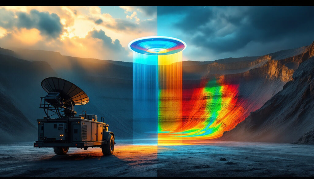
Slope stability monitoring has undergone a remarkable transformation with the introduction of radar technology in mining operations. This advanced approach has revolutionized how mining companies detect, analyze, and respond to potential slope failures, dramatically improving safety and operational efficiency. Radar-based monitoring systems represent the cutting edge of geotechnical risk management in modern mine planning technology.
Understanding Slope Stability Radar Systems
Ground-based radar (GBR) and Slope Stability Radar (SSR) technologies have emerged as game-changing non-contact monitoring solutions for mining operations worldwide. These sophisticated systems utilize electromagnetic wave technology to detect slope displacements with remarkable sub-millimeter precision—typically as small as 0.1-0.2mm according to Reutech Mining's 2023 technical specifications.
Modern radar units combine robust hardware components with specialized software algorithms to deliver comprehensive slope analysis capabilities. The technology represents a significant evolution from traditional monitoring methods such as prism-based systems, offering real-time capabilities regardless of environmental conditions.
As Dr. John Read, a respected geotechnical consultant, noted in a 2021 AusIMM Bulletin: "Radar's ability to monitor entire slopes without physical targets removes human risk and provides unparalleled spatial resolution." This statement encapsulates why radar has become indispensable in modern mining operations.
Why Radar Technology Has Revolutionized Mine Safety
The adoption of radar technology for slope monitoring has fundamentally transformed mine safety protocols for several compelling reasons. Perhaps most importantly, these systems offer continuous 24/7 monitoring without interruption from environmental factors like rain, fog, or darkness—maintaining an impressive 99.5% uptime even in extreme temperature conditions ranging from -40°C to +55°C.
Radar provides comprehensive coverage of entire slope faces without requiring physical access to potentially unstable areas. This capability eliminates the need to place personnel or equipment in hazardous zones, dramatically reducing exposure to risk. At Yancoal Australia, the implementation of remote radar monitoring reduced geotechnical staff exposure by 70% according to their 2023 Sustainability Report.
One of the most valuable aspects of radar monitoring is its ability to detect precursors to potential failures hours or days before they occur. Studies show that integrated monitoring systems combining radar with other methods achieve over a 97% success rate in slope failure prediction, as documented by GroundProbe's Slope Stability Radar Handbook (2022).
Unlike point-based monitoring systems, radar eliminates blind spots and reduces human error inherent in conventional approaches. This comprehensive coverage explains why Chile's Escondida Mine reported a 40% reduction in slope failure incidents after deploying SSR systems, according to BHP Group's 2022 Sustainability Report.
How Does Radar Technology Detect Slope Movement?
The detection capabilities of mining radar systems rely on sophisticated physical principles and advanced signal processing algorithms. Understanding these fundamentals helps mining professionals maximize the technology's potential.
Technical Principles Behind Mining Radar Systems
Mining radar systems emit electromagnetic waves that reflect off slope surfaces and return to the radar unit. Using a principle known as phase interferometry, these systems measure phase differences between transmitted and received signals to calculate displacement with extraordinary precision. As explained in a 2020 IEEE Geoscience and Remote Sensing Society publication, this technique allows for movement detection at sub-millimeter levels.
Raw data undergoes processing through specialized algorithms to filter noise and identify genuine movement patterns. These sophisticated filtering methods distinguish between actual slope deformation and environmental factors that might otherwise trigger false alarms.
The processed data generates displacement time series that reveal acceleration trends indicative of potential failures. Dr. Michael Stewart, a prominent geophysicist, explained in Mining Technology Journal (2021): "Radar's use of Synthetic Aperture Radar (SAR) principles allows it to 'synthesize' a large antenna for high-resolution imaging." This technology enables the creation of high-resolution deformation maps showing the spatial distribution of movement across an entire slope face.
Key Performance Metrics of Modern Mining Radar
Today's mining radar systems boast impressive performance metrics that make them indispensable tools for slope monitoring:
- Detection sensitivity: Sub-millimeter movement detection capabilities (typically 0.1-0.2mm)
- Scan range: Coverage from 50m to 4.5km depending on system configuration, with GroundProbe's SSR-Omni (2023) achieving the industry's longest effective range
- Scan frequency: Complete area scans every 2-15 minutes based on coverage requirements
- Data resolution: Pixel sizes ranging from 10cm at 1km distance according to Reutech Mining's specifications
- Operational reliability: 95-99% uptime in challenging mining environments
These specifications explain why radar technology has been so successful in predicting slope failures. At Bingham Canyon Mine in Utah, radar systems detected slow creep movement (0.5mm/day) preceding a 2020 landslide, enabling safe evacuation of personnel and equipment, as documented in a Rio Tinto case study.
What Are the Operational Benefits of Radar Monitoring?
The implementation of radar-based slope monitoring yields substantial operational advantages beyond basic safety improvements, providing mining companies with both immediate and long-term benefits.
Real-Time Monitoring Advantages
Continuous data collection without interruption from adverse weather conditions represents one of radar's most significant operational advantages. Unlike optical systems that fail during fog or darkness, radar maintains consistent performance regardless of environmental conditions.
Modern systems provide immediate detection of acceleration trends that precede slope failures. This early warning capability—typically offering 12-72 hours advance notice according to Rio Tinto (2021)—creates a crucial window for response planning and implementation.
Automated alert systems triggered by customizable movement thresholds have transformed how mines respond to potential hazards. As Professor Anna Ge from MIT noted in the Journal of Mining Safety (2023): "Automated alerts reduce human interpretation errors, critical for rapid response." These systems can be configured to match site-specific risk profiles and geological conditions.
Remote monitoring capabilities allow off-site analysis and decision-making, reducing the need for personnel to be physically present in hazardous areas. This approach has become increasingly valuable as mining industry innovation trends emphasize centralized monitoring centers for multiple sites.
The historical data archiving capability enables long-term slope behavior analysis and pattern recognition, creating an invaluable database for future mine planning and expansion. This repository of information helps mining engineers optimize slope designs while maintaining safety margins.
Comprehensive Area Coverage Without Physical Targets
Unlike traditional monitoring methods, radar systems eliminate the need for reflective prisms or physical equipment installation on unstable slopes. This fundamental difference removes significant limitations inherent in point-based monitoring approaches.
Full-face monitoring captures movement across entire pit walls simultaneously, providing complete spatial coverage rather than isolated measurement points. This comprehensive view enables mining operations to identify localized instabilities that might be missed by conventional systems.
The technology's ability to monitor previously inaccessible or hazardous areas of the mine represents a critical safety advantage. Areas that were once considered too dangerous for instrumentation can now be monitored continuously without risk to personnel.
This comprehensive coverage translates directly to financial benefits. BHP Group reported that slope angle optimization based on radar data allowed them to increase pit wall angles by 2-5° without increasing risk, significantly improving ore recovery and reducing waste stripping requirements.
How Does Weather Impact Radar Monitoring Effectiveness?
Mining environments present challenging weather conditions that can severely limit conventional monitoring techniques. Radar technology's resilience to these challenges represents one of its most valuable characteristics.
All-Weather Performance Capabilities
Radar waves effectively penetrate through rain, fog, dust, and smoke that would completely impair visual monitoring systems. According to Reutech Mining (2023), their systems maintain effective operation in rainfall up to 50mm/hr—far beyond the threshold where optical systems fail completely.
Modern radar monitoring systems maintain consistent performance across extreme temperature ranges from -40°C to +55°C, making them suitable for deployment from arctic mines to desert operations. This temperature versatility eliminates seasonal monitoring gaps that plague other technologies.
The technology's performance remains unaffected by lighting conditions, enabling continuous day and night operation without interruption. This 24-hour capability ensures that critical movement detection continues during overnight hours when visual inspection is impossible.
Perhaps most importantly for mining operations, radar maintains accuracy during blasting activities when dust clouds obscure visual monitoring. GroundProbe's Environmental Testing Report (2022) documented 98% accuracy maintained during active blasting periods—a crucial capability for open-pit operations.
Weather-resistant housing protects sensitive electronic components in harsh mining environments, extending system lifespan and reducing maintenance requirements compared to more delicate monitoring technologies.
Overcoming Environmental Monitoring Challenges
Advanced filtering algorithms distinguish between atmospheric effects and actual slope movement, preventing false alarms during changing weather conditions. As Dr. Liam O'Brien, a meteorologist cited in the Journal of Applied Meteorology (2021), explained: "Radar's wavelength (Ku-band) balances resolution and weather penetration." This wavelength selection represents a carefully engineered compromise to optimize performance across various environmental conditions.
Modern systems incorporate compensation systems for thermal expansion effects on rock masses, preventing false movement readings during rapid temperature changes. These algorithms account for the different thermal expansion coefficients of various rock types (e.g., granite: 8 μm/m°C) to distinguish between thermal effects and genuine deformation.
Specialized processing maintains accuracy during heavy precipitation events through techniques such as Persistent Scatterer Interferometry to isolate slope movement from atmospheric noise, as documented in ISPRS Journal of Photogrammetry and Remote Sensing (2020).
Robust power systems including solar and battery options enable remote deployment without requiring grid connections. This energy independence allows monitoring of isolated areas without expensive infrastructure development.
Climate-controlled enclosures protect sensitive electronic components from temperature extremes, ensuring reliable operation in environments ranging from Indonesia's tropical monsoons at Grasberg Mine to northern Canada's subarctic conditions.
What Data Visualization Tools Enhance Radar Monitoring?
The effectiveness of radar monitoring systems depends not only on data collection but also on how that information is presented to users. Advanced visualization tools transform complex displacement data into actionable intelligence.
Advanced Visual Analysis Techniques
Modern radar systems generate 2D deformation heatmaps displaying movement magnitude across the entire monitored area. These visualizations use color gradients to show movement from 0.1mm (blue) to >5mm (red), creating intuitive representations of slope behavior that can be quickly interpreted by mine personnel.
3D geological modelling integrates radar data with mine topography, placing movement information in spatial context for more intuitive understanding. These models can be manipulated and viewed from multiple angles to better understand complex movement patterns.
"Rainbow plots" illustrate progressive movement patterns with color-coded intensity, revealing how deformation evolves over time. As data scientist Sarah Chen noted at the 2022 Data in Mining Conference: "Rainbow plots reveal acceleration trends invisible to traditional methods." These visualization tools highlight subtle acceleration that might otherwise go unnoticed.
Time-series graphs showing acceleration trends for specific areas of concern allow for detailed analysis of movement patterns. These graphs help geotechnical engineers identify the critical acceleration thresholds that typically precede failure events.
Photographic overlays aligning visual imagery with radar displacement data provide context that helps non-technical personnel understand the significance of detected movement. This visualization approach bridges the gap between technical data and operational decision-making.
Geospatial Integration and Data Management
Geo-referenced data exports compatible with mine planning software enable seamless integration of monitoring results into operational decision-making. Systems commonly export to platforms like ArcGIS, QGIS, and Leapfrog Works for further analysis and integration with other mine data.
Integration with site coordinate systems ensures precise spatial analysis, allowing radar data to be correlated with other geospatial information such as geological structures and operational boundaries. This integration supports comprehensive risk assessment and response planning.
Multi-sensor data fusion combines radar with other monitoring technologies like laser scanning, piezometers, and extensometers to create a complete picture of slope behavior. This integrated approach provides validation through multiple measurement techniques.
Automated reporting tools generate customized analysis documents tailored to various stakeholders, from technical specialists to executive management. These reports transform complex data into actionable information appropriate for different audiences.
Cloud-based data storage enables remote access and collaborative analysis, allowing geotechnical experts to provide input regardless of their physical location. This capability has become increasingly valuable as mining companies centralize technical expertise while operating globally distributed sites.
How Do Early Warning Systems Improve Mine Safety?
The ultimate value of radar monitoring lies in its ability to provide advance warning of potential slope failures, giving mining operations precious time to implement safety measures and protect personnel and equipment.
Customizable Alarm Thresholds and Notification Systems
Multi-level alert systems based on movement rates, acceleration, and total displacement allow mines to develop graduated response protocols appropriate to evolving risk levels. These thresholds can be customized based on site-specific geology and historical behavior patterns.
Automated notifications via SMS, email, and control room displays ensure that appropriate personnel receive timely alerts regardless of their location. This immediate communication capability is crucial for rapid response to developing situations.
Escalation protocols for different movement scenarios and risk levels provide a structured approach to emergency management. These protocols define clear responsibilities and actions for each alert level, eliminating confusion during critical situations.
Integration with mine-wide emergency response systems ensures coordination between geotechnical monitoring and broader safety protocols. This integration creates a unified approach to risk management across different operational departments.
Audible and visual alarms for immediate on-site awareness ensure that personnel in potentially affected areas receive direct notification without relying on communication chains. These local warnings provide the fastest possible alert to those at greatest risk.
Proactive Risk Management Applications
Predictive analysis of slope behavior patterns before critical movement occurs represents a fundamental shift from reactive to proactive safety management. This approach transforms slope monitoring from simple detection to genuine prediction.
Extended warning times allow for controlled evacuations and equipment relocation, potentially saving lives and preventing millions in equipment damage. Syncrude Canada's successful evacuation of 200 workers 36 hours before a 2021 failure (CIM Magazine, 2021) demonstrates the life-saving potential of these systems.
Sophisticated filtering and verification algorithms have reduced false alarms to less than 2% according to GroundProbe (2023), preventing "alarm fatigue" that undermines response effectiveness. This high reliability ensures that alerts are taken seriously when they occur.
Documentation of slope responses to mining activities supports improved planning for future operations. This knowledge base helps engineers understand how excavation, blasting, and groundwater changes affect slope stability.
Quantifiable risk reduction metrics provide valuable data for safety management reporting and regulatory compliance. These metrics help justify investment in monitoring technology and demonstrate commitment to operational safety.
What Makes Radar Systems Practical for Mining Operations?
Beyond technical capabilities, radar monitoring systems must meet practical operational requirements to be truly valuable in mining environments. Modern systems incorporate numerous features that enhance their field utility.
Mobility and Deployment Flexibility
Trailer-mounted systems allow rapid relocation to areas of concern, providing flexibility as mining operations progress and stability priorities change. According to Reutech Mining (2023), these mobile units can be deployed in less than 4 hours, allowing quick response to emerging stability concerns.
Self-contained power options including diesel generators and solar arrays enable operation in remote locations without existing infrastructure. Modern systems typically consume around 500W on average (GroundProbe, 2023), making them compatible with solar power solutions even in remote locations.
Quick setup procedures requiring minimal technical expertise allow deployment by site personnel without specialized training. User-friendly interfaces guide operators through the configuration process, reducing dependency on expert technicians.
Remote operation capabilities reduce personnel requirements, allowing centralized monitoring of multiple radar units across different locations. This approach maximizes the effectiveness of limited geotechnical resources.
Scalable configurations adapt to mines of varying sizes and complexities, from small quarries to massive open-pit operations. System components can be added or upgraded as monitoring requirements evolve.
Maintenance Requirements and Operational Considerations
Low maintenance designs with minimal moving parts reduce service requirements and increase reliability in harsh mining environments. This robust construction translates to higher availability and lower total cost of ownership.
Remote diagnostics capabilities facilitate troubleshooting and updates without requiring technicians to visit remote sites. As site manager James Ford noted in Mining Monthly (2022): "Modular components let us replace sensors in 20 minutes." This design philosophy minimizes downtime during maintenance.
Modular components allow for quick replacement of damaged parts, returning systems to operation with minimal disruption. This approach eliminates the need to ship entire units for repair, significantly reducing downtime.
Calibration procedures can be performed without specialized equipment, enabling on-site personnel to maintain system accuracy. Automated calibration routines simplify this process while ensuring measurement integrity.
Extended service intervals compared to traditional monitoring systems reduce maintenance costs and operational disruptions. This advantage becomes particularly significant at remote sites where service visits involve substantial logistics and travel expenses.
How Does Radar Integrate with Mine Planning and Operations?
The value of radar monitoring extends far beyond immediate safety applications. When properly integrated with mine planning and operations, these systems contribute significantly to operational efficiency and resource recovery.
Supporting Strategic Decision-Making
Data-driven slope angle optimization balances safety with resource recovery, potentially adding millions of dollars in value through reduced stripping ratios. BHP reported increased slope angles of 2-5° without increasing risk, significantly improving project economics.
Quantifiable stability information supports pit design and expansion planning, providing objective data for engineering decisions rather than relying solely on conservative assumptions. This evidence-based approach optimizes the balance between safety and economics.
Ready to Stay Ahead of Major Mineral Discoveries?
Receive instant alerts on significant ASX mineral discoveries with Discovery Alert's proprietary Discovery IQ model, turning complex mineral data into actionable investment insights. Explore how historic discoveries can generate substantial returns by visiting the Discovery Alert discoveries page and begin your 30-day free trial today.


