The Evolution of Resource Estimation Software: Bridging Data Abundance and Practical Implementation
The mining industry stands at a technological crossroads, where unprecedented volumes of geological data meet traditional resource estimation practices. This intersection creates both remarkable opportunities and significant challenges for mining companies seeking to maximize the value of their exploration investments.
The Data Abundance Challenge
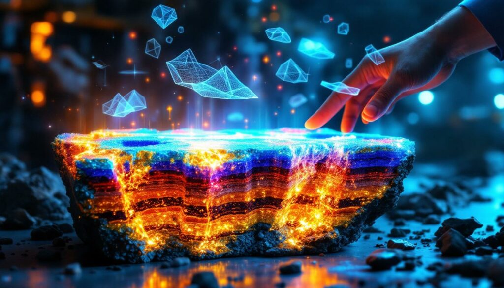
Modern resource estimation now deals with an extraordinary volume of data generated by advanced scanning technologies. Core scanning systems can produce terabytes of information per drill hole with resolution capabilities down to 100 microns—a level of detail previously unimaginable in the industry.
"Companies are spending 20 bucks a meter to scan or analyze core that is giving you incredible detail that you've never had before in terms of mineralogy, texture, and chemistry," notes Paul Hodkiewicz, an industry expert with experience at Anglo American, BHP, and SRK Consulting.
Despite this wealth of information, data-driven mining operations face significant difficulties translating these detailed datasets into practical geological models. The investment is substantial—approximately $20 per meter for advanced core scanning that captures detailed mineralogy, texture, and chemistry—yet the full value often remains unrealized.
Key insight: The resolution gap between data collection (microscopic) and practical mining applications (meter-scale) represents one of the industry's most pressing technological challenges.
Key Software Players in the Resource Space
The resource estimation software landscape features both established platforms and innovative newcomers. Traditional platforms like Leapfrog pioneered 3D visualization capabilities for large datasets and remain industry standards for many operations.
Emerging companies are filling specialized niches in the workflow:
- Verasio, Corsan, and Geological AI provide specialized scanning services that generate high-resolution data
- Data Rock offers tools specifically designed for translating visual data into geological intervals
- CSIRO's Data Mosaic delivers multivariate analysis capabilities for domain definition
These tools represent different parts of the workflow puzzle, with some focusing on data acquisition while others specialize in interpretation and modeling. The fragmentation of this ecosystem contributes to integration challenges that many mining operations face.
Why is There a Disconnect Between Data Collection and Resource Models?
The Resolution Reduction Problem
The industry's fundamental challenge lies in what experts call the "resolution reduction problem"—translating high-resolution multivariate data into practical geological models that can guide mining operations.
"How do you go from terabytes of data per drill hole to intervals? That is the problem," explains Hodkiewicz. This transition from "pixels to intervals" represents the critical gap in most resource estimation workflows.
Despite having access to complex, detailed information, most resource geologists continue estimating into simple domains and grade shells. This simplification often discards valuable contextual information that could improve geological understanding and ultimately resource models.
Workflow bottlenecks occur specifically when moving from detailed scans to traditional modeling approaches. The industry lacks standardized methodologies for data reduction that preserve the most valuable insights while creating usable models.
Software Integration Challenges
A significant disconnect exists between scanning technology providers and modeling software developers. This commercial gap creates practical challenges for end-users attempting to implement comprehensive workflows.
Resource geologists often lack training on how to incorporate new data types into existing workflows. University programs typically teach traditional logging and modeling techniques without addressing the challenges of integrating multivariate datasets.
"There's limited communication between scanning technology providers and modeling software developers," notes Hodkiewicz, highlighting the systemic nature of the problem.
Many operations continue relying on traditional logging practices, sometimes deliberately isolating geologists from knowing drill hole locations to avoid bias. While this approach made sense in previous decades, it prevents leveraging the contextual 3D information now available.
How Are Advanced Technologies Transforming Resource Estimation?
Multivariate Data Analysis Capabilities
Modern scanning technologies capture multiple elements simultaneously rather than just target commodities. This comprehensive approach provides a more complete picture of the subsurface environment.
New software in the resource estimation space allows visualization of mineral assemblages and textural relationships that would be invisible to traditional logging methods. These subtle features often control ore distribution and quality but were previously unmappable.
"High-resolution data reveals complexities that contradict simplified geological models from textbooks," Hodkiewicz observes. This recognition challenges geologists to reconsider textbook models in favor of deposit-specific understandings.
One of the most valuable applications is mapping geometallurgical domains based on mineralogy rather than just grade. This approach leads to improved processing predictions and more accurate recovery estimates.
3D Visualization and Interpretation
Advanced software platforms now enable treatment of drill holes as "long skinny outcrops" in three-dimensional space. This perspective shift allows geologists to interpret features with more contextual information than traditional core logging provides.
Modern tools help overcome sectional bias by enabling down-plunge and off-section visualization. These capabilities are particularly valuable in structurally complex deposits where 2D interpretations can be misleading.
Implicit modeling techniques can now incorporate multiple variables beyond simple grade values. The result is more robust geological models that better represent the complexity of natural systems.
3D geological modelling tools allow geologists to map features across multiple holes in a true 3D environment, leading to more consistent interpretations and more accurate resource models.
What Are the Practical Implementation Challenges?
Workflow Transformation Hurdles
Despite clear benefits, resistance to change persists across the industry. Many operations continue logging core without reference to spatial context or previous interpretations, leading to inconsistencies between geologists.
"We shouldn't be looking at [core] in core boxes… it should be in 3D," argues Hodkiewicz, highlighting the disconnect between available technology and actual practice.
Traditional practices sometimes deliberately isolate geologists from knowing drill hole locations to prevent bias. While this approach has merits, it significantly limits the contextual understanding that 3D visualization can provide.
Limited translation services exist to convert high-resolution data into practical geological intervals. This service gap represents a market opportunity for software developers who can effectively bridge the resolution gap.
Data Utilization Gaps
A persistent challenge is that companies often collect comprehensive datasets but only use target commodity values in resource estimation. This selective approach leaves significant value untapped in existing datasets.
Resource geologists frequently receive only gold or copper values despite having access to full geochemical data. This information siloing prevents recognition of important geological relationships that could improve models.
"Convincing clients they already possess valuable data remains a persistent challenge," notes Hodkiewicz. Many companies have invested millions in data collection but fail to extract maximum value from these investments.
Key insight: The most cost-effective improvement for many operations isn't collecting more data—it's better utilizing the data they already have.
How Can the Industry Bridge the Gap Between Data and Models?
Educational and Training Opportunities
Universities can play a critical role by incorporating scanning technology training into undergraduate geology programs. Students need exposure to modern tools before entering professional environments where on-the-job learning may be limited.
Collaboration between technology vendors and educational institutions creates valuable opportunities for hands-on learning. These partnerships benefit both students and companies seeking skilled graduates.
Professional development programs for existing geologists represent another important avenue. Short courses focused on specific tools and workflows can help bridge the knowledge gap for experienced professionals.
Graduates should understand how to integrate advanced data into traditional geological workflows. This integration perspective is often missing from current educational programs that treat digital tools as separate from core geological skills.
Resolution Adjustment Approaches
Software in the resource estimation space like CSIRO's Data Mosaic allows users to adjust resolution levels to match drilling density. This flexibility helps geologists find the optimal level of detail for their specific project requirements.
Best practices include starting with broad domains to establish continuity before refining to higher resolution. This approach ensures that the foundation of the model is sound before adding complexity.
"Testing whether drill hole spacing supports the level of detail being modeled is essential," advises Hodkiewicz. Over-interpretation leads to false confidence and potentially misleading resource estimates.
Finding the right balance between detail and practical usability in mining operations requires careful consideration of downstream uses. Different applications (long-term planning vs. short-term grade control) require different levels of detail.
What Does the Future Hold for Resource Estimation Software?
Integration of Artificial Intelligence
AI tools are beginning to assist with pattern recognition across complex multivariate datasets. These algorithms can identify relationships invisible to human interpreters, particularly when analyzing thousands of variables simultaneously.
Machine learning algorithms help identify correlations between multiple parameters, potentially revealing new proxies for mineralization or processing characteristics. These insights can guide more efficient exploration and development strategies.
Automated domain boundary suggestions based on multiple parameters simultaneously represent a significant advance over traditional methods. While human oversight remains essential, these tools accelerate the interpretation process.
The potential for real-time updating of geological models as new data becomes available represents perhaps the most transformative possibility. This dynamic approach would allow mining industry evolution to continuously refine their understanding rather than relying on periodic updates.
Collaborative Development Opportunities
The industry needs stronger partnerships between scanning technology providers and modeling software developers. These collaborations could create more seamless workflows that preserve data integrity throughout the process.
Standardized data formats would significantly improve interoperability between systems. Current proprietary formats often create unnecessary friction in multi-software workflows.
Growing recognition of the value in translation services that bridge technological gaps creates business opportunities. Companies that can effectively convert high-resolution data into practical geological models will find ready markets.
"The most successful mining operations of the future will be those that effectively integrate all available data into their decision-making processes," predicts Hodkiewicz. This integration requires both technological solutions and organizational changes.
How Can Resource Geologists Maximize Value from New Technologies?
Best Practices for Implementation
Successful implementation begins with a clear understanding of what geological features are critical to the deposit type. This focus helps prevent data overload and keeps modeling efforts directed toward value-adding activities.
Establishing consistent workflows for translating detailed data into practical intervals ensures reproducibility and auditability of resource models. Documentation of these workflows becomes a valuable corporate asset.
Using multivariate analysis to identify previously unrecognized patterns in the data often reveals unexpected insights. These discoveries can lead to improved geological understanding and more accurate resource estimates.
Testing interpretations at multiple resolution levels helps find the optimal balance between detail and practicality. This iterative approach leads to more robust models that better represent geological reality.
Practical Application Examples
Forward-thinking operations are using mineral assemblage data to define alteration domains more accurately. These domains often correlate better with metallurgical performance than traditional grade-based boundaries.
Identifying textural variations that correlate with metallurgical performance helps optimize processing parameters. These relationships may not be evident from assay data alone but become clear with advanced scanning.
Mapping structural features across multiple drill holes in true 3D space improves continuity modeling. This approach is particularly valuable in structurally controlled deposits where AI transforming drilling and blasting practices can significantly impact resource estimates.
Defining geometallurgical domains based on mineralogical rather than grade boundaries leads to more accurate recovery predictions. This application directly impacts project economics through AI-powered mining efficiency and improved processing outcomes.
FAQ: Software in Resource Estimation
What is the biggest challenge in modern resource estimation software?
The primary challenge is bridging the gap between high-resolution data collection (often at microscopic scales) and practical geological modeling at mining scales. This "resolution reduction problem" requires specialized tools and workflows to translate detailed information into usable intervals and domains.
How has core scanning technology changed resource estimation?
Core scanning technology has transformed resource estimation by providing unprecedented detail about mineralogy, texture, and chemistry. However, the industry still struggles to incorporate this wealth of information into traditional modeling workflows, creating a disconnect between data collection and practical application.
What software tools are helping bridge the data translation gap?
Tools like Data Mosaic from CSIRO, Data Rock's interpretation software, and specialized solutions from companies like Geological AI are helping translate pixel-level data into geological intervals that can be used in resource models. These tools allow geologists to identify patterns across multiple variables simultaneously.
Why aren't mining companies fully utilizing the data they collect?
Many companies face workflow challenges, lack specialized training, or struggle with software integration issues. Additionally, traditional practices and resistance to change can prevent full utilization of available data, even when companies have invested significantly in data collection technologies.
How can universities better prepare geologists for modern resource estimation?
Universities can incorporate training on scanning technologies and multivariate data analysis into undergraduate geology programs, establish partnerships with technology vendors for hands-on experience, and teach students how to integrate advanced data into traditional geological workflows.
Further Exploration
Readers interested in learning more about software in the resource estimation space can explore the "Measured Podcast" interviews with industry experts discussing technological innovations in mining geology. These discussions provide valuable insights into emerging trends and practical implementation strategies.
Disclaimer: This article presents current trends and expert opinions in the field of resource estimation software. The technology landscape is rapidly evolving, and specific implementations should be evaluated based on project-specific requirements. The author makes no representations about the suitability of any particular software solution for specific applications.
Ready to Spot the Next Major Mineral Discovery?
Discovery Alert's proprietary Discovery IQ model delivers instant notifications on significant ASX mineral discoveries, translating complex geological data into actionable investment insights. Explore how historical discoveries have generated substantial returns by visiting Discovery Alert's dedicated discoveries page and position yourself ahead of the market.


