What is Ambient Noise Tomography?
Ambient noise tomography (ANT) represents a groundbreaking approach to understanding Earth's subsurface structure without traditional seismic sources. Unlike conventional methods relying on earthquakes or controlled explosions, ANT utilizes the continuous background vibrations—Earth's whispers—that constantly travel through our planet.
These background vibrations originate from various sources:
- Ocean waves interacting with continental margins
- Atmospheric pressure fluctuations
- Human activities (industrial, transportation)
- Wind interactions with topography
These seemingly random vibrations, recorded at multiple seismic stations and processed through sophisticated mathematical techniques, reveal detailed images of Earth's interior—from shallow sedimentary basins to deep crustal boundaries. Operating primarily at 0.1-0.2 Hz frequencies, ambient noise tomography Australia is particularly effective in Australia, which is surrounded by oceans providing ideal conditions for ambient noise studies.
How Does Ambient Noise Tomography Work?
The Science Behind Listening to Earth
The fundamental principle behind ambient noise tomography involves cross-correlation of ambient seismic recordings between station pairs. This process essentially measures how long it takes for seismic energy to travel between two points, revealing velocity variations in the subsurface.
The workflow typically includes:
- Data Collection: Continuous recording of background seismic vibrations at multiple stations
- Cross-Correlation: Computing the similarity between waveforms recorded at different stations
- Dispersion Analysis: Measuring how different frequencies (which penetrate to different depths) travel at different speeds
- Inversion: Converting these measurements into 3D velocity models of the subsurface
Stations located on opposite sides of Australia (east and west) require approximately one year of data (9,000 hours) to produce stable signals, while stations 3,000km apart may need up to 60,000 hours of data for reliable results. This approach works without waiting for earthquakes, providing continuous data collection and enabling imaging in seismically quiet regions like much of Australia.
From Noise to Knowledge: Technical Challenges
Converting ambient noise into meaningful geological insights presents several technical challenges:
- Signal Extraction: Distinguishing useful signal from random noise
- Data Processing: Handling enormous volumes of continuous data (27,000 noise correlation functions for the Australasian region)
- Frequency Limitations: Balancing resolution (higher frequencies) with depth penetration (lower frequencies)
- Computational Requirements: Processing cross-correlations between hundreds of station pairs
Only about 10% of dispersion curves appear "smooth and reliable" without specialized processing. Recent advances in automated dispersion curve picking, including the Zero-Crossing Distance Scaling (ZDS) algorithm and Well-placed Zero Ratio (WZR) quality metrics, have significantly improved the reliability and efficiency of ANT processing workflows in Australia.
Australia's Continental-Scale Ambient Noise Tomography Program
Deployment Strategy and Coverage
Australia's national ambient noise tomography initiative represents one of the most ambitious passive seismic imaging programs globally. The deployment strategy has evolved through several phases:
- Phase 1 (OZER): 2016-2020, half-degree spacing in Northern Territory
- Phase 2: 2020-2024, two-degree spacing across the continent
- Future Deployment: Planned half-degree nationwide coverage under the Resourcing Australia's Prosperity Initiative
The initial phase produced 15,000 cross-correlations, with expansion to hundreds of thousands anticipated in later phases. This systematic approach has transformed Australia from having sparse, uneven seismic coverage to becoming one of the most thoroughly imaged continents through passive seismic methods.
Overcoming Deployment Challenges
Establishing this network presented numerous logistical challenges:
- Remote Access: Many stations required helicopter deployment due to lack of road access
- Extreme Conditions: Temperatures reaching 45°C in shade during installation
- Wildlife Interference: Cattle damaging equipment and chewing GPS cables
- Natural Disasters: Floods and fires preventing station servicing
- Pandemic Restrictions: COVID-19 limiting interstate travel
Stations are buried 0.5 meters underground with solar panel tents facing north for power generation. Despite these obstacles, the collaborative effort between government agencies, academic institutions, and industry partners has successfully maintained data collection across this vast network.
Revealing Australia's Hidden Geology
Mapping Sedimentary Basins with Unprecedented Detail
One of the most significant applications of ambient noise tomography in Australia has been mapping sedimentary basins with exceptional clarity. The technique has revealed:
- Great Artesian Basin: Precise delineation of Australia's largest groundwater reservoir
- Canning Basin: Detailed velocity structure of Western Australia's largest sedimentary basin
- Officer Basin: New insights into the depth and extent of this Neoproterozoic to Devonian basin
- Newly Discovered Basins: Confirmation and characterization of recently identified basins like Kurara
High-frequency analysis (0.4 Hz, 2.5 seconds) enables imaging of the top 2 kilometers of crust, providing critical information for groundwater management, energy resource assessment, and mineral exploration importance. Cross-sections reveal sediment thickness variations from surface to 20km depth.
Crustal Architecture and Ancient Cratons
Beyond sedimentary basins, ambient noise tomography has illuminated Australia's complex crustal architecture:
- Craton Boundaries: Sharp delineation of ancient continental cores like the Yilgarn and Pilbara cratons
- Internal Craton Structure: Previously unrecognized velocity variations within seemingly homogeneous cratons
- Crustal Thickness Variations: Detailed mapping of how Australia's crust thickens and thins across tectonic boundaries
These insights help reconstruct Australia's geological evolution from ancient continental fragments to the modern continent, revealing the complex architecture of a landmass that becomes increasingly ancient toward the west, with geology spanning billions of years.
The Complex Australian Moho
Redefining Our Understanding of the Crust-Mantle Boundary
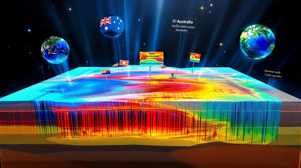
The Mohorovičić discontinuity (Moho)—the boundary between Earth's crust and mantle—has been revealed in unprecedented detail through ambient noise tomography combined with receiver function analysis.
Traditional models depicted Australia's Moho as a relatively smooth, continuous boundary. However, new high-resolution imaging shows:
- Double Moho Structures: Areas where the crust-mantle boundary appears to split or duplicate
- Moho Jumps: Abrupt changes in depth across tectonic boundaries
- Variable Transition Zones: Regions where the crust-mantle transition occurs gradually over several kilometers versus sharp boundaries elsewhere
A 1989 study by Bruce Goleby and Brian Kennett first predicted these complex Moho structures, identifying velocity proxies of approximately 3.8 km/s above the Moho and 4.4 km/s below it. Modern ANT imaging has now confirmed these predictions with direct evidence.
Case Study: Northern Territory Gravity Anomaly
A particularly striking example comes from central Northern Territory, where:
- A dramatic gravity high corresponds precisely with a complex Moho structure
- High-velocity lower crustal material appears to rise toward the surface
- The Moho boundary shows a significant vertical offset
This configuration, first hypothesized in active seismic studies decades ago, has now been confirmed through ambient noise tomography, demonstrating how lower crustal material can be tectonically transported upward—a feature with significant implications for mineral deposit tiers.
Deep Lithospheric Structure and Mineral Deposits
Mapping the Lithosphere-Asthenosphere Boundary (LAB)
Ambient noise tomography combined with earthquake data has enabled mapping of the lithosphere-asthenosphere boundary (LAB)—the mechanical transition from Earth's rigid outer layer to the weaker, flowing asthenosphere below.
Previous studies suggested correlations between:
- LAB depth transitions (particularly around 170km depth)
- The location of major mineral deposits across Australia
A partnership with Mondike (Switzerland) using Salvis software for full waveform inversion has enhanced this research. Australia's unique position—surrounded by earthquakes—provides ideal natural laboratory conditions for this analysis. New higher-resolution models are refining these relationships, potentially providing new targeting criteria for mineral exploration.
Probabilistic Approaches to Earth Models
A key advancement in Australian ambient noise tomography involves moving from deterministic to probabilistic Earth models. Rather than producing a single "best" model, this approach:
- Propagates data uncertainties through the modeling process
- Generates ensembles of velocity models
- Converts these to temperature model ensembles
- Produces mean values with quantified uncertainty ranges
This probabilistic framework acknowledges the inherent ambiguities in geophysical data and provides more robust foundations for geological interpretation and resource targeting by explicitly representing uncertainties in the final models.
Applications in Resource Exploration
Mineral Systems Targeting
The detailed crustal and lithospheric images produced through ambient noise tomography are transforming mineral exploration strategies across Australia:
- Identifying Fluid Pathways: Mapping structures that may have channeled mineralizing fluids
- Crustal Architecture: Recognizing favorable settings for mineral deposit formation
- Cover Thickness Mapping: Determining sedimentary cover thickness over prospective basement rocks
These applications are particularly valuable in Australia, where approximately 80% of the continent is covered by regolith, concealing potential mineral resources. The correlation between LAB transitions and major mineral deposits, highlighted in work by Hoggard and Paton, provides a compelling framework for exploration targeting.
Natural Hydrogen Exploration
An emerging application involves mapping potential natural hydrogen systems:
- Fault Systems: Identifying deep-reaching structures that might channel hydrogen
- Mafic/Ultramafic Bodies: Locating potential hydrogen-generating rock units
- Cover Sequences: Determining if impermeable layers might trap hydrogen accumulations
Recent surveys in South Australia's Gawler Craton have demonstrated ANT's effectiveness in mapping these features for hydrogen exploration, adding a new dimension to the technique's resource applications.
Commercial Applications
The proven value of ambient noise tomography has led to commercial adoption:
- Satellite-Enabled Systems: Companies like Fleet Space deploying networks of wireless geophones linked via satellite
- Rapid Deployment: Temporary arrays providing subsurface images within weeks rather than years
- Targeted Exploration: Focusing expensive drilling programs based on ANT-derived models
These commercial applications demonstrate how fundamental research techniques can transition to practical exploration tools with significant cost-saving potential.
Future Directions
Technical Innovations on the Horizon
The field of ambient noise tomography continues to evolve rapidly, with several promising directions:
- Machine Learning Integration: Automated feature recognition and interpretation
- Higher Frequency Analysis: Pushing toward higher resolution imaging of shallow features
- Joint Inversion: Combining ANT with other geophysical methods for improved models
- 4D Monitoring: Repeated surveys to detect subsurface changes over time
These technical advancements will further enhance the resolution, reliability, and applicability of ambient noise tomography across Australia and globally. Furthermore, the integration of data driven mining techniques with ANT data promises to revolutionize resource exploration and development.
Completing Australia's Subsurface Image
The ongoing deployment of seismic stations across Australia aims to achieve:
- Complete Continental Coverage: Half-degree (50km) station spacing nationwide
- Multi-Scale Imaging: From shallow sedimentary cover to deep lithospheric structure
- Integrated Interpretation: Combining seismic, gravity, magnetic, and geological data
This comprehensive approach will provide unprecedented insight into Australia's geological evolution and resource potential, positioning Australia to become the world's most comprehensively imaged continent through passive seismic methods.
Conclusion
Ambient noise tomography Australia has transformed our understanding of Australia's subsurface, revealing the continent's hidden architecture from shallow sedimentary basins to deep lithospheric structures. By literally listening to Earth's whispers—the continuous background vibrations traveling through our planet—geoscientists have created detailed three-dimensional images that would be impossible with conventional seismic methods.
These advances support both fundamental geological understanding and practical applications in resource exploration, groundwater management, and natural hazard assessment. As the nationwide network continues to expand and analytical techniques improve, Australia is positioned to become the world's most comprehensively imaged continent through ambient noise tomography.
This non-invasive, environmentally friendly approach to subsurface imaging represents a sustainable path forward for understanding Earth's structure while minimizing environmental impact—truly a case of gaining knowledge by simply listening to what the Earth has been whispering all along. In the context of ongoing mining industry evolution, these techniques are increasingly being adopted alongside AI in mining operations to create more efficient and sustainable resource development.
Further Exploration
Readers interested in learning more about ambient noise tomography in Australia can also explore related educational content, such as Geoscience Australia's public lecture "Listening to Earth's Whisper" available online. Additionally, Power Nickel's innovative partnership with Fleet Space demonstrates how these technologies are being applied in real-world mineral exploration scenarios. These presentations offer additional perspectives on how seismic imaging techniques are revealing Australia's hidden geology.
Ready to Invest in Companies Using Cutting-Edge Exploration Methods?
Discover how advanced techniques like ambient noise tomography are transforming mineral exploration by visiting Discovery Alert's dedicated discoveries page, where our proprietary Discovery IQ model identifies ASX companies deploying innovative technologies for potential major discoveries.