Underground mining operations face unprecedented challenges when collecting critical operational data while maintaining personnel safety. Traditional surveying methods expose workers to hazardous conditions and require extensive time commitments that impact productivity. The emesent hovermap for underground mines has emerged as a revolutionary solution to address these operational constraints through advanced sensor technologies and artificial intelligence algorithms, transforming how mining operations approach safety and data collection.
Understanding Autonomous Underground Mapping Technology
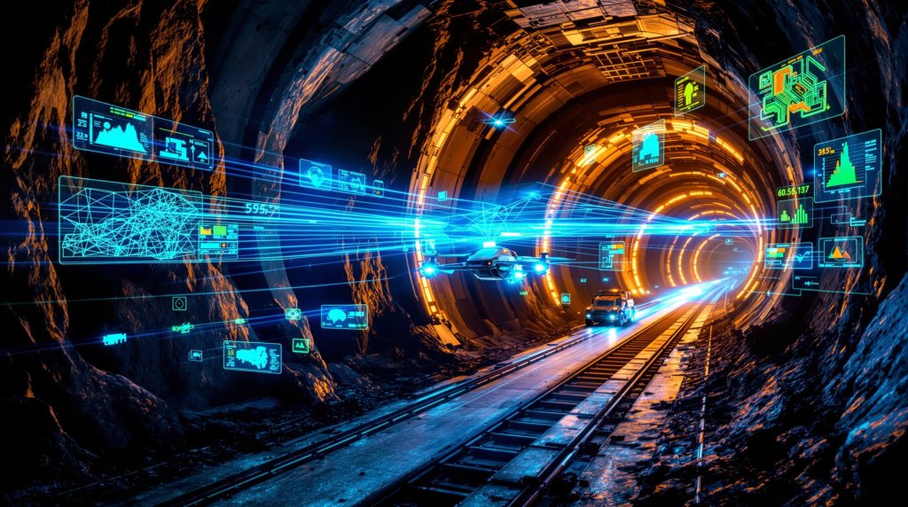
Light Detection and Ranging technology forms the foundation of autonomous underground mapping systems. LiDAR sensors generate precise 3D point clouds by measuring distances through rapid laser pulses, creating detailed environmental representations. According to industry specifications, current systems achieve measurement accuracy within 2-5 millimeters at typical underground distances.
Simultaneous Localization and Mapping algorithms enable autonomous navigation in GPS-denied environments. These sophisticated software systems process sensor data in real-time to build maps while simultaneously tracking the device's position within those maps. This capability proves essential for underground operations where satellite positioning remains unavailable.
Real-time data processing capabilities transform raw sensor information into actionable intelligence immediately upon collection. Mining operations can access detailed LiDAR insights soon after mapping completion, enabling rapid decision-making for operational planning and emergency response situations. Furthermore, this advancement supports comprehensive 3d geological modelling initiatives across mining operations.
Operational Advantages Over Traditional Methods
Autonomous mapping systems eliminate human exposure to structurally unstable areas and hazardous atmospheric conditions. Personnel no longer need to enter potentially dangerous zones to collect survey data, significantly reducing occupational safety risks. Emergency response teams can deploy autonomous systems to assess situations without additional personnel exposure.
Survey completion times decrease dramatically compared to traditional methods. Operations that previously required days of manual surveying can now be completed within hours using autonomous mapping technology. This efficiency improvement allows mining operations to maintain more current understanding of their underground environments.
Data precision reaches millimeter-level accuracy across complex three-dimensional spaces. Modern systems generate point cloud data with exceptional detail, providing comprehensive spatial information for engineering analysis and operational planning. This precision enables more accurate volumetric calculations and structural assessments while supporting modern mine planning processes.
Transforming Mine Safety Through Autonomous Technology
Mining operations worldwide report significant safety improvements when implementing autonomous mapping technologies. These systems address critical safety challenges that have historically endangered personnel during routine surveying and emergency response activities. Additionally, they contribute to data-driven mining operations by providing real-time safety intelligence.
Emergency Response and Rescue Operations
Real-time hazard assessment capabilities enable immediate evaluation of structural integrity following ground fall incidents. Autonomous systems can safely access unstable areas and provide detailed 3D mapping of damage extent without risking human lives. This capability proves particularly valuable when trapped personnel require rescue planning.
A recent case study from a Canadian underground mine demonstrates the life-saving potential of autonomous mapping technology. Following a ground fall incident that trapped several miners, autonomous drones conducted mapping flights to assess the affected area. The collected 3D data helped rescue teams understand access points and plan extraction routes.
According to reports, the drone's lights came within view of the trapped miners, providing hope during the rescue operation. Emergency response teams can now obtain comprehensive situational awareness within hours of incidents, compared to traditional methods that might require days of assessment before determining safe rescue approaches.
Convergence Monitoring and Predictive Safety
Early detection of ground movement patterns enables proactive safety measures before catastrophic failures occur. Continuous monitoring systems identify subtle structural changes that might indicate impending ground falls or infrastructure failure. This predictive capability allows operations to implement preventive measures and evacuate personnel from high-risk areas.
Automated alert systems provide immediate notification when predetermined movement thresholds are exceeded. Mining operations can establish monitoring protocols that trigger safety responses based on measured convergence rates and structural displacement patterns. Historical data comparison enables trend analysis for long-term stability assessment.
Case Study Applications
An Iowa underground mine experienced a ground fall incident requiring immediate assessment. Traditional surveying methods posed significant safety risks due to unstable conditions throughout the affected area. The operation utilised previously captured 3D data for initial risk assessment and deployed autonomous systems to remap the area safely.
Multiple autonomous flights determined that several areas had collapsed across approximately one kilometre from the surface entry point. The mapping revealed the complete extent of the new ground fall without exposing personnel to hazardous conditions. This comprehensive assessment enabled informed decisions about area accessibility and recovery operations.
Primary Applications in Underground Mining Operations
Modern mining operations utilise autonomous mapping across multiple operational areas, each addressing specific productivity and safety requirements. More than 25 distinct applications have been identified for autonomous mapping systems in underground environments. These applications integrate seamlessly with ai in drilling & blasting technologies to optimise extraction processes.
Production Optimisation Applications
| Application Area | Key Benefits | Implementation Focus |
|---|---|---|
| Stope Volumetrics | Precise volume calculations | Production reconciliation |
| Blast Optimisation | Structural analysis | Excavation planning |
| Equipment Navigation | Hazard identification | Operational safety |
| Infrastructure Monitoring | Condition assessment | Maintenance planning |
Autonomous Stope Mapping
Complete three-dimensional visualisation of extraction areas enables accurate production planning and reconciliation. Autonomous systems navigate complex stope geometries to capture comprehensive spatial data without personnel entry. This capability proves particularly valuable in narrow vein operations where traditional surveying presents significant challenges.
Precise volume calculations support accurate production forecasting and ore reserve management. Mining operations can quantify extracted material volumes and compare actual production against planned targets. Over-break and under-break analysis provides insights into blasting effectiveness and excavation precision.
Infrastructure Monitoring Applications
Tunnel stability assessment through regular autonomous surveys enables proactive maintenance scheduling. Support structure evaluation identifies potential failure points before they compromise operational safety. Ventilation system mapping ensures adequate airflow distribution throughout underground workings.
Access route condition monitoring maintains safe transportation corridors for personnel and equipment. Regular autonomous surveys document changes in tunnel dimensions and identify potential hazards that might impact vehicle operations. However, these monitoring capabilities represent just one aspect of broader mining industry evolution trends.
Vehicle-Integrated Scanning Solutions
Load-Haul-Dump Integration
Three-hundred-sixty-degree scanning during normal equipment operations provides continuous environmental monitoring without additional survey missions. Real-time obstacle detection capabilities enhance operator safety and equipment protection. Structural hazard identification occurs automatically during loading and hauling activities.
Integration with mining equipment reduces operational disruption while maintaining comprehensive mapping coverage. Equipment operators receive immediate alerts about changing conditions that might impact safety or operational efficiency. This continuous monitoring approach ensures current understanding of underground conditions.
Implementation Strategies for Mining Operations
Successful deployment of autonomous mapping systems requires strategic planning and phased implementation approaches. Mining operations must carefully evaluate their specific requirements and operational constraints to maximise technology benefits. For instance, companies like Emesent have pioneered mining applications that demonstrate the practical implementation of autonomous mapping solutions.
Assessment and Planning Phase
Current surveying method evaluation identifies opportunities for improvement and technology integration points. Risk area identification helps prioritise implementation focus on locations where autonomous mapping provides maximum safety and operational benefits. Technology integration requirements analysis ensures compatibility with existing operational systems.
Staff training programme development addresses operational procedures and safety protocols for autonomous mapping systems. Personnel must understand system capabilities, limitations, and proper operational procedures to maximise technology effectiveness.
Pilot Programme Execution
Limited area testing validates system performance under actual operational conditions. Workflow integration optimisation ensures autonomous mapping enhances rather than disrupts existing operational procedures. Data quality verification protocols establish confidence in system accuracy and reliability.
Performance metric establishment provides quantitative measures of system effectiveness and operational improvement. Mining operations can track safety incident reduction, survey time improvements, and data accuracy enhancement through systematic measurement programmes.
Full-Scale Deployment Considerations
Mine-wide system implementation requires careful coordination with ongoing operations to minimise disruption. Continuous monitoring protocol establishment ensures sustained operational benefits and system performance optimisation. Advanced analytics integration enables predictive maintenance and operational optimisation through data-driven decision making.
Technical Specifications and Performance Characteristics
Understanding technical capabilities helps mining operations select appropriate autonomous mapping solutions for their specific operational requirements and environmental conditions. The emesent hovermap for underground mines delivers exceptional performance across various technical parameters.
Sensor Performance Standards
LiDAR sensor specifications determine system effectiveness in underground environments. Current technology achieves scan rates up to 600,000 points per second with measurement ranges suitable for typical mining applications. Operating temperature ranges from -20°C to +60°C accommodate most underground conditions.
Dust and moisture resistance ratings of IP65 or higher ensure reliable operation in challenging mining environments. Point cloud density optimisation balances data quality with storage and processing requirements for practical operational use.
Data Processing Capabilities
Real-time SLAM processing enables immediate mapping feedback during autonomous missions. Point cloud data undergoes automatic optimisation to reduce storage requirements while maintaining operational accuracy. Multi-platform data synchronisation ensures compatibility across different operational systems.
Processing Timeline Considerations
- Immediate: Basic mapping and obstacle detection
- 1-2 hours: Detailed point cloud processing
- 2-4 hours: Comprehensive analysis and reporting
- Variable: Advanced analytics and comparative studies
Software Integration Features
Change detection algorithms automatically identify differences between survey periods, enabling efficient monitoring of structural changes and operational impacts. Volumetric calculation automation provides immediate quantification of excavated areas and material movements.
Export compatibility with major mine planning software ensures seamless integration with existing operational workflows. Virtual reality integration options enhance visualisation capabilities for training and operational planning applications.
Global Implementation Patterns and Operational Scales
Different mining environments and operational scales realise varying benefits from autonomous mapping implementation. Geographic distribution shows significant adoption across Australia, the United States, Canada, and Sweden for both production and safety applications.
Large-Scale Hard Rock Operations
Complex underground networks requiring comprehensive mapping benefit significantly from autonomous systems. High-value ore bodies demand precise extraction planning that autonomous mapping technology enables through detailed spatial analysis. Multiple simultaneous work areas require coordination that autonomous systems facilitate through real-time mapping updates.
Significant safety risks in large operations justify technology investment through demonstrated reduction in personnel exposure to hazardous conditions. Operations report substantial improvements in emergency response capabilities and predictive safety measures.
Specialised Mining Applications
Narrow vein operations benefit from autonomous navigation capabilities that traditional surveying methods cannot safely provide. High-grade deposits where dilution control remains critical utilise precise mapping for optimised extraction planning. Geologically challenging conditions that present ongoing safety risks see particular benefit from continuous autonomous monitoring.
Remote mining locations where personnel safety concerns are paramount find autonomous mapping essential for maintaining operational safety standards while achieving production objectives.
Geographic and Environmental Factors
Deep underground operations with extreme environmental conditions rely on autonomous systems for regular monitoring without personnel exposure. Seismically active mining regions require frequent structural assessment that autonomous systems can provide safely and efficiently.
Operations in complex geological formations benefit from detailed 3D mapping that reveals structural relationships invisible through traditional surveying methods. Remote locations where emergency response times are extended find autonomous mapping critical for rapid incident assessment.
Supporting Mine Planning and Engineering Applications
Integration with existing mine planning workflows enhances decision-making capabilities and operational efficiency across multiple engineering disciplines. Furthermore, comprehensive case studies demonstrate maximising mining efficiency through successful implementations of autonomous mapping technologies.
Engineering Design Integration
Ground support design optimisation utilises actual measured conditions rather than theoretical models for structural analysis. Ventilation system planning benefits from precise tunnel dimension data that autonomous mapping provides consistently. Equipment selection decisions utilise measured clearances and spatial constraints for optimal operational planning.
Access route planning incorporates detailed spatial analysis to optimise traffic flow and maintain operational efficiency. Convergence monitoring, blast optimisation, and stope design represent critical variables that benefit from autonomous mapping data integration.
Production Planning Enhancement
Accurate reserve calculations utilise measured volumes rather than estimated quantities for financial planning and operational scheduling. Extraction sequence optimisation incorporates actual structural conditions revealed through autonomous mapping surveys.
Equipment deployment planning utilises spatial analysis to optimise equipment utilisation and operational efficiency. Quality control through dilution monitoring enables real-time production adjustments to maintain ore quality standards.
Long-Term Strategic Benefits
Historical database development enables trend analysis for predictive operational planning and risk management. Predictive maintenance scheduling utilises condition monitoring data to optimise equipment reliability and operational uptime.
Regulatory compliance documentation automation reduces administrative burden while ensuring thorough record-keeping for safety and environmental requirements. Investment decision support through accurate operational data enables informed strategic planning for future development.
Future Developments in Underground Mining Automation
Emerging technologies continue expanding autonomous mapping capabilities and applications throughout the mining industry. Advanced analytics integration promises enhanced operational insights and predictive capabilities for the emesent hovermap for underground mines and similar systems.
Advanced Analytics Integration
Artificial intelligence applications enable automated hazard recognition and classification without human interpretation requirements. Predictive modelling for ground stability utilises historical data patterns to forecast potential safety risks before they manifest.
Optimised survey route planning maximises data collection efficiency while minimising operational disruption. Pattern recognition algorithms identify operational anomalies that might indicate developing safety or productivity concerns.
Enhanced Automation Features
Recent technological advances include exploration modes that eliminate waypoint programming requirements. Operators can provide rough bounding boxes and autonomous systems explore designated volumes until battery depletion or physical constraints prevent further progress. This advancement particularly benefits emergency response situations where environmental changes make precise flight planning difficult.
Exploration Mode Capabilities
- Autonomous area exploration without pre-programmed waypoints
- Adaptive navigation around obstacles and structural changes
- Complete volume mapping within operator-defined boundaries
- Automatic mission termination based on battery life or accessibility
Internet of Things Connectivity
Sensor network integration enables continuous monitoring capabilities that extend beyond periodic survey missions. Real-time data streaming to surface operations provides immediate awareness of underground conditions and changes.
Automated alert systems notify operators of critical condition changes that require immediate attention or response. Remote monitoring capabilities enable unmanned shift operations while maintaining comprehensive safety oversight.
Frequently Asked Questions About Underground Mapping Automation
What training requirements exist for autonomous mapping system operation?
Basic operational training typically requires 2-3 days for fundamental system operation and safety procedures. Advanced feature utilisation may require additional specialised instruction depending on specific operational requirements. Most manufacturers provide comprehensive training programmes with ongoing technical support.
How do autonomous mapping systems perform in dusty underground conditions?
Modern systems incorporate dust-resistant housings with IP65 or higher environmental protection ratings. Advanced algorithms filter environmental interference while maintaining measurement accuracy in challenging conditions. Regular maintenance protocols ensure sustained performance in harsh mining environments.
What data storage and processing requirements are necessary?
Point cloud data storage requirements typically range from 1-5 gigabytes per survey depending on area size and resolution settings. Cloud-based processing options minimise on-site computational requirements while providing advanced analytical capabilities. Local processing systems offer immediate data availability for time-critical applications.
How quickly can survey data be processed and made available for operational use?
Real-time processing provides immediate basic mapping and obstacle detection capabilities during autonomous missions. Detailed point cloud analysis and comprehensive reporting typically require 1-4 hours depending on survey complexity and required output formats. Advanced comparative analysis may require additional processing time for specialised applications.
What integration challenges exist with existing mine operational systems?
Most modern autonomous mapping systems provide standard data formats compatible with major mine planning software platforms. Initial integration typically requires information technology support for system configuration and workflow optimisation. Ongoing technical support addresses operational questions and system optimisation opportunities.
Further Exploration: Mining professionals interested in autonomous mapping technologies can access additional educational resources through industry publications and mining technology conferences. Australian Mining magazine regularly features emerging technology updates and case studies from global mining operations implementing advanced automation solutions.
Looking to Stay Ahead in Mining Discovery Investment?
Discovery Alert's proprietary Discovery IQ model delivers real-time alerts on significant ASX mineral discoveries, transforming complex exploration data into actionable investment insights powered by advanced AI. Experience why major discoveries can generate substantial returns by exploring Discovery Alert's discoveries page showcasing historical examples of exceptional outcomes, then begin your 30-day free trial to position yourself ahead of the market.