Understanding Seismic Tomography and Earth's Deep Structure
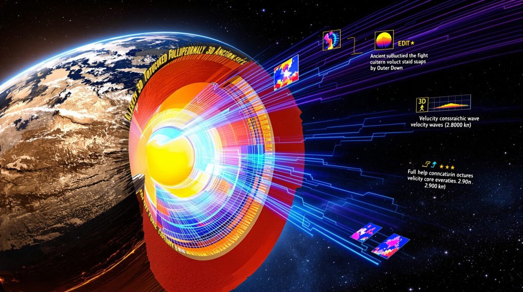
Seismic tomography transforms earthquake data into detailed three-dimensional models of subsurface structures, revealing variations in rock density, composition, and temperature from the surface down to the core-mantle boundary at 2,900 kilometers depth. This revolutionary imaging technique analyzes how seismic waves travel through different materials beneath our feet, creating unprecedented views of Earth's internal architecture. Furthermore, seismic tomography and slab reconstructions provide critical insights into plate tectonic processes that have shaped our planet over hundreds of millions of years.
When seismic waves encounter different materials during their journey through Earth, their speed changes dramatically. Dense, cold materials like subducted oceanic plates cause waves to accelerate, creating high-velocity anomalies that appear as distinct features in tomographic images. These fast-velocity zones typically show velocity increases of +1% to +3% compared to surrounding mantle material.
Conversely, hot, less dense materials such as mantle plumes slow down seismic waves, producing low-velocity anomalies with typical velocity decreases of -1% to -2% that indicate thermal upwelling. The relationship between velocity and temperature follows established mineral physics principles, where temperature increases of approximately 1°C correspond to velocity decreases of about 0.01 km/s in olivine-rich mantle rocks.
Resolution Limitations and Technical Challenges
Modern seismic tomography advances achieve spatial resolution no better than 100 kilometers, with actual resolution often significantly coarser depending on earthquake distribution and station coverage. This fundamental limitation creates substantial challenges for geological interpretations, as fine-scale features remain invisible to current imaging techniques.
The resolution achievable depends critically on several factors:
- Earthquake distribution – gaps in seismic activity create "blind zones"
- Station density – sparse networks cannot resolve detailed features
- Frequency content – higher frequencies achieve better resolution but attenuate over distance
- Model parameterization – trade-offs exist between resolution and solution stability
Resolution tests using checkerboard patterns reveal that features smaller than approximately 100 kilometers cannot be reliably reconstructed, requiring researchers to focus on large-scale structural interpretations rather than detailed local geology.
Advanced Methods for Reconstructing Ancient Subducting Slabs
Subducted oceanic plates manifest as fast-velocity anomalies in seismic tomography due to their relatively cold, dense composition compared to surrounding mantle material. These thermal anomalies preserve temperatures 500-1000°C cooler than ambient mantle conditions, creating detectable velocity contrasts that persist for hundreds of millions of years.
The velocity-depth relationship in subducted slab insights shows faster velocities at shallow depths (100-200 km) with gradual velocity reduction as slabs thermally equilibrate at greater depths. Some slabs remain traceable to the core-mantle boundary at 2,900 km depth, providing records of subduction processes extending back over 300 million years.
Traditional Vertical Sinking Models
Conventional reconstruction methods assume slabs sink vertically at uniform rates of approximately 1.2 cm/year, based on relationships between slab depth and subduction age derived from global tomographic analyses. This approach projects present-day slab positions backward through time, reconstructing ancient subduction zones directly beneath current slab locations.
Using this vertical sinking model:
- Depth (km) ≈ 1.2 cm/year × age (years)
- A 100 million-year-old slab should reside at approximately 1,200 km depth
- Deviations from this relationship suggest non-vertical paths or variable sinking rates
However, recent geodynamic modeling reveals significant complications to this simple picture, particularly in regions like western North America where complex mantle dynamics influence slab behavior.
Complex Dynamic Models and Non-Uniform Sinking
Advanced seismic tomography developments using realistic subduction histories reveal that while most global regions show relatively uniform vertical slab sinking, certain areas exhibit non-uniform behavior with temporal variations spanning 100-150 million years from simple vertical projections.
These models suggest sinking rate variations result from interactions with:
- Deep mantle plumes originating from the core-mantle boundary
- Return flow patterns in the lower mantle
- Thermal and chemical heterogeneities affecting buoyancy
- Regional mantle viscosity variations
Circum-Pacific regions experience particularly complex slab dynamics due to the concentration of active plume systems and associated return flow in the lower mantle.
Area-Balance Reconstruction Methodology
Alternative reconstruction techniques employ area-balance principles that avoid assumptions about sinking rates or trajectories. This approach measures total slab area visible in tomographic images and "unfolds" subducted material back to Earth's surface through an iterative process:
- Extract slab geometry from present-day tomographic models
- Calculate total slab area or length depending on mantle depth
- Unfold slab material back to Earth's surface in one step
- Apply plate reconstructions to test for overlaps with continental positions
- Search deeper in mantle for older slab segments when gaps appear
- Iterate backward in time from youngest to oldest slabs
This methodology produces testable predictions about ancient subduction zone locations without relying on contested assumptions about uniform sinking rates.
Plate Reconstructions and Subduction History
Oceanic plates older than approximately 200 million years have been almost entirely subducted into Earth's mantle, creating massive uncertainties in reconstructing ancient plate configurations. For tectonically active regions like western North America, these gaps can create positional uncertainties exceeding 8,000 kilometers when attempting to place geological features in their original locations.
Integration of Multiple Data Sources
Robust plate reconstruction methods combine multiple independent data sources to constrain ancient plate motions:
| Data Type | Information Provided | Temporal Range | Typical Precision |
|---|---|---|---|
| Seafloor spreading anomalies | Precise plate motions | 0-200 Ma | ±2-5 million years |
| Seismic tomography | Deep slab geometry | 0-300+ Ma | ±50-100 million years |
| Paleomagnetic data | Ancient latitudes | 0-500+ Ma | ±5-10° |
| Geological terranes | Surface constraints | Variable | ±10-50 million years |
Seafloor spreading anomalies provide the most precise kinematic constraints but are limited to the last 200 million years. In contrast, seismic tomography and slab reconstructions extend this record deeper in time but with significantly greater uncertainty in age assignments.
Testing Reconstructions Against Independent Evidence
Reliable plate models must successfully predict observable geological phenomena:
- Magmatic arc locations and timing – volcanic activity should align with predicted subduction zones
- Collision events and signatures – continental margins should show deformation where models predict convergence
- Paleomagnetic inclinations and declinations – ancient magnetic directions should match predicted paleolatitudes
- Exotic terrane distribution – displaced continental fragments should follow logical transport paths
The challenge lies in balancing tomographic constraints (which extend further back in time) with geological evidence (which provides more precise temporal and spatial constraints for recent periods).
Geodynamic Models and Slab Behaviour Insights
Global geodynamic simulations reveal fundamental differences between regional slab sinking patterns. While most parts of Earth show relatively uniform vertical slab descent at approximately 1.2 cm/year, western North America exhibits non-uniform and non-vertical slab sinking with significant deviations from simple models.
Recent modelling work using millions of tracers in realistic Earth simulations shows that slabs beneath North America can experience mismatches of 100-150 million years from predicted ages based on vertical sinking assumptions. This non-uniform behaviour results from complex interactions with deep mantle structures.
Influence of Mantle Plumes and Return Flow
Circum-Pacific regions experience particularly complex slab dynamics due to:
- Deep mantle plumes rising from the core-mantle boundary
- Return flow patterns created by plume upwelling in the central Pacific
- Thermal heterogeneities affecting local mantle viscosity
- Chemical variations influencing slab buoyancy and deformation
These interactions create lateral slab migration during descent, variable sinking rates, and deflection from purely vertical paths. The implications extend far beyond academic interest, directly impacting interpretations of terrain accretion timing, arc magmatism distribution, and mineral deposit formation.
Implications for Reconstruction Accuracy
Non-uniform sinking creates significant challenges for traditional reconstruction methods, potentially misplacing ancient subduction zones by thousands of kilometers and tens of millions of years. This uncertainty directly impacts:
- Terrain accretion timing and collision mechanisms
- Arc magmatism patterns and their relationship to subduction processes
- Mineral deposit formation models and exploration targeting
- Regional uplift and deformation interpretations
The recognition of these complexities has led to development of alternative reconstruction approaches that account for dynamic slab behaviour.
Conjugate Plate Analysis: Pacific Ocean History Reconstruction
The central Pacific preserves evidence of massive volcanic plateaus formed during the Early Cretaceous, including the Shatsky Rise and Hess Rise. Recent research suggests these features represent parts of an integrated hotspot system connected by the Ojin Seamount chain, forming a continuous volcanic province exceeding 3,000 kilometers in length.
Reconstructing Missing Conjugates
Since the Farallon plate carrying the conjugate portions of these plateaus has been subducted, scientists must model the characteristics of these missing pieces through detailed analysis of spreading patterns and hotspot behaviour.
Key findings from conjugate reconstruction work include:
- Shatsky conjugate estimated at approximately 40% the size of the preserved Pacific portion
- Complex ridge-jump history created asymmetric spreading patterns rather than simple symmetric conjugates
- Integrated hotspot system subducted beneath western North America between 90-50 million years ago
- Total system length approached 3,000 kilometers of plume-modified lithosphere
Evidence for Integrated Hotspot Systems
Analysis of the Shatsky-Hess system reveals isotopic similarities and age-progressive volcanism from 145 to 110 million years ago. New argon-argon dating confirms connections between these features through the Ojin Seamount chain, supporting models of continuous plume activity.
However, the Ojin seamounts appear to have formed off-ridge rather than directly at the spreading centre, raising questions about conjugate formation. Models suggest these seamounts represent waning volcanism as the hotspot migrated away from the ridge, then renewed activity when it approached the ridge again.
Implications for North American Tectonics
If accurate, this reconstruction suggests that massive volumes of buoyant, plume-modified lithosphere subducted beneath the western United States during the Late Cretaceous to Paleocene period. This material would have created:
- Flat-slab subduction geometries due to increased buoyancy
- Modified arc magmatism patterns through altered mantle chemistry
- Regional uplift and deformation from isostatic effects
- Shift complexes and low-angle faulting in areas like the southern Sierra Nevada
The timing of this subduction aligns with geological evidence for significant changes in western North American tectonics, including the formation of metamorphic core complexes and changes in magmatic patterns.
Applications to Mineral Exploration and Resource Prediction
Advanced plate reconstruction models increasingly serve as inputs for supervised machine learning algorithms designed to predict mineral deposit locations. These systems analyse complex relationships between plate tectonic parameters and mineralisation processes, particularly for porphyry copper systems that show strong correlations with subduction zone dynamics.
Machine Learning Applications in Resource Targeting
Research into porphyry copper deposits reveals that specific plate tectonic parameters demonstrate strong predictive power for deposit occurrence. Furthermore, machine learning in exploration applications integrate these tectonic insights with geochemical and geological data.
Positive Predictors:
- High absolute convergence rates exceeding 10-13 cm/year
- Optimal subduction zone geometries and dip angles
- Specific timing relationships between subduction initiation and arc magmatism
- Volatile flux parameters related to water content in subducting slabs
Weak or Non-Predictive Parameters:
- Oceanic crust carbonate content (shows no discriminatory power between positive and negative sites)
- Simple distance-to-trench measurements without considering convergence dynamics
- Basic lithological classifications of subducting plates
The machine learning approach identifies that higher convergence rates correlate with increased volatile flux into subduction zones, enhancing conditions for porphyry copper formation through improved fluid transport and concentration mechanisms.
Impact of Terrane Translation Uncertainties
Traditional plate models that ignore large-scale terrane translations create substantial uncertainty in mineral exploration targeting. The "Baja BC" hypothesis and similar large-scale translations can shift prospectivity maps across thousands of square kilometres, fundamentally altering exploration strategies.
Comparative analysis using different plate reconstruction models shows:
- Significant differences in predicted prospectivity between Arizona and Washington state
- High to moderate prospectivity zones that shift dramatically based on assumed terrane motions
- Uncertainty areas spanning entire geological provinces when translation scenarios are considered
This variability demonstrates the critical importance of accurate plate reconstructions for effective mineral exploration and resource assessment.
Testing Multiple Reconstruction Scenarios
For the first time, researchers have systematically tested different cordilleran plate reconstruction models using machine learning algorithms to evaluate their impact on mineral prospectivity predictions. This approach reveals:
- Model-dependent variations in prospectivity across major mining regions
- Systematic differences between reconstructions with and without terrane translations
- Training data limitations that require expanded geological databases for robust predictions
The systematic testing process requires approximately one year of data preparation and validation, highlighting the complexity of integrating geological, geophysical, and machine learning approaches.
Current Limitations and Future Research Directions
Despite decades of advancement, seismic tomography and slab reconstructions still face fundamental limitations that constrain their application to plate reconstruction problems. Resolution remains spatially variable and dependent on earthquake distribution, creating trade-offs between model detail and stability that affect geological interpretations.
Technical Challenges in Tomographic Resolution
Key limitations include:
- Spatially variable resolution ranging from 100 km to >300 km depending on seismic network geometry
- Trade-offs between resolution and model stability in regularised inversion solutions
- Difficulty distinguishing between thermal and compositional velocity anomalies
- Uncertainty quantification that remains challenging to propagate through reconstruction algorithms
Resolution testing using synthetic models reveals that tomographic images cannot reliably resolve features smaller than the imposed grid spacing, limiting interpretations to large-scale geological structures.
Integration of Multiple Datasets
Future progress requires better integration of diverse data sources:
- High-resolution regional tomography with global velocity models
- Geochemical constraints on slab composition and alteration processes
- Geodynamic modelling with observational constraints from seismology and geology
- Machine learning approaches for pattern recognition in complex, multidimensional datasets
The challenge lies in developing frameworks that can accommodate different types of uncertainty and temporal resolution across these diverse data sources.
Community-Based Model Development
The complexity of plate reconstruction problems suggests that community-wide collaboration may be necessary to achieve robust solutions. Proposed approaches include:
- Standardised geological constraint databases accessible to all researchers
- Consensus model development for testing against tomographic data
- Open-source reconstruction tools that facilitate method comparison and validation
- Interdisciplinary research frameworks connecting geophysics, geology, and computational sciences
One promising direction involves creating geological plate reconstruction models that incorporate magmatic records and other geological constraints, then testing these predictions against independent tomographic and paleomagnetic evidence.
Significance for Understanding Earth's Evolution
Advances in seismic tomography and slab reconstructions directly impact fundamental questions about Earth's long-term evolution and the driving forces behind plate tectonics. These methods provide unique insights into processes that operate over geological timescales and affect global systems. Moreover, quantitative analysis of tomographic data continues to refine our understanding of deep Earth structure.
Implications for Global Tectonics
Improved understanding of slab behaviour affects interpretations of:
- Long-term plate motion patterns and their relationship to mantle convection
- Subduction zone dynamics and their role in global geochemical cycles
- Continental growth processes through arc accretion and collision
- Mantle mixing mechanisms and the preservation of geochemical heterogeneities
The recognition that slab sinking rates vary regionally and temporally challenges simple models of mantle convection and suggests more complex interactions between surface tectonics and deep Earth processes.
Applications to Natural Hazards
Enhanced knowledge of slab geometry and behaviour improves:
- Earthquake hazard assessment in subduction zones through better understanding of slab structure
- Volcanic eruption forecasting via improved models of magma generation processes
- Tsunami generation mechanisms related to subduction zone earthquakes
- Long-term seismic cycle characterisation incorporating deep structural controls
These applications have direct societal relevance, particularly for populations living in active margin settings where subduction processes control natural hazard occurrence.
Economic and Resource Implications
Better plate reconstructions enable more effective approaches to:
- Mineral exploration strategies incorporating dynamic plate tectonic models
- Critical mineral supply chain security through improved resource assessment
- Sustainable development practices informed by long-term geological processes
- Hydrocarbon exploration in complex tectonic settings
The economic implications extend beyond immediate resource extraction to include long-term planning for mineral security and sustainable development in tectonically active regions.
Disclaimer: This article discusses ongoing research in seismic tomography and plate reconstruction. Some findings represent preliminary results or works in revision that may be subject to change as research progresses. Readers interested in the most current developments should consult recent peer-reviewed literature and academic institutions specialising in geophysics and tectonics research.
Seeking Opportunities in Mineral-Rich Exploration Companies?
Discovery Alert provides real-time notifications on significant ASX mineral discoveries using its proprietary Discovery IQ model, enabling investors to capitalise on exploration breakthroughs before broader market recognition. Explore how major mineral discoveries can generate exceptional returns and begin your 30-day free trial to gain immediate access to actionable investment insights in the dynamic Australian resources sector.