Understanding Australia's Advanced Geophysical Mapping Initiative
The global mining industry evolution stands at a technological crossroads where traditional exploration methods increasingly struggle to locate the next generation of mineral deposits. As surface-level resources become depleted and exploration targets shift to deeper, more concealed deposits, Australia has positioned itself at the forefront of revolutionary subsurface detection technologies through precision gravitational measurement systems. The new gravity testing site in Western Australia represents a pivotal advancement in this technological transformation.
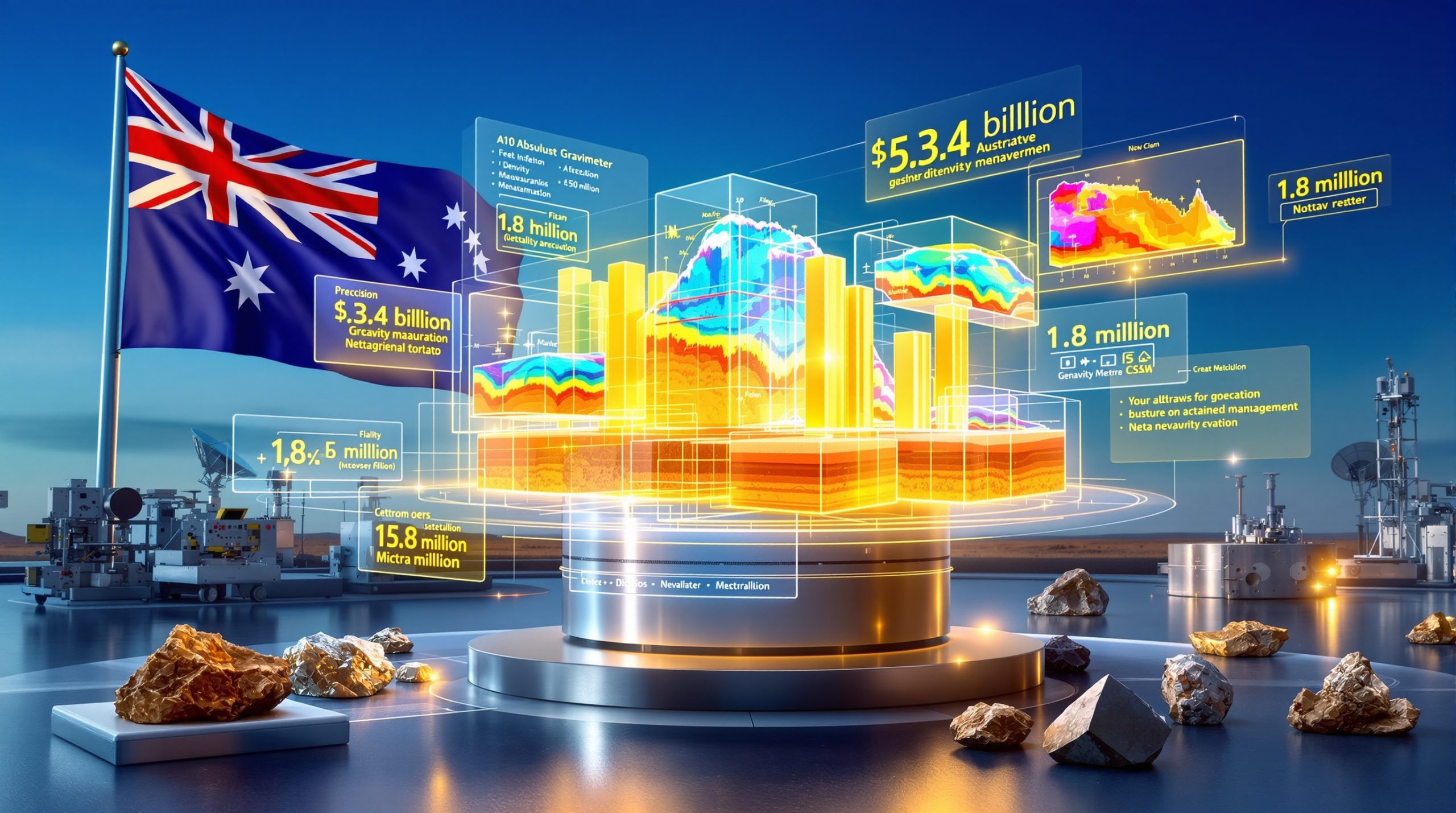
Australia's mineral exploration sector is undergoing a fundamental transformation driven by the $3.4 billion Resourcing Australia's Prosperity initiative. This comprehensive program represents the nation's most ambitious approach to continental-scale resource mapping, utilising cutting-edge gravitational analysis technology to unlock previously undetectable mineral concentrations buried hundreds of metres below surface level. The significance of mineral exploration importance cannot be overstated in this context.
Initiative Overview:
• Total federal investment: $3.4 billion allocated across multiple years
• Technology integration: Satellite systems combined with ground-based gravity measurement
• Geographic scope: Continental-scale geological mapping coverage
• Data accessibility: Open-source online database platform
• Implementation timeline: Long-term comprehensive mapping programme
Federal Resources Minister Madeleine King emphasised the strategic importance of accurate gravity data in understanding subsurface geological features, noting that detailed gravity information enables both geological mapping and mineral exploration whilst supporting the GPS navigation systems that Australians rely upon daily. Furthermore, the Australia's first state-wide airborne gravity model demonstrates the expanding scope of these technological advances.
The Science Behind Gravitational Anomaly Detection
Gravitational measurement technology operates on fundamental physics principles where subsurface rock formations exhibit distinct density variations that create measurable gravitational signatures. Dense rock formations produce stronger gravitational readings, while less dense materials generate weaker gravitational responses, enabling geologists to map underground structures with unprecedented precision.
Rock Density Characteristics:
| Rock Type | Average Density (g/cm³) | Gravity Signature | Exploration Applications |
|---|---|---|---|
| Granite | 2.7 | Strong readings | High-density mineral detection |
| Sandstone | 2.3 | Weak readings | Groundwater aquifer mapping |
| Metamorphic | 1.9–3.5 (variable) | Variable readings | Complex mineral assemblages |
| Sedimentary | 2.4 | Moderate readings | Hydrocarbon and water resources |
Gravitational Anomaly Detection Principles
Modern gravity-based exploration relies on the fundamental principle that subsurface geological formations display measurable density contrasts. These variations, whether occurring between mineralised zones and surrounding host rocks or between different geological formations, produce distinctive gravitational patterns that trained geophysicists can interpret without surface disturbance.
Dense mineral concentrations such as iron ore deposits or base metal sulphides generate significantly stronger gravitational readings compared to surrounding lower-density country rock. Consequently, this density differential enables exploration teams to map subsurface structural features that remain completely invisible to conventional surface geological mapping techniques.
Detection Capabilities:
• Mineral deposits located hundreds of metres below surface
• Subsurface structural features invisible to surface analysis
• Groundwater-bearing formations through density contrast analysis
• Hydrocarbon-bearing structures via density differentiation
Advanced Gravimeter Technology Applications
The A10 absolute gravimeter represents the technological pinnacle of precision gravitational measurement systems, achieving sensitivity levels capable of detecting gravitational variations as minute as one part in a billion. This extraordinary measurement precision enables exploration professionals to identify mineral concentrations buried at significant depths below surface level.
Technical Specifications:
• Measurement precision: Micro-gravity level detection (1 microgal threshold)
• Operational capability: Surface to deep subsurface analysis
• Accuracy classification: Absolute gravimeter providing non-relative measurements
• Calibration standard: International Bureau of Weights and Measures protocols
• Data integration: Real-time satellite coordination systems
Real-Time Satellite Coordination Systems
Contemporary absolute gravimeters integrate sophisticated data streams from satellite positioning systems to establish precise vertical positioning, enable continuous positional tracking during field surveys, facilitate seamless data integration with satellite-derived gravity anomaly information, and support comprehensive three-dimensional spatial referencing protocols.
The integration of ground-based measurements with satellite gravitational data creates comprehensive three-dimensional subsurface models with accuracy levels previously unattainable through traditional exploration methodologies. Moreover, this technological convergence provides exploration teams with detailed geological understanding before committing substantial financial resources to expensive drilling programmes.
Strategic Location Selection and Operational Framework
The Bunbury testing facility established in November 2025 serves as Australia's gravitational measurement benchmark, strategically positioned within Western Australia's mineral-rich geological corridor. This location provides optimal conditions for calibrating advanced measurement systems across diverse geological formations whilst establishing standardised protocols for nationwide resource mapping applications.
Facility Capabilities:
• Benchmark standard establishment for national gravity measurements
• Regional calibration protocols development
• Multi-terrain testing environments across varied geological formations
• Integrated satellite data processing infrastructure
• Continental-scale mapping coordination centre
Western Australia's Strategic Mineral Context
Western Australia's selection as the primary testing location reflects the state's extraordinary mineral endowment, producing approximately 90% of Australia's gold, 75% of lithium production, and substantial portions of iron ore, base metals, and rare earth elements. This geological diversity makes Western Australia optimal for establishing calibration infrastructure that can be applied across Australia's varied mineral terrains.
The Bunbury facility's proximity to diverse geological formations enables comprehensive testing across granite basement terrains, sedimentary sequences, metamorphic complexes, and integrated historical gravity data spanning 87 years of continuous measurement collection. In addition, this comprehensive approach supports the development of data-driven mining operations throughout the region.
National Gravity Database Integration
Australia's National Gravity Database contains over 1.8 million gravity observations collected systematically since 1938, representing one of the world's most comprehensive gravitational datasets spanning nearly nine decades of continuous measurement. This extensive historical repository provides unprecedented baseline information for comparative analysis of subsurface features across Australia's diverse geological terrains.
Database Specifications:
• Historical observations: 1.8+ million gravity measurements
• Collection timeframe: 87 years of continuous monitoring (1938–2025)
• Geographic coverage: Continental-scale mapping across Australia
• Data accessibility: Public online platform with no access fees
• Quality assurance: Automated validation protocols comparing new measurements against historical baselines
Database Architecture and Integration Protocols
The database utilises standardised digital records incorporating spatial coordinates, gravity values, and comprehensive measurement metadata. New measurements from facilities like Bunbury undergo automated processing through established validation routines before integration into the public platform, ensuring data quality and consistency across the national dataset.
This systematic approach enables temporal analysis of gravitational changes over decadal timescales whilst providing exploration professionals with immediate access to both historical and contemporary gravity information for enhanced targeting accuracy. Furthermore, this approach supports comprehensive [mineral deposit tiers guide](https://discoveryalert.com.au/mineral deposit-tiers-guide-2025/) development for various exploration targets.
Enhanced Exploration Targeting Efficiency
Gravity-based mineral exploration delivers substantial economic advantages through precise subsurface mapping before physical drilling investigation. Modern gravity surveys enable exploration companies to reduce preliminary drilling costs by 40-60% whilst achieving three times higher success rates compared to traditional surface-only exploration approaches.
Economic Impact Analysis:
| Metric | Traditional Exploration | Gravity-Enhanced Approach | Improvement |
|---|---|---|---|
| Drilling Cost Reduction | Baseline | 40-60% savings | Major cost advantage |
| Target Accuracy | Standard | 3x higher success | Significant improvement |
| Assessment Timeline | 100% baseline | 50% faster evaluation | Substantial time savings |
| Risk Mitigation | Standard dry hole rates | Reduced probability | Enhanced confidence |
Pre-Drilling Risk Reduction Methodology
Gravity surveys establish comprehensive subsurface density models prior to physical drilling through systematic identification of structural features controlling mineralisation, mapping of lithological boundaries affecting mineral distribution, detection of density anomalies diagnostic of mineral concentration, and strategic reduction of drilling locations from hundreds to dozens through scientifically-validated targeting.
Typical Workflow Enhancement:
• Traditional approach: 100 drill holes required for adequate prospect evaluation
• Gravity-enhanced method: 30-50 drill holes achieving equivalent confidence levels
• Economic result: 50-70% drilling cost reduction whilst maintaining exploration confidence
Groundwater and Critical Mineral Detection
Beyond traditional base metal exploration, gravity testing reveals essential groundwater aquifers critical for mining operations whilst identifying critical mineral deposits crucial for renewable energy technologies. This dual-purpose capability maximises the value proposition of each measurement campaign across multiple resource categories.
Resource Detection Applications:
• Critical minerals: Lithium, cobalt, rare earth element concentrations
• Groundwater systems: Aquifer mapping and capacity assessment protocols
• Base metals: Copper, zinc, lead deposit indicators
• Precious metals: Gold and silver concentration signatures
• Energy resources: Hydrocarbon structure identification
Minister Madeleine King highlighted the technology's capability in identifying potential sites for both groundwater and critical minerals, emphasising that accurate gravity data enhances understanding of subsurface features essential for Australia's resource security and renewable energy transition requirements. The federal government's commitment to measuring gravity demonstrates the national importance of this initiative.
Geophysical Survey Method Comparison
Contemporary mineral exploration utilises multiple geophysical technologies, each offering distinct advantages and limitations across different geological settings and exploration objectives. Gravity testing provides unique benefits in terms of detection depth, environmental impact, and cost efficiency compared to alternative survey methodologies.
Comparative Analysis of Exploration Methods:
| Survey Method | Maximum Detection Depth | Cost Efficiency | Environmental Impact | Data Resolution Quality |
|---|---|---|---|---|
| Gravity Testing | 500+ metres | High efficiency | Minimal disruption | Excellent resolution |
| Magnetic Surveys | 200-300 metres | Moderate efficiency | Low impact | Good resolution |
| Seismic Analysis | 1000+ metres | Low efficiency | Moderate disruption | Variable quality |
| Core Drilling | Unlimited depth | Very low efficiency | High impact | Precise but localised |
Integration Advantages
Modern exploration programmes increasingly combine multiple geophysical methods to maximise geological understanding whilst minimising exploration risks. Gravity testing serves as an ideal first-phase exploration tool, providing regional-scale geological understanding that guides subsequent detailed investigation through complementary technologies.
The integration of gravity data with magnetic surveys, seismic analysis, and targeted drilling creates comprehensive geological models that significantly improve exploration success rates whilst reducing overall project costs and environmental impact. In addition, 3D geological modelling enhances the interpretation of these integrated datasets.
Integration with Satellite Technology
The new gravity testing site in Western Australia demonstrates Australia's commitment to integrating ground-based precision measurements with satellite-derived gravitational data. This technological convergence creates unprecedented three-dimensional subsurface models combining the accuracy of ground-based measurements with the broad coverage capabilities of satellite systems.
Satellite Integration Components:
• Ground-based systems: Direct measurement using absolute gravimeters at specific locations
• Satellite gravitational data: Continental-scale coverage through orbital measurement platforms
• Data synthesis protocols: Integration algorithms creating comprehensive subsurface models
• Real-time coordination: GPS/GNSS positioning for precise spatial referencing
• Quality assurance: Cross-validation between ground and satellite measurements
Three-Dimensional Geological Modelling
The combination of satellite and ground-based gravity data enables creation of sophisticated three-dimensional geological models that reveal subsurface structures at multiple scales. These models provide exploration teams with comprehensive geological context before initiating expensive drilling programmes, significantly improving targeting accuracy and reducing exploration risks.
Advanced data processing algorithms integrate measurements from multiple sources, applying sophisticated corrections for atmospheric effects, instrumental drift, and temporal variations to produce highly accurate subsurface density models suitable for mineral exploration targeting.
Strategic Resource Security Enhancement
Australia's comprehensive gravity mapping initiative positions the nation as the global leader in mineral resource intelligence, supporting long-term resource security whilst maintaining competitive advantages in international commodity markets. This technological leadership provides strategic benefits extending beyond immediate exploration applications.
Strategic National Advantages:
• Enhanced discovery rates: Improved success in identifying new mineral deposits
• Economic efficiency: Better project economics through reduced exploration costs
• Environmental stewardship: Minimised exploration environmental impact
• Export competitiveness: Strengthened position in global commodity markets
• Resource security: Comprehensive understanding of national mineral endowment
Long-Term Economic Implications
The Resourcing Australia's Prosperity initiative creates lasting economic value through systematic mapping of Australia's mineral potential. This comprehensive approach supports sustainable resource development whilst providing the geological intelligence necessary for strategic planning across multiple commodity sectors.
Access to high-quality gravity data enables smaller exploration companies to compete more effectively with major mining corporations, democratising access to sophisticated geological intelligence previously available only to well-capitalised organisations.
Innovation in Sustainable Exploration Practices
Gravity-based exploration represents a paradigm shift toward environmentally sustainable mineral exploration practices that minimise surface disturbance whilst maintaining exploration effectiveness. This technology-driven approach aligns with Australia's commitment to responsible resource development and environmental stewardship.
Sustainability Advantages:
• Minimal surface disturbance: No excavation or drilling required for initial surveys
• Reduced environmental footprint: Significantly lower impact compared to traditional methods
• Enhanced targeting precision: Reduced requirement for speculative drilling
• Efficient resource utilisation: Optimised allocation of exploration capital
• Long-term data value: Permanent geological database for future reference
The establishment of standardised gravity measurement protocols through facilities like the new gravity testing site in Western Australia ensures consistent, high-quality data collection across diverse geological terrains whilst supporting sustainable exploration practices that balance resource development with environmental protection.
Economic Impact on Australian Mining
The integration of advanced gravity testing technology creates substantial economic benefits across Australia's mining sector through improved exploration efficiency, reduced project risks, and enhanced resource discovery rates. These technological improvements translate directly into improved project economics and increased mining sector competitiveness.
Industry-Wide Benefits:
• Capital efficiency: Reduced exploration expenditure per successful discovery
• Risk mitigation: Lower probability of unsuccessful drilling programmes
• Timeline acceleration: Faster progression from exploration to development
• Resource optimisation: More effective allocation of exploration budgets
• Technology leadership: Global competitive advantage in exploration methodology
Supporting Smaller Exploration Companies
Public availability of high-quality gravity data through the national database provides smaller exploration companies with access to sophisticated geological intelligence previously available only to major mining corporations. This democratisation of geological data creates more competitive exploration markets whilst supporting innovation across the mining sector.
The economic multiplier effects of improved exploration efficiency extend throughout the mining services sector, supporting employment in geological consulting, drilling services, and related technical specialties essential for successful mineral exploration programmes.
Future Expansion and Development
Australia's investment in gravity testing infrastructure represents the foundation for expanded geological mapping capabilities that will continue evolving with advancing technology. The new gravity testing site in Western Australia serves as a model for potential additional facilities across different geological terrains and commodity-specific exploration requirements.
Development Opportunities:
• Geographic expansion: Additional testing facilities in other mineral-rich regions
• Technology advancement: Integration of emerging measurement technologies
• International collaboration: Partnerships with other mineral-rich nations
• Education and training: Workforce development in advanced geophysical techniques
• Data enhancement: Continuous improvement of measurement precision and coverage
The long-term vision encompasses Australia as the global centre of excellence for gravity-based mineral exploration, supporting both domestic resource development and international collaboration in advanced exploration technologies.
Australia's pioneering approach to gravity-based mineral exploration through initiatives like the new gravity testing site in Western Australia demonstrates the nation's commitment to technological leadership in resource discovery. This comprehensive integration of advanced measurement technology with historical geological data creates an unprecedented platform for sustainable mineral exploration that balances economic development with environmental responsibility.
The $3.4 billion Resourcing Australia's Prosperity initiative represents more than a technological upgrade; it establishes Australia as the global benchmark for precision-guided resource exploration. Through systematic gravity mapping, comprehensive data integration, and open-access geological intelligence, Australia ensures continued leadership in global mineral supply whilst supporting the transition to sustainable exploration practices that minimise environmental impact.
As the mining industry evolves toward deeper, more challenging exploration targets, Australia's investment in gravity testing infrastructure positions the nation at the forefront of next-generation exploration technology, ensuring sustained competitiveness in global commodity markets whilst supporting responsible resource development for future generations.
Ready to Invest in Australia's Next Major Mineral Discovery?
Discovery Alert's proprietary Discovery IQ model delivers real-time notifications on significant ASX mineral discoveries, instantly empowering subscribers to identify actionable opportunities ahead of the broader market. Visit Discovery Alert's dedicated discoveries page to understand why historic mineral discoveries can generate substantial returns, then begin your 30-day free trial today to position yourself ahead of the market with cutting-edge exploration insights.