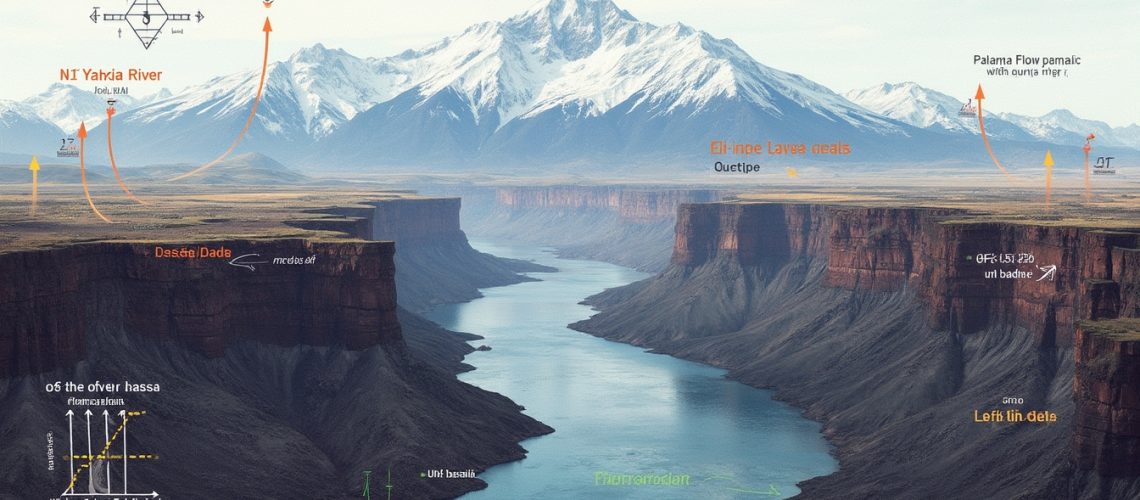
The Cascade Range is a vital geological landscape in the Pacific Northwest, where tectonic processes have dramatically reshaped the terrain over millions of years. This mountainous region, stretching from northern California through Oregon and Washington to British Columbia, is emblematic of rock deformation, showcasing the dynamic nature of Earth’s crust. Understanding the relationship between the uplift of the Cascade Range and the Columbia River Flood Basalts (CRBs) offers profound insights into the complex geological evolution of this area.
Initiating around 16 million years ago, the Columbia River Flood Basalts represent one of the largest volcanic events in Earth’s history. Enormous volumes of basaltic lava flowed across the landscape, covering an area of approximately 163,700 square kilometres with a volume exceeding 174,300 cubic kilometres. This monumental activity fundamentally transformed the region’s topography. Concurrently, major uplift pulses in the Cascade Range occurred, with significant movements documented as recently as 3 million years ago. These uplifts have created a dynamic geological narrative that continues to intrigue and challenge geologists seeking to understand the intricate processes shaping the Earth’s surface.
Flowing from the Rocky Mountains to the Pacific Ocean, the Columbia River uniquely cuts through the Cascade Range, which is unusual for a river to traverse such a significant mountain arc. This makes it an extraordinary natural laboratory for studying tectonic changes and uplift patterns. According to USGS geologist Lydia Staisch, the river’s near-sea-level base serves as an invaluable reference point for dating tectonic transformations, allowing researchers to construct a detailed timeline of the region’s geological evolution. “The Columbia River provides critical markers that are essential for understanding regional uplift dynamics,” she notes.
Geological Markers and Uplift Mechanisms
Basalt flows act as essential chronological “markers” in tracking the region’s geological history. These basalt flows are invaluable in reconstructing the geological timeline of the Pacific Northwest. Specific formations like the Pomona Basalt, dated between 11 and 12 million years ago, and the younger Pine Creek latites, ranging from 2.4 to 3.6 million years old, offer crucial insights into the complex uplift processes. By analysing these formations, geologists can infer the rates and scales of uplift and erosion over time, piecing together the complex uplift mechanisms at play.
Researchers employ sophisticated methodologies to unravel these geological mysteries. Stable isotope geochemistry allows scientists to interpret past climatic conditions and elevation changes by examining the isotopic composition of minerals and fluids. Low-temperature thermochronology, on the other hand, involves studying the thermal history of rocks to determine the timing and rate of uplift and erosion. These techniques have revealed significant topographic growth in the region between 27 and 15 million years ago, followed by major uplift pulses that have shaped the current landscape. Understanding the interplay between tectonic uplift and volcanic activity not only elucidates the region’s geological history but also has implications for mineral deposits.
Structural Complexity of Regional Deformation
The Yakima Fold Belt, a series of east-west oriented folds in south-central Washington, introduces additional complexity to the regional deformation narrative. This geological feature results from compressional forces that have folded the basaltic layers of the CRBs. The interaction between the Yakima Fold Belt’s east-west compression and the Cascade Range’s north-south compression creates an intricate stress field that profoundly influences the region’s tectonic activity.
Lydia underscores that both the Yakima Fold Belt and the Cascade Range have exhibited tectonic activity in relatively recent geological times. This suggests that the deformation processes in these regions may have been simultaneous but potentially intermittent, with periods of quiescence and reactivation. The overlapping stress fields from different compressional forces demonstrate the dynamic and complex nature of the region’s geological evolution, highlighting the interplay between various tectonic mechanisms.
What Is the Evidence of Younger Uplift Phases?
Recent research has brought to light evidence of a significant uplift phase within the last 3 million years. Geological indicators such as basalt flows displaying hyaloclastite facies—formed when lava interacts explosively with water—suggest that there has been approximately 900 metres of vertical movement during this period. This substantial elevation change points to ongoing tectonic activity and mountain-building processes in the Cascade Range.
Additional support for the recent uplift comes from Jim O’Connor’s Geological Society of America field trip guide, which documents elevated basalt occurrences along the Columbia River Gorge. These elevated basalts, which were once at or near sea level, now sit hundreds of metres above the current river level. Such findings challenge previous models and understanding of the region’s tectonic history, suggesting that significant uplift has occurred more recently than previously thought.
Did Earlier Basalt Flows Cross Present Barriers?
One intriguing question is whether earlier Columbia River Flood Basalt flows managed to cross areas that are now significant topographic barriers. The colossal volume of the Grand Ronde basalt suggests potential westward migration through lower-relief corridors that existed at the time. Understanding these ancient flow pathways is crucial for reconstructing the paleodrainage systems and appreciating how the landscape has evolved over millions of years.
These ancient volcanic activities have not only shaped the topography but also influenced the formation of mineral deposits in the region, including the development of porphyry and epithermal deposits. Such deposits are significant for their economic value and provide insights into the geothermal systems associated with volcanic activity.
Evidence supporting these hypotheses comes from the Pomona Flow, a basalt flow that channelised through the ancestral Columbia River system into what is now the Chehalis Basin. This suggests that there were lower-relief corridors facilitating westward lava flow. However, as the Cascade Range continued to uplift, it likely blocked these widespread pathways in later geological periods, altering the course of both lava flows and river systems.
Methodological Insights
To uncover the region’s geological history, scientists employ various methodological approaches. Stable isotope analysis in fossilised remains, soil carbonates, and lake sediments allows researchers to infer past climate conditions related to elevation changes. Isotopic ratios of oxygen and hydrogen can indicate ancient temperatures and precipitation patterns, which are influenced by altitude. Low-temperature thermochronology offers additional insights by tracking the cooling history of rocks as they are exhumed to the surface, effectively providing a timeline for uplift and erosion processes.
These multi-method approaches enable researchers to differentiate between changes caused by rock uplift and those due to global climate fluctuations. This is crucial for constructing accurate models of geological transformations, as it helps isolate the tectonic factors from climatic ones. Such nuanced understanding is essential for comprehending how the interplay of different Earth systems shapes the planet’s surface.
Current Research Directions
Despite advancements, ongoing debates persist regarding the precise timing and extent of major uplift events in the Cascade Range. Estimates vary widely, with some studies suggesting significant uplift occurred between 12 and 4 million years ago. Emerging research is focusing on geochemical fingerprinting of basaltic gravels found in regions like the Chehalis Basin and Puget Sound. By analysing the geochemical signatures of these gravels, scientists hope to trace their origins and transport pathways, which could shed light on historical river courses and uplift patterns.
This geochemical analysis is akin to methods used in studying the geology of ore deposits, where tracing elemental compositions helps in understanding the formation processes and sources of mineral deposits. Such techniques are instrumental in both academic research and practical applications like mining exploration.
Lydia’s perspective encapsulates the dynamic and ever-evolving nature of geological research: “Everything’s possible… there’s always room for more research.” This open-minded approach underscores the importance of continual exploration and reassessment in the field of geology, as new techniques and discoveries constantly refine our understanding of Earth’s complex systems.
Conclusion
The uplift of the Cascade Range is a complex, multi-phase geological phenomenon intimately connected with the Columbia River Flood Basalts. The interplay between volcanic activity, tectonic uplift, and erosion has sculpted the landscape over millions of years, creating the dramatic topography we observe today. Ongoing interdisciplinary research continues to unravel the intricate mechanisms of tectonic transformation, providing increasingly sophisticated insights into the region’s geological evolution.
These efforts not only enhance our understanding of past geological events but also have practical implications. For instance, they inform assessments of natural hazards such as volcanic eruptions and earthquakes and guide exploration for natural resources, including mineral deposits and geothermal energy. Understanding the tectonic and volcanic history aids in identifying areas with mineralisation potential, such as scarn zones.
By integrating advanced methodologies like stable isotope geochemistry, thermochronology, and detailed field studies, geologists are progressively decoding the remarkable geological history of the Pacific Northwest. These comprehensive approaches continue to shed light on the complex processes that have shaped, and continue to shape, this dynamic region of the Earth.
Are You Ready to Unlock the Secrets of Major Geological Discoveries?
Dive deeper into the world of significant geological transformations with Discovery Alert’s real-time notifications on major mineral discoveries. Whether you’re a seasoned geologist or a curious investor, our service simplifies complex geological data, such as the Cascade Range uplift insights, helping you make informed decisions. Experience our 30-day free trial today by visiting Discovery Alert and enhance your understanding of our dynamic planet.


