Geophysical surveys represent sophisticated scientific methods that enable mining companies to examine subsurface geology without physical excavation. These non-invasive techniques measure variations in physical properties beneath the Earth's surface, revealing potential mineral deposits at depths ranging from hundreds to thousands of meters below ground level. Furthermore, mineral exploration significance continues to drive technological advancement in survey methodologies.
Modern exploration programs utilise these advanced methodologies to significantly reduce surface disturbance while providing comprehensive geological understanding. The geophysical survey at Taguas Project demonstrates this approach perfectly, where Orvana Argentina has initiated comprehensive subsurface analysis across 15 mining concessions covering 3,274 hectares in Argentina's San Juan province.
Core Principles of Geophysical Exploration
The fundamental physics underlying geophysical exploration relies on detecting contrasts in subsurface physical properties:
• Resistivity mapping identifies areas where electrical conductivity changes indicate different rock types or mineralisation zones
• Magnetic field analysis detects variations in magnetic susceptibility that suggest specific mineral assemblages or structural features
• Gravitational measurements reveal density contrasts that may indicate ore bodies, geological structures, or lithological boundaries
• Electromagnetic responses provide information about conductivity variations and potential sulphide mineralisation
The Taguas Project exemplifies integrated geophysical methodology, combining magnetotelluric and induced polarisation surveys with historical geological data to create comprehensive subsurface models. This approach enables exploration companies to prioritise drilling targets with significantly higher success rates compared to random drilling programmes. Additionally, 3D geological modelling enhances interpretation accuracy throughout these integrated programmes.
How Do Magnetotelluric (MT) Surveys Revolutionise Deep Exploration?
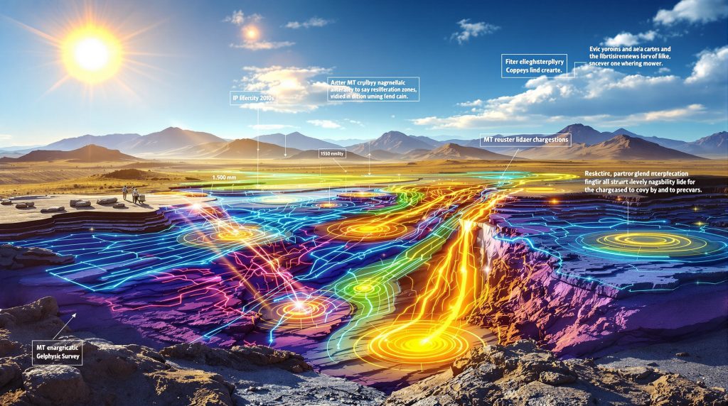
Magnetotelluric surveys utilise natural electromagnetic fields generated by solar wind interactions and atmospheric lightning to probe deep subsurface structures. This passive technique measures electrical resistivity variations at exceptional depths, with the geophysical survey at Taguas Project targeting depths of approximately 1,500 meters through MT methodology.
The revolutionary aspect of MT surveys lies in their ability to penetrate far deeper than conventional exploration methods while maintaining cost-effectiveness. Unlike active electromagnetic techniques that require artificial current injection, MT surveys harness naturally occurring electromagnetic fields, making them environmentally sustainable and logistically simpler to implement. However, comprehensive drilling campaigns remain essential for confirming geophysical interpretations.
Technical Advantages of MT Methodology
MT surveys provide several critical advantages for deep mineral exploration:
• Exceptional depth penetration allows exploration far beyond conventional drilling limits, reaching depths where traditional methods become economically prohibitive
• Three-dimensional modelling capabilities provide comprehensive subsurface visualisation, enabling geologists to understand structural relationships and geological continuity
• Cost-effective reconnaissance reduces expensive drilling requirements during early exploration phases by identifying priority target zones
• Passive measurement approach eliminates the need for artificial current sources, reducing equipment complexity and environmental impact
The MT component of the Taguas geophysical programme will deliver three-dimensional subsurface resistivity models, providing the structural framework necessary for precise drilling target selection.
MT Survey Implementation Process
The implementation of MT surveys follows a systematic workflow designed to maximise data quality and interpretive accuracy:
| Survey Phase | Duration | Depth Range | Primary Objective |
|---|---|---|---|
| Site preparation | 2-3 weeks | Surface | Equipment positioning and baseline establishment |
| Data acquisition | 4-6 weeks | 0-1,500m | Continuous electromagnetic field recording |
| Processing | 3-4 weeks | All depths | Resistivity model development |
| Interpretation | 2-3 weeks | Target zones | Geological correlation and target identification |
Regional Expertise Application:
Ridgeback Geofísica Argentina, an affiliate of Southernrock Geophysics, brings substantial experience in high-resolution geophysical surveys across the Andes. Their previous work at projects including Valeriano (Atex Resources) and Altar (Aldebaran Resources) demonstrates proven MT survey capabilities in complex Andean geological settings similar to Taguas.
What Role Does Induced Polarisation (IP) Play in Mineral Detection?
Induced polarisation surveys measure the electrical chargeability of subsurface materials when subjected to controlled electrical currents. This technique excels at detecting sulphide mineralisation and alteration zones associated with precious metal deposits, making it an essential complement to MT surveys in comprehensive exploration programmes.
The geophysical survey at Taguas Project employs IP methodology to develop chargeability models to depths of approximately 800-1,000 metres, focusing on zones where MT surveys identify favourable structural conditions. This depth range targets the shallow to intermediate levels where epithermal mineralisation typically occurs within porphyry-related systems. Consequently, drilling results interpretation becomes more accurate when combined with geophysical targeting.
IP Survey Capabilities and Mineral Detection
IP surveys provide direct detection capabilities for various mineralisation styles:
Strengths in Mineral Detection:
• Sulphide discrimination enables direct detection of copper, lead, zinc, and gold-bearing minerals through their characteristic chargeability signatures
• Alteration mapping identifies hydrothermal systems even without visible mineralisation, crucial for identifying concealed deposits
• Shallow to intermediate depth coverage typically ranging from 200-1,000 metres, optimal for epithermal and shallow porphyry targets
• Quantitative chargeability measurement allows discrimination between different sulphide mineral assemblages and alteration intensities
Technical Considerations:
• Environmental sensitivity requires careful planning in areas with infrastructure, water bodies, or conductive overburden
• Data interpretation complexity demands experienced geophysicists for accurate target delineation and geological correlation
• Array geometry optimisation must consider topography, access constraints, and target depth requirements
The Taguas Project's IP programme integrates with comprehensive relogging of historical drill holes and short-wave infrared (SWIR) alteration analysis, creating robust geological correlations between IP anomalies and known mineralisation vectors.
How Do Integrated Geophysical Programmes Maximise Exploration Success?
Modern mineral exploration employs multiple geophysical techniques simultaneously to create comprehensive subsurface models. This integrated approach significantly improves target identification accuracy while reducing exploration risks and optimising resource allocation.
The geophysical survey at Taguas Project exemplifies optimal integration methodology, combining MT deep structural analysis with IP mineralisation targeting, supported by geological relogging and SWIR alteration studies. This multi-disciplinary approach creates convergent evidence for drilling target selection. Moreover, data-driven mining operations increasingly rely on such integrated geophysical datasets.
Complementary Survey Integration Strategy
MT + IP Synergistic Benefits:
• Structural framework development through MT provides the deep geological context necessary for understanding mineralisation controls
• Mineralisation targeting through IP delivers detailed sulphide signatures within MT-identified favourable zones
• Risk reduction occurs when multiple independent techniques indicate the same target areas, reducing false positives
• Depth-scale integration combines regional (MT) and prospect-scale (IP) resolution for comprehensive target definition
Multi-scale Resolution Integration:
• Regional scale (1,500m MT depth): Identifies major geological structures, deep intrusive bodies, and large-scale resistivity architecture
• Prospect scale (800-1,000m IP depth): Defines specific mineralisation zones, alteration patterns, and drilling vectors
• Surface scale (geological/SWIR): Provides ground-truth calibration and surface expression correlation
Sequential Workflow Optimisation
The Taguas Project demonstrates systematic integration through sequential data collection and interpretation:
-
Historical data review identified mineralisation vectors along a 2.5-kilometre north-south corridor from Cerro IV to Cerro Campamento
-
MT surveys will map deep structural controls and resistivity architecture to 1,500-metre depths
-
IP surveys will target mineralisation signatures within structurally favourable MT zones to 1,000-metre depths
-
Integrated interpretation will prioritise drilling targets for the January 2026 deep drilling campaign
This workflow enables Orvana to establish what CEO Juan Gavidia describes as "a disciplined and strategic path toward unlocking the system's broader potential."
Which Geological Settings Benefit Most from Advanced Geophysical Surveys?
Different geological environments require tailored geophysical approaches based on their specific mineralisation styles, structural characteristics, and depth distributions. The geophysical survey at Taguas Project targets both high-sulphidation epithermal and porphyry-style deposits within the renowned Andean mineral belt, representing optimal geological settings for integrated MT/IP surveys.
Porphyry Copper-Gold Systems
Porphyry systems exhibit distinctive geophysical characteristics that make them ideal targets for MT/IP integration:
• Resistivity contrasts between altered cores (typically lower resistivity due to clay alteration) and fresh host rock (higher resistivity) enable clear system delineation through MT surveys
• Chargeability anomalies from disseminated sulphide minerals (pyrite, chalcopyrite, molybdenite) create strong IP responses directly correlating with mineralisation intensity
• Structural controls including intrusive contacts, fault systems, and hydrothermal breccias become apparent through integrated geophysical modelling
• Zonal alteration patterns produce distinctive geophysical signatures enabling exploration vectoring toward higher-grade zones
High-Sulphidation Epithermal Deposits
Epithermal systems within the Andean belt display characteristic geophysical expressions:
• Silicification zones create distinctive resistivity signatures due to quartz replacement and vuggy silica development
• Argillic alteration halos produce characteristic low-resistivity IP responses from clay mineral assemblages
• Vertical zonation patterns guide exploration vector development from epithermal caps toward deeper porphyry sources
• Structural intersections where epithermal systems connect to deeper porphyry sources become identifiable through integrated MT/IP analysis
The Taguas property's location within this geological setting provides optimal conditions for demonstrating integrated geophysical effectiveness in complex mineral systems. Furthermore, mining industry evolution continues to drive advances in geophysical survey capabilities.
What Are the Economic Implications of Geophysical Survey Results?
Geophysical surveys generate substantial economic value through risk reduction, target optimisation, and drilling cost minimisation. The geophysical survey at Taguas Project represents a strategic investment in data acquisition before commencing expensive drilling programmes scheduled for January 2026.
Cost-Benefit Framework Analysis
Investment Timing and Risk Mitigation:
The Taguas approach demonstrates optimal resource allocation by investing in comprehensive geophysical analysis before deep drilling. This methodology reduces the risk of drilling in suboptimal locations while maximising the probability of intersecting significant mineralisation.
Target Prioritisation Economics:
• Geological model validation reduces interpretation uncertainties by integrating multiple independent datasets
• Target ranking focuses limited drilling budgets on highest-probability zones identified through converging geophysical evidence
• Infrastructure optimisation allows access planning and logistics coordination based on comprehensive subsurface understanding
• Regulatory compliance demonstrates systematic approach to environmental stewardship through reduced surface disturbance
Strategic Value Creation
Long-term Exploration Efficiency:
Orvana's integrated approach at Taguas creates lasting value through systematic geological understanding. The MT surveys provide structural framework applicable to future exploration phases, while IP results guide immediate drilling priorities. Additionally, recent exploration developments at Taguas demonstrate increasing industry confidence in the project's potential.
Corporate Risk Management:
By implementing comprehensive geophysical programmes before deep drilling, Orvana demonstrates disciplined capital allocation and technical competence to stakeholders and potential partners. This approach supports corporate credibility in subsequent financing or joint venture negotiations.
How Do Environmental and Regulatory Factors Influence Survey Design?
Modern geophysical surveys must balance exploration effectiveness with environmental stewardship and regulatory compliance requirements. The geophysical survey at Taguas Project demonstrates best practices for minimising environmental impact while maximising geological data quality.
Environmental Stewardship Approach
Minimal Surface Disturbance Benefits:
• Non-invasive methodology eliminates the need for trenching, bulk sampling, or extensive surface preparation compared to traditional exploration approaches
• Temporary equipment deployment requires only temporary installation of monitoring stations with no permanent infrastructure development
• Reversible impact ensures complete site restoration after survey completion with minimal long-term environmental consequences
• Wildlife protection integration enables survey timing coordination to avoid sensitive breeding seasons or migration patterns
Regulatory Compliance Framework
Permitting and Stakeholder Engagement:
Geophysical surveys typically require comprehensive environmental assessment and community consultation processes. The Taguas Project's location in Argentina's San Juan province requires compliance with national mining regulations and provincial environmental standards.
Community Relations:
• Local engagement builds community support through transparent communication about survey objectives and environmental protection measures
• Cultural heritage protection incorporates traditional land use considerations and archaeological site avoidance protocols
• Economic benefit sharing provides local employment opportunities during survey implementation phases
The Taguas Project's systematic approach to environmental compliance demonstrates responsible exploration practices while advancing geological understanding.
What Technological Advances Are Transforming Geophysical Exploration?
Cutting-edge developments in geophysical technology continue expanding exploration capabilities while improving data quality and interpretation accuracy. The geophysical survey at Taguas Project utilises state-of-the-art MT and IP instrumentation representing current technological capabilities.
Advanced Instrumentation Development
Broadband MT Systems:
Modern MT equipment captures wider frequency ranges than previous generations, enabling improved resolution across multiple depth scales. This technological advancement allows single surveys to provide both deep structural information and shallow detail resolution.
Multi-channel IP Arrays:
Contemporary IP systems enable rapid large-area coverage through simultaneous multi-electrode measurement, significantly reducing survey duration while improving spatial resolution.
Real-time Processing Capabilities:
Advanced data processing software allows immediate quality control and preliminary interpretation during field operations, enabling survey optimisation and target refinement during data collection phases.
Emerging Technology Integration
Artificial Intelligence Applications:
• Pattern recognition algorithms identify subtle mineralisation signatures in complex geophysical datasets
• Automated anomaly detection reduces interpretation time while improving consistency across large datasets
• Predictive modelling enhances target generation through machine learning analysis of successful exploration databases
Data Integration Platforms:
• Cloud-based processing enables real-time collaboration between field teams and interpretation specialists
• 3D visualisation systems improve geological understanding through immersive data exploration capabilities
• Mobile data collection streamlines field operations through tablet-based data recording and immediate quality control
How Should Companies Evaluate Geophysical Survey Contractors?
Selecting appropriate geophysical contractors significantly impacts survey quality and exploration outcomes. The geophysical survey at Taguas Project demonstrates optimal contractor selection through Orvana's engagement of Ridgeback Geofísica Argentina, an affiliate of Southernrock Geophysics with proven regional experience.
Technical Expertise Assessment
Regional Experience Evaluation:
Ridgeback Geofísica Argentina brings substantial experience in high-resolution geophysical surveys across the Andes, including previous work at Valeriano (Atex Resources) and Altar (Aldebaran Resources). This regional expertise proves crucial for understanding complex Andean geological settings and associated geophysical responses.
Equipment Capability Verification:
• Instrumentation specifications must match project depth requirements and resolution objectives
• Processing software capabilities should include advanced 3D inversion algorithms and integration platforms
• Quality control procedures must demonstrate consistent data collection and processing standards
Performance Track Record Analysis
Project Outcome Documentation:
• Successful target identification in comparable geological settings demonstrates proven methodology effectiveness
• Client satisfaction records indicate professional service delivery and technical competence
• Timeline adherence shows project management capabilities and resource planning effectiveness
Safety and Compliance History:
• Environmental compliance record demonstrates commitment to sustainable exploration practices
• Safety performance indicates professional field operations and risk management capabilities
• Regulatory relationship management shows ability to navigate complex permitting and compliance requirements
What Future Developments Will Shape Geophysical Exploration?
The geophysical exploration industry continues evolving through technological innovation and improved understanding of mineral system processes. The geophysical survey at Taguas Project represents current best practices while pointing toward future technological developments.
Anticipated Technological Evolution
Advanced Sensor Technology:
• Quantum magnetometry may enable unprecedented magnetic field sensitivity for detecting subtle mineralisation signatures
• Superconducting quantum interference devices (SQUIDS) could revolutionise electromagnetic surveying through ultra-high sensitivity measurements
• Fiber optic sensing might provide continuous monitoring capabilities along survey lines for real-time geological process observation
Satellite-Based Geophysics:
• Hyperspectral imaging continues improving alteration mapping capabilities across large areas with minimal ground access requirements
• Gravity gradiometry from satellite platforms may enable regional-scale density mapping for large-scale geological structure identification
• Synthetic aperture radar interferometry could provide ground deformation monitoring related to subsurface geological processes
Industry Trend Implications
Sustainability Integration:
Future geophysical development emphasises environmental sustainability through reduced surface impact, renewable energy integration for field operations, and carbon footprint minimisation across exploration workflows.
Critical Mineral Focus:
Expanding demand for battery metals, rare earth elements, and strategic minerals drives geophysical applications to new commodity types requiring specialised detection methodologies and interpretation approaches.
Deep Exploration Emphasis:
As shallow deposits become increasingly depleted, geophysical methods must achieve greater depth penetration and resolution for economic mineral discovery at depths exceeding 2,000 metres.
The Taguas Project's systematic integration of MT and IP surveys with comprehensive geological analysis represents the current state of exploration best practices while establishing foundation knowledge for future technological advancement applications.
Industry Evolution: Companies implementing comprehensive geophysical programmes today position themselves advantageously for incorporating emerging technologies and maintaining competitive exploration capabilities as the industry continues advancing toward deeper, more complex mineral targets.
Searching for Your Next High-Potential ASX Mineral Discovery?
Discovery Alert delivers instant notifications on significant ASX mineral discoveries using its proprietary Discovery IQ model, transforming complex geological data into actionable investment insights for both short-term traders and long-term investors. Visit Discovery Alert's dedicated discoveries page to understand why major mineral discoveries can generate exceptional returns, then begin your 30-day free trial to position yourself ahead of the market.