Understanding Gravitational Field Variations in Resource Exploration
Modern resource discovery increasingly relies on sophisticated geophysical techniques that can reveal subsurface geological structures without invasive drilling operations. The establishment of a new gravity testing site in Western Australia represents a significant advancement in Australia's geological mapping capabilities. Gravitational surveying represents one of the most precise methods for detecting density variations in underground formations, enabling scientists to map potential mineral deposits, groundwater reserves, and geological hazards with remarkable accuracy.
The fundamental principle behind gravitational measurement involves detecting minute variations in Earth's gravitational field strength across different geographic locations. Dense materials such as granite formations, metallic ore concentrations, and mineral-rich rock structures create stronger gravitational pulls compared to less dense formations like sandstone or sedimentary layers. These variations, though extremely subtle, can be measured using advanced gravimetric instruments capable of detecting differences as small as microGals.
The Science Behind Gravity-Based Geological Mapping
Gravitational anomalies provide direct insight into subsurface density distributions, allowing geophysicists to construct detailed three-dimensional models of underground geological structures. When deployed systematically across exploration areas, gravity measurements reveal patterns that indicate potential mineralization zones, fault systems, and structural geological features that might contain valuable resources.
Traditional geological survey methods often require extensive physical sampling, core drilling, or invasive exploration techniques that can be environmentally disruptive and economically expensive. Furthermore, modern mine planning requires comprehensive subsurface data to optimise extraction strategies. Gravitational surveying offers a non-invasive alternative that can cover large geographic areas efficiently while providing preliminary subsurface intelligence before committing to more intensive exploration methods.
Applications Beyond Mineral Exploration
The versatility of gravitational measurement extends far beyond mineral discovery applications. Groundwater detection and aquifer mapping benefit significantly from gravity-based surveys, as water-saturated underground formations exhibit distinct density characteristics compared to dry geological structures. This capability proves particularly valuable for agricultural planning, urban development, and water resource management in arid regions.
Infrastructure planning and geological hazard assessment also utilise gravitational data to identify unstable formations, subsidence risks, and structural weaknesses in proposed construction areas. Additionally, mineral exploration insights demonstrate how gravitational data complements other exploration techniques. GPS calibration and navigation system accuracy depend on precise gravitational field measurements to maintain positioning accuracy, making gravity data essential for modern transportation and communication technologies.
Advanced Gravimeter Technology and Measurement Precision
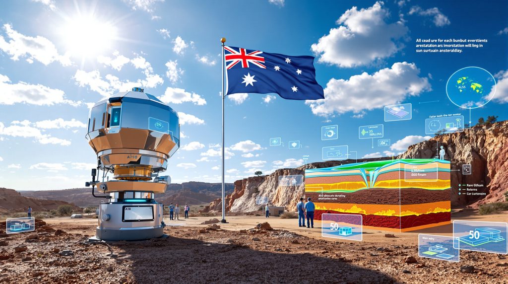
The deployment of A10 absolute gravimeter technology represents a significant advancement in geophysical measurement capabilities. These sophisticated instruments can establish benchmark measurements with unprecedented precision, creating reference points for regional and national gravitational mapping programs. The A10 system's ability to provide absolute gravity measurements rather than relative readings makes it particularly valuable for establishing long-term monitoring networks.
Technical Capabilities of Modern Gravimeters:
• MicroGal-level precision for detecting subtle density variations
• Environmental stability across diverse operating conditions
• Rapid data collection enabling efficient large-area surveys
• Integration capabilities with satellite-based gravitational monitoring systems
Integration with Satellite-Based Gravitational Data
Contemporary gravitational mapping combines ground-based measurements with orbital observation data to create comprehensive three-dimensional subsurface models. Satellite gravitational monitoring provides broad regional coverage, while ground-based gravimeters deliver high-resolution local measurements necessary for detailed resource assessment.
This integrated approach enables validation and cross-referencing between different measurement platforms, increasing confidence in geological interpretations and reducing uncertainty in resource estimation. In addition, interpreting drill results becomes more accurate when combined with gravitational data. Data fusion techniques combine multiple measurement sources to produce more accurate subsurface models than either method could achieve independently.
Strategic Geographic Positioning for National Gravitational Networks
The selection of Bunbury, Western Australia as a gravitational benchmark location reflects careful consideration of geological diversity, infrastructure accessibility, and strategic positioning within Australia's mineral-rich regions. According to Australian Mining's recent report, this new gravity testing site in Western Australia will significantly enhance the quality of exploration data available to mining companies. Bunbury's location provides access to multiple geological formations including granite basement terrains, sedimentary sequences, and metamorphic complexes necessary for comprehensive gravitational calibration.
Western Australia's geological complexity makes it an ideal testing ground for gravitational measurement technologies. The region contains diverse rock types with varying density characteristics, providing natural calibration opportunities for gravimeter systems. Additionally, the area's established mining infrastructure and research facilities support long-term monitoring operations.
Infrastructure and Research Facility Advantages
Transportation networks and research facility proximity enable efficient equipment deployment and maintenance for permanent gravitational monitoring installations. Long-term site stability requirements for precise measurements favour locations with minimal seismic activity and consistent geological conditions, criteria that Bunbury's geographic position satisfies effectively.
The establishment of benchmark sites creates foundation points for expanding gravitational networks across larger geographic areas. These reference locations provide calibration standards for regional surveys and ensure measurement consistency across different equipment deployments and time periods.
Comprehensive National Resource Mapping Initiative
Australia's $3.4 billion Resourcing Australia's Prosperity initiative represents one of the most ambitious geological mapping programs undertaken globally. This comprehensive strategy combines gravitational measurement networks with satellite imagery, ground-based surveys, and advanced data processing infrastructure to create detailed subsurface resource maps across the continent.
The program integrates multiple technological platforms to develop Australia's most detailed geological database. Furthermore, data-driven mining operations will benefit significantly from this enhanced geological intelligence. Satellite-based gravitational monitoring systems provide broad coverage, while expanded ground-based gravimeter networks deliver high-resolution local measurements. Data processing and analysis infrastructure enables real-time integration of measurements from multiple sources.
Open-Source Database Development and Public Access
The initiative's commitment to making results available online for free represents a significant departure from traditional proprietary geological data models, potentially democratising access to critical subsurface information for exploration companies and research institutions.
Implementation Components Include:
• Gravitational measurement network expansion across priority geological regions
• Satellite data integration for comprehensive coverage validation
• Public database development with open-source accessibility
• Real-time data processing capabilities for immediate result availability
The integration of new measurements with Australia's existing database of over 1.8 million gravity observations collected since 1938 creates an unprecedented geological intelligence resource spanning nearly nine decades of continuous data collection.
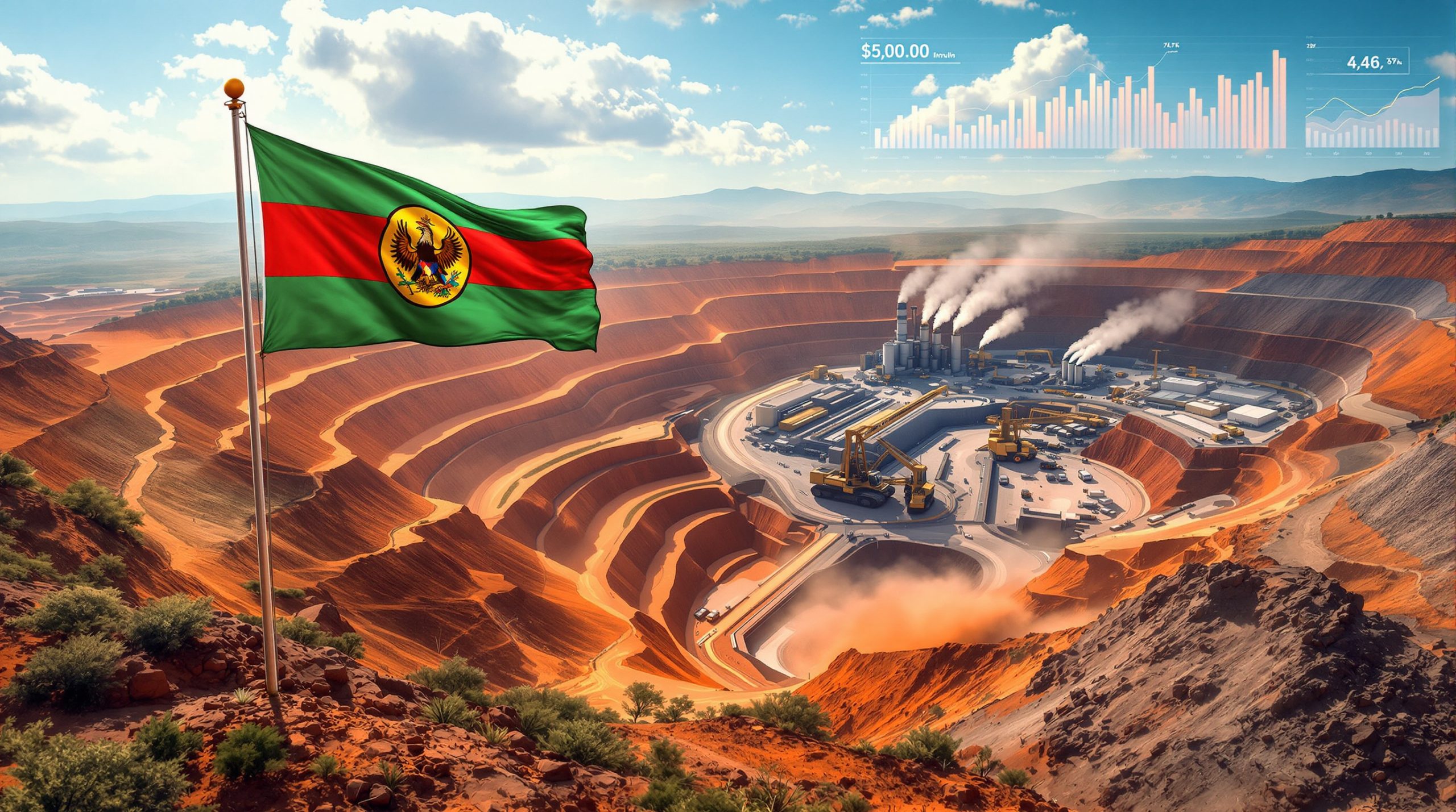
Transformation of Australia's Mining and Exploration Sector
Gravitational surveying technology offers the potential to significantly reduce exploration costs and environmental impact associated with traditional resource discovery methods. By providing detailed subsurface information before committing to expensive drilling operations, companies can target exploration efforts more precisely and avoid speculative excavation in low-probability areas.
The integration of gravity data with satellite imagery enables exploration companies to develop more sophisticated geological models before physical intervention. This approach reduces environmental disruption during early-stage exploration while potentially improving resource identification accuracy.
Enhanced Precision in Resource Estimation
Gravitational anomaly mapping provides exploration companies with preliminary subsurface intelligence that can guide strategic decision-making about where to focus expensive drilling operations. Rather than conducting broad exploratory drilling across large areas, companies can use gravity data to identify the most promising locations for detailed investigation.
However, understanding mineral deposit tiers remains crucial for proper resource evaluation. Potential Operational Improvements:
• Reduced speculative drilling through targeted exploration strategies
• Lower environmental impact from more precise resource targeting
• Faster preliminary assessment of potential resource areas
• Improved investor confidence through data-backed exploration planning
Competitive Advantages for Australian Mining Operations
Access to comprehensive national gravitational data provides Australian mining companies with information advantages over competitors operating in regions without equivalent geological intelligence. This enhanced understanding of subsurface conditions enables more strategic exploration planning and potentially faster resource development timelines.
The availability of free public access to gravity data creates competitive advantages for domestic exploration companies while attracting international investment in Australian resource development projects. Enhanced geological understanding supports more accurate resource estimation and reduces exploration risks.
Resource Detection Capabilities Across Commodity Types
Gravitational surveying can identify various resource types based on their distinct density characteristics. Critical minerals including lithium deposits in pegmatite formations, rare earth element concentrations, and copper-nickel sulfide deposits each produce measurable gravitational signatures that trained geophysicists can interpret for exploration targeting.
Detectable Resource Categories:
| Resource Type | Formation Characteristics | Gravitational Signature |
|---|---|---|
| Lithium Deposits | Pegmatite formations | High-density anomalies |
| Rare Earth Elements | Concentrated mineral veins | Variable density patterns |
| Copper-Nickel Sulfides | Massive sulfide bodies | Strong positive anomalies |
| Iron Ore | Magnetite formations | Pronounced density contrasts |
Energy Resource Applications
Beyond traditional mineral exploration, gravitational surveying supports energy resource identification including uranium deposits, geothermal energy sources, and coal seam delineation. The technology's ability to detect density variations makes it valuable for identifying underground formations suitable for hydrogen storage and carbon sequestration projects.
Groundwater detection capabilities support renewable energy project planning, particularly for geothermal development where understanding subsurface water circulation patterns proves essential for project viability assessment.
Global Context and International Comparison
Australia's gravity database containing over 1.8 million observations since 1938 represents one of the most comprehensive national geological datasets globally. This 87-year continuous data collection period provides temporal geological intelligence that few countries possess, creating unique advantages for understanding long-term geological processes and resource formation patterns.
The longevity of Australia's gravitational observation program demonstrates sustained institutional commitment to geological data collection across multiple political and economic cycles. This consistency enables trend analysis and geological change detection that shorter-duration programs cannot achieve.
International Collaboration and Standardisation
Integration with global gravitational measurement networks enables data sharing and collaborative research opportunities with international geological survey organisations. Standardised measurement protocols facilitate cross-border geological studies and resource assessment projects.
Research partnerships with international institutions enhance Australia's gravitational surveying capabilities while contributing to global geological understanding. These collaborations support technology development and methodology refinement for gravitational measurement applications.
Economic Implications and Strategic Positioning
The $3.4 billion investment in gravitational measurement infrastructure signals government recognition of the long-term economic value generated by enhanced geological intelligence. This substantial funding commitment indicates expectation of significant returns through improved resource discovery, reduced exploration costs, and enhanced national resource sovereignty.
Supply chain security for critical minerals benefits from domestically-generated geological data that reduces dependence on foreign geological intelligence. Enhanced understanding of national resource endowments supports strategic planning for critical mineral supply chains and export market positioning.
Innovation and Technology Development Opportunities
Australia's leadership in gravitational surveying technology creates potential export markets for geological mapping services and geophysical equipment. The development of advanced gravitational measurement capabilities supports domestic technology industries while enhancing Australia's position in global geophysics markets.
Long-Term Economic Benefits:
• Enhanced resource sovereignty through domestic geological intelligence
• Reduced exploration risks for mining investment projects
• Technology export opportunities for gravitational surveying equipment
• Research and development leadership in geophysical sciences
Practical Implementation and Data Accessibility
The commitment to making gravitational data freely available online represents a significant shift toward open-source geological information sharing. This accessibility model enables broader participation in resource exploration while supporting research and development activities across academic and commercial sectors.
Data integration with existing geological databases enhances the value of historical information while providing comprehensive subsurface intelligence for exploration planning. Real-time data availability supports rapid decision-making for exploration projects and infrastructure development planning.
Timeline for National Network Development
The phased implementation of Australia's gravitational measurement network begins with benchmark site establishment and expands to regional coverage before achieving national network completion. This systematic approach ensures measurement consistency and data quality while building comprehensive geological intelligence capabilities.
Expected Development Phases:
• Benchmark establishment in key geological regions
• Regional network expansion across priority mineral belts
• National coverage completion with integrated data systems
• Ongoing maintenance and data quality assurance programs
Future Implications for Resource Discovery
Australia's gravitational measurement infrastructure positions the nation as a global leader in geological intelligence capabilities. The integration of advanced measurement technologies with comprehensive data sharing creates competitive advantages for domestic exploration while attracting international investment in Australian resource development projects.
The transformation of resource discovery through gravitational surveying supports more sustainable exploration practices by reducing environmental impact and improving exploration efficiency. Consequently, the new gravity testing site in Western Australia serves as a cornerstone for these developments, as highlighted by Resource Review's coverage of this landmark initiative. Enhanced geological understanding enables more strategic resource development planning and supports Australia's position in global critical mineral supply chains.
This comprehensive approach to geological mapping represents a fundamental shift toward data-driven resource exploration that could serve as a model for other resource-rich nations seeking to enhance their geological intelligence capabilities while supporting sustainable development practices.
Want to Stay Ahead of the Next Major Discovery?
Discovery Alert's proprietary Discovery IQ model delivers instant notifications when significant ASX mineral discoveries are announced, transforming complex geological data into actionable investment opportunities. Explore historic discovery examples that generated substantial returns and begin your 30-day free trial today to position yourself ahead of the market.