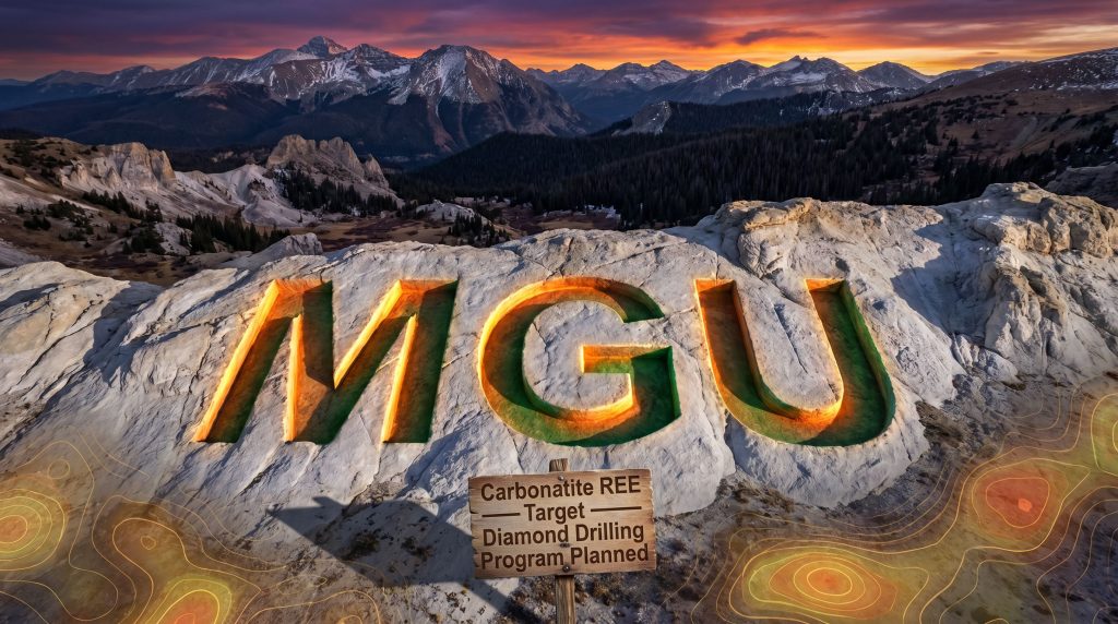
Magnum Mining and Exploration Ltd
- ASX Code: MGU
- Market Cap: $16,065,186
- Shares On Issue (SOI): 3,213,037,149
Magnum Mining Defines ~3.3 km² eTh Footprint at Wet Mountain, Advancing Colorado REE Project Toward First Drilling
The Magnum Mining Wet Mountain rare earth project drill programme in Colorado has taken a significant step forward, with Magnum Mining and Exploration Ltd (ASX: MGU) reporting an integrated reprocessing and interpretation of airborne magnetic and gamma-ray spectrometry data at the Wet Mountain Rare Earth Element (REE) Project in Fremont County, Colorado.
The work has outlined an approximately 3.3 km² cumulative ≥12 ppm equivalent thorium (eTh) radiometric pathfinder footprint within the claim area, including a principal connected lobe of approximately 2.6 km². These results sit around historical USGS rock-chip samples grading up to 79,900 ppm TREE (7.99%) and are being used to define priority field-validation and conceptual drill targets.
The Wet Mountain workstream is positioned alongside Magnum Mining and Exploration Ltd's Azimuth REE Project in Brazil, where a 10,000 m auger drilling programme remains in progress targeting an ionic adsorption clay (IAC) REE system.
When big ASX news breaks, our subscribers know first
From Historical Samples to a Coherent Targeting Framework
When Magnum Mining and Exploration Ltd acquired Wet Mountain, the key attraction was a cluster of historical high-grade USGS samples. These rock-chip samples are point measurements at surface and cannot be used to infer continuity, however, they provided an early indication of anomalous REE enrichment.
The new geophysical interpretation integrates:
- Historical USGS rock-chip REE assays
- Airborne gamma-ray spectrometry (radiometrics)
- Airborne magnetics, including Magnetic Vector Inversion (MVI) modelling
- Interpreted structural lineaments and claim boundaries
This combined dataset has been used to build a geologically consistent drill-targeting framework rather than relying on isolated surface data.
According to Magnum Mining and Exploration Ltd, several of the highest-grade historical rock-chip samples now sit on, or close to, elevated eTh trends and interpreted magnetic or structural features, which is being used to rank target areas.
Key historical USGS rock-chip results cited in the ASX release are:
| Sample ID | TREE (ppm / %) | Nd (ppm) | Pr (ppm) | Sm (ppm) | Heavy REE (ppm) |
|---|---|---|---|---|---|
| 75A‑221 | 79,900 / 7.99% | 20,000 | 5,000 | 2,000 | 1,900 |
| 75A‑218 | 41,145 / 4.11% | 7,000 | 2,000 | 1,000 | 545 |
| 75A‑219 | 28,930 / 2.89% | 5,000 | 1,500 | 1,000 | 980 |
| 75A‑217 | 28,085 / 2.81% | 5,000 | 1,500 | 700 | 535 |
| 75A‑220 | 16,220 / 1.62% | 3,000 | 500 | 700 | 1,370 |
These assays were collected and analysed historically by the USGS and are reported by Magnum Mining and Exploration Ltd with explicit caution. They have not yet been confirmed by modern resampling or contemporary QA/QC procedures.
All five samples fall within the newly defined ≥12 ppm eTh footprint, consequently supporting Magnum Mining and Exploration Ltd's focus on this corridor for potential first-pass drilling.
"Wet Mountain has now moved from a collection of high-grade historical surface occurrences into a more coherent target-generation framework. The attraction is the combination of historical carbonatite samples grading up to 7.99% TREE at surface, a multi-square-kilometre eTh radiometric footprint, and magnetic/structural features that may reflect the intrusive architecture of the system.
The significance of Wet Mountain is that it provides Magnum with a clear opportunity to drill test the potential for a high-grade, large-scale carbonatite-related REE discovery in the United States," said Antonio Vitor Junior, Managing Director of Magnum Mining and Exploration Ltd.
Understanding the Key Technical Concept: What Is an eTh Radiometric Pathfinder Footprint?
The centrepiece of the Wet Mountain update is the definition of a ~3.3 km² eTh radiometric pathfinder footprint. For investors without a geophysics background, understanding what this means is important.
What Is Equivalent Thorium (eTh)?
Airborne gamma-ray spectrometry surveys measure natural radiation from the ground. Different elements emit radiation at different energy levels, allowing sensors to distinguish between potassium, uranium and thorium.
- Equivalent thorium (eTh) is a calculated measure of the thorium-related signal at surface.
- Thorium is often associated with certain intrusive rocks, including carbonatites, which can host REE mineralisation.
- Areas with higher eTh readings can therefore indicate zones where thorium-bearing rocks are present near surface.
At Wet Mountain, the exploration model is carbonatite-related REE mineralisation. Carbonatites commonly carry elevated thorium and REEs. For this reason, eTh anomalies are being used as "pathfinders" to areas where the carbonatite-related system may be most developed.
What Does the 12 ppm Threshold Mean?
Magnum Mining and Exploration Ltd has:
- Applied a ≥12 ppm eTh threshold to airborne radiometric data
- Defined areas within the claim boundary above this threshold as the eTh pathfinder footprint
This threshold is a target-generation tool, not a mineralised outline. As clearly stated in the ASX announcement:
- The ≥12 ppm eTh footprint is not a mineralised envelope
- It is not a Mineral Resource, Ore Reserve or estimate of tonnage or grade
- It is used to define areas where the radiometric response is elevated relative to background and consistent with the expected signature of a carbonatite-related system
For investors, the footprint provides a way to visualise how broad the geophysical anomaly is and how it relates to known surface samples.
Why Is the eTh Footprint Relevant for Investors?
A multi-square-kilometre radiometric footprint can assist with:
- Scale context: A ~3.3 km² eTh anomaly, including a ~2.6 km² connected lobe, indicates that the thorium-enriched system at surface is extensive within the claims.
- Target ranking: Where high-grade historical samples coincide with elevated eTh, plus magnetic and structural features, those locations can be given higher priority for follow-up work.
- Capital allocation: By narrowing first-pass drilling to areas with multiple supporting datasets, Magnum Mining and Exploration Ltd is seeking to deploy drilling funds more efficiently.
It remains important to recognise that radiometrics alone do not confirm mineralisation at depth. They are, however, one layer in a broader exploration toolkit.
Quick Glossary of Key Terms
To make the technical aspects of the announcement more accessible, several terms used by Magnum Mining and Exploration Ltd can be summarised as follows:
- eTh (equivalent thorium): A measurement derived from airborne gamma-ray surveys that estimates thorium content at surface, often elevated in carbonatite and related intrusive rocks.
- MVI (Magnetic Vector Inversion): A 3D modelling method that converts magnetic survey data into a volume model, helping interpret the shape and depth of magnetic bodies below the surface.
- Carbonatite: A type of igneous rock rich in carbonate minerals. Carbonatites can be important hosts for REEs and are the geological model being tested at Wet Mountain.
- TREE (Total Rare Earth Elements): The sum of all REEs measured in a sample, typically reported in ppm or as a percentage.
- IAC (Ionic Adsorption Clay): A style of REE mineralisation where rare earths are weakly bound to clay minerals, often allowing relatively simple leaching in suitable conditions.
- Rock-chip sample: A small piece of rock collected from surface outcrop for geochemical testing. Results are localised and do not indicate thickness or continuity without additional work such as drilling.
The Geological Case for Wet Mountain
Wet Mountain is located within the Wet Mountains alkaline igneous province in Colorado, a region containing alkaline and carbonatite intrusions that have been the subject of USGS work since at least the 1970s.
According to the ASX release and the cited USGS literature, the exploration model is carbonatite-related REE mineralisation associated with:
- Alkaline intrusions
- Thorium enrichment
- Structural corridors
- Documented historical carbonatite occurrences
Magnum Mining and Exploration Ltd summarises the main targeting factors as follows:
| Targeting vector | Detail |
|---|---|
| Geological setting | Wet Mountains alkaline igneous province; carbonatite-related REE model |
| Historical surface grades | Up to 79,900 ppm TREE (7.99%), with four samples above 28,000 ppm TREE |
| Radiometric footprint | Approximately 3.3 km² cumulative ≥12 ppm eTh; principal connected lobe ~2.6 km² |
| Coincident targeting | Several high-grade samples located on or near elevated eTh trends, interpreted structures and MVI features |
| Claim area | Approximate 10.47 km² claim boundary |
| Jurisdiction | Colorado, USA |
The geophysical review and targeting work was undertaken by Fabricio Santos, MSc, using Geosoft Oasis montaj software. The work combined reprocessed magnetic and radiometric grids, inversion outputs and geological interpretation into Magnum Mining and Exploration Ltd's carbonatite-related REE targeting model.
The Company's JORC Table 1 reiterates that historical samples are point data and are not representative of width, tonnage or grade continuity. Furthermore, the eTh footprint is used strictly as a targeting tool, and MVI features and interpreted structures are used for drill planning only.
A Two-Project REE Portfolio Across the USA and Brazil
Wet Mountain is one of two active REE projects for Magnum Mining and Exploration Ltd. The other is the Azimuth REE Project in Brazil, where a 10,000 m auger drilling programme is underway targeting a large-scale ionic adsorption clay (IAC) REE system.
The two projects differ in geological style and stage:
| Feature | Wet Mountain (Colorado, USA) | Azimuth (Brazil) |
|---|---|---|
| Mineralisation style | Carbonatite-related REE | Ionic adsorption clay (IAC) REE |
| Current stage | Geophysical interpretation, drill targeting, pre-drilling planning | Auger drilling in progress (10,000 m programme) |
| Project type | Greenfield, high-grade historical surface data | Large-tonnage IAC target |
| Exploration focus | Integration of radiometrics, magnetics, structures and historical samples for diamond drilling design | Defining clay-hosted REE distribution and grade using auger drilling |
Magnum Mining and Exploration Ltd presents this dual approach as a way to gain exposure to two globally relevant REE deposit styles: high-grade carbonatite systems and lateritic/IAC clay systems.
Geophysical Review and Conceptual Drill Targeting
According to the ASX announcement, Magnum Mining and Exploration Ltd has used the reprocessed aeromagnetic and radiometric data to select indicative drill-pad target areas within the eTh footprint.
Conceptual drill traces shown in the Company's figures are designed to test shallow to moderate-depth MVI magnetic responses and prioritise areas spatially associated with elevated eTh radiometrics, historical USGS rock-chip REE samples, and interpreted structural lineaments.
Key technical points from the geophysical and targeting section of the ASX release include:
- Airborne survey parameters are reported as approximately 150 m traverse line spacing, 1,000 m tie-line spacing and 80 m nominal clearance.
- The ≥12 ppm eTh threshold was applied to define the cumulative footprint.
- Conceptual diamond drill traces are planning outputs only and remain subject to access, permitting, land status, field validation, contractor input, funding, and final technical approval.
The Competent Person statement attached to the ASX release confirms that the integrated interpretation has been reviewed for alignment with the JORC Code (2012) requirements for reporting exploration results.
What Comes Next: Path to a First-Pass Diamond Drilling Programme
Magnum Mining and Exploration Ltd outlines a staged progression from geophysical targeting towards diamond drilling at Wet Mountain. All steps are explicitly described as subject to access, permitting, funding, contractor availability and final technical approval.
Planned next steps include:
- Ground-checking — visit historical high-grade sample locations, inspect and validate the ≥12 ppm eTh footprint on the ground, and review priority MVI and structural targets in the field.
- Modern field validation and resampling — undertake new sampling where access and conditions permit, collecting data under modern chain-of-custody and QA/QC protocols to verify the historical USGS results.
- Tenure, access and permitting review — confirm surface ownership and claim status, define access arrangements and permitting pathways, and identify environmental and cultural requirements for potential drill pads.
- Technical drill design — refine collar positions, hole orientations and target depths, and plan practical pad and access logistics in conjunction with drilling contractors.
- Contractor engagement and budgeting — obtain budgetary and firm quotes from suitable diamond drilling contractors experienced in mountain terrain.
- Programme preparation — prepare a staged first-pass diamond drilling programme, which the Company's JORC Table 1 indicates is being targeted for H2 2026, subject to the conditions above.
For investors following Magnum Mining and Exploration Ltd, the key short- to medium-term milestones will likely be results from modern resampling and field validation at Wet Mountain, finalisation and announcement of a detailed diamond drilling programme design, and progress updates from the ongoing Azimuth auger drilling programme in Brazil.
The next major ASX story will hit our subscribers first
Investor Relevance: Why Monitor the Wet Mountain Progress?
The ASX announcement frames the Magnum Mining Wet Mountain rare earth project drill programme in Colorado as a high-priority carbonatite-related REE exploration target, sitting within a broader REE portfolio strategy.
From an investor perspective, the update highlights several points of interest:
- Scale of anomaly: The ~3.3 km² eTh footprint suggests a laterally extensive thorium-enriched system within the claims. While this does not imply mineralisation or economic potential, it provides a large geophysical search space to test with drilling.
- Exceptional historical surface grades: Historical USGS samples report up to 7.99% TREE, with four samples above 28,000 ppm TREE. These results are subject to verification but, if supported by modern work, could point to high-grade REE zones within the broader system.
- Critical magnet REEs: The highest-grade samples also contain elevated neodymium (Nd) up to 20,000 ppm (2.00%) and praseodymium (Pr) up to 5,000 ppm (0.50%), both key inputs for permanent magnets in electric vehicles and wind turbines.
- Jurisdictional context: Wet Mountain is located in Colorado within a recognised alkaline igneous province. For investors seeking REE exposure in North American jurisdictions, Magnum Mining and Exploration Ltd's position may be of particular interest.
- Portfolio balance: With a carbonatite-focused project in the USA and an IAC-focused project in Brazil, Magnum Mining and Exploration Ltd is building exposure to two different REE deposit concepts and regulatory settings.
The ASX release is clear that no Mineral Resource or Ore Reserve has been declared at Wet Mountain, and that historical rock-chip results and geophysical anomalies are being used for target generation only. Any future economic case would, furthermore, depend on drilling outcomes, metallurgical testwork, environmental studies, and a range of technical and commercial factors.
For now, Wet Mountain remains an early-stage, high-potential exploration target where the next critical step will be modern field validation and the commencement of a staged diamond drilling programme, if approvals and funding are secured.
Ready to Explore Magnum Mining's REE Portfolio in More Detail?
Magnum Mining and Exploration Ltd (ASX: MGU) is advancing two strategically distinct rare earth projects — the high-grade carbonatite-related Wet Mountain REE Project in Colorado and the large-scale Azimuth IAC REE Project in Brazil. With a ~3.3 km² eTh radiometric footprint now defined at Wet Mountain, a first-pass diamond drilling programme targeted for H2 2026, and auger drilling actively underway at Azimuth, MGU represents a dual-jurisdiction REE exploration story at a compelling stage of development. Investors seeking to learn more about the company, its projects, and its progress can visit www.mmel.com.au for the latest updates.