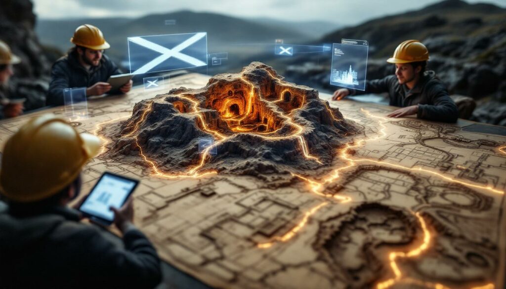
What Are the British Geological Survey's Plans for Abandoned Scottish Mines?
The British Geological Survey (BGS) has undertaken a significant digital preservation initiative through its National Geoscience Data Centre (NGDC), making over 500 historical plans for abandoned Scottish mines publicly accessible. This ambitious digitization project marks a crucial step in safeguarding Scotland's rich mining heritage while simultaneously providing essential resources for modern development, safety planning, and historical research.
"This initiative represents the BGS's ongoing commitment to preserving Scotland's invaluable mining heritage while making this critical information accessible to researchers, developers, and the public," notes the British Geological Survey in its official announcement of the project.
The Digital Archive Initiative
The scope of this undertaking is impressive, with more than 500 historical mine plans now available through the BGS's specialized plans viewer. These high-resolution digital scans focus primarily on non-coal mines throughout Scotland, capturing detailed underground workings that have remained largely inaccessible to the public until now.
The digitization process employed advanced imaging technology to ensure the preservation of even the most delicate details from these fragile historical documents. Each plan has been meticulously scanned and cataloged to create a comprehensive, searchable database of Scotland's mining past.
Historical Significance of the Collection
The collection primarily covers mining operations from the 19th and early 20th centuries, documenting a critical period in Scotland's industrial development. These plans represent a diverse range of metalliferous mines, including significant lead workings like those at Leadhills, and important ironstone operations such as the Garscube Colliery.
One notable example from the collection is the detailed plan of Garscube Colliery pit number 6, which shows the extensive Garibaldi Clayband Ironstone Workings. This particular document illustrates the typical level of detail captured in these historical records, showing shaft locations, underground passages, and geological features that influenced mining operations.
The geographic coverage spans numerous mining regions across Scotland, providing a comprehensive view of how mineral extraction shaped the country's landscape and economy. Many plans include handwritten notes from mining engineers, offering unique insights into historical mining practices and challenges.
Why Is This Digital Archive Important for Scotland?
The significance of this digital archive extends far beyond historical preservation. These plans for abandoned Scottish mines serve as critical resources for addressing contemporary challenges in land management, urban development, and environmental protection throughout Scotland.
Modern Development and Safety Applications
Mitigating Geohazards
The plans provide essential data for assessing subsidence risks in former mining areas, allowing engineers and planners to identify potential ground stability issues before they become dangerous. This information is particularly valuable for infrastructure planning in regions with extensive historical mining activity.
By documenting the precise location of shafts, tunnels, and workings, these plans enable the creation of comprehensive geohazard maps that guide safe urban development. Local authorities can use this information to establish appropriate building codes and construction methodologies for areas undermined by historical workings.
The plans also offer crucial guidance for mine reclamation innovation efforts at abandoned mine sites, helping specialists design effective treatment strategies for potential hazards. This proactive approach to managing mining legacies significantly reduces public safety risks.
Supporting Sustainable Development
For brownfield redevelopment projects, these historical records provide invaluable insights into subsurface conditions, facilitating the safe repurposing of former mining land for housing, commercial use, or recreational spaces.
The plans also aid in groundwater management by documenting potential contamination pathways from abandoned workings. Environmental engineers can use this information to develop monitoring programs and protective measures for water resources in mining-affected areas.
From an environmental protection standpoint, the archive helps identify areas requiring ongoing monitoring or intervention to prevent pollution from mine waste or drainage. This allows for more targeted and cost-effective environmental management strategies.
The plans may also reveal opportunities for resource recovery, allowing modern operators to assess the potential for extracting remaining minerals or harnessing mine water for geothermal energy applications.
Historical and Cultural Value
Preserving Industrial Heritage
These meticulously preserved plans document the evolution of mining techniques in Scotland, showing how extraction methods developed over time in response to technological advances and changing economic conditions.
The archive serves as a valuable resource for labour historians, offering insights into working conditions and community development around mining operations. Many plans include references to worker accommodations, transportation systems, and support facilities that shaped mining communities.
Technological innovation is clearly visible in the progression of these plans, which track advances in mining engineering from primitive hand-dug workings to more sophisticated mechanized operations. This provides a tangible record of Scotland's contributions to industrial technology.
Perhaps most importantly, the collection documents how mining industry evolution shaped Scotland's cultural landscape, mapping the profound impact of mineral extraction on communities, economies, and environments throughout the country.
How Can Users Access and Utilize the Abandoned Mine Plans?
The BGS has developed a sophisticated digital platform to make these historical resources accessible to a wide range of users, from professional engineers to local historians and the general public.
The BGS Plans Viewer Platform
User Interface and Features
The platform offers interactive mapping capabilities that allow users to navigate geospatially through Scotland's mining regions. This intuitive interface makes it easy to locate mines of interest based on their geographic position.
Advanced search capabilities enable users to find specific mines by location, mineral type, or time period, streamlining research for specific mining operations. The system's comprehensive indexing makes even obscure mining sites discoverable.
High-quality zoom functionality allows users to examine the fine details of historical drawings, revealing annotations, measurements, and other critical information that might otherwise be overlooked. This level of detail is essential for both historical research and technical applications.
The platform provides download options for accessing high-resolution copies of the plans, facilitating their use in research, planning, and educational contexts beyond the BGS website itself.
Data Integration Possibilities
The digital format ensures GIS compatibility, allowing users to import these historical records into modern geographic information systems for spatial analysis and comparison with contemporary data. This integration capability significantly enhances the practical utility of the archive.
The plans offer substantial 3D geological modelling potential, providing the foundation for creating detailed subsurface visualizations from historical data. Engineers and geologists can use these models to better understand the complex underground environments created by historical mining.
Cross-referencing with modern surveys becomes possible as users can combine these historical records with contemporary geophysical data to create more comprehensive subsurface models. This integration of old and new information improves the accuracy of geohazard assessments.
The platform also enables timeline visualization, allowing users to track the development of mining operations over time by comparing plans from different periods. This chronological perspective reveals how mining practices evolved and expanded throughout Scotland's industrial era.
What Technical Challenges Were Overcome in This Project?
The creation of this digital archive required overcoming significant technical challenges related to the preservation and digitization of fragile historical documents.
Preservation and Digitization Process
Document Conservation
Many of these historical plans required specialized handling techniques due to their fragile condition. Conservation experts developed protocols for safely manipulating deteriorated documents without causing further damage during the digitization process.
Some plans needed substantial restoration before they could be digitized, addressing damage from age, moisture, and improper storage conditions that had accumulated over decades or even centuries. This painstaking work ensured that no information was lost during the digitization process.
The project adhered to strict preservation standards, meeting archival quality benchmarks for both the physical handling of documents and their digital representation. This ensures the long-term viability of both the original plans and their digital copies.
A comprehensive metadata development effort accompanied the digitization, creating detailed cataloging systems that make the plans searchable and contextually rich. This metadata includes information about the mines, the plans' creators, and historical context that enhances their research value.
Scanning Technology
The project employed high-resolution imaging technologies capable of capturing the fine details of hand-drawn plans, including faint pencil marks, color variations, and textural elements that convey important information. This attention to detail preserves the full informational content of each document.
Achieving color accuracy presented another technical challenge, as many plans use color-coding to distinguish between different mineral veins, geological features, or chronological phases of development. The digitization process carefully preserved these original notations and colorations.
Many mine plans are oversized historical documents that required specialized large-format handling equipment and techniques. The BGS developed custom workflows to accommodate these non-standard document sizes without compromising image quality.
Rigorous quality control processes were implemented to ensure the legibility and completeness of each digital copy, with multiple verification stages to catch and correct any deficiencies before final archiving.
How Might These Plans Impact Future Geothermal Energy Development?
One of the most promising modern applications for this historical information lies in the emerging field of mine water geothermal energy, which harnesses the thermal properties of flooded mine workings.
Mine Water Energy Potential
Thermal Resource Assessment
These historical plans enable temperature gradient mapping by documenting the depth and extent of mine workings, helping engineers identify mines with favorable geothermal characteristics. Deeper workings generally offer higher temperatures that can be more efficiently exploited for heating applications.
The plans assist with water volume estimation by documenting the three-dimensional extent of mine voids, allowing engineers to calculate the potential energy storage capacity of flooded workings. This information is crucial for assessing the scale and sustainability of potential geothermal systems.
By showing connections between different levels and adjacent workings, the plans facilitate circulation pathway analysis, helping engineers understand the hydraulic connections between different parts of abandoned mines. This knowledge is essential for designing efficient heat exchange systems.
The comprehensive nature of the archive supports seasonal variation modeling, allowing engineers to predict how mine water systems might perform throughout the year under different temperature and usage conditions.
Implementation Considerations
These historical records help identify the infrastructure requirements for accessing and utilizing mine water resources, showing shaft locations, tunnel dimensions, and surface features that might affect system design and installation.
The plans are valuable for assessing community heating potential by showing the proximity of substantial mine workings to population centers, identifying suitable locations for district heating schemes powered by mine water energy.
By documenting the extent and arrangement of different mine types, the plans support commercial viability assessment, enabling cost-benefit analysis for geothermal development across a range of mining contexts and geological settings.
The detailed information provided by these plans helps developers navigate the regulatory framework for geothermal development, providing the technical details needed to secure permissions and demonstrate project feasibility to authorities.
What Case Studies Demonstrate Successful Mine Repurposing?
Several notable projects in Scotland demonstrate how historical mining sites can be successfully repurposed, using the kind of information now available through this digital archive.
Notable Scottish Mine Transformation Projects
Leadhills Mining Museum
The Leadhills Mining Museum stands as a testament to the historical significance of Scotland's lead mining heritage, preserving and interpreting one of the country's most important mineral extraction industries. The museum's development relied heavily on historical mine plans to accurately represent original working conditions.
Visitors to Leadhills benefit from educational displays that use interactive elements to demonstrate historical mining techniques, many of which are documented in the plans for abandoned Scottish mines now available through the BGS archive. These exhibits bring Scotland's industrial past to life for contemporary audiences.
The museum represents a successful example of community engagement in preservation efforts, with local residents contributing knowledge, artifacts, and volunteer support. This community connection enhances the authenticity and sustainability of the heritage site.
From an economic perspective, Leadhills demonstrates the tourism impact of well-preserved industrial heritage, bringing visitors to a rural area and generating revenue that supports the local economy. This model could be replicated in other former mining regions using information from the digital archive.
Garscube Ironstone Workings Redevelopment
The redevelopment of the Garscube Ironstone Workings illustrates the remediation challenges associated with former mine sites, particularly issues related to ground stability in areas undermined by extensive ironstone extraction. Historical plans were essential for identifying and addressing these challenges.
This project employed innovative land reclamation techniques to transform undermined territory into usable space, developing methods for stabilizing ground, managing contamination, and creating suitable foundations for new construction.
The current land use at Garscube demonstrates successful repurposing of former mining land, showing how industrial sites can be transformed into valuable assets for contemporary communities. This transformation was guided by the kind of historical plans now available through the BGS archive.
From an economic regeneration perspective, the Garscube redevelopment has created jobs and attracted investment to a formerly derelict area, demonstrating the potential economic benefits of informed mine site reclamation.
What Environmental Considerations Are Associated with Abandoned Mines?
Abandoned mines present significant environmental challenges that must be understood and managed, particularly when considering redevelopment or restoration projects.
Contamination and Remediation
Water Quality Impacts
Acid mine drainage represents one of the most serious environmental consequences of abandoned mines, forming through chemical reactions when sulfide minerals in mine waste or workings are exposed to air and water. The resulting acidic runoff can severely damage aquatic ecosystems and water resources.
Many abandoned mines also produce heavy metal contamination as minerals containing lead, zinc, cadmium, and other toxic elements dissolve in acidic mine waters. These metals can persist in the environment for decades or centuries if not properly addressed.
Effective management requires comprehensive groundwater monitoring through detection and tracking systems that can identify contamination sources and pathways. Historical mine plans are invaluable for positioning these monitoring systems effectively.
A range of treatment technologies exists for addressing mine water pollution, from passive systems like reed beds and limestone drains to active treatments involving chemical neutralization and metal precipitation. The appropriate approach depends on site-specific conditions often documented in historical plans.
Ecological Restoration
Despite their environmental challenges, abandoned mines often present habitat creation opportunities, with features like mine ponds, spoil heaps, and open workings potentially converted into wildlife havens through appropriate management and restoration.
Successful restoration typically involves specialized revegetation strategies for establishing plant communities on mine waste, using species adapted to the challenging soil conditions and potential contamination found at mining sites.
Many reclaimed mine sites support biodiversity enhancement efforts, contributing to species recovery in former mining areas through the creation of specialized habitats that may be rare in the surrounding landscape.
These environmental benefits require long-term management commitments, including ongoing monitoring and maintenance to ensure that contamination remains controlled and restoration objectives are met over time.
How Does This Initiative Compare to International Approaches?
The BGS digital archive project represents part of a global effort to document and manage mining heritage, with comparable initiatives underway in many countries with significant mining histories.
Global Best Practices in Mine Documentation
Similar Programs Worldwide
European approaches to mine documentation include extensive archives in Germany's Ruhr region, the historical mining districts of Poland, and Cornwall's tin mining landscape in England. These programs share many features with the Scottish initiative but often operate under different regulatory frameworks.
North American systems for documenting abandoned mines include comprehensive inventories maintained by the US Office of Surface Mining and various Canadian provincial authorities. These systems typically focus on safety and environmental concerns rather than historical preservation.
Australian frameworks for documenting historical mining regions emphasize the integration of Aboriginal cultural heritage with European mining history, recognizing the complex cultural landscapes created by mining activities.
The Scottish initiative creates international collaboration opportunities for knowledge sharing and standardization of documentation methods across different national contexts. This global perspective enhances the value of all mining heritage documentation efforts.
Innovation in Data Utilization
Cutting-edge applications include machine learning algorithms that can recognize patterns in historical mine plans, automatically identifying features like shafts, tunnels, and geological structures to enhance data usability.
Some international programs incorporate crowdsourced information, allowing community members to contribute local knowledge about mining sites that may not appear in official records. This participatory approach enriches formal documentation with lived experience.
Virtual reality experiences based on historical mine plans offer immersive exploration of abandoned workings, making this heritage accessible to people who cannot physically visit mining sites or museums.
Citizen science initiatives engage the public in monitoring and research at abandoned mine sites, collecting valuable environmental data while building community awareness of mining heritage and its ongoing significance.
What Are the Future Directions for the BGS Mine Plans Project?
The current digital archive represents just the beginning of a broader effort to document and utilize Scotland's mining heritage, with significant expansion and enhancement possibilities on the horizon.
Expansion and Enhancement Possibilities
Collection Growth
Future development will likely include additional mine types beyond the current non-coal focus, incorporating Scotland's extensive coal mining heritage along with other mineral workings. This expansion would create a more comprehensive picture of the country's extractive industries.
Geographic expansion could extend coverage to other UK regions, creating a nationwide resource for mining heritage and geohazard management. This broader scope would enhance the value of the archive for national planning and research purposes.
Extending the temporal range to include more recent mine closures would document the transition from historical to modern mining practices, capturing important technological and regulatory developments in the industry.
The addition of supplementary documentation such as photographs, reports, and other records would enrich the context of the mine plans, providing a more complete picture of Scotland's mining history and its social impacts.
Technological Advancement
Emerging technologies like AI-assisted analysis could enable automated feature extraction from plans, accelerating the process of digitizing and interpreting historical mining records. This automation would make more information accessible more quickly.
The integration of predictive modeling capabilities could help forecast subsidence or contamination risks based on historical mining patterns, creating powerful planning tools for developers and local authorities.
Augmented reality applications could enable on-site visualization of underground features, allowing users to "see" historical mine workings beneath their feet through mobile devices. This technology would make mining heritage more accessible and engaging for the public.
Enhanced public engagement platforms could make mining information more accessible and interactive for non-specialists, supporting educational initiatives and heritage tourism development throughout Scotland's former mining regions.
The implementation of data-driven mining operations principles to historical data could reveal new
Interested in Discovering the Next Major Mining Opportunity?
Discover significant ASX mineral discoveries as they happen with Discovery Alert's proprietary Discovery IQ model, turning complex mineral data into actionable investment insights. Visit our dedicated discoveries page to understand why major mineral discoveries can lead to exceptional market returns and begin your 30-day free trial today.