June 25, 2026
Geology of the Chumstick Basin: Formation, Features, and Significance
The Chumstick Basin, located in the Cascade region of the Pacific Northwest, represents one of the most well-preserved examples of a pull-apart basin in North America. Formed during the Eocene epoch approximately 49 million years ago, this geological feature provides researchers with exceptional insights into the rapid formation and evolution of strike-slip basins. The basin's remarkable preservation, diverse sedimentary facies, and precise chronostratigraphy make it an invaluable natural laboratory for understanding tectonic processes.
Located between the Wenatchee and Chelan structural blocks, the Chumstick Basin developed during a period of accelerated dextral strike-slip faulting throughout the Pacific Northwest. Its formation, structure, and sedimentary fill tell a fascinating story of rapid geological change in a relatively brief window of geological time.
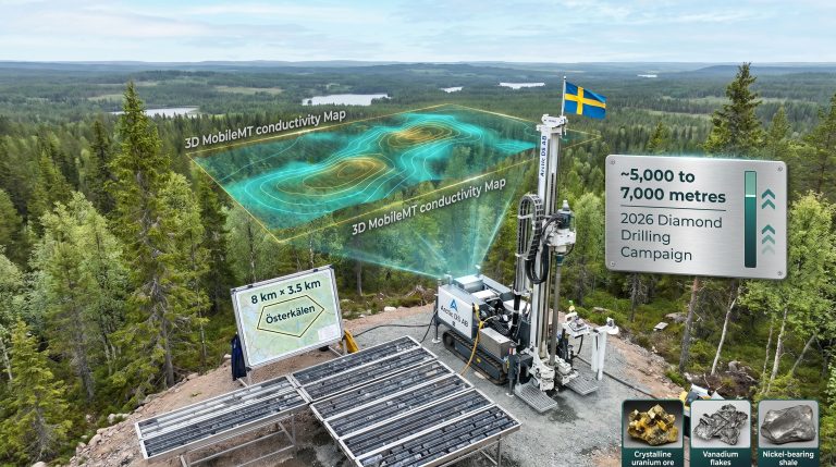
When big ASX news breaks, our subscribers know first
What is the Chumstick Basin?
The Chumstick Basin represents a textbook example of a pull-apart basin—a specific type of strike-slip basin formed when crustal extension occurs between offset segments of strike-slip faults. What makes this basin particularly significant is its exceptional preservation and the precision with which geologists have been able to date its formation and evolution.
Origin and Age of the Basin
The basin formed approximately 49 million years ago during the post-Laramide Eocene period when regional tectonics shifted from compressional to strike-slip regimes. This transition created the perfect conditions for basin formation as the crust responded to new stress patterns. The Chumstick Basin developed between two major dextral strike-slip fault systems—the Leavenworth Fault Zone marking its western boundary and the Entiat Fault Zone defining its eastern margin.
What's particularly remarkable about the geology of the Chumstick Basin is the relatively brief window of its active depositional period. High-precision radiometric dating of volcanic tuff beds within the basin fill indicates that the main phase of basin development occurred between 49 MA and 46.5 MA—a mere 3 million years. During this short interval, the basin accumulated an astonishing 8.5 kilometers of sediment, demonstrating extraordinarily rapid subsidence and sedimentation rates.
Structural Classification and Significance
Structurally, the Chumstick Basin exemplifies classic pull-apart basin geometry. The left-stepping segments within the bounding Leavenworth Fault Zone created zones of extension where the basin developed. The basin is further subdivided by the Eagle Creek Fault Zone, which separates western and eastern sub-basins, each with distinct sedimentological characteristics.
The basin's position between the Wenatchee and Chelan structural blocks places it at a critical juncture for understanding regional tectonic evolution. Analysis of offset markers suggests approximately 30 kilometers of dextral displacement along the bounding faults during and after basin formation, providing key constraints on Eocene crustal deformation rates in the Pacific Northwest.
How Did the Chumstick Basin Form?
The formation of the Chumstick Basin represents a dramatic episode in the geological evolution of the Pacific Northwest. Its development provides insights into how rapidly geological processes can operate under specific tectonic conditions.
Tectonic Setting and Basin Development
Following the Laramide Orogeny, the Cascade region experienced a fundamental shift in tectonic regime as dextral strike-slip faulting became the dominant mode of crustal deformation. The Chumstick Basin formed during the acceleration of this strike-slip system, when left-stepping offsets in the Leavenworth Fault Zone created zones of local extension.
The initial stage of basin development featured extraordinarily rapid subsidence—geologists describe this phenomenon as "the basin floor dropping out." This created immense accommodation space that was quickly filled by sediments shed from adjacent highlands. The basin boundaries were dynamic, with ongoing fault movement influencing sedimentation patterns throughout the basin's active life.
Sedimentation Rates and Basin Evolution
One of the most striking aspects of the Chumstick Basin is the extraordinary sedimentation rates documented through high-precision chronostratigraphy. Analysis of dated tuff beds reveals that during the initial basin formation, sedimentation rates reached an astonishing 6-7 millimeters per year—among the highest rates documented in any ancient basin.
As the basin matured, sedimentation rates stabilized to 2-3 millimeters per year, which is still remarkably rapid but more typical for strike-slip basins. This transition from extreme to merely rapid sedimentation reflects the evolution of the basin and its bounding fault systems. Over its brief 3-million-year active phase, the basin accumulated approximately 8.5 kilometers of sediment—a volume that would typically require tens of millions of years in most sedimentary basins.
What Rock Types Characterize the Chumstick Basin?
The Chumstick Basin contains diverse lithofacies that reflect its complex depositional history and the influence of active faulting on sedimentation patterns. The rapid lateral changes in rock types are a hallmark feature of pull-apart basins and provide valuable insights into ancient environments.
Major Lithofacies and Their Distribution
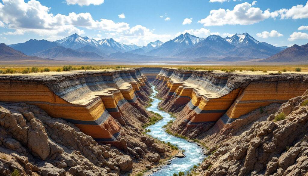
Along the western margin, adjacent to the Leavenworth Fault Zone, the basin contains coarse-grained boulder conglomerates composed almost exclusively of tonalite clasts derived from the Mount Stuart Batholith. These monolithic conglomerates in the southern basin feature clasts reaching up to 2 meters in diameter, indicating minimal transport and steep depositional gradients from an actively uplifting source terrain.
The basin axis is characterized by massive sandstones and interbedded sandstone-conglomerate sequences that represent fluvial channel and overbank deposits. These rocks record the meandering river systems that flowed axially through the basin, periodically shifting course as fault movement altered the basin topography.
Along the eastern margin, cobble conglomerates derived from the Chelan block demonstrate different source lithologies and generally smaller clast sizes, indicating a different style of source area uplift and sediment delivery compared to the western margin.
Interbedded throughout the sequence are numerous volcanic tuff beds—the most prominent being the Eagle Creek Tuff, a distinctive bluish-green ash layer that serves as an important marker horizon across the basin. These tuffs not only provide precise age constraints but also record the volcanic activity that was occurring synchronously with basin development.
Sedimentary Structures and Environments
The sedimentary structures preserved in the Chumstick Basin rocks paint a detailed picture of ancient depositional environments. Western margin deposits show characteristic features of steep alluvial fans, including poorly sorted boulder conglomerates with matrix-supported fabrics and debris flow deposits.
In the basin axis, meandering and braided stream systems are recorded by trough cross-stratification, ripple cross-lamination, and lateral accretion surfaces. The lenticular sandstone channel beds, some reaching 15 meters in thickness, demonstrate the substantial size of the ancient river systems that drained the basin.
Eastern margin deposits show features consistent with low-gradient, braided stream-dominated alluvial fans, including imbricated cobble conglomerates and sheet-like sandstone bodies. The more organized nature of these deposits suggests more stable, less tectonically active source areas compared to the western margin.
Where Are the Best Exposures in the Chumstick Basin?
For geologists and interested visitors, the Chumstick Basin offers several accessible locations where its geological story can be observed and appreciated. These exposures provide windows into different aspects of basin development and fill.
Key Outcrops and Geological Features
Leavenworth Ski Hill provides an excellent exposure of the interfingering relationship between the Tom Water Mountain Member and Clark Canyon facies. Here, visitors can observe how coarse conglomerates from the basin margin transition to finer-grained sandstones of the basin interior, demonstrating the lateral facies relationships characteristic of pull-apart basins.
Eagle Creek features the prominent Eagle Creek Tuff—a distinctive bluish-green volcanic ash deposit that serves as both a chronostratigraphic marker and evidence of explosive volcanism contemporaneous with basin formation. This location offers perhaps the most visually striking geological feature in the basin.
The Camas Land Syncline displays massive sheet sands and thick-bedded sandstones deposited in the central basin axis. The folded nature of these beds demonstrates the post-depositional deformation that affected the basin as regional tectonics continued to evolve.
Number 2 Canyon provides an excellent overview of the western sub-basin, with panoramic views of the basin structure and well-exposed outcrops of conglomerates and sandstones. The railroad crossing at Chumstick Highway offers accessible exposures of conglomerate facies cut by minor faults, illustrating the ongoing tectonic activity during basin fill.
Significant Geological Markers
The Eagle Creek Tuff stands out as the most prominent marker horizon in the basin. This bluish-green volcanic ash deposit north of Leavenworth can be traced across much of the basin and provides a precise chronostratigraphic reference point dated to approximately 47.7 MA.
Beyond the Eagle Creek Tuff, numerous other tuff beds serve as marker horizons throughout the basin. These tuffs enable precise chronostratigraphic correlation and have revealed that some potentially correlate with the Golden Horn Batholith based on chemical composition and age matching.
The monolithic conglomerates in the southern basin, composed of 100% tonalite clasts derived from the Mount Stuart Batholith, represent another distinctive marker. These conglomerates not only indicate source area but also demonstrate the dramatic relief and proximity of uplifted blocks adjacent to the actively subsiding basin.
What Makes the Chumstick Basin Geologically Significant?
The Chumstick Basin holds special importance in the geological sciences due to several unique features that make it an exceptional natural laboratory for understanding basin dynamics and tectonic processes.
Unique Features and Scientific Importance
Perhaps the most significant aspect of the Chumstick Basin is the exceptional preservation of a complete basin-fill sequence. Unlike many ancient basins that have been partially eroded or deformed beyond recognition, the Chumstick preserves a nearly complete record from initial subsidence through basin abandonment.
The presence of numerous datable tuff beds enables precise chronostratigraphy—a luxury rarely available in ancient sedimentary basins. This chronological framework allows geologists to determine rates of geological processes with unusual precision, revealing the rapid pace of basin evolution.
Evidence of approximately 30 kilometers of offset along the bounding strike-slip faults provides crucial constraints on regional tectonic models and helps quantify deformation rates during the Eocene. The basin thus serves as a key data point in reconstructing the tectonic evolution of the Pacific Northwest.
The basin also demonstrates rapid formation and equally rapid abandonment, providing insights into the lifecycle of strike-slip basins and the controls on their development. This pattern of "boom and bust" basin evolution contrasts with the more gradual development typical of other basin types.
The preservation of plant fossils in mudstone interbeds indicates a humid paleoenvironment, contributing to our understanding of Eocene climate and ecology in the region. These fossils suggest a landscape quite different from the modern semi-arid conditions of north-central Washington.
Modern Research Applications
Today, the Chumstick Basin serves as a model for understanding plate tectonics and deposits worldwide. Its well-constrained chronology and exceptional exposure make it an ideal reference for interpreting less well-preserved basins elsewhere.
The basin provides valuable insights into rates of tectonic processes and basin evolution, demonstrating how quickly geological systems can respond to changes in tectonic regime. The high-precision chronostratigraphy reveals nuances in basin formation rates that were previously unrecognized in other settings.
Modern research in the basin has documented the transition from initial rapid subsidence to more stable conditions, helping to refine models of how strike-slip basins evolve through time. This evolutionary pattern may serve as a template for interpreting similar basins in regions where age constraints are less precise.
The next major ASX story will hit our subscribers first
How Can Visitors Experience the Chumstick Basin Geology?
The Chumstick Basin offers numerous opportunities for geologists, students, and interested visitors to observe and appreciate its remarkable geological features. Several accessible sites provide windows into different aspects of basin development and fill.
Accessible Geological Sites
Leavenworth Ski Hill represents one of the most accessible locations featuring basin margin and interfingering facies. Here, visitors can observe how coarse conglomerates transition to finer-grained sandstones, demonstrating the lateral relationships characteristic of pull-apart basins. In winter months, the ski area provides excellent vantage points for viewing the basin's overall structure.
Eagle Creek Road leads to easy access points for viewing the prominent Eagle Creek Tuff exposure. This distinctive bluish-green volcanic ash layer stands out dramatically against the surrounding sedimentary rocks and serves as both a chronostratigraphic marker and evidence of explosive volcanism contemporaneous with basin formation.
Number 2 Canyon trails offer hiking opportunities with panoramic views of the western sub-basin. From elevated vantage points, visitors can appreciate the basin's overall structure and the relationship between sedimentary fill and bounding faults.
Chumstick Highway provides convenient roadside exposures of conglomerates and fault structures. Several pullouts allow visitors to safely examine outcrops displaying sedimentary features and minor fault structures that record the basin's tectonic history.
Viewpoints along the Entiat fault offer overlooks of both eastern and western sub-basins, providing context for understanding how the basin fits into the broader regional geography and structural setting.
Field Observation Tips
When visiting the Chumstick Basin, look for lateral changes in rock types from basin margins to basin center. These changes reflect the different depositional environments that existed simultaneously across the basin and demonstrate how sediment sources influenced basin fill patterns.
Observe the bluish-green color of tuff beds that mark specific time horizons. These volcanic ash layers not only provide precise chronological markers but also record the explosive volcanic activity that occurred during basin formation.
Examine conglomerate clast compositions to determine source areas. The monolithic tonalite clasts along the western margin indicate derivation from the Mount Stuart Batholith, while more diverse clast assemblages elsewhere reflect different source terrains.
Note the steeply dipping beds that reflect post-depositional deformation. The orientation of these beds can reveal how the basin was compressed and folded after its active depositional phase ended.
Search for plant fossils in mudstone layers indicating the ancient humid environment. These fossils provide glimpses of the Eocene ecosystem that existed in the region—a time when the landscape was much more lush and humid than today.
The Chumstick Basin in Context
The Chumstick Basin's formation coincided with a significant transitional period in the tectonic evolution of the Pacific Northwest. Understanding its relationship to broader regional processes helps place this unique geological feature in context.
The basin developed during the early Eocene, following the Laramide Orogeny but predating the main development of the Cascade volcanic arc. This timing places it during a period when the region was transitioning from compressional to transpressional tectonics, with strike-slip faulting becoming increasingly dominant.
While the modern Cascade Mountains developed later, the basin formation represents an important stage in the tectonic evolution that would eventually lead to the present landscape. The strike-slip fault systems that bounded the Chumstick Basin were part of a larger network of dextral faults that accommodated regional crustal strain during this transitional period.
Paleoenvironmental evidence from plant fossils indicates that during the basin's active phase, the region experienced a warm, humid climate quite different from today's conditions. This evidence contributes to broader understanding of Eocene climate patterns and how they influenced landscape development.
The Chumstick Basin represents just one of several strike-slip basins that formed in the Pacific Northwest during the Eocene, including the Swauk and Roslyn basins. Together, these basins record a regionally significant period of crustal extension and transtension that helped shape the modern landscape of Washington state. Furthermore, studies of such basins provide valuable comparative data for understanding how epithermal deposits formation and mesothermal greenstone deposits occur in other geological contexts, helping to identify potential zones where Carlin gold deposits might be found.
Ready to Spot the Next Major Mineral Discovery?
Stay ahead of the market with Discovery Alert's proprietary Discovery IQ model, which provides instant notifications on significant ASX mineral discoveries. Visit our discoveries page to explore how historic mineral discoveries have generated substantial returns and begin your 30-day free trial today.