What Makes Gold So Valuable and Sought After?
Gold has captivated humanity for millennia, serving as both a symbol of wealth and a practical store of value across civilizations. The fascination with this precious metal stems from a combination of its physical properties, rarity, and cultural significance that has endured throughout human history.
The Historical Significance of Gold
Gold's influence on human civilization cannot be overstated. From the earliest civilizations to modern economies, this precious metal has shaped our world in profound ways. Ancient Egyptians believed gold was the flesh of the gods, while the Inca called it "tears of the sun." These powerful associations demonstrate gold's deep cultural roots.
Throughout history, gold has:
- Crowned emperors and adorned royalty as the ultimate symbol of power
- Backed entire economic systems and currencies
- Inspired mass migrations and gold rushes that shaped nations
- Sparked conflicts and wars over its possession and control
The California Gold Rush of 1849 drew over 300,000 people to the region, transforming it from a sparsely populated territory to a booming state. Similarly, the discovery of gold in the Witwatersrand Basin launched South Africa's economy and reshaped its political landscape. These historical events demonstrate how gold discoveries fundamentally alter societies.
Gold's Unique Properties and Characteristics
Gold's value extends far beyond cultural significance—its physical and chemical properties make it uniquely valuable. With an atomic number of 79, gold possesses extraordinary characteristics that few other elements can match:
- Rarity: Gold constitutes approximately 0.004 g/ton in Earth's crust, with only one gold atom per billion atoms in crustal rock
- Density: At 19.3 g/cm³, gold is one of the densest naturally occurring metals
- Malleability: A single ounce of gold can be hammered into a sheet covering 100 square feet
- Conductivity: Excellent electrical conductivity with minimal corrosion
- Resistance: Unlike most metals, gold doesn't oxidize or tarnish, even at its melting point of 1064°C
"Gold's electron configuration makes it chemically inert, allowing it to survive geological cycles unchanged." – Dr. John Muntean, Economic Geologist
These properties explain why artifacts like Tutankhamun's golden sarcophagus (1323 BCE) remain brilliantly preserved after thousands of years. This permanence has made gold a reliable store of value, maintaining over 90% value retention even during severe global recessions.
Gold's unique combination of beauty, rarity, and indestructibility ensures its continued value in both traditional applications like jewelry and modern uses in electronics, medicine, and aerospace technology. Recent gold prices analysis shows the enduring economic importance of this precious metal.
Where Does Gold Form in the Earth's Crust?
Gold doesn't form evenly throughout Earth's crust—it concentrates in specific geological environments through complex processes spanning millions of years. Understanding these formation mechanisms is crucial for how geologists hunt for gold in new deposits.
Understanding Hydrothermal Gold Deposits
Most economic gold deposits form through hydrothermal processes—hot, mineral-laden water circulating deep underground. This process creates the conditions necessary for gold concentration:
- Temperature: Hydrothermal fluids typically range from 200°C to 400°C
- Pressure: Formation occurs at 1-5 kilobars, equivalent to depths of 3-15km
- Chemistry: Fluids contain dissolved gold complexes with chloride or bisulfide
- Transport: Gold remains dissolved until rapid changes in temperature, pressure, or chemistry trigger precipitation
The source of these mineral-rich fluids often lies near magmatic intrusions—bodies of molten rock that have pushed into existing rock formations. As these intrusions cool, they release water and dissolved minerals into surrounding rock.
Gold precipitation typically occurs when these hydrothermal fluids experience:
- Rapid cooling
- Pressure reduction (often at fault junctions)
- Chemical reactions with surrounding rock
- Mixing with different fluids
This process explains why gold deposits often form along fault lines, fracture zones, and areas of significant geological activity where fluids can migrate and conditions change rapidly. The record high gold prices have intensified interest in understanding these formation processes.
Key Gold-Forming Geological Environments
Several distinct geological settings produce the world's major gold deposits, each with unique characteristics:
1. Orogenic Gold Deposits
These form during mountain-building events when tectonic plates collide, creating deep fault systems that channel gold-bearing fluids. Responsible for approximately 75% of primary gold production, these deposits typically feature:
- Quartz-carbonate veins along shear zones
- Formation at depths of 5-15km
- Association with metamorphic rocks
- Examples: Mother Lode (California), Bendigo (Australia)
2. Epithermal Systems
Forming in shallow volcanic environments (typically <1.5km depth), these deposits result from hot fluids related to volcanic activity:
- Lower temperatures (150-300°C)
- Often contain silver alongside gold
- Feature distinctive banded quartz veins
- Examples: Hishikari (Japan), Waihi (New Zealand)
3. Porphyry Systems
These large, low-grade deposits form around intrusive igneous bodies:
- Average grades of 0.4-0.6 g/ton but massive volume
- Often associated with copper mineralization
- Contain more than 500 million ounces globally
- Examples: Grasberg (Indonesia), Bingham Canyon (Utah)
4. Archaean Greenstone Belts
Some of Earth's oldest and richest gold deposits form in these ancient volcanic belts:
- Formed 2.5-3.8 billion years ago
- Host 70% of Archaean gold worldwide
- The Yilgarn Craton in Western Australia produces over 250 tonnes annually
- Examples: Kalgoorlie Super Pit (Australia), Timmins (Canada)
Understanding these formation environments allows geologists to target their exploration efforts more effectively, focusing on geological settings with the highest probability of gold mineralization.
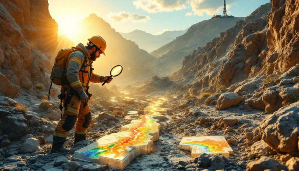
What Surface Indicators Do Geologists Look For?
Before the expensive process of drilling begins, geologists rely on surface evidence to identify promising exploration targets. This detective work combines geological mapping with geochemical sampling to narrow down potential drilling locations.
Geological Mapping Techniques
Field geologists meticulously document rock types and structures across exploration areas, looking for telltale signs of gold mineralization:
Rock Associations
Certain rock types frequently host gold deposits:
- Greenstone belts (metamorphosed volcanic rocks)
- Granitic intrusions with specific alteration patterns
- Sedimentary rocks with carbonaceous material (especially in Carlin-type deposits)
- Iron formations and banded iron formations
Structural Features
Gold often concentrates along geological structures that control fluid movement:
- Fault zones and intersections between multiple faults
- Shear zones where rocks have been deformed under pressure
- Fold hinges where layers of rock have been bent
- Dilational jogs where fault movement creates openings
Quartz Vein Systems
Quartz veins represent ancient fluid pathways that may contain gold:
- Systematic mapping of vein orientation, thickness, and continuity
- Documentation of vein textures (e.g., ribbon, cockade, or brecciated)
- Presence of sulfide minerals within veins
- Observation of distinctive "buck" quartz with bluish tint
Alteration Patterns
Chemical changes in host rocks often create visible halos around gold deposits:
- Silicification (increased silica content creating hardened zones)
- Carbonatization (introduction of carbonate minerals)
- Sericitization (formation of fine-grained mica)
- Sulfidation (presence of pyrite, arsenopyrite, and other sulfides)
Detailed field notes, structural measurements, and rock samples provide the foundation for targeting further exploration work. Mineral exploration insights have evolved significantly in recent years, improving the efficiency of these processes.
Geochemical Sampling Strategies
Geochemical sampling detects minute traces of gold and associated elements that have migrated from buried deposits to the surface environment:
Soil Sampling
Systematic collection of soil samples along grids can reveal hidden mineralization:
- Typically collected at B-horizon depth (20-30cm)
- Grid spacing from 25-200m depending on exploration stage
- Can detect anomalies from deposits at depths exceeding 100m
- Analysis for gold and pathfinder elements
Rock Sampling
Targeted collection of rock specimens provides direct evidence of mineralization:
- Outcrop sampling of promising lithologies
- Chip sampling across structures and veins
- Channel sampling for systematic coverage
- Float sampling of displaced rock fragments
Stream Sediment Sampling
Collection of sediments from active streams efficiently covers large areas:
- Samples taken from low-energy depositional environments
- Heavy mineral concentrates isolated through panning
- Effective first-pass technique for regional exploration
- Can identify source areas through systematic upstream sampling
Pathfinder Elements
Gold rarely travels alone—it associates with a distinctive suite of elements:
- Arsenic (As): The most reliable gold pathfinder with typical ratios of As:Au = 100:1
- Antimony (Sb): Forms stable compounds in oxidizing environments
- Bismuth (Bi): Especially important in intrusion-related systems
- Tellurium (Te): Forms gold tellurides in epithermal systems
- Mercury (Hg): Volatile element that forms dispersion halos
"Bismuth is the canary in the coal mine for intrusion-related gold systems." – Dr. Rich Goldfarb, USGS
These pathfinder elements typically form larger, more detectable dispersion halos than gold itself. The specific As:Sb:Bi ratio of 100:10:1 in gold systems provides a distinctive fingerprint that helps geologists identify promising targets.
Successful exploration programs integrate mapping and geochemical data to build a coherent picture of potential gold mineralization before committing to expensive drilling programs overview.
How Do Geophysical Methods Reveal Hidden Gold?
When gold deposits lie hidden beneath the surface, geophysicists deploy sophisticated technology to "see" underground. These non-invasive methods map physical property contrasts that might indicate mineralization, providing crucial targeting information before drilling begins.
Modern Geophysical Exploration Techniques
Geophysical surveys measure various physical properties of rocks to identify anomalies associated with gold deposits:
Induced Polarization (IP) Surveys
IP measures the ground's capacity to store electrical charge, making it particularly effective for detecting disseminated sulfide minerals often associated with gold:
- Detects sulfide concentrations as low as 1-2%
- Penetrates to depths of approximately 500m
- Measures both chargeability (sulfide content) and resistivity (rock type)
- Most effective for disseminated sulfide deposits
IP surveys have proven especially valuable for Carlin-type deposits in Nevada, where gold occurs with fine-grained pyrite that produces distinctive chargeability anomalies of 15-20 milliseconds against background readings of 2-5 milliseconds.
Magnetic Surveys
Magnetometers measure variations in Earth's magnetic field caused by different rock types:
- Identify magnetite destruction in alteration zones (magnetic lows)
- Map mafic/ultramafic rocks that may host gold
- Delineate structural features like faults and shear zones
- Can be conducted from ground, air, or drone platforms
Modern drone-based magnetic surveys cover terrain 100 times faster than traditional ground methods, collecting data with centimeter-scale precision. According to researchers at Geoscience Australia, advanced geophysical techniques have revolutionized how geologists hunt for gold in complex geological settings.
Gravity Surveys
Gravity measurements detect density variations in subsurface rocks:
- Map density contrasts between ore bodies and host rocks
- Identify silicified zones (lower density) in epithermal systems
- Detect dense sulfide accumulations in certain deposit types
- Help define the overall architecture of mineral systems
Electromagnetic Methods
EM techniques detect variations in electrical conductivity:
- Airborne EM systems map regional conductivity patterns
- Ground-based systems provide detailed follow-up
- Particularly effective for massive sulfide bodies
- Can identify graphitic shear zones that may host gold
Each method has strengths and limitations, with effectiveness varying by deposit type, depth, and local geological conditions. The table below compares their relative effectiveness:
| Method | Depth Range | Best Target Type | Limitations |
|---|---|---|---|
| IP | 30-500m | Disseminated sulfides | Slow, expensive |
| Magnetics | Surface to deep | Structural features | Ineffective for non-magnetic ores |
| Gravity | 10-1000m | Dense ore bodies | Regional variations mask local anomalies |
| EM | 10-300m | Conductive sulfides | Limited depth penetration |
Creating 3D Subsurface Models
Modern exploration relies on sophisticated 3D modeling to integrate multiple data sources and visualize potential drill targets:
Data Integration Techniques
Multiple datasets combine to create comprehensive subsurface models:
- Co-kriging of geophysical and geochemical data
- Weighted overlay analysis based on deposit models
- Machine learning algorithms to identify subtle patterns
- Inversion modeling to convert surface measurements to 3D property distributions
Visualization Tools
Specialized software transforms complex data into interpretable 3D models:
- GOCAD and Leapfrog for geological modeling
- UBC-GIF for geophysical inversions
- Oasis Montaj for data integration
- Virtual reality systems for immersive data exploration
The Tropicana gold project in Western Australia demonstrates the power of integrated geophysical modeling. Discovered beneath 30 meters of cover, the deposit was identified through a distinctive combination of magnetic lows (indicating magnetite destruction) with coincident high resistivity (signaling silicification). This signature led to a successful drilling program that discovered a 7.9 million ounce gold resource.
Despite these powerful tools, geophysical interpretation remains challenging:
- Multiple geological scenarios can produce similar signatures
- Varying background geology creates different responses for similar targets
- Data resolution decreases with depth
- Most methods detect features associated with gold rather than gold itself
Successful exploration teams combine technical expertise with geological intuition, using geophysical data to generate testable hypotheses rather than definitive answers about what lies beneath.
What Happens During the Drilling Phase?
Drilling represents the moment of truth in gold exploration—when theories about what lies beneath are tested against physical reality. This critical phase provides the first direct evidence of gold mineralization and forms the foundation for resource calculation.
Diamond Core Drilling Methodology
Diamond drilling uses rotating bits impregnated with industrial diamonds to cut cylindrical rock samples (cores) from deep underground:
Equipment and Techniques
Modern drilling systems balance depth capability with sample quality:
- Rig types range from lightweight portable systems to heavy truck-mounted units
- Standard core sizes:
- PQ (85mm diameter) – For shallow, weathered zones
- HQ (63.5mm diameter) – Most common for resource definition
- NQ (47.6mm diameter) – For deeper drilling
- Typical drilling rates: 30-50 meters per 12-hour shift
- Maximum depths exceed 3,000 meters in some operations
Core Recovery and Handling
Maintaining sample integrity is critical for accurate analysis:
- Core extracted in 3-meter runs using wireline retrieval systems
- Technicians measure core recovery (length retrieved vs. length drilled)
- Core placed in sequential, labeled trays
- Technicians mark depth measurements and orientation lines
- Core photographed both wet and dry for permanent record
- Core transported to logging facility with chain-of-custody documentation
Industry standards require core recovery above 95% for resource definition drilling, with lower recoveries triggering investigation and possible redrilling.
Oriented Core Technology
Modern drilling employs specialized tools to mark the core's original orientation:
- Electronic or mechanical orientation tools mark the bottom of the core
- Orientation allows precise measurement of geological structures
- Critical for understanding vein systems and fault geometries
- Improves structural models and drilling efficiency
This technology proved crucial at Australia's Fosterville Mine, where oriented core drilling revealed a complex network of high-grade veins that previous drilling had missed. Grades increased from an average of 5 g/t to more than 30 g/t gold in targeted zones. The current gold price forecast makes such discoveries increasingly valuable.
Sample Analysis and Grade Determination
The analytical process transforms drill core into quantifiable gold values through systematic protocols:
Core Logging Procedures
Geologists document every aspect of the recovered core:
- Lithology (rock type) with standardized codes
- Alteration types and intensity
- Miner
Ready to Identify the Next Major Mineral Discovery?
Discovery Alert's proprietary Discovery IQ model provides instant notifications on significant ASX mineral discoveries, transforming complex data into actionable investment insights that could lead to substantial returns. Explore our dedicated discoveries page to understand how major mineral discoveries have historically generated exceptional market outcomes, and position yourself ahead of the market with our 30-day free trial.