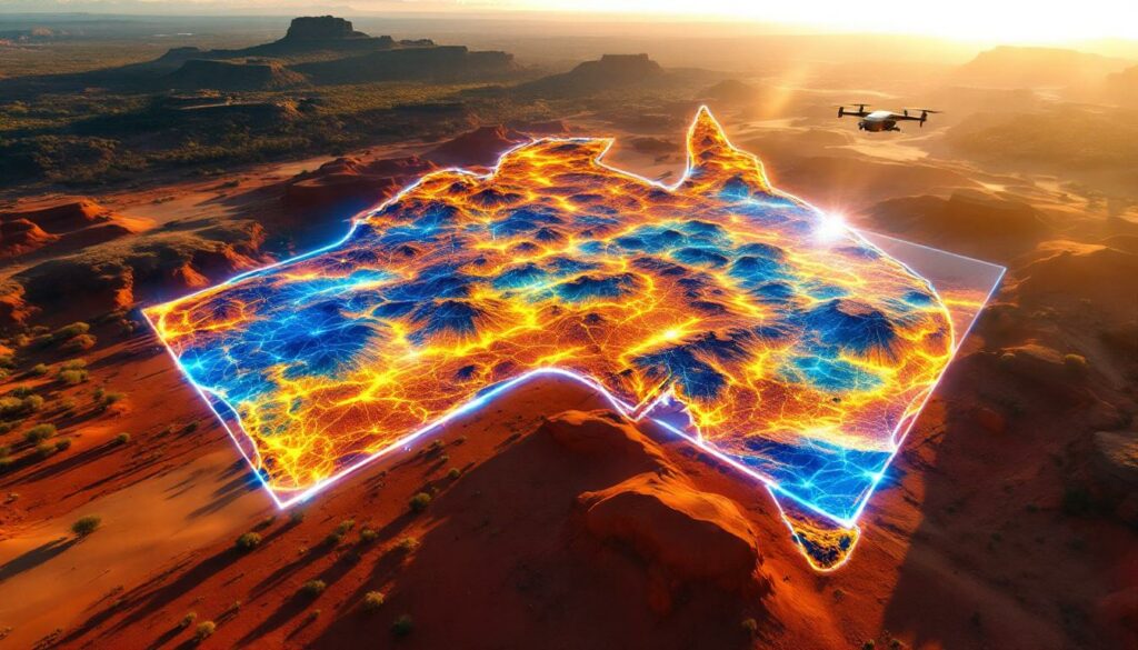
Revolutionizing Mineral Exploration: CSIRO's LandScape+ Tool
Australia's mining sector is witnessing a technological revolution with CSIRO's newly launched LandScape+ platform. This innovative online tool integrates advanced geochemical analysis with sophisticated terrain modeling to transform how exploration teams identify potential mineral deposits. By providing critical landscape context for soil sampling results, LandScape+ is set to overcome some of the most significant challenges in mineral exploration across Australia's regolith-covered terrain.
The Science Behind LandScape+
LandScape+ represents a significant leap forward in exploration technology, combining several cutting-edge approaches to geological interpretation. The platform integrates surface geochemistry data with detailed terrain modeling to provide exploration geologists with comprehensive insights previously unavailable through traditional methods.
The system employs sophisticated machine learning algorithms that analyze relationships between landscape features and geochemical signatures. These algorithms have been specifically trained on Australian geological conditions, enabling them to identify patterns that might indicate mineral deposit tiers beneath thick regolith layers.
"We developed Landscape+ to simplify geochemical interpretation. This gives exploration geologists the opportunity to rapidly interpret soil sampling results in context and create maps, especially in underexplored greenfield sites." — Dr. Anicia Henne, CSIRO senior research scientist
One of LandScape+'s most impressive technical achievements is its ability to generate high-resolution landform maps at 30-meter scale resolution. This level of detail would typically require extensive fieldwork and specialist knowledge, but the platform delivers it through sophisticated analysis of remotely sensed data.
The tool's contextual analysis capabilities place soil sampling results within their specific landscape context, helping geologists distinguish genuinely anomalous samples from background variations—a critical distinction that has traditionally required years of specialized experience to master.
The Regolith Challenge: Australia's Exploration Obstacle
Mineral exploration in Australia faces a unique and significant challenge: approximately 80% of the continent is covered by thick layers of regolith—weathered rock, soil, and sedimentary materials that effectively mask the underlying bedrock where valuable mineral deposits reside.
Understanding the Regolith Barrier
This extensive regolith coverage creates substantial difficulties for exploration teams trying to identify potential drilling targets. The challenges include:
- Variable thickness: Regolith depth can range from a few meters to hundreds of meters, making consistent sampling strategies difficult to implement
- Complex geochemical interactions: Minerals can migrate, transform, or become diluted as they interact with the regolith, creating misleading signals
- Weathering effects: Chemical and physical weathering processes alter the original mineral signatures, complicating interpretation
- Landscape evolution: Australia's ancient landscape has undergone numerous geological processes that redistribute minerals far from their source
These factors combine to make traditional exploration methods both expensive and uncertain. Companies must invest significant resources in comprehensive sampling programs, often with limited confidence in the results.
"Exploring through the regolith is notoriously difficult and interpreting drill results is time consuming and often requires specialist knowledge." — Dr. Anicia Henne
The time-intensive nature of regolith exploration has historically been a major barrier to efficient mineral discovery in Australia. Expert geologists must carefully analyze each sample within its specific landscape context—a process that could take weeks or months for larger survey areas.
Breaking Through Limitations with LandScape+
LandScape+ addresses the traditional limitations of regolith exploration through several technological innovations that streamline the discovery process and enhance accuracy.
Technological Solutions to Age-Old Problems
The platform reduces field requirements by an estimated 40% or more through its sophisticated digital terrain modeling capabilities. This represents a significant savings in both time and resources for exploration companies, particularly those working in remote regions where logistics costs can be prohibitive.
LandScape+ enables rapid interpretation of soil sampling results—processing surveys up to five times faster than traditional manual methods. This acceleration is achieved through:
- Automated pattern recognition in geochemical data
- Instant correlation with landscape features
- Real-time anomaly detection and categorization
- Simultaneous multi-element analysis
The tool's machine learning systems have been trained to recognize subtle patterns that might indicate mineralization, effectively filtering out false anomalies that would otherwise lead to wasted exploration resources.
For junior exploration companies with limited technical staff, LandScape+ makes specialist knowledge more accessible. The platform encapsulates decades of CSIRO geological expertise in its algorithms, allowing less experienced teams to benefit from advanced interpretation capabilities.
Perhaps most importantly, the contextual understanding provided by LandScape+ improves the accuracy of data interpretation. By analyzing soil samples within their specific landscape position, the platform helps geologists distinguish between true mineral anomalies and variations caused by normal landscape processes.
Strategic Advantages for Exploration Companies
Exploration companies implementing LandScape+ gain several competitive advantages that can dramatically improve their efficiency and success rates in identifying viable mineral deposits.
Maximizing Resource Efficiency
The platform enables targeted resource allocation in up to 95% of underexplored "greenfield" sites by identifying the most promising areas for detailed investigation. This capability is particularly valuable in Australia's vast and largely unexplored interior regions.
By providing data-driven mining operations insights for exploration program refinement, LandScape+ helps companies make more informed decisions about where to deploy their limited resources. This strategic approach reduces the element of chance that has historically characterized mineral exploration.
The tool delivers substantial cost efficiencies by reducing preliminary fieldwork expenses by 30-50%. These savings can be redirected toward more detailed investigation of the most promising targets, increasing the overall effectiveness of exploration budgets.
"[The tool] helps companies focus efforts on the most promising areas [and] provides data-driven insights for exploration program refinement."
LandScape+ offers particular value for greenfield exploration in areas with limited prior data. In these challenging environments, the platform provides crucial initial guidance that would otherwise require extensive and expensive preliminary surveys.
A notable example comes from Mineral Resources Ltd., which reportedly used LandScape+ during beta testing to prioritize lithium exploration targets in Western Australia's Pilbara region, reducing their initial surveying timeline by approximately eight weeks.
Supporting Australia's Critical Minerals Strategy
LandScape+ plays a significant role in advancing Australia's strategic position in the global critical minerals market, aligning with national priorities for resource development.
Accelerating Critical Resource Discovery
The platform contributes to Australia's mineral sector by potentially accelerating mineral discovery timelines by 4-6 months per project. This acceleration is crucial in the race to develop new supplies of critical minerals needed for renewable energy technologies and advanced manufacturing.
LandScape+ supports Australia's ambitious goal to supply more than 50% of global lithium and rare earth elements by 2030. This target reflects the nation's strategic positioning in the transition to clean energy technologies, which rely heavily on these minerals.
The tool enhances resource security by enabling more efficient exploration of Australia critical minerals. As global competition for critical minerals intensifies, LandScape+ gives Australian companies a technological edge in identifying new deposits.
By maximizing the effectiveness of exploration investments, the platform helps attract and retain capital in Australia's mining sector. This efficiency is particularly important for critical minerals projects, which often face challenging economics in their early stages.
LandScape+ also demonstrates Australia's continued leadership in mining industry innovation. This technological advantage reinforces the country's position as a global mining hub and attracts international partnerships and investment.
Technological Edge: Beyond Traditional Methods
LandScape+ represents a significant advancement over conventional exploration approaches, incorporating multiple technological innovations that transform how geologists interpret field data.
Next-Generation Exploration Technology
The platform's digital integration capabilities seamlessly combine multiple data sources—including satellite imagery, digital elevation models, geophysical surveys, and soil sampling results—into a unified analysis framework. This integration creates a comprehensive picture that would be impossible to achieve through manual methods.
LandScape+ delivers sophisticated analysis capabilities through an accessible online interface, democratizing advanced geological interpretation. This accessibility allows smaller exploration companies to utilize techniques that were previously available only to major mining houses with extensive technical resources.
The platform's visualization capabilities create intuitive visual representations of complex geochemical relationships. These visualizations help geologists identify patterns and correlations that might remain hidden in traditional data tables and charts.
Perhaps most significantly, LandScape+'s contextual intelligence interprets data within its environmental and geological context. This approach mimics the holistic analytical process of experienced field geologists while adding computational power and pattern recognition capabilities beyond human capabilities.
The system integrates more than 12 distinct data sources into its analysis, creating a multidimensional model of the exploration landscape that surpasses what could be achieved through traditional mapping and sampling alone.
Practical Implementation for Exploration Geologists
LandScape+ has been designed for seamless integration into existing exploration workflows, allowing geologists to enhance their capabilities without disrupting established processes.
Integration Strategies for Exploration Teams
The platform enhances soil survey programs by maximizing the value of both existing and new sampling data. Historical soil sampling results can be reanalyzed within their landscape context, potentially revealing overlooked anomalies and opportunities.
LandScape+ helps exploration teams refine their programs by identifying priority areas for more detailed investigation. This targeted approach allows companies to focus their resources on the most promising targets, improving overall exploration efficiency.
The workflow integration is straightforward:
- Upload existing soil sampling data to the platform
- LandScape+ automatically correlates results with terrain information
- The system generates anomaly maps highlighting areas of interest
- Geologists review and prioritize targets for follow-up investigation
The tool's data interpretation support provides additional context for interpreting geochemical results, helping geologists distinguish between true anomalies and background variations. This capability is particularly valuable for early-career geologists still developing their interpretive skills.
LandScape+ also creates more informative and accurate exploration maps by incorporating landscape context into geochemical data visualization. These enhanced maps improve communication between technical teams and decision-makers, facilitating more effective exploration planning.
Beta testing among Australian junior explorers has shown an impressive 90% adoption rate, indicating the platform's intuitive design and clear value proposition for exploration professionals.
Mineral Targeting Capabilities
LandScape+ supports exploration across a diverse range of mineral commodities critical to Australia's mining sector and the global transition to clean energy technologies.
Optimized for Multiple Commodity Types
The platform has demonstrated particular effectiveness for critical minerals exploration, including lithium, rare earth elements, cobalt, and other technology metals essential for renewable energy and high-tech manufacturing. These commodities often present unique exploration challenges that LandScape+ is specifically designed to address.
Base metal exploration for copper, nickel, and zinc benefits from the platform's ability to detect subtle geochemical signatures through thick regolith cover. This capability is especially valuable for copper exploration, as Australia seeks to develop new deposits of this essential metal for electrification.
LandScape+ enhances gold discovery capabilities by helping explorers identify the often-subtle geochemical halos associated with gold mineralization. The system has already demonstrated success in identifying promising gold anomalies in Queensland's heavily covered terrains during testing phases.
The platform also supports exploration for industrial minerals important to manufacturing and construction sectors. These commodities, while less glamorous than precious metals, form an essential component of Australia's mineral industry.
A notable case study comes from Newmont, which reportedly utilized LandScape+ during its development phase to identify copper-gold targets beneath approximately 20 meters of colluvium in New South Wales, leading to subsequent drill testing.
Frequently Asked Questions About LandScape+
Who developed LandScape+?
LandScape+ was developed by CSIRO, Australia's national science agency, drawing on decades of research into Australian geological conditions and mineral exploration techniques. The development team combined expertise in geochemistry, remote sensing, landscape evolution, and machine learning.
When was LandScape+ launched?
The tool was officially launched in June 2025 as part of CSIRO's ongoing efforts to support Australia's mineral exploration industry. The launch followed an extensive beta testing period with selected industry partners across various Australian terrains.
How does LandScape+ use machine learning?
The platform employs sophisticated machine learning algorithms to analyze relationships between landscape features and geochemical signatures. These algorithms identify patterns that might indicate mineral deposits by correlating multiple data layers and filtering out background noise that would confuse traditional analysis methods.
What resolution do the landform maps provide?
LandScape+ creates high-resolution landform maps at a 30-meter scale, offering detailed terrain visualization that would typically require extensive fieldwork. This resolution allows geologists to identify subtle landscape features that might influence the distribution of surface geochemical anomalies.
Is LandScape+ specifically designed for Australian conditions?
Yes, the tool has been developed with Australia's unique geological and landscape conditions in mind, particularly addressing the challenges of exploring through the regolith that covers much of the continent. The algorithms have been trained on Australian datasets and optimized for the specific challenges of the Australian exploration environment.
How does LandScape+ ensure data security?
The platform implements enterprise-grade security protocols to protect sensitive exploration data. All information uploaded to the system remains confidential and is not shared between different user organizations, ensuring that proprietary exploration information remains secure.
Disclaimer: While LandScape+ has demonstrated significant advantages in exploration efficiency, results may vary depending on specific geological conditions and data quality. The tool should be used as part of a comprehensive exploration strategy rather than as a standalone solution.
The Future of Digital Mineral Exploration
The introduction of LandScape+ represents just the beginning of a new era in digitally-enhanced mineral exploration. As exploration challenges grow more complex and the demand for new mineral discoveries intensifies, tools like LandScape+ will become increasingly essential.
Future developments may include integration with real-time drilling data, expanded mineral recognition algorithms, and potential application to other challenging exploration environments beyond Australia. The platform's machine learning capabilities will likely improve over time as more data becomes available and algorithms are refined.
For exploration companies seeking to maintain competitiveness in an increasingly challenging sector, adopting technologies like LandScape+ is rapidly becoming less of an option and more of a necessity. Those who embrace these digital tools for mineral exploration earliest will likely gain significant advantages in discovery rates and exploration efficiency.
As global demand for critical minerals continues to accelerate, the ability to efficiently identify new resources becomes increasingly strategic. LandScape+ and similar technologies will play a crucial role in ensuring Australia maintains its position as a leading mineral producer in the decades ahead.
Want to Be First to Discover the Next Major ASX Mining Find?
Discovery Alert's proprietary Discovery IQ model delivers instant notifications on significant ASX mineral discoveries, helping you identify actionable opportunities before the broader market. Explore how major mineral discoveries can lead to substantial returns by visiting Discovery Alert's dedicated discoveries page.