Understanding Mount Si's Unique Geological Composition
Mount Si stands as one of Washington State's most recognizable peaks, rising dramatically near North Bend and attracting thousands of hikers annually. Beyond its recreational appeal, this mountain represents a fascinating geological puzzle that connects the Pacific Northwest to distant Alaskan terranes through processes spanning millions of years. The geological connection between Mount Si and Alaska provides compelling evidence for large-scale terrane transport across the North American Cordillera.
The Metamorphic Crown of Mount Si
The upper portion of Mount Si consists of exceptionally resistant metamorphic rock that forms the mountain's distinctive profile. This hard caprock represents metagabbro – originally oceanic igneous rock that underwent intense heat and pressure transformation. The term gabbro refers to coarse-grained mafic igneous rock typically found in oceanic crustal settings, composed primarily of plagioclase feldspar and pyroxene minerals.
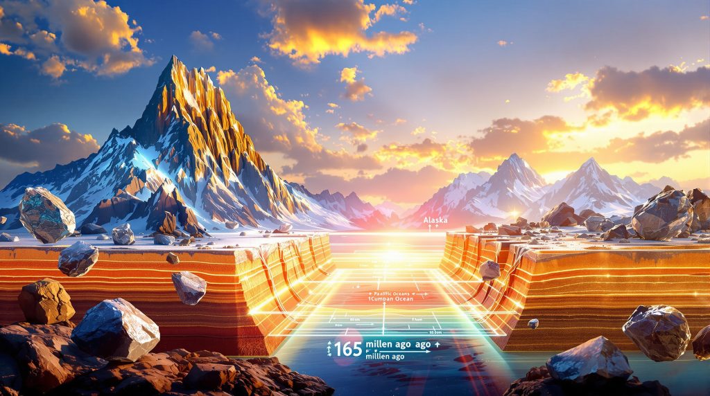
Radiometric dating of zircon crystals extracted from these metagabbro blocks reveals ages of approximately 165 million years, placing their formation during the Middle Jurassic period when dinosaurs roamed the Earth. This timing indicates the original oceanic crustal material crystallized in a mid-ocean ridge environment during the breakup of the supercontinent Pangaea.
The metagabbro exhibits distinctive mineral assemblages including:
• Recrystallized plagioclase feldspar showing strain textures
• Metamorphic epidote replacing original pyroxene
• Secondary biotite and muscovite mica development
• Foliated structures indicating intense deformation
Sedimentary Foundation and Mélange Complexity
Beneath the resistant metagabbro cap lies a dramatically different geological environment. The lower slopes of Mount Si contain a complex mélange – a chaotic mixture of sedimentary rocks, fault blocks, and exotic fragments that tells a story of violent tectonic disruption.
This mélange assemblage includes:
Primary Components:
• Argillite – fine-grained metamorphosed mudstone
• Graywacke sandstone with marine turbidite characteristics
• Limestone blocks derived from oceanic carbonate platforms
• Polymictic conglomerate containing diverse clast populations
• Shale and siltstone fragments
The sedimentary rocks display intensive deformation features including pervasive shearing, folding, and recrystallization. Sandstone units occur as lenticular bodies within a foliated argillite matrix, indicating the entire assemblage experienced significant tectonic stress after initial deposition. Furthermore, these formations demonstrate the importance of understanding geological logging techniques in documenting such complex assemblages.
Ocean Floor Origins in Washington's Cascades
Every rock type present in Mount Si originated in Pacific Ocean environments, reflecting the complex history of terrane accretion along North America's western margin. The metagabbro blocks represent fragments of oceanic crust, while the surrounding sedimentary rocks accumulated in deep marine basins through turbidity current deposition.
This oceanic heritage connects Mount Si to broader patterns of exotic terrane assembly that characterize the North American Cordillera. During the Mesozoic Era, oceanic plates carried volcanic islands, seamounts, and sedimentary complexes thousands of kilometers northward before collision and accretion onto the continental margin. However, the mineral exploration importance of these formations extends beyond academic interest to practical resource applications.
What Makes the Chugach Terrain Geologically Significant?
The geological connection between Mount Si and Alaska becomes apparent when examining the Chugach terrain, a distinctive geological belt extending from south of Anchorage to Kodiak Island. This Alaskan terrane shares remarkable similarities with Washington's Western Mélange Belt, suggesting these now-distant rock assemblages may have originated as a single geological unit.
Turbidite Formations and Marine Sediment Patterns
The Chugach terrain consists predominantly of turbidite sequences – sedimentary rocks deposited by submarine gravity flows in deep ocean basins. These distinctive formations exhibit characteristic graded bedding, where coarse sediments at the base fine upward to clay-rich tops, reflecting the physics of turbidity current deposition.
Key characteristics of Chugach turbidites include:
• Rhythmic alternation between sandstone and shale layers
• Bouma sequence structures indicating submarine fan environments
• Deep marine fossils confirming oceanic depositional settings
• Flysch-type sedimentary architectures
The turbidite packages within the Chugach terrain demonstrate deposition in abyssal plain environments, likely within oceanic trenches or forearc basins associated with active subduction zones during the Mesozoic Era. In addition, these sedimentary deposit insights help researchers understand similar formations across different geological contexts.
Structural Similarities Across Tectonic Boundaries
Detailed structural analysis reveals striking parallels between the Chugach terrain and Mount Si's mélange complex. Both regions exhibit:
Deformation Characteristics:
• Intense shearing and foliation development
• Chaotic block-in-matrix textures
• Multiple generations of folding and faulting
• High-pressure, low-temperature metamorphic conditions
These shared structural features suggest both terranes experienced similar tectonic processes, potentially within the same subduction complex before subsequent geographical separation.
Age Dating and Temporal Connections
Geochronological studies of both the Mount Si region and Chugach terrain reveal overlapping age populations that support correlation hypotheses. The 165-million-year metagabbro ages from Mount Si correspond to similar oceanic crustal ages documented within Alaskan mélange complexes.
| Geological Unit | Primary Rock Types | Age Range (Ma) | Depositional Environment |
|---|---|---|---|
| Mount Si Mélange | Metagabbro, argillite, turbidites | 165-100 | Oceanic crust and trench |
| Chugach Terrain | Turbidites, mélange, basalt | 180-60 | Accretionary wedge |
| Western Mélange Belt | Mixed oceanic fragments | Variable | Subduction complex |
How Do Tectonic Processes Connect Distant Terranes?
The geological connection between Mount Si and Alaska requires understanding large-scale tectonic mechanisms capable of transporting rock assemblages across thousands of kilometers. Several processes contribute to long-distance terrane migration along active continental margins.
Northward Migration Mechanisms in the Pacific Northwest
Paleomagnetic evidence indicates significant northward displacement of Pacific Northwest terranes during specific geological time windows. The concept of "Baja BC" describes intervals when paleomagnetic declination angles suggest rock units formed at much more southerly latitudes than their current positions.
Critical time periods for northward migration include:
Late Cretaceous Period (85-70 Ma):
• Initial terrane docking and accretion events
• Subduction zone reconfiguration
• Major thrust fault development
Paleogene Period (70-50 Ma):
• Continued northward transport
• Strike-slip fault activation
• Terrane fragmentation and dispersal
Neogene Period (<50 Ma):
• Final positioning and modern fault systems
• Ongoing incremental displacement
Strike-Slip Fault Systems and Terrain Transport
Major strike-slip fault systems provide the primary mechanism for long-distance horizontal transport of geological terranes. The San Andreas Fault system serves as a modern analogue, demonstrating how dextral (right-lateral) motion can transport crustal blocks hundreds of kilometers northward over geological time scales.
Similar fault systems operated throughout Cordilleran history, including:
• Proto-San Andreas fault networks during the Paleogene
• Fraser River – Straight Creek fault system
• Denali fault system in Alaska
• Various intra-arc and forearc fault zones
These fault systems create a complex network capable of slicing, rotating, and transporting geological terranes across vast distances while preserving their internal coherence.
Subduction Zone Dynamics and Accretion Processes
Subduction zones represent the primary sites where oceanic terranes dock against continental margins. The Cascadia Subduction Zone and its predecessors facilitated the initial accretion of oceanic materials that now comprise Mount Si and related formations.
Key subduction processes include:
- Offscraping: Sediments and oceanic crust scrape off the descending plate
- Underplating: Deep accretion beneath existing crustal materials
- Tectonic erosion: Removal and recycling of previously accreted materials
- Transform motion: Strike-slip displacement along trench-parallel faults
Furthermore, understanding these processes helps classify different mineral deposit tiers based on their tectonic settings and formation environments.
Western Mélange Belt: A Continental-Scale Geological Feature
The Western Mélange Belt represents a continental-scale geological feature extending from North Bend through Granite Falls, Washington, and potentially far beyond. This linear belt preserves evidence of ancient oceanic environments and subsequent tectonic disruption.
Geographic Distribution from North Bend to Granite Falls
Field mapping reveals the Western Mélange Belt's continuous exposure across approximately 80 kilometres of rugged Cascade foothills. Key locations include:
Northern Extent:
• Granite Falls area – complex fault-bounded blocks
• Darrington region – highly deformed mélange sequences
• US Highway 2 corridor near Goldbar
Central Sections:
• Mount Si vicinity – type locality for metagabbro blocks
• North Bend area – classic mélange exposures
Southern Extensions:
• Interstate 90 corridor exposures
• Potential continuation to White Pass region
• Russell Ranch unit correlations
Rock Composition Analysis and Mineral Content
Detailed petrographic analysis reveals the Western Mélange Belt's complex composition, reflecting diverse oceanic source regions and subsequent metamorphic modification. Consequently, the mineralogy and ore economics of these formations provide insights into both academic research and potential resource applications.
Primary Rock Types:
| Component | Description | Age (Million Years) | Origin Environment |
|---|---|---|---|
| Metagabbro blocks | Metamorphosed oceanic crust | ~165 | Mid-ocean ridge |
| Argillite matrix | Fine-grained sedimentary rock | Mesozoic | Deep marine basin |
| Sandstone units | Marine turbidite deposits | Variable | Submarine fans |
| Limestone fragments | Oceanic carbonate platforms | Jurassic-Cretaceous | Tropical seas |
| Volcanic clasts | Arc and oceanic volcanic rocks | Variable | Island arcs |
Mineral Assemblages:
The mélange exhibits diverse mineral assemblages reflecting multiple metamorphic events:
• Primary minerals: Plagioclase, pyroxene, quartz
• Metamorphic minerals: Epidote, biotite, muscovite, chlorite
• Secondary minerals: Calcite, prehnite, pumpellyite
• Alteration products: Clay minerals, zeolites, serpentine
Structural Deformation and Metamorphic Processes
The Western Mélange Belt records intense structural deformation through multiple tectonic events. Characteristic features include:
Deformation Structures:
• Pervasive shearing and foliation development
• Isoclinal folding with axial planar cleavage
• Boudinage structures in competent layers
• Fault-bounded lenticular blocks
• Cataclastic textures in high-strain zones
Metamorphic Conditions:
Mineral assemblages indicate low-grade metamorphic conditions consistent with subduction zone environments:
• Temperature range: 200-400°C
• Pressure conditions: 3-8 kbar
• Metamorphic facies: Prehnite-pumpellyite to greenschist
• High pressure/temperature ratios typical of subduction
What Evidence Supports Long-Distance Terrain Correlation?
Establishing correlations between geologically distant terranes requires multiple lines of evidence beyond simple age matching. The geological connection between Mount Si and Alaska relies on integrated datasets spanning various analytical approaches.
Petrographic Analysis and Mineral Assemblages
Detailed petrographic analysis provides crucial evidence for terrane correlation through systematic comparison of mineral assemblages, textures, and metamorphic histories.
Comparative Mineral Analysis:
Both Mount Si mélange and Chugach terrain exhibit similar metamorphic mineral assemblages:
• Epidote-bearing assemblages indicating similar pressure-temperature conditions
• Plagioclase compositions within comparable An (anorthite) ranges
• Mica polytypes suggesting similar metamorphic environments
• Chlorite chemistry reflecting comparable fluid compositions
Textural Correlations:
Microscopic textures provide additional correlation evidence:
• Pressure solution features in both locations
• Similar grain size distributions in matrix materials
• Comparable deformation twin patterns in plagioclase
• Parallel development of metamorphic foliations
Structural Fabric Comparisons
Structural analysis reveals consistent deformation patterns between Mount Si and Chugach terrain assemblages, suggesting shared tectonic histories.
Fabric Elements:
• S1 foliation orientations showing statistical similarity
• Fold vergence patterns indicating consistent shear sense
• Lineation orientations suggesting similar transport directions
• Fault kinematics implying comparable stress fields
Deformation Sequence:
Both regions record similar deformation sequences:
- D1 Event: Initial foliation and isoclinal folding
- D2 Event: Crenulation cleavage and open folding
- D3 Event: Brittle faulting and cataclasis
- Late-stage: Retrograde alteration and weathering
Paleomagnetic Data and Latitudinal Displacement
Paleomagnetic studies provide critical quantitative constraints on terrane displacement histories by measuring ancient magnetic field orientations preserved in rocks.
Declination Analysis:
Paleomagnetic declination angles indicate the degree of rotation and latitudinal displacement since rock formation:
• Shallow inclination angles suggest formation at lower latitudes
• Declination anomalies indicate clockwise or counterclockwise rotation
• Statistical comparison of site means enables correlation testing
The presence of 165-million-year-old metagabbro blocks within both the Mount Si formation and Chugach terrain suggests these oceanic crustal fragments originated from the same paleo-oceanic environment before being incorporated into their respective geological settings through large-scale terrane transport processes.
Displacement Calculations:
Quantitative paleomagnetic analysis suggests:
• Minimum northward displacement: 1,000-2,000 kilometres
• Timing of transport: Multiple episodes from 85-50 Ma
• Rotation components: 15-30 degrees clockwise rotation
• Confidence intervals: Statistical uncertainty ranges ±10-20 degrees
Pacific Ring of Fire Context and Regional Tectonics
The geological connection between Mount Si and Alaska must be understood within the broader context of Pacific Ring of Fire tectonics, where active subduction zones drive complex terrane assembly processes.
Subduction Zone Influence on Northwestern Geology
The Cascadia Subduction Zone and its predecessors represent the primary tectonic drivers responsible for terrane accretion and subsequent northward transport along the Pacific Northwest coast. Additional insights from the United States Geological Survey provide comprehensive documentation of these regional tectonic relationships.
Modern Cascadia System:
• Convergence rate: 35-45 mm/year
• Subduction angle: 8-12 degrees (very shallow)
• Locked zone depth: 15-20 kilometres
• Megathrust earthquake recurrence: 300-600 years
Historical Subduction Systems:
Previous subduction configurations during the Mesozoic and Cenozoic created the tectonic framework for terrane transport:
• Farallon Plate subduction: Primary driver for Cordilleran orogenesis
• Kula Plate interactions: Northern Pacific plate reorganisation
• Explorer Plate fragmentation: Modern three-plate junction complexity
Exotic Terrane Assembly in the North American Cordillera
The North American Cordillera preserves one of Earth's most complete records of exotic terrane assembly, where oceanic and continental fragments accreted over hundreds of millions of years.
Major Terrane Groups:
• Wrangellia Superterrane: Large oceanic plateau and island arc complex
• Stikinia: Volcanic arc terrane with Paleozoic-Mesozoic history
• Cache Creek Complex: Oceanic and island arc assemblages
• Intermontane Superterrane: Composite continental margin terranes
Assembly Mechanisms:
- Oblique convergence: Creates transpressive deformation zones
- Transform faulting: Enables lateral terrane transport
- Microplate capture: Incorporates oceanic fragments
- Arc-continent collision: Drives major orogenic events
Ongoing Tectonic Activity and Modern Fault Systems
Contemporary tectonic processes continue the long history of terrane modification and transport along the Pacific Northwest coast. Research from Sitka's geological formation demonstrates the ongoing nature of these processes throughout southeastern Alaska.
Active Fault Systems:
• Seattle Fault Zone: East-west trending reverse faults
• Southern Whidbey Island Fault: Major crustal structure
• Olympia Structure: Blind thrust fault system
• Mount St. Helens Seismic Zone: Active volcanic arc faulting
Modern Displacement Rates:
GPS measurements reveal ongoing crustal deformation:
• Northward motion: 10-15 mm/year relative to stable North America
• Eastward compression: 3-5 mm/year across Cascade Range
• Vertical uplift: 1-3 mm/year in Olympic Mountains
• Strike-slip motion: Variable along individual fault zones
Why Do Some Geological Correlations Remain Controversial?
Despite compelling evidence for the geological connection between Mount Si and Alaska, significant scientific debate continues regarding the scale, timing, and mechanisms of proposed terrane correlations.
Paleomagnetic Constraints and Timing Debates
Paleomagnetic data provides both the strongest support for large-scale terrane transport and the greatest source of controversy regarding specific displacement amounts and timing.
Data Limitations:
• Sampling density: Limited number of paleomagnetic sites
• Age constraints: Uncertainty in precise timing of magnetisation
• Tilt corrections: Ambiguity in structural restorations
• Laboratory procedures: Potential for artificial magnetic overprints
Statistical Challenges:
Paleomagnetic correlation requires rigorous statistical analysis:
• Confidence intervals often overlap between different interpretations
• Site-to-site variation may reflect local rather than regional processes
• Secular variation of Earth's magnetic field complicates simple comparisons
• Post-emplacement rotation can obscure primary displacement signals
Alternative Transportation Mechanisms
Scientific debate continues regarding the specific tectonic mechanisms responsible for long-distance terrane transport, with multiple competing hypotheses.
Strike-Slip Translation Model:
• Large-scale dextral fault systems transport intact terranes
• Displacement occurs primarily during discrete time intervals
• Preserves internal terrane coherence during transport
Subduction Shuffle Model:
• Complex interactions within subduction zone environments
• Multiple episodes of accretion and re-mobilisation
• Fragmentation and dispersal during transport
Oroclinal Bending Model:
• Regional-scale folding of previously linear geological belts
• Explains apparent displacement without requiring transport
• Controversial application to Cordilleran geology
Scale of Proposed Displacements
The magnitude of suggested terrane displacements remains highly controversial, with estimates ranging from hundreds to thousands of kilometres.
Conservative Estimates:
• 500-1,000 km northward displacement
• Limited to specific time windows
• Focused on well-documented terrane boundaries
Maximum Estimates:
• 2,000-4,000 km total displacement
• Multiple episodes spanning 100+ million years
• Affects majority of Cordilleran terranes
How far did these rock formations actually travel?
Current evidence suggests minimum northward displacements of 1,000-2,000 kilometres for Mount Si-type terranes, though maximum estimates reach 3,000-4,000 kilometres. The uncertainty reflects limitations in paleomagnetic data and alternative interpretation models.
What timeframe did this geological migration occur over?
Terrane transport likely occurred during multiple episodes between 85-50 million years ago, with additional movements continuing into the Cenozoic Era. Individual transport events may have been rapid (1-10 million years) separated by longer periods of relative stability.
Are there other examples of similar long-distance terrain transport?
Yes, the Wrangellia Superterrane provides a well-documented example of long-distance transport, with paleomagnetic evidence suggesting northward displacement from equatorial latitudes. Similar processes affected terranes throughout the Cordilleran system and other active continental margins globally.
Modern Implications for Understanding Continental Growth
The geological connection between Mount Si and Alaska provides crucial insights into fundamental processes of continental growth and terrane assembly that operate throughout Earth history.
Lessons for Global Terrain Analysis
Understanding Pacific Northwest terrane correlations offers important lessons applicable to continental growth processes worldwide.
Universal Principles:
• Large-scale horizontal transport commonly affects convergent margins
• Oceanic terranes preserve records of ancient plate configurations
• Multiple correlation techniques provide strongest evidence
• Timing relationships constrain transport mechanisms
Comparative Examples:
Similar terrane transport processes operate globally:
• Appalachian Mountains: Taconic and Acadian exotic terranes
• European Caledonides: Laurentian and Baltican terrane assembly
• Central Asian Orogenic Belt: Complex Paleozoic terrane accretion
• Australian Cordillera: Lachlan and New England terrane systems
Resource Distribution and Geological Mapping
Terrane correlation studies have practical implications for natural resource exploration and geological mapping strategies.
Resource Implications:
• Mineral deposits may occur in predictable patterns across correlated terranes
• Hydrocarbon exploration benefits from basin correlation studies
• Construction materials assessment requires understanding bedrock distribution
• Groundwater resources depend on structural and lithological continuity
Mapping Applications:
Modern geological mapping incorporates terrane concepts:
• Digital geological databases link correlated units across regions
• Remote sensing analysis identifies similar terranes in unexplored areas
• Geophysical surveys trace buried terrane boundaries
• Geochronological databases facilitate regional correlations
Climate and Environmental Reconstruction Applications
Terrane transport studies provide unique opportunities for paleoclimate reconstruction by tracking rocks across ancient latitudinal gradients.
Paleoclimate Applications:
• Fossil assemblages record ancient climate zones during transport
• Sedimentary structures indicate paleoenvironmental conditions
• Isotopic compositions preserve temperature and precipitation signals
• Paleosol development records terrestrial climate evolution
Environmental Insights:
Understanding ancient terrane positions helps reconstruct:
• Ocean current patterns and their evolution
• Mountain building effects on regional climate
• Volcanic arc activity and atmospheric impacts
• Continental configuration influences on global circulation
Future Research Directions and Technological Advances
Advancing understanding of the geological connection between Mount Si and Alaska requires integration of emerging analytical techniques with traditional field-based geological methods.
Advanced Dating Techniques and Geochemical Fingerprinting
Next-generation analytical technologies promise to resolve remaining uncertainties in terrane correlation studies.
Emerging Dating Methods:
• Laser ablation ICP-MS: High spatial resolution age dating
• Ion microprobe analysis: In-situ mineral age determination
• Raman spectroscopy: Non-destructive mineral identification
• Automated mineralogy: Rapid quantitative mineral analysis
Geochemical Advances:
• Hafnium isotope analysis: Enhanced crustal provenance determination
• Trace element fingerprinting: Detailed source rock characterisation
• Clumped isotope thermometry: Improved temperature estimates
• Multi-collector mass spectrometry: Increased analytical precision
High-Resolution Structural Analysis Methods
Advanced structural analysis techniques enable more detailed characterisation of deformation histories and correlation criteria.
Technological Innovations:
• Digital outcrop mapping: 3D geological model generation
• Drone-based photography: Improved structural data collection
• Ground-penetrating radar: Subsurface structure imaging
• Portable X-ray diffraction: Field-based mineral identification
Analytical Improvements:
• Statistical analysis of structural datasets
• Machine learning applications to pattern recognition
• Integration of multi-scale structural observations
• Kinematic modelling of complex deformation histories
Integration of Satellite and Ground-Based Geological Surveys
Remote sensing technologies increasingly complement traditional field geology in terrane correlation studies.
Satellite Applications:
• Hyperspectral imaging: Regional mineral mapping
• Interferometric SAR: Subtle topographic analysis
• Thermal infrared spectroscopy: Rock type discrimination
• Digital elevation models: Structural trend analysis
Integration Strategies:
• Combine satellite data with detailed field observations
• Develop predictive models for unexplored regions
• Create comprehensive digital geological databases
• Enable real-time data sharing between research groups
Case Study: Mount Si-Chugach Correlation Analysis
A comprehensive approach to testing the proposed Mount Si-Chugach connection would integrate multiple analytical techniques:
- Systematic paleomagnetic sampling across both regions with rigorous statistical analysis
- High-precision geochronology using multiple dating systems (U-Pb, Ar-Ar, Rb-Sr)
- Detailed geochemical fingerprinting of metagabbro blocks and matrix materials
- Structural analysis comparing deformation styles and kinematics
- Sedimentological studies of turbidite sequences and provenance analysis
This integrated approach exemplifies how complex terrane correlation problems require multiple lines of evidence and interdisciplinary collaboration to resolve satisfactorily.
The geological connection between Mount Si and Alaska represents more than just an interesting correlation between distant rock assemblages. It provides fundamental insights into the dynamic processes that shape continental margins and demonstrates how local geological features connect to global-scale tectonic systems. Future research will undoubtedly refine our understanding of these connections while revealing new complexities in the ever-evolving story of North American geological assembly.
Ready to Discover What Lies Beneath Your Next Investment?
Unlock the geological secrets that drive mineral discoveries with Discovery Alert's proprietary Discovery IQ model, delivering instant notifications when significant ASX mineral discoveries are announced. Explore how major geological formations like Mount Si's unique terrane assemblages can guide modern mineral exploration strategies, then begin your 30-day free trial to gain the market-leading advantage in identifying actionable investment opportunities.