
June 11, 2026
How Do Quartzite Cobbles Tell the Story of Ancient Rivers?
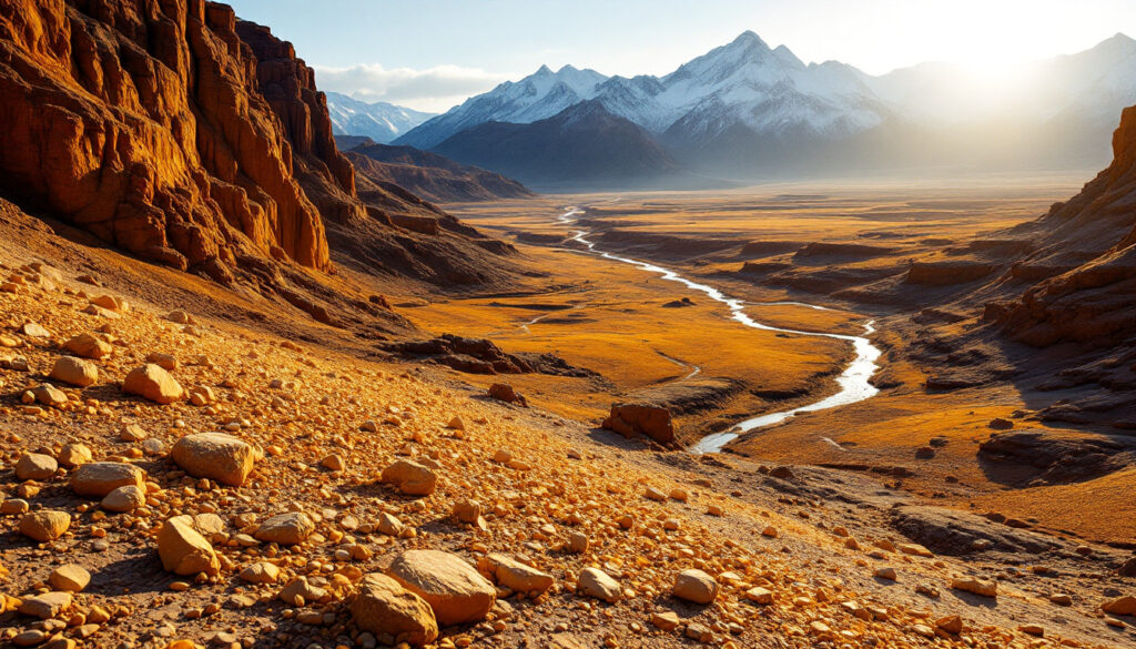
Quartzite cobbles, with their distinctive golden hue, serve as geological breadcrumbs tracing the ancient paths of the Columbia and Snake Rivers across the Pacific Northwest. These durable stones have become crucial evidence for geologists reconstructing the dramatic shifts in river courses over millions of years.
The analysis of these cobbles allows researchers to map prehistoric drainage networks with remarkable precision, offering a window into landscape evolution spanning more than 16 million years. By examining their distribution patterns, geologists can identify ancient river channels that have since been buried, diverted, or completely transformed.
The Significance of Golden Quartzite
Golden quartzite cobbles hold special importance in understanding river history because of their distinctive properties and distribution patterns:
- They originate primarily from Belt Supergroup bedrock sources in northeastern Washington and northern Idaho
- Their exceptional durability allows them to persist in the geological record for millions of years
- Their presence indicates ancient river pathways with high confidence
- Their distribution helps map prehistoric drainage patterns across hundreds of miles
- Their composition provides clues about source regions and transport mechanisms
- Their stratigraphic position reveals timing of river system changes
"What makes quartzite special is its resistance to weathering," explains Jim O'Connor, a USGS geologist who has extensively studied these formations. "While other rock types deteriorate, quartzite endures, making it an ideal tracer for ancient river systems."
However, recent research has complicated the traditional view that quartzite cobbles exclusively indicate Columbia River deposits. Both the Columbia and Snake River systems contain quartzite materials, making definitive attribution challenging without additional evidence. This overlap has prompted geologists to develop more sophisticated mineral exploration strategies that can distinguish between the two river systems.
When big ASX news breaks, our subscribers know first
When Did Quartzite Cobbles First Appear in Central Washington?
The presence of quartzite cobbles throughout geological formations in central Washington provides a timeline of river evolution spanning millions of years. These golden markers appear consistently in specific stratigraphic sequences, allowing researchers to reconstruct river positions with remarkable temporal precision.
Earliest Appearances in the Ellensburg Formation
Quartzite cobbles first appear consistently in the Ellensburg Formation, which includes several distinct horizons:
-
Vantage Horizon (≈16 million years ago): Early evidence suggests the Columbia River was active in the region even before Columbia River Basalt eruptions. These cobbles predating the massive lava flows indicate established drainage systems were already in place.
-
Lower Ellensburg Formation (≈16-10.8 million years ago): Contains intermittent quartzite deposits showing the Columbia River shifting east and west across the landscape. These oscillations created alternating layers of river-derived cobbles and volcanic sediments.
-
Upper Ellensburg Formation (≈10.8-5 million years ago): Features abundant quartzite cobbles, particularly in the Snipes Mountain Conglomerate. This formation contains some of the densest concentrations of quartzite cobbles in the region, indicating a major river channel persisted in this location.
During these periods, the Columbia River repeatedly changed course, influenced by volcanic sediments from the Cascade Range. When volcanic activity increased, the resulting sediment fans pushed the river eastward; during quieter periods, the river worked westward. This dynamic interplay between volcanism and river positioning created the complex pattern of quartzite deposits observed today.
"The Columbia River was essentially playing a game of cat and mouse with volcanic activity," notes O'Connor. "Sediments would push it east, then it would migrate back west when volcanism subsided."
How Did the Columbia River's Path Change Over Time?
The ancient Columbia River followed dramatically different routes than its present course, with major shifts occurring between 10 and 3 million years ago. These paleochannels represent one of the most significant examples of river reorganization in North American geological history.
The Surprising Southwest Route
Geological evidence reveals that after the Elephant Mountain basalt flows (≈10.8 million years ago), the Columbia River:
- Flowed southwest from the Yakima Basin through an ancient valley
- Crossed what is now the Horse Heaven Hills near Bickleton, an area currently several hundred meters above the modern river
- Continued toward the present-day Goldendale area and likely joined the ancestral Columbia Gorge
- Did not follow its current path through Wallula Gap, which didn't exist as a river channel at that time
This southwest-flowing river left behind extensive quartzite cobble deposits at sites like:
- Snipes Mountain, where quartzite-rich conglomerates form distinctive layers
- Cherry Hill, which contains well-preserved river gravels
- Emerald Road quarry, featuring dense accumulations of rounded cobbles
- The northern front of Horse Heaven Hills, where river deposits now stand at improbable angles
The Vertical Cobble Mystery
One of the most striking pieces of evidence for this ancient route is found at the northern front of the Horse Heaven Hills, where Columbia River gravels now stand vertically. This dramatic deformation indicates:
- The river deposited gravels before the Horse Heaven Hills existed as a topographic barrier
- Significant tectonic uplift occurred after deposition, tilting the once-horizontal beds
- The landscape underwent major transformation in a geologically short timeframe
As O'Connor noted, "For a quaternary geologist, it's mind-boggling… seeing these Columbia River gravels going up the slope, over the Horse Heaven Hills. If you're used to working with younger deposits, seeing river gravels standing on end is quite extraordinary."
This vertical orientation of river cobbles provides unequivocal evidence of tectonic activity post-dating river deposition, offering a rare glimpse into the dynamic forces that shaped the modern landscape.
What Caused the Columbia River to Change Course?
The diversion of the Columbia River from its southwest path to its current route through Wallula Gap represents one of the most significant hydrological shifts in the region's history. This redirection fundamentally altered the drainage pattern of the entire Pacific Northwest and created the foundation for today's river system.
The Dallas Basin Evidence
Key geological findings in the Dallas Basin provide timing constraints for this major event:
- Sediments in the eastern Columbia River Gorge contain no quartzite cobbles below a 5.4-million-year-old basalt layer, indicating the Columbia didn't flow there at that time
- These quartzite-free gravels show characteristics of eastern Oregon drainage (Paleo-John Day or Deschutes rivers)
- Quartzite cobbles appear above 1-million-year-old basalt flows, confirming the Columbia's arrival in this area
- This evidence suggests the Columbia River changed course sometime between 5.4 and 1 million years ago
This bracketed timeframe has allowed researchers to correlate river diversion with other geological events occurring in the same period, strengthening causal hypotheses.
Competing Theories for the River Diversion
Several hypotheses attempt to explain what caused this dramatic shift:
| Theory | Proponent | Mechanism | Supporting Evidence |
|---|---|---|---|
| Fold Growth | Various | Gradual uplift of Horse Heaven Hills diverted the river | Deformed river gravels on fold flanks |
| Volcanic Fan Blockage | Aaron Waters | Ellensburg Formation sediments blocked the river's path | Thick accumulations of sediment in potential blockage zones |
| Cascade Arc Volcanism | Gary Smith | Volcanic activity in the Cascades dammed the river | Timing correlates with increased Cascade volcanism |
| Simcoe Volcanics | Recent research | Lava flows (4.5-1 million years ago) blocked the southwest route | Volcanic deposits filling paleocanyons along the ancient river route |
The Simcoe Volcanics theory has gained traction as timing evidence aligns with the diversion period. These volcanics filled paleocanyons that contained Pomona and Elephant Mountain flows, potentially creating a natural dam that forced the river to find a new path. Isotopic dating of these volcanic deposits provides a timeframe consistent with river reorganization.
"Once we established when the diversion happened, we could look for geological events that coincided," explains O'Connor. "The Simcoe Volcanics entered the picture as a compelling candidate because they occurred in the right place at the right time."
What Role Did the Ringold Formation Play?
The Ringold Formation, dating from approximately 8 to 3 million years ago, represents a critical piece of the river diversion puzzle. These sedimentary deposits in the Pasco Basin preserve a record of changing environmental conditions that coincide with major river reorganization.
The Mysterious Lake Phase
The upper Ringold Formation contains distinctive lacustrine (lake) deposits that have long puzzled geologists. Key observations include:
- Multiple lake cycles are evident in the sedimentary record, indicating repeated flooding and draining
- Earlier lake cycles filled with sediment, recording a pattern of basin filling
- The final lake cycle appears to have drained suddenly, suggesting a breach event
- The lake's existence coincides with the time of Columbia River diversion (approximately 3-4 million years ago)
These lake deposits include fine-grained sediments, fossilized aquatic organisms, and shoreline features that confirm standing water persisted in the Pasco Basin for extended periods. The abrupt transition from lake sediments to river gravels marks a fundamental change in the basin's hydrology.
The Lake-Diversion Connection
Current research suggests a compelling scenario linking the Ringold lake to river diversion:
- A blockage (possibly Simcoe volcanics) dammed the Columbia's southwest route
- This created the Ringold lake in the Pasco Basin as water backed up behind the obstruction
- The lake level rose until it found an outlet at what would become Wallula Gap
- Once the river established this new path through the gap, there was "no going back"
- The new route became the permanent course of the Columbia River
This explanation resolves the long-standing mystery of how a lake formed in this basin and why the Columbia River abandoned its ancient southwest path. The geological record preserves evidence of this sequence: lake sediments overlain by river gravels, with the transition marking the moment when the Columbia River found its new course.
"What's fascinating is how these pieces fit together," notes O'Connor. "The lake sediments tell us the basin was filling with water, and then suddenly the river establishes a new outlet. Once that pathway was cut, it became the path of least resistance."
Where Was the Snake River During These Changes?
The Snake River's ancient path has been equally dynamic, with recent research challenging conventional understanding of its history. While less extensively studied than the Columbia, new evidence suggests the Snake played a crucial role in regional drainage evolution.
Evidence of Snake River Presence
Several lines of evidence suggest the Snake River's involvement in this complex story:
- Conglomerates at the base of Ringold exposures show Snake River characteristics, including specific mineral compositions
- These deposits contain abundant greenstones typical of Snake/Salmon/Clearwater systems from northeastern Oregon and western Idaho
- Some Snipes Mountain conglomerate gravels in the eastern Yakima Valley contain Snake River indicators mixed with Columbia River quartzites
- Detrital zircon signatures reveal distinctive Snake River patterns in certain deposits previously attributed solely to the Columbia
These indicators have led researchers to reconsider the Snake River's prehistoric route and its relationship to the Columbia River system.
A Counterintuitive Ancient Route
Emerging evidence suggests the ancient Snake River may have followed a path that seems counterintuitive by modern standards:
- Flowed into the Umatilla Basin from its eastern headwaters
- Crossed the Pasco Basin in the opposite direction of the modern Columbia
- Moved up the Yakima River valley, contrary to today's drainage pattern
- Joined the Columbia somewhere in the Yakima Valley or western basin
- Crossed the Horse Heaven Hills alongside the Columbia through a now-uplifted channel
This reconstructed path challenges previous assumptions about the independence of these river systems and suggests they may have shared portions of their ancient courses. The evidence includes mixed cobble assemblages containing both Snake and Columbia River indicators in locations that don't align with modern drainage patterns.
"It's a pattern that makes little sense in the modern landscape," admits O'Connor, "but the evidence points to these rivers flowing in directions that would be impossible today. It underscores how dramatically the landscape has changed."
The next major ASX story will hit our subscribers first
How Do Scientists Track Ancient River Paths?
Modern research employs multiple complementary techniques to reconstruct prehistoric river courses with increasing precision. This multi-method approach has revolutionized understanding of river evolution in the Pacific Northwest.
Traditional Cobble Analysis
The classic approach involves detailed examination of river gravels:
- Identifying distinctive rock types (like golden quartzite) that can be traced to specific source regions
- Conducting pebble counts (sometimes analyzing thousands of samples) to determine proportional representation
- Mapping cobble distributions across landscapes to identify ancient river corridors
- Tracing cobbles to their source regions through mineralogical and petrographic analysis
This methodology has provided the foundation for river reconstruction for decades, but has limitations when rivers share similar source materials or when deposits have been eroded away.
Detrital Zircon Analysis
This newer technique examines sand rather than cobbles, offering complementary data:
- Zircon minerals in sand preserve distinctive chemical signatures and crystallization ages
- These signatures can be matched to source regions through isotopic analysis
- Statistical models help identify river system "fingerprints" based on zircon age populations
- Sand samples can reveal river histories even when cobbles are absent or ambiguous
"Detrital zircon analysis has been revolutionary," explains O'Connor. "It allows us to differentiate between river systems that might contain similar cobbles but have distinct zircon age signatures. The Columbia and Snake Rivers, for instance, have overlapping quartzite sources but different zircon fingerprints."
Integrated Approaches
Modern research combines multiple lines of evidence for robust conclusions:
- Cobble composition analysis establishes basic provenance
- Detrital zircon fingerprinting differentiates between similar-appearing river systems
- Volcanic ash dating provides precise chronological constraints
- Fossil analysis offers environmental context and additional dating
- Stratigraphic relationships establish relative timing of events
When these approaches align, they provide compelling evidence for ancient river reconstructions. As O'Connor noted: "For the most part, these approaches have been basically lining up… it's been a very fortuitous convergence of interest and directions."
This integration of methods allows researchers to address questions that would be impossible with any single technique, creating a more comprehensive understanding of river evolution.
What Broader Geological Changes Coincided with River Diversions?
The dramatic shifts in river courses coincided with major geological changes across the Pacific Northwest between 3 and 2 million years ago. This period represents a time of profound landscape reorganization that extended far beyond river systems.
Cascade Range Uplift
Recent research indicates significant vertical growth of the Cascade Mountains:
- Substantial uplift in the Cascade Range axis began after 3-3.5 million years ago
- Most dramatic uplift may have initiated around 2 million years ago
- Uplift rates increased from less than 0.1 mm/year to more than 1 mm/year in some areas
- This timing aligns closely with Columbia River diversion
The relationship between Cascade uplift and river diversion remains an active area of research. Increased elevation in the Cascades would have affected precipitation patterns, snowmelt regimes, and sediment transport, potentially contributing to the changing river dynamics.
Regional Deformation
The period also saw widespread tectonic activity:
- Development of the Horse Heaven Hills fold and other anticlines across the Columbia Basin
- Increased uplift across central/eastern Oregon and Washington
- Vertical deformation of previously horizontal river gravels (now tilted up to 90 degrees)
- Transformation from a low-relief to high-relief landscape with prominent ridges and valleys
These regional changes created the topographic framework that guides modern rivers, suggesting a profound reorganization of the Pacific Northwest landscape in geologically recent times. The timing correlation between tectonic activity and river reorganization points to a causal relationship, though the exact mechanisms continue to be investigated.
"We're looking at a landscape that underwent a remarkable transformation," notes O'Connor. "Within a few million years—a blink in geological time—the entire drainage system reorganized as mountains rose and basins subsided."
Conclusion: What Can Quartzite Cobbles Tell Us About Landscape Evolution?
The golden quartzite cobbles scattered across central Washington represent more than just interesting rocks—they document a dramatic story of geological change with implications for understanding landscape evolution globally:
- Rivers that once flowed southwest now flow west, revealing drainage network reorganization
- Hills that didn't exist 5 million years ago now stand hundreds of meters high, demonstrating rapid tectonic deformation
- Lakes formed and drained as rivers found new paths, reflecting the dynamic interplay between uplift and erosion
- The entire drainage system of the Pacific Northwest reorganized in response to volcanic and tectonic forcing
This research demonstrates how seemingly simple evidence—the presence of distinctive cobbles in unexpected places—can reveal complex histories of landscape evolution. The story of the Columbia and Snake Rivers continues to be refined as new techniques and discoveries add details to this fascinating geological narrative.
Perhaps most significantly, this work illustrates how landscapes we perceive as permanent features are actually dynamic systems that continue to evolve. The rivers we see today follow courses that would have been unrecognizable just a few million years ago, and future plate tectonics influence could drive further changes in the region's hydrology.
"What makes this research so compelling is that it uses humble river cobbles to reveal extraordinary changes in Earth
Want to Discover the Next Major ASX Mineral Find Before the Market Does?
Receive instant notifications on significant ASX mineral discoveries using Discovery Alert's proprietary Discovery IQ model, turning complex geological data into actionable investment insights. Explore why historic discoveries lead to substantial market returns by visiting the Discovery Alert discoveries page and begin your 30-day free trial today.