What Makes Quartzite Mountain a Geological Landmark?
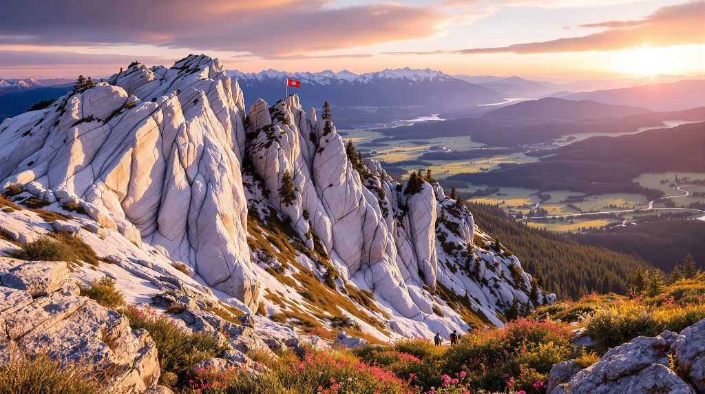
Quartzite Mountain stands as a distinctive geological feature near Chewelah in northeastern Washington, representing a fascinating window into North America's ancient past. Rising to 3,714 feet above sea level, this prominent landmark showcases exposed quartzite formations that tell a story of continental evolution spanning hundreds of millions of years.
The mountain's geological significance derives from its position at the boundary between ancient North America and accreted exotic terrains, making it a natural laboratory for understanding regional tectonic history. Its distinctive light-colored outcrops are visible from miles away, serving as a navigational landmark for travelers through the Colville River Valley.
The Distinctive Geology of Quartzite Mountain
The primary rock type forming Quartzite Mountain is a metamorphosed sandstone that has undergone significant transformation through heat and pressure. This transformation has created medium to thick-bedded quartzite displaying various colors including white, gray, purple, and brown, with the lighter "blonde" quartzite being particularly distinctive.
Associated minerals include meta-argillite, meta-siltite, conglomerate, and meta-dolomite interbedded within the dominant quartzite layers. These varied rock types reflect the dynamic depositional environment that existed approximately 580 million years ago during the late Cambrian period, spanning the Proterozoic-Paleozoic boundary.
What makes this quartzite particularly interesting to geologists is its metamorphic characteristics, featuring distinctive fracture patterns through quartz grains rather than around them—a key trait that distinguishes true quartzite from ordinary quartz sandstone. This property gives the rock exceptional hardness and durability, explaining why it has withstood erosion to form the prominent mountain we see today.
Topographical Features and Accessibility
The summit of Quartzite Mountain reaches precisely 3,714 feet above sea level, confirmed by the USGS survey marker installed at the top. The relatively accessible nature of this geological feature makes it particularly valuable for educational purposes, with a moderately challenging trail extending approximately 3 miles round trip with 800 feet of elevation gain.
Visitors reaching the summit will find several human-made features including a metal bench, fire pits, and the aforementioned USGS survey marker. The mountain's location approximately 5 miles from Highway 395 near Chewelah makes it a convenient stop for those exploring northeastern Washington's geological wonders.
From a distance, the mountain displays striking flat iron formations above the town of Chewelah, creating a distinctive profile that has made it a regional landmark. These formations result from the tilting of once-horizontal sedimentary layers during the complex tectonic processes that have shaped the region.
How Did Quartzite Mountain Form?
The formation of Quartzite Mountain represents a fascinating chapter in the geological evolution of northeastern Washington. Understanding its origins requires examining both the initial depositional environment and subsequent tectonic processes that transformed and positioned these rocks.
Ancient Shoreline Deposits
Quartzite Mountain's primary rock material began as quartz-rich sand deposits along the ancient margin of North America. These sediments accumulated during the late Proterozoic to early Cambrian periods when this region represented a continental shoreline environment.
The well-sorted nature of the original sand suggests deposition in shallow marine or beach environments where wave action effectively sorted sediment grains by size and composition. The abundance of quartz in these ancient sands indicates significant weathering of source rocks, as quartz is one of the most resistant minerals during the weathering process.
These sand deposits formed part of what geologists call a "draping sequence"—sediments that covered the edge of a rifted continental margin. This positioning is crucial to understanding the mountain's significance, as it represents the literal edge of ancient North America before subsequent tectonic events dramatically changed the continent's configuration.
Metamorphic Transformation
Over millions of years, these sandy deposits underwent metamorphic transformation through several processes:
- Burial Pressure: Deep burial beneath younger sediments created intense pressure, compacting the original sand grains
- Heat Exposure: Regional thermal events associated with mountain-building episodes provided the heat necessary for metamorphism
- Mineral Recrystallization: Original quartz grains recrystallized and fused together, obliterating the spaces between grains that existed in the original sandstone
- Structural Deformation: Folding and faulting events tilted and exposed the hardened quartzite, creating the mountain's current orientation
This metamorphic process transformed what was once beach sand into exceptionally hard quartzite rock. Unlike sandstone where individual grains are merely cemented together, quartzite features completely recrystallized quartz where fractures cut through grains rather than around them—a characteristic visible in hand samples from Quartzite Mountain.
Tectonic Context and Regional Significance
Quartzite Mountain's geology connects to broader regional structures that help geologists piece together the complex history of western North America:
- Thrust Faults: Four major thrust faults in the Chewelah Valley have repeated geological sections, essentially stacking rock units on top of each other
- Continental Boundary Marker: The mountain is located near the transition between ancestral North America and accreted exotic terrains, with the north-south flowing Columbia River near Kettle Falls potentially marking this significant boundary
- Belt Supergroup Relationship: The Addy Quartzite (which forms Quartzite Mountain) overlies the rifted Belt sediments, representing a younger draping sequence covering the continental edge
Competing theories exist regarding these rock formations. The traditional view holds that these sediments represent material eroded from ancient North America into a rifted basin. However, some geologists, including Robert S. Hildebrand, have proposed alternative hypotheses suggesting that portions of these rocks may have formed elsewhere and later accreted to North America—a contentious but intriguing perspective that continues to spark geological debate.
What Can Visitors See on Geological Tours of Quartzite Mountain?
Exploring Quartzite Mountain offers visitors a unique opportunity to witness geological processes spanning hundreds of millions of years. While formal commercial geology tours aren't widely advertised, self-guided explorations reveal numerous features of interest to both casual observers and serious geology enthusiasts.
Key Geological Observations
The mountain presents several distinctive geological features that tell its ancient story:
- Exposed Quartzite Outcrops: Visitors can observe distinctive white to gray quartzite formations with visible bedding planes that represent the original layering of sediments
- Vertical Bedding Patterns: The now-vertical orientation of once-horizontal sedimentary layers reveals the powerful tectonic forces that have tilted and shaped the region
- Jointing Systems: Natural fracture networks create blocky patterns in the quartzite, showing how the brittle rock responded to stress
- Color Variations: Different mineral content and impurities have created white, gray, purple, and brown banding in the rock, with the "blonde quartzite" being particularly distinctive
These features are especially visible along the trail as it winds upward, with increasing exposure of bedrock near the summit. The quartzite's exceptional durability explains why it forms the mountain while surrounding softer rocks have eroded away.
Panoramic Viewpoints and Landscape Interpretation
From the summit, visitors gain perspective on regional geological relationships that help place Quartzite Mountain in its broader context:
- Colville River Valley: Views of the valley floor showcase more recent alluvial deposits laid down by the river system
- Surrounding Mountains: Visual comparison of different rock types forming nearby peaks provides insight into the varied geology of northeastern Washington
- Structural Features: Evidence of regional faulting and folding becomes visible in landscape patterns when viewed from this elevated perspective
- Town of Chewelah: The panorama includes a view of this small community, illustrating how human settlement patterns often relate to geological resources and topography
On clear days, the visibility can extend for miles, allowing observers to trace landscape features that correspond to underlying geological structures, providing a literal overview of the region's complex geology.
Seasonal Natural Features
The mountain's geological foundation creates diverse ecological niches that change with the seasons:
- Spring Wildflower Displays: Diverse plant communities adapted to the quartzite substrate create colorful displays, particularly in late spring
- Wild Strawberry Meadows: Acidic soils derived from quartzite support distinctive vegetation including wild strawberry patches that thrive in these specific conditions
- Pine Forest Transitions: Changes in forest composition reflect underlying geological variations, with certain tree species preferring the well-drained quartzite soils
- Primitive Campground: A small camping area near the summit is occasionally used by local Boy Scout troops, offering an opportunity to experience the mountain's geology overnight
Visitors should prepare for varying weather conditions, as the exposed summit can experience significant temperature fluctuations. During summer months, temperatures can reach the high 90s Fahrenheit, making early morning or evening visits more comfortable.
Why Is Quartzite Mountain Important to Understanding Washington's Geological History?
Quartzite Mountain serves as a crucial puzzle piece in understanding the complex geological evolution of northeastern Washington. Its significance extends beyond local interest to inform broader theories about continental development and the assembly of western North America.
Continental Margin Evidence
The quartzite formations represent ancient shoreline environments that provide key insights into Earth's distant past:
- Mark Continental Boundaries: These rocks help define the edge of ancestral North America, preserving evidence of the continent's original western margin
- Record Sea Level Changes: Variations in the rock layers preserve evidence of marine transgressions and regressions that occurred hundreds of millions of years ago
- Document Sediment Sources: The composition of the quartzite provides clues about the makeup of ancient landmasses that supplied the original sand
- Indicate Paleoenvironments: Sedimentary structures within the quartzite suggest warm, shallow marine conditions during deposition around 580 million years ago
These features make Quartzite Mountain valuable for reconstructing the geographical configuration of North America during the late Proterozoic to early Cambrian periods—a time when the continent looked dramatically different than it does today.
Connections to Regional Geological Units
Quartzite Mountain's rocks relate to other significant geological formations that help geologists piece together the region's complex history:
- Hamill Group Correlation: The Addy Quartzite shows similarities to formations in east-central British Columbia, suggesting a once-continuous depositional environment
- Belt Supergroup Relationship: The quartzite represents younger deposits overlying the rifted Belt sediments, helping establish the chronological sequence of regional rock formation
- Addy Quartzite Classification: The mountain's rocks form part of the formally named Addy Quartzite formation that extends beyond this single mountain, creating a regional geological marker
- Gypsy Quartzite Association: In regional mapping, portions of the Addy Quartzite are interchangeable with the Gypsy Quartzite, demonstrating the complex relationships between named rock units
These connections allow geologists to correlate rock units across large areas, building a more comprehensive picture of the region's geological evolution over hundreds of millions of years.
Competing Geological Theories
The mountain's position has sparked scholarly debate about regional tectonic history, with different interpretations offering contrasting views:
- Traditional View: Most geologists interpret these sediments as material eroded from ancient North America into a rifted basin—a relatively straightforward continental margin story
- Alternative Hypothesis: Some researchers propose a potential exotic origin where these rocks may have formed elsewhere and later accreted to North America through plate tectonic processes
- Baja BC Connection: A controversial concept called "Baja British Columbia" suggests large-scale northward movement of crustal blocks, which may relate to some rocks in this region
- Kettle Falls Boundary: The north-south flowing Columbia River near Kettle Falls potentially marks a significant boundary between geological provinces, with Quartzite Mountain providing context for this interpretation
These competing theories demonstrate how Quartzite Mountain continues to contribute to evolving understanding of western North America's complex geological assembly. The mountain provides physical evidence that researchers use to test different hypotheses about regional tectonic history.
How to Experience Quartzite Mountain's Geological Features
For visitors interested in exploring Quartzite Mountain's geological wonders, several approaches offer rewarding experiences. While specialized geology tours aren't commercially available, self-guided options provide flexibility and discovery opportunities.
Self-Guided Hiking Experience
The Quartzite Trail offers accessible geological exploration for visitors with moderate hiking experience:
- Trailhead Access: Located approximately 5 miles off Highway 395 near Chewelah, with parking available at the base
- Trail Difficulty: Moderately challenging with steep sections but manageable for most hikers in reasonable physical condition
- Hiking Duration: Typically requires 2-3 hours round trip depending on observation stops and photography interests
- Best Seasons: Late spring through fall, with summer offering fullest access but potentially hot conditions exceeding 90°F
Hikers should be prepared for the trail's terrain, which becomes increasingly rocky as it approaches the summit, exposing more quartzite outcrops along the way. The trail follows switchbacks in steeper sections, providing excellent opportunities to observe rock formations up close.
Recommended Observation Points
Key locations along the trail showcase different geological features that help tell the mountain's story:
- Lower Trail Outcrops: Initial exposures of quartzite with visible bedding planes that show the original sedimentary layering
- Mid-Mountain Viewpoints: Several clearings provide perspective on regional structural relationships and the mountain's position in the landscape
- Forest-Meadow Transitions: Areas where vegetation changes reflect underlying geological variations and soil conditions
- Summit Area: The peak offers comprehensive views of the Colville River Valley and surrounding mountains, with the USGS marker confirming the 3,714-foot elevation
Each of these locations offers unique insights into different aspects of the mountain's geology, from microscale rock features to macroscale landscape relationships.
Preparation Tips for Geological Exploration
To maximize the educational value of a visit to Quartzite Mountain:
- Bring Reference Materials: Local geological guides or digital resources help identify features and understand their significance
- Carry Protection: Sun protection is essential as the exposed quartzite creates reflective conditions that can intensify solar radiation
- Pack Water: Limited water sources on the mountain necessitate bringing adequate supplies, especially during summer months
- Wear Appropriate Footwear: Sturdy hiking boots are recommended for navigating rocky terrain safely
- Consider Timing: Early morning starts help avoid afternoon heat, especially in summer when temperatures can reach the high 90s Fahrenheit
A small rock hammer and hand lens can enhance the experience for serious geology enthusiasts, allowing closer examination of mineral compositions and structural features in hand samples. However, visitors should practice responsible collection, taking only photographs in sensitive areas.
What Other Geological Sites Complement a Visit to Quartzite Mountain?
Northeastern Washington offers several complementary geological sites that, when combined with Quartzite Mountain, provide a more comprehensive understanding of the region's complex geological history.
Nearby Related Geological Features
Several locations within driving distance offer geological contexts that enhance appreciation of Quartzite Mountain:
- Kettle Falls Area: Exposures near the Columbia River potentially mark the boundary between ancient North America and exotic terrains, providing context for Quartzite Mountain's position
- Columbia River Gorge: Showcases more recent volcanic and sedimentary sequences that contrast with the ancient quartzite
- Colville National Forest: Contains additional outcrops of metamorphic and igneous rocks that help complete the regional geological picture
- Spokane Area Basalts: Younger volcanic features providing dramatic contrast to the ancient quartzite, illustrating the region's long and varied geological history
These sites collectively tell a more complete story of northeastern Washington's geological evolution, from ancient continental margins to more recent volcanic episodes.
Regional Geological Context
Understanding Quartzite Mountain within its broader setting helps visitors appreciate its significance:
- Okanogan Highlands: This diverse geological province with complex metamorphic history provides regional context for Quartzite Mountain
- Canadian Border Region: Geological structures continue into British Columbia, demonstrating that geological processes don't respect political boundaries
- Ancient Continental Margin: The mountain provides evidence of North America's western edge before accretion of younger terranes dramatically expanded the continent
- Belt Basin Remnants: Related sedimentary sequences preserved in nearby areas help reconstruct the ancient geography of western North America
This regional perspective places Quartzite Mountain within the broader story of continental assembly and evolution over hundreds of millions of years.
Suggested Multi-Site Itineraries
For comprehensive geological exploration of northeastern Washington:
- Weekend Geology Tour: Combine Quartzite Mountain with Kettle Falls and Columbia River exposures for a two-day introduction to the region's geology
- Ancient North America Focus: Visit sites highlighting the oldest rocks in northeastern Washington, including Quartzite Mountain and related Precambrian outcrops
- Metamorphic Rock Circuit: Explore locations showcasing different grades and types of metamorphism, from slightly altered sedimentary rocks to completely recrystallized examples
- Continental Margin Transect: Take an east-to-west journey across geological provinces, from the stable continental interior to accreted terranes of the Pacific Northwest
Each of these itineraries provides a different perspective on the region's geology, with Quartzite Mountain serving as a central reference point for understanding northeastern Washington's complex geological history.
FAQs About Quartzite Mountain Geology
What exactly is quartzite and how is it different from regular sandstone?
Quartzite is a metamorphic rock formed when quartz-rich sandstone undergoes heat and pressure, causing the individual quartz grains to recrystallize and fuse together. Unlike regular sandstone where grains are cemented but distinct, quartzite features interlocking crystals where original grain boundaries become obscured through recrystallization.
The quartzite at Quartzite Mountain shows characteristic fracture patterns running through quartz grains rather than around them, creating a much harder and more durable rock than its sedimentary parent material. This transformation explains why the mountain stands as a prominent feature—the resistant quartzite has withstood erosion while surrounding softer rocks have been worn away.
When did the sand that formed Quartzite Mountain originally accumulate?
The sand deposits that eventually formed Quartzite Mountain accumulated approximately 580 million years ago during the late Cambrian period. These sediments were deposited along the ancient margin of North America as part of a sequence spanning the Proterozoic-Paleozoic boundary.
These deposits likely formed in beach or shallow marine environments along the continental shelf, as evidenced by the well-sorted nature of the quartz grains. At this time, the western margin of North America looked entirely different than today, with the continent's edge running roughly north-south through what is now eastern Washington.
How tall is Quartzite Mountain and what can you see from the summit?
Quartzite Mountain reaches an elevation of 3,714 feet above sea level, confirmed by a USGS survey marker at the summit. While not exceptionally tall by Cascade standards, its prominence above the surrounding landscape makes it a significant local landmark.
From the top, visitors enjoy panoramic views of the Colville River Valley, the town of Chewelah, surrounding forests, and distant mountain ranges. This vantage point provides excellent perspective on the regional landscape and its relationship to underlying geological structures. On clear days, visibility can extend for miles, allowing observers to trace landscape features that correspond to geological formations.
Are there organized geology tours available for Quartzite Mountain?
While there are no widely advertised commercial geology tours specifically focused on Quartzite Mountain, the well-maintained trail is suitable for self-guided exploration. Local hiking organizations and the Washington Trails Association provide detailed guides that include geological information.
Educational institutions in the region occasionally organize field trips to the area, which may be open to public participation. The nearby communities of Chewelah and Spokane sometimes host amateur geology club outings that include Quartzite Mountain on their itineraries. Visitors interested in guided experiences should check with local visitor centres or geological societies for potential opportunities.
What is the "Belt Supergroup" mentioned in relation to Quartzite Mountain?
The Belt Supergroup is a massive sequence of Precambrian sedimentary rocks extending through western Montana, northern Idaho, and into northeastern Washington. These rocks represent ancient deposits formed between 1.45 billion and 850 million years ago in a large basin.
The Addy Quartzite (which forms Quartzite Mountain) overlies and is younger than these Belt sediments, representing part of a "draping sequence" that covered the edge of the rifted continental margin. The relationship between these rock units helps geologists reconstruct the sequence of geological events that shaped northeastern Washington.
Some geologists have proposed controversial hypotheses suggesting that portions of the Belt Supergroup may have formed elsewhere and later accreted to North America through plate tectonic processes—a perspective that continues to generate scholarly debate and research.
The Geological Significance of Quartzite Mountain
Quartzite Mountain stands as more than just a scenic landmark near Chewelah—it represents a critical window into the ancient geological history of northeastern Washington. The mountain's distinctive quartzite formations preserve evidence of ancient shoreline environments dating back approximately 580 million years, providing crucial insights into North America's continental evolution.
The mountain's position near the boundary between ancestral North America and accreted exotic terrains makes it particularly valuable for understanding regional tectonic development. Its rocks tell a story of sand deposition along ancient beaches, deep burial, metamorphic transformation, and eventually uplift and exposure through complex mountain-building processes.
For visitors, Quartzite Mountain offers an accessible geological adventure with its moderately challenging 3-mile round-trip trail. The journey from trailhead to summit reveals progressively more impressive quartzite exposures, culminating in panoramic views that place the mountain's geology in its broader landscape context.
Whether approached as a casual hiking destination or a serious geological study site, Quartzite Mountain rewards explorers with its combination of scientific significance and natural beauty. The mountain continues to inspire geological inquiry, potentially contributing to evolving theories about continental development and the complex assembly of western North America.
Ready to Discover Your Next Mining Investment Opportunity?
Gain an instant edge with Discovery Alert's proprietary Discovery IQ model, delivering real-time notifications on significant ASX mineral discoveries and turning complex geological data into actionable investment insights. Visit our discoveries page to explore historic examples of how major mineral discoveries can generate substantial returns for early investors.