
June 19, 2026
What Are the Key Sedimentary Environments in the Columbia River Basin?
The Columbia River Basin contains a diverse array of sedimentary environments that provide crucial insights into the region's geological history. These environments preserve evidence of environmental changes during periods of volcanic activity, offering a unique window into ancient ecosystems and their responses to Large Igneous Province (LIP) volcanism.
Fluvial Systems and Their Distribution
Fluvial environments dominated the Columbia River Basin landscape, particularly during the Wanapum time period. These river systems exhibited a fascinating pattern of distribution, predominantly establishing themselves along the margins of lava fields rather than cutting through their centers. This peripheral distribution wasn't random—it represented the path of least resistance for water flowing across a landscape repeatedly transformed by volcanic activity.
When massive lava flows erupted, they physically displaced existing river channels, forcing drainage systems to reconfigure themselves. Field evidence shows that rivers worked continuously to reestablish pathways either around or occasionally through these newly formed lava fields. The Vantage Member exposures reveal particularly illuminating examples of these fluvial environments, with varied characteristics across different locations in the basin.
One striking feature of these river systems was their adaptability. Drainage networks were frequently pushed aside or completely diverted by incoming lava flows, creating a dynamic landscape that changed with each eruption cycle. This continuous reorganization resulted in complex sedimentary patterns, with river deposits interbedded between successive lava flows.
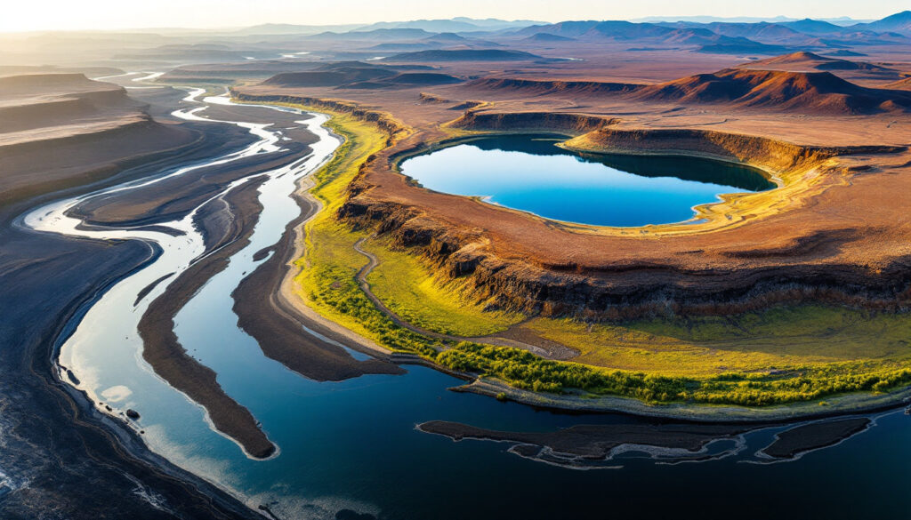
Lake Environments and Diatomaceous Deposits
In contrast to the high-energy fluvial environments, the Columbia River Basin also supported numerous lake systems that formed in depressions within the lava fields. These isolated lakes created distinct sedimentary environments characterized by fine-grained deposits and often remarkable diatomite beds. The presence of these diatomite deposits indicates exceptionally clean, nutrient-rich waters with minimal siliciclastic input from surrounding landscapes.
Interestingly, evidence suggests many of these lakes were fed primarily by groundwater rather than surface rivers. This hydrogeological setting created stable conditions conducive to diatom proliferation and the accumulation of their siliceous remains. The resulting fine-grained, muddy, organic-rich deposits provided ideal preservation conditions for pollen and sedimentary environments in the Columbia River Basin, making these lacustrine environments invaluable archives of paleoenvironmental information.
These lakes varied significantly in size and duration across the basin. Some represented ephemeral water bodies that formed briefly between eruption events, while others persisted for extended periods during volcanic hiatuses, allowing for the development of diverse aquatic ecosystems and the accumulation of thick sedimentary sequences.
Soil Development and Weathered Horizons
The third major sedimentary environment type found in the Columbia River Basin consists of paleosols and weathered horizons. In more elevated areas of the lava field, where sediment accumulation was minimal, weathering processes dominated over deposition. This resulted in the formation of distinctive red beds through in-situ chemical alteration of volcanic materials.
Paleosols developed during volcanic hiatuses, particularly in the central parts of the lava field where topography limited sediment transport. These ancient soil profiles represent periods of landscape stability when weathering processes could operate uninterrupted by new eruptions or significant sediment influx. The limited erosion in these elevated areas allowed for the development of mature soil profiles that preserve evidence of the prevailing environmental conditions.
These weathered horizons provide valuable information about climate conditions, vegetation, and the duration of volcanic hiatuses. Their presence interbedded with lava flows creates a stratigraphic record of alternating periods of volcanic activity and quiescence, allowing researchers to reconstruct the temporal evolution of environmental conditions in the basin.
When big ASX news breaks, our subscribers know first
How Did Large Igneous Province (LIP) Volcanism Affect Sedimentation Patterns?
The massive volcanic activity associated with the Columbia River Basalt Group fundamentally altered sedimentation patterns across the basin. Understanding these volcano-sedimentary interactions provides crucial insights into how Large Igneous Province (LIP) eruptions reshape landscapes and influence environmental systems.
Lava Flow Interactions with Drainage Systems
The enormous Grand Ronde lava fields dramatically impacted drainage systems, pushing rivers toward basin margins and fundamentally altering the region's hydrology. Rivers typically followed paths of least resistance, finding their way along the edges of newly formed lava fields rather than cutting directly through them. This created a characteristic pattern of fluvial deposits concentrated along the periphery of volcanic centers.
When lava flows encountered existing sedimentary beds, particularly those containing water, they physically disturbed these deposits. Field evidence shows how advancing lava "stirred up" older sedimentary layers, creating complex interbed patterns with chaotic textures. These interaction zones preserve direct evidence of the dynamic relationship between volcanic and sedimentary processes.
Drainage patterns throughout the basin experienced repeated disruption and reestablishment following eruptions. Each new lava flow would displace rivers, forcing them to find new routes across the transformed landscape. This cycle of disruption and adjustment created a complex stratigraphic record that captures the long-term evolution of the basin's drainage network in response to volcanic forcing.
Temporal Changes in Sedimentary Environments
The sedimentary interbeds found between lava flows represent volcanic hiatuses—periods when eruptions temporarily ceased and sedimentary processes dominated the landscape. These intervals allowed for the development of diverse depositional environments, from rivers and floodplains to lakes and soil horizons. The Vantage Member, which formed between the Grand Ronde and Frenchman Springs eruptions, represents one of the most prominent and well-studied of these interbed sequences.
Detailed analysis of units like the Squaw Creek and other interbeds reveals rapid environmental changes during these volcanic pauses. By reconstructing these environments in three dimensions across the basin, researchers have documented how landscapes responded to the cessation of volcanic activity and how they were subsequently transformed by renewed eruptions.
Facies analysis of interbed sequences shows systematic changes in environment types over time. These patterns reflect both the influence of pre-existing topography created by earlier lava flows and the broader climatic and tectonic conditions prevailing during each hiatus. This temporal dimension adds crucial context to our understanding of how plate tectonics influence mineral deposits formation worldwide and shape volcanic landscapes during periods of relative quiescence.
Provenance of Sedimentary Materials
The sediments preserved between lava flows originated from multiple source areas that contributed material to the basin simultaneously. Provenance studies have identified distinct signatures that trace sediment origins, revealing a complex supply network that evolved throughout the basin's history.
Cascade-derived volcanic material features prominently in certain interbeds, particularly in the western portions of the basin. These deposits contain distinctive mineral assemblages and lithic fragments that can be tied directly to Cascade volcanism. In contrast, northern-sourced materials exhibit different mineralogical characteristics, allowing researchers to track changing patterns of sediment input through time.
Eastern sources, including the Snake River Plain, became increasingly significant contributors in later units such as the Rattlesnake Ridge Member. The presence of quartzite cobbles and muscovite flakes in many interbed deposits indicates non-Cascade sources for a substantial portion of the basin's sediment budget. This multi-source pattern underscores the regional nature of sedimentary processes operating concurrently with the localized effects of Columbia River Basalt volcanism.
What Does Pollen Analysis Reveal About Ancient Environments?
Palynological studies of the Columbia River Basin's sedimentary interbeds offer a powerful tool for reconstructing ancient plant communities and their responses to volcanic disturbances. This microscopic evidence provides insights into ecological dynamics that complement the broader sedimentological record.
Preservation Conditions for Palynological Records
Not all sedimentary environments preserve pollen equally well. The best preservation occurs in fine-grained, muddy, oxygen-poor environments where microbial degradation is limited. Organic-rich interbed deposits, particularly those formed in lacustrine settings, yield the most complete and diverse pollen assemblages.
The quality of pollen preservation varies significantly across sedimentary facies. In coarser sediments, mechanical destruction during transport and post-depositional oxidation often limit pollen survival. This preservation bias must be considered when interpreting palynological data, as taphonomic processes can significantly influence the apparent composition of fossil plant communities.
The Vantage Member and Squaw Creek interbeds contain particularly well-preserved pollen assemblages that have yielded valuable paleoenvironmental information. Laboratory processing of these samples requires specialized acid treatments to dissolve mineral components while preserving the chemically resistant outer walls of pollen grains and spores. This technical challenge highlights the specialized nature of palynological research and the importance of careful sample selection.
Plant Community Responses to Volcanic Activity
Pollen records from the Columbia River Basin document rapid vegetation changes following eruption events. These records show that plant communities demonstrated remarkable resilience but also experienced significant turnover after major disturbances. Pioneer species typically colonized fresh volcanic substrates first, followed by more diverse communities as soils developed and microclimates stabilized.
Ash falls from both the Columbia River Basalt eruptions and the contemporaneous Snake River Plain hotspot volcanism caused major disruptions to plant ecosystems. These disturbances are recorded as distinctive shifts in pollen assemblages, often marked by the temporary dominance of disturbance-adapted taxa followed by gradual recovery of more diverse forest communities.
High-resolution sampling of individual interbeds has revealed detailed plant succession patterns, capturing vegetation changes at century or even decade scales. This fine temporal resolution allows researchers to track ecosystem recovery trajectories following volcanic disturbances, providing mineral exploration insights into resilience mechanisms that operated in these ancient environments.
Lateral variations in pollen assemblages across the basin reflect local environmental conditions, with different plant communities occupying river corridors, lakeshores, and upland areas. This spatial heterogeneity created a mosaic of habitats that responded differently to volcanic disturbances, with some areas serving as refugia from which plants could recolonize more severely impacted landscapes.
Climate Indicators from Palynological Data
Pollen assemblages provide qualitative indicators of relative humidity levels and other climate parameters. Changes in the abundance of moisture-loving taxa versus drought-tolerant species reflect fluctuations in precipitation patterns through time. These signals allow researchers to assess how climate conditions varied across the basin during volcanic hiatuses.
The relationship between volcanism and climate conditions can be assessed through pollen records, though disentangling the effects of regional climate change from localized volcanic impacts remains challenging. Nevertheless, clear patterns emerge showing how regional climate patterns influenced the distribution of plant communities across the basin during intervals between eruptions.
While quantitative climate reconstructions from pollen data remain limited for the Columbia River Basin, the qualitative indicators provide clear evidence of relative wet and dry periods throughout the sequence. These climate signals provide important context for understanding broader environmental dynamics during the development of this Large Igneous Province.
How Do Columbia River Basin Sediments Compare to Other Large Igneous Provinces?
The sedimentary record of the Columbia River Basin offers exceptional opportunities to study the environmental effects of Large Igneous Province volcanism. Comparing this record to those of other LIPs worldwide provides valuable context for understanding broader patterns of volcano-sedimentary interactions.
Advantages of the Columbia River Basin for LIP Studies
The Columbia River Basin presents exceptional land exposure compared to other Large Igneous Provinces worldwide. Many major LIPs, such as the Ontong Java Plateau and Kerguelen Plateau, are predominantly underwater or poorly exposed at the surface, limiting direct access to their sedimentary records. In contrast, the Columbia River Basin offers extensive and accessible exposures that can be studied in detail.
Road cuts and natural exposures throughout the basin provide easy access to outcrops, facilitating comprehensive field investigations. This accessibility has enabled researchers to document lateral facies changes and complex stratigraphic relationships that would be difficult or impossible to reconstruct from limited outcrops or drill cores alone.
The well-preserved interbeds between lava flows provide detailed environmental records spanning the entire duration of LIP emplacement. This combination of volcanic and sedimentary records allows for integrated study of how eruption events affected landscapes and ecosystems, making the Columbia River Basin a world-class example for studying LIP effects on terrestrial environments.
Comparison with North Atlantic Igneous Province
The North Atlantic Igneous Province (NAIP) represents another major LIP that has been extensively studied, though primarily through cores due to its predominantly underwater location. Limited terrestrial exposures in Scotland, Greenland, and the Faroe Islands provide some comparable data, but the extent and accessibility of these exposures pale in comparison to the Columbia River Basin.
Research questions regarding the environmental impacts of LIP volcanism are similar across these provinces, focusing on ecosystem disruption, climate effects, and landscape evolution. However, the Columbia River Basin provides a more complete terrestrial environmental record that complements the marine-dominated record of the NAIP.
Studies in the Columbia River Basin have been designed in part to provide comparative data that can inform research on other LIPs worldwide. By establishing patterns of environmental response in a well-preserved and accessible terrestrial LIP, researchers can develop models that may apply to less well-exposed provinces where direct evidence is more limited.
Research Methodologies and Collaborative Approaches
The study of sedimentary environments and pollen records in the Columbia River Basin has benefited from interdisciplinary approaches combining sedimentology, palynology, volcanology, and geochemistry. This integration of methods provides a more comprehensive understanding of the complex interactions between volcanic and environmental processes.
Field reconnaissance efforts have been supported by local geological expertise, drawing on decades of previous research in the region. This collaborative approach has allowed researchers to build on existing knowledge while applying new techniques and perspectives to long-standing questions about the basin's evolution.
International collaboration between researchers from institutions in the United Kingdom, Germany, and the United States has brought diverse expertise to bear on the study of the Columbia River Basin. This multinational effort highlights the global significance of the basin as a natural laboratory for understanding LIP environmental impacts.
What Are the Key Research Findings About Basin-Wide Environmental Changes?
Integrating sedimentological, palynological, and volcanic data has yielded significant insights into how environments across the Columbia River Basin responded to LIP volcanism. These findings have broader implications for understanding the impact of massive volcanic episodes on terrestrial ecosystems.
Three-Dimensional Environmental Reconstruction
Detailed facies analysis of sedimentary interbeds across the basin has enabled researchers to reconstruct paleoenvironments in three dimensions. By correlating time-equivalent units from western to eastern basin margins, scientists have mapped how environments varied spatially during volcanic hiatuses.
The integration of sedimentological and palynological datasets provides a more complete picture of ancient landscapes than either approach alone. Sedimentary structures and textures reveal physical processes and depositional environments, while pollen assemblages document the plant communities that inhabited these environments.
This comprehensive approach has yielded a detailed picture of how environments evolved during volcanic hiatuses, capturing both spatial and temporal dimensions of landscape change. The resulting reconstructions show how river systems, lakes, and soil-forming environments coexisted and interacted across the basin, creating a mosaic of habitats that responded differently to volcanic disturbances.
Volcanic Disturbance Patterns
Research has documented a spectrum of volcanic disturbance effects, from local disruptions caused by individual lava flows to regional impacts from widespread ash falls. These disturbances operated at different spatial and temporal scales, creating complex patterns of environmental change across the basin.
Differential recovery rates have been observed in various parts of the basin, reflecting local factors such as proximity to volcanic centers, topographic position, and pre-existing ecological conditions. This variability underscores the complex interplay between volcanic activity and environmental resilience, with some areas showing rapid recovery while others experienced more prolonged disruption.
Evidence for both gradual and abrupt environmental changes appears throughout the record, reflecting different modes of volcanic impact and ecosystem response. Abrupt changes typically followed major eruption events, while gradual transitions characterized recovery phases and responses to less intense disturbances. This pattern of multiple response modes highlights the complex, non-linear nature of volcano-environmental interactions.
Unresolved Questions and Future Research Directions
Despite significant advances, many questions remain about environmental dynamics in the Columbia River Basin during LIP volcanism. High-resolution studies of vegetation changes within thin interbeds could provide more detailed insights into ecological succession following eruptions, potentially revealing patterns not visible at coarser sampling scales.
A more detailed understanding of plant community succession following eruptions would illuminate resilience mechanisms and recovery trajectories. This knowledge has potential applications for understanding modern ecosystem responses to large-scale disturbances, including contemporary volcanic events and other environmental changes.
Further investigation of complex outcrops near the Hanford site and other key locations could resolve outstanding stratigraphic questions and improve correlations between widely separated sections. Better quantification of climate signals from palynological data represents another important research frontier, potentially allowing for more precise reconstruction of climate conditions during volcanic hiatuses.
Additional work is needed on correlations between eastern and western basin sections to create a truly integrated basin-wide model of environmental change. This effort would benefit from new dating techniques and the application of chemostratigraphic methods to establish more precise temporal frameworks for interbed formation and volcanic episodes.
The next major ASX story will hit our subscribers first
FAQ: Understanding Pollen and Sedimentary Environments in the Columbia River Basin
What are sedimentary interbeds and why are they important?
Sedimentary interbeds are layers of sedimentary rock found between lava flows in the Columbia River Basin. They represent periods when volcanic activity temporarily ceased, allowing rivers, lakes, and soils to develop on the landscape. These interbeds provide crucial information about environmental conditions and plant communities that existed between eruption events, effectively preserving snapshots of the ecosystem during volcanic hiatuses.
The importance of these interbeds cannot be overstated—they represent the only windows into environmental conditions during the emplacement of the Columbia River Basalt Group. Without them, our understanding of how ecosystems responded to this massive volcanic episode would be severely limited. By studying the geology of ore deposits and the composition, structure, and biological content of these sedimentary layers, researchers can reconstruct ancient environments and track their changes
Curious About Capitalising on Mineral Discoveries Like These?
Discover significant ASX mineral discoveries in real-time with Discovery Alert's proprietary Discovery IQ model, transforming complex geological data into actionable investment insights within moments of announcement. Explore historic discoveries and their impressive returns by visiting our dedicated discoveries page and begin your 30-day free trial today.