Understanding Advanced Ocean Bottom Node Technology
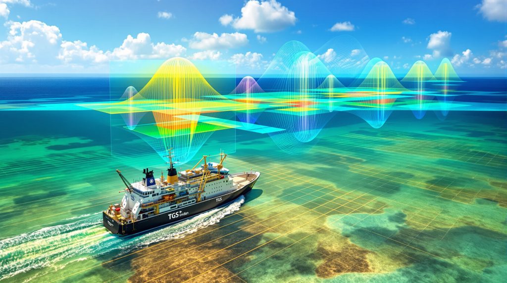
Ocean Bottom Node (OBN) surveys have revolutionised deepwater exploration in the Gulf of Mexico, with the Laconia Phase III project representing a significant technological milestone. This 151-block Outer Continental Shelf coverage area demonstrates the scale and ambition of modern seismic acquisition programs targeting complex geological formations. Furthermore, these TGS Viridien seismic results showcase the evolution of oil price movements and their impact on exploration investment strategies.
The fundamental advantage of OBN technology lies in its superior data acquisition capabilities compared to traditional towed streamer systems. While conventional methods drag seismic receivers behind vessels, OBN systems place sensitive recording equipment directly on the seafloor. This positioning enables ultra-long offset measurements that capture low-frequency seismic energy critical for imaging deep geological structures.
Technical Specifications of Dual TPS Systems
The dual Tuned Pulsed Source (TPS) low-frequency system employed in Laconia Phase III represents cutting-edge seismic acquisition technology. According to David Hajovsky, Executive Vice President of Multi-Client Services at TGS, the successful deployment of this technology reflects exceptional operational capabilities and enables delivery of industry-leading data quality in technically demanding environments. These advancements align with broader industry innovation trends transforming resource exploration.
Key operational advantages include:
- Enhanced signal-to-noise ratios through optimised source-receiver geometries
- Improved low-frequency content capture for better deep structural imaging
- Extended receiver spacing enabling superior velocity model building
- Superior subsurface illumination in complex salt-dominated environments
The 151-block coverage area encompasses significant portions of the deepwater Gulf of Mexico, providing integrated regional context for exploration planning. This comprehensive approach allows operators to evaluate prospects within broader geological frameworks rather than isolated seismic patches.
Operational Excellence in Complex Environments
The successful execution of ultra-long offset OBN surveys requires precise coordination of specialised marine vessels, seafloor equipment deployment, and advanced source technology. The technical complexity increases substantially in deepwater environments where water depths exceed 1,500 metres and challenging weather conditions can impact operations.
OBN systems demonstrate particular value in areas where:
- Complex salt geometries distort conventional seismic imaging
- Multiple geological layers require detailed velocity analysis
- Reservoir characterisation demands high-resolution amplitude information
- Exploration targets lie beneath acoustically challenging overburden
How Does Full Waveform Inversion Transform Subsurface Imaging?
Full Waveform Inversion (FWI) processing represents a paradigm shift from conventional seismic imaging methods, utilising complete waveform information rather than simplified arrival time data. The Laconia Phase III processing timeline demonstrates the evolution from fast-track deliverables to high-resolution final products. Moreover, these data-driven operations exemplify how modern technology transforms subsurface analysis.
Acoustic vs. Elastic FWI Processing Methods
The progression from 5Hz Acoustic Time-Lag FWI (AFWI) to 12Hz Elastic FWI (EFWI) reflects increasing sophistication in subsurface characterisation. Acoustic FWI processing, available immediately in November 2025, provides rapid structural insights using compressional wave data exclusively.
Processing Timeline and Capabilities:
| Processing Stage | Frequency Content | Delivery Schedule | Primary Applications |
|---|---|---|---|
| Acoustic AFWI | 5Hz | November 2025 | Rapid structural interpretation |
| Elastic EFWI (Fast Track) | 5Hz | Q1 2026 | Enhanced reservoir characterisation |
| Elastic EFWI (Final) | 12Hz | January 2027 | High-resolution prospect evaluation |
Elastic FWI processing incorporates both compressional (P-wave) and shear (S-wave) information, enabling more comprehensive subsurface characterisation. This dual-wave approach provides critical insights into rock properties, fluid content, and lithological variations that acoustic processing alone cannot resolve.
Advanced Imaging Capabilities
The technological advancement from legacy 15Hz Reverse Time Migration to advanced FWI processing delivers substantial improvements in geological structure visualisation. Visual comparisons demonstrate enhanced fault definition, improved salt boundary delineation, and superior imaging of previously unresolvable features. These capabilities exemplify AI drilling innovations revolutionising subsurface exploration.
Dechun Lin, Executive Vice President of Earth Data at Viridien, emphasised that these advanced imaging technologies play a crucial role in unlocking potential from deepwater Paleogene formations. The early results demonstrate significant impact in revealing subsurface complexity that conventional methods failed to illuminate.
Key imaging enhancements include:
- Breakthrough visualisation of previously invisible geological structures
- Enhanced delineation of complex salt geometries and fault systems
- Improved characterisation of reservoir boundaries beneath salt formations
- Basement-level imaging capabilities for comprehensive structural understanding
The Time-Lag FWI methodology focuses on temporal wave propagation accuracy, enabling superior velocity model refinement without requiring absolute amplitude preservation. This approach proves particularly effective in complex geological environments where traditional FWI methods struggle with convergence issues.
Resolution Improvements Over Legacy Systems
The transition from 15Hz RTM processing to 12Hz EFWI represents more than frequency bandwidth enhancement. Modern FWI algorithms utilise complete waveform information, including amplitude, phase, and frequency content, to build detailed subsurface velocity models through iterative inversion processes.
Processing improvements deliver:
- Superior vertical resolution through enhanced frequency bandwidth utilisation
- Improved lateral continuity in fault and horizon mapping
- Enhanced velocity model accuracy for drilling hazard assessment
- Advanced noise suppression capabilities in challenging acoustic environments
What Makes the Paleogene Play Critical for Gulf Exploration?
The Paleogene play represents one of the most technically challenging and potentially rewarding exploration targets in the Gulf of Mexico. These deepwater formations, deposited during the Paleogene period approximately 66 to 23 million years ago, contain significant undeveloped hydrocarbon resources trapped beneath complex geological overburden. Consequently, understanding the exploration importance of these formations becomes crucial for future development.
Geological Significance and Resource Potential
Paleogene formations present unique exploration challenges due to their stratigraphic complexity and structural deformation. The depositional environment created thick sedimentary sequences with varying rock properties, creating both reservoir potential and imaging difficulties for conventional seismic methods.
According to the TGS Viridien seismic results, early processing reveals significant imaging uplift across the Paleogene play, providing valuable insights to reduce exploration risk. This improvement suggests that previous exploration limitations resulted from technological constraints rather than resource absence.
Critical geological factors include:
- Salt weld structures creating complex trap geometries
- Minibasin formations with localised sedimentary thickness variations
- Low-velocity shale units causing seismic imaging distortions
- Complex fault systems controlling hydrocarbon migration patterns
Historical Exploration Barriers
Traditional seismic imaging methods struggled to penetrate the acoustically challenging overburden that characterises Paleogene exploration areas. Salt bodies, velocity inversions, and multiple geological layers created imaging artifacts that obscured potential reservoir targets.
The breakthrough visualisation capabilities demonstrated by advanced OBN and FWI technology address fundamental limitations that previously hindered Paleogene exploration:
Enhanced subsurface clarity reduces exploration uncertainty by providing unprecedented detail in complex geological environments where conventional methods failed to deliver reliable structural interpretation.
Risk Reduction Through Advanced Technology
Modern seismic acquisition and processing methods directly address the technical challenges that historically limited Paleogene exploration success. Ultra-long offset OBN surveys capture low-frequency energy essential for imaging through complex overburden, while FWI processing builds accurate velocity models that eliminate traditional imaging artifacts.
The basement-level imaging capabilities provide comprehensive structural context for prospect evaluation. Understanding basement topography and fault systems enables more accurate prediction of sedimentary deposition patterns and hydrocarbon migration pathways within Paleogene formations.
Integration advantages include:
- Reduced dry hole probability through improved structural definition
- Enhanced prospect ranking based on superior geological understanding
- Optimised drilling locations informed by accurate subsurface models
- Improved reservoir development planning with detailed fault and horizon mapping
How Will These Results Influence December 2025 Lease Sale BBG 1?
The December 10, 2025 lease sale BBG 1 (officially designated Lease Sale 262) represents a critical opportunity for Gulf of Mexico exploration companies. The strategic timing of Laconia Phase III data availability provides unprecedented competitive intelligence approximately one month before the lease sale deadline. Additionally, external analysis from World Oil confirms the significant impact these results will have on operator strategies.
Strategic Timing and Competitive Advantages
The 5Hz Acoustic AFWI data released in November 2025 creates a narrow but significant evaluation window for exploration companies. This compressed timeline demands efficient data processing workflows and rapid prospect assessment capabilities to maximise competitive positioning.
Companies with early access to enhanced datasets gain substantial advantages:
- Superior prospect identification through advanced structural imaging
- Reduced exploration risk assessment based on high-quality seismic data
- Optimised lease block selection informed by comprehensive regional coverage
- Enhanced economic modelling with improved geological confidence levels
Market Response and Bidding Strategy Implications
The availability of 151-block OCS coverage fundamentally changes the information landscape for lease sale participants. Historical lease sales operated with limited or outdated seismic control, creating significant geological uncertainty that influenced bidding strategies and risk premiums. Furthermore, TGS's official press release details the technical specifications driving these market changes.
Expected market impacts include:
- Increased lease block valuations in areas with favourable seismic results
- Enhanced operator confidence leading to more aggressive bidding strategies
- Improved capital allocation efficiency through data-driven prospect ranking
- Regional exploration budget reallocation toward high-confidence opportunities
The phased data delivery schedule creates multiple decision points for operators:
- November 2025: Initial prospect screening with 5Hz AFWI data
- Q1 2026: Enhanced interpretation with 5Hz EFWI processing
- January 2027: Final high-resolution analysis with 12Hz EFWI products
Partnership Formation and Industry Positioning
Advanced seismic data availability influences partnership formation patterns as companies seek to share both financial risk and technical expertise. The complexity of modern deepwater exploration demands collaborative approaches that combine seismic interpretation capabilities with operational experience.
Strategic considerations include:
- Joint venture formation to share data acquisition costs
- Technical partnership development for specialised interpretation expertise
- Risk-sharing arrangements for high-value prospect development
- Portfolio diversification across multiple lease blocks and geological trends
Technical Specifications and Data Quality Improvements
The Laconia Phase III project establishes new standards for deepwater seismic acquisition and processing in the Gulf of Mexico. Technical specifications demonstrate the scale and sophistication of modern multi-client seismic programs designed to support regional exploration planning.
Comprehensive Technical Parameters
Laconia Phase III Technical Specifications:
| Parameter | Specification | Industry Significance |
|---|---|---|
| Survey Coverage | 151 OCS blocks | Largest sparse OBN survey in Gulf region |
| Initial Processing | 5Hz Acoustic AFWI | Available November 2025 for lease sale preparation |
| Fast Track Delivery | 5Hz Elastic EFWI | Q1 2026 completion with enhanced rock properties |
| Final Processing | 12Hz Elastic EFWI | January 2027 delivery with maximum resolution |
| Source Technology | Dual TPS low-frequency | Enhanced signal-to-noise ratio and penetration |
| Imaging Depth | Basement-level penetration | Unprecedented structural control and context |
The dual TPS low-frequency source technology represents a significant advancement in seismic source design. This system generates enhanced low-frequency energy essential for deep penetration and superior imaging through complex geological overburden.
Data Quality Enhancement Metrics
Comparison between legacy StagSeis 15Hz RTM and Laconia III 5Hz Acoustic TLFWI demonstrates quantifiable improvements in structural definition and fault resolution. Visual evidence shows enhanced continuity in geological horizons and improved delineation of complex salt boundaries.
Processing improvements include:
- Superior frequency bandwidth utilisation for enhanced vertical resolution
- Advanced velocity model accuracy reducing drilling hazard uncertainties
- Improved amplitude preservation enabling better reservoir characterisation
- Enhanced structural imaging in acoustically challenging environments
Technological Integration and Workflow Optimisation
The progression from acoustic to elastic FWI processing demonstrates sophisticated workflow design that balances rapid data availability with ultimate processing quality. This phased approach enables immediate prospect evaluation while preserving options for enhanced interpretation capabilities.
Processing Evolution Benefits:
- Immediate structural insight through 5Hz acoustic processing
- Enhanced rock property analysis via elastic wave processing
- Progressive resolution improvement from 5Hz to 12Hz frequency content
- Comprehensive subsurface characterisation through multi-phase delivery
Comparative Analysis with Previous Gulf Seismic Surveys
Historical seismic surveys in the Gulf of Mexico operated under significant technological constraints that limited imaging quality and geological understanding. The Laconia Phase III results demonstrate substantial advancement over legacy acquisition and processing methods.
Legacy Data Limitations and Historical Constraints
Traditional towed streamer surveys struggled with fundamental limitations in complex geological environments. Limited offset coverage, reduced low-frequency content, and simplified processing algorithms created imaging artifacts that obscured critical geological details.
Historical challenges included:
- Inadequate salt imaging due to limited low-frequency content
- Poor fault definition from insufficient offset coverage
- Velocity model inaccuracies affecting depth positioning and amplitude analysis
- Limited penetration capability restricting basement and deep structure imaging
Technological Advancement Benchmarks
The transition to ultra-long offset OBN acquisition addresses fundamental limitations of conventional methods. Seafloor receiver placement enables recording of seismic energy that towed streamers cannot capture due to operational and geometric constraints.
Quantitative Improvements:
- Enhanced low-frequency content improving deep structure visibility
- Superior signal-to-noise ratios through optimised receiver coupling
- Increased offset coverage enabling better velocity analysis
- Improved azimuthal sampling for enhanced structural interpretation
The Full Waveform Inversion processing represents a fundamental advancement over traditional Reverse Time Migration methods. FWI utilises complete waveform information to build detailed velocity models through iterative optimisation, while RTM relies on simplified kinematic assumptions.
Regional Impact and Industry Standards
The 151-block coverage area establishes new standards for regional seismic programs in the Gulf of Mexico. This comprehensive approach enables integrated prospect evaluation across geological trends rather than isolated survey patches.
Industry implications include:
- Enhanced exploration efficiency through comprehensive regional coverage
- Improved prospect correlation across geological trends and fault systems
- Superior economic evaluation with consistent data quality and processing
- Reduced exploration risk through enhanced geological understanding
Long-Term Industry Implications and Future Applications
The success of Laconia Phase III establishes precedents for future seismic acquisition programs and technological development in deepwater exploration. Integration of advanced OBN technology with sophisticated processing algorithms creates new possibilities for complex geological imaging.
Technology Transfer and Global Applications
Ultra-long offset OBN surveys combined with Full Waveform Inversion processing demonstrate applicability beyond the Gulf of Mexico. Similar geological challenges exist in other deepwater basins worldwide, creating opportunities for technology transfer and adaptation.
Potential global applications include:
- West Africa deepwater basins with analogous salt tectonics
- Brazil pre-salt exploration requiring superior subsalt imaging
- North Sea complex fault systems demanding enhanced structural resolution
- Mediterranean deepwater prospects beneath challenging overburden
Integration with Artificial Intelligence and Machine Learning
Advanced seismic datasets provide foundation data for artificial intelligence applications in exploration workflows. High-quality velocity models and detailed structural interpretation enable machine learning algorithms to identify subtle geological patterns and prospect indicators.
AI Integration Opportunities:
- Automated fault and horizon interpretation using supervised learning algorithms
- Prospect ranking optimisation through pattern recognition and geological analogy
- Drilling hazard identification via automated velocity analysis and anomaly detection
- Reservoir property prediction using integrated seismic and geological databases
Foundation Development for 4D Seismic Monitoring
The comprehensive baseline data established by Laconia Phase III enables future 4D seismic monitoring programs for reservoir development projects. High-quality initial surveys provide essential reference data for time-lapse analysis of production-related changes.
4D monitoring applications include:
- Reservoir drainage monitoring during primary production phases
- Enhanced recovery optimisation through injection well placement
- Fault seal integrity assessment during reservoir pressure changes
- CO2 sequestration monitoring for carbon storage projects
Strategic Considerations for Exploration Companies
The TGS Viridien seismic results create new strategic imperatives for Gulf of Mexico exploration companies. Access to advanced datasets fundamentally changes risk assessment methodologies and portfolio optimisation strategies.
Data Integration and Workflow Optimisation
Successful utilisation of advanced seismic datasets requires sophisticated interpretation workflows that integrate multiple data types and geological disciplines. Companies must develop technical capabilities that match the quality and complexity of available seismic information.
Essential Integration Elements:
- Multi-disciplinary interpretation teams combining geophysics, geology, and engineering expertise
- Advanced workstation capabilities for handling large-volume seismic datasets
- Integrated database management linking seismic, well, and production data
- Quality control procedures ensuring interpretation accuracy and consistency
Risk Assessment Model Updates
Traditional exploration risk assessment relied on limited seismic control and geological analogy. Enhanced imaging capabilities enable more sophisticated risk evaluation that incorporates detailed structural and stratigraphic information.
Updated Risk Factors:
- Reduced geological risk through superior structural definition
- Improved drilling hazard assessment via accurate velocity models
- Enhanced reservoir characterisation using amplitude analysis and rock physics
- Optimised well placement informed by detailed fault and horizon mapping
Partnership and Investment Strategy Implications
Access to premium seismic data influences partnership formation and investment allocation decisions. Companies must balance data acquisition costs against competitive advantages and exploration success improvement.
Strategic considerations include:
- Joint venture participation in multi-client seismic programs
- Technology licensing agreements for advanced processing algorithms
- Partnership formation with companies possessing complementary technical expertise
- Capital allocation optimisation toward data-supported exploration opportunities
Key Takeaways: Maximising Value from Advanced Seismic Technology
The Laconia Phase III results demonstrate transformative potential for Gulf of Mexico exploration when advanced acquisition and processing technologies are properly integrated. Success requires strategic planning, technical expertise development, and workflow optimisation.
Critical Success Factors for Seismic Data Value Extraction:
Early access to processed datasets provides substantial competitive advantages in lease sale preparation and prospect evaluation. Integration of multiple data types enhances exploration success rates through comprehensive geological understanding. Technical expertise development is essential for extracting maximum value from sophisticated seismic datasets. Strategic partnerships optimise access to cutting-edge seismic technology while sharing financial and technical risks.
Operational Excellence Requirements
Advanced seismic interpretation demands operational excellence across multiple technical disciplines. Companies must invest in human resources, technology infrastructure, and workflow development to capitalise on available data quality.
Excellence Components:
- Technical team training in advanced interpretation methodologies
- Software and hardware infrastructure capable of handling large datasets
- Quality assurance procedures ensuring interpretation accuracy and consistency
- Integration capabilities linking seismic analysis with geological and engineering workflows
Future Readiness and Technology Adaptation
The pace of technological advancement in seismic acquisition and processing continues accelerating. Companies must maintain awareness of emerging technologies and adaptation strategies to preserve competitive positioning.
Technology Readiness Factors:
- Continuous learning programs for technical staff development
- Strategic technology partnerships with service companies and research institutions
- Flexible workflow design enabling integration of new technologies and methodologies
- Long-term planning processes incorporating technology evolution forecasts
Disclaimer: This analysis is based on publicly available information and industry observations. Exploration results and economic outcomes may vary significantly based on geological conditions, operational execution, and market factors. Readers should conduct independent technical and economic evaluation before making investment decisions.
Looking for Your Next Big Investment Opportunity?
Discovery Alert's proprietary Discovery IQ model delivers real-time alerts on significant ASX mineral discoveries, instantly empowering subscribers to identify actionable opportunities ahead of the broader market. Explore historic examples of exceptional mineral discovery returns to understand the potential of early positioning, then begin your 30-day free trial today to secure your market-leading advantage.