Satellite-enabled lithium exploration represents a fundamental shift in how geological formations reveal their hidden mineral wealth. Traditional pegmatite identification methods, once constrained by surface accessibility and geological survey limitations, now operate within comprehensive orbital monitoring frameworks that process electromagnetic signatures, gravity anomalies, and spectral data through AI transforming drilling algorithms. This technological convergence transforms subsurface detection capabilities from reactive ground-based campaigns into predictive orbital intelligence systems operating across continental scales.
Modern lithium exploration integrates multiple sensing platforms deployed across geostationary and low Earth orbit configurations, creating continuous monitoring networks capable of detecting mineral signatures at depths exceeding traditional drilling capabilities. The evolution from conventional geological surveying toward space-based mineral detection systems demonstrates how electromagnetic conductivity mapping, hyperspectral imaging, and gravity measurement technologies combine to identify lithium-bearing formations through distinctive subsurface patterns invisible to surface exploration methods.
Revolutionary Detection Capabilities Transform Exploration Economics
Orbital Intelligence Networks Replace Ground-Based Limitations
Mineral exploration historically operates under severe economic constraints, with traditional discovery success rates reaching only 0.3% of potential deposits achieving commercial viability. This statistical reality reflects the inherent challenges of subsurface geological analysis using conventional survey methods, where exploratory campaigns often require extensive ground-based operations across vast territories without precise targeting capabilities.
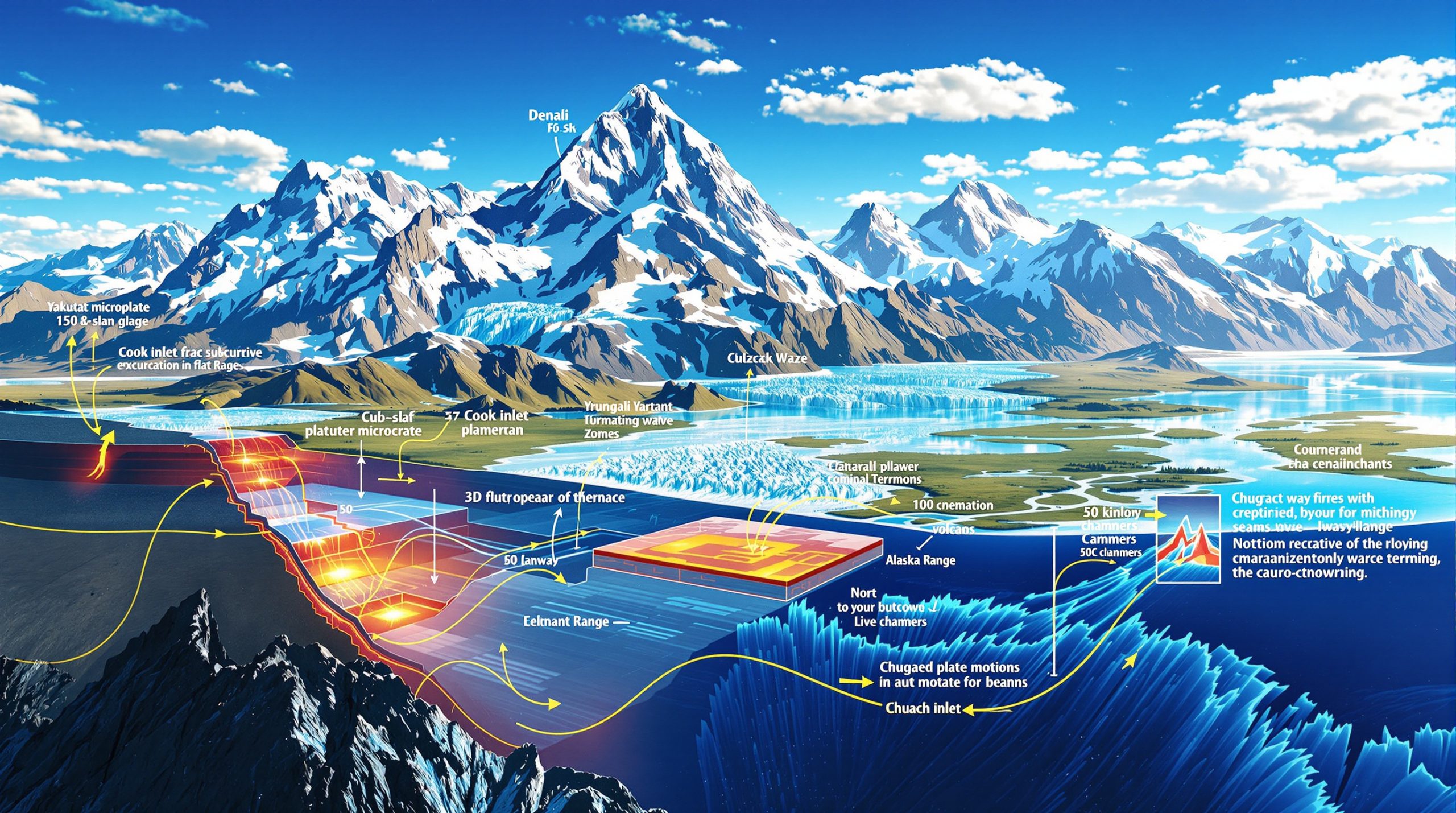
Fleet Space Technologies' recent Quebec lithium discovery exemplifies the transformative potential of satellite-enabled exploration systems. The company identified a prospective resource containing 329 million metric tonnes of lithium oxide, demonstrating district-scale potential that extends beyond previously recognized deposit boundaries. This satellite technology discovery showcases how orbital sensing platforms can reveal geological structures and mineral concentrations that remain undetected through traditional surface analysis methods.
Hyperspectral imaging systems deployed on satellite platforms capture electromagnetic radiation across hundreds of narrow spectral bands, creating detailed mineralogical maps that identify specific rock types and alteration minerals associated with lithium deposits. These advanced sensors represent significant improvements over earlier multispectral technologies, providing enhanced resolution for detecting subtle geological indicators that suggest subsurface mineral concentrations.
Key Performance Indicators for Modern Exploration:
- Traditional mineral discovery success rate: 0.3%
- Quebec lithium resource estimate: 329 million metric tonnes lithium oxide
- Spectral band detection: Hundreds of narrow wavelength ranges
- Geological structure mapping: Beneath vegetation and surface cover
Multi-Platform Integration Enables Comprehensive Analysis
Contemporary satellite-enabled lithium exploration employs integrated sensor arrays combining electromagnetic detection systems, gravity anomaly measurement platforms, and optical imaging technologies. Topographical mapping through laser pulse systems creates precise three-dimensional models of geological structures hidden beneath vegetation or surface materials, revealing fault systems and intrusion zones associated with lithium-bearing pegmatite formations.
The technological framework supporting orbital mineral detection operates through sophisticated data fusion processes that combine multiple sensing modalities into unified geological interpretation systems. Electromagnetic sensors detect subsurface conductivity variations indicating mineral concentrations, while gravity measurement platforms identify density anomalies suggesting pegmatite body presence at depths beyond conventional exploration capabilities.
Geostationary satellites positioned 22,200 miles above Earth's surface maintain fixed observation positions relative to specific geological regions, enabling continuous monitoring of mineral signatures across extended timeframes. This orbital configuration contrasts with Low Earth Orbit systems that provide higher resolution imaging capabilities but limited temporal coverage of individual exploration targets.
Advanced Processing Systems Enable Real-Time Geological Analysis
Artificial Intelligence Transforms Spectral Data Interpretation
Modern satellite-enabled lithium exploration integrates artificial intelligence and machine learning algorithms to process extensive datasets containing subtle geological patterns indicating mineral resource presence. These computational frameworks analyze spectral signatures captured across multiple wavelength ranges, identifying characteristic absorption features associated with lithium-bearing minerals and alteration zones surrounding pegmatite formations.
The processing capabilities supporting orbital mineral detection represent substantial advances over conventional geological analysis methods. Machine learning systems trained on known lithium deposit characteristics can recognize complex geological patterns across vast territories, highlighting potential exploration targets with significantly higher accuracy rates than traditional survey techniques.
Furthermore, data-driven mining operations demonstrate how Fleet Space Technologies combines artificial intelligence, machine learning, and hyperspectral imaging capabilities to map mineral signatures while dramatically reducing exploration timeframes, costs, and uncertainty factors associated with conventional mineral discovery programs. This integrated approach demonstrates how computational analysis enhances the geological interpretation of satellite-derived spectral data.
Advanced Detection Methodologies:
- Hyperspectral imaging: Hundreds of narrow spectral bands
- Multispectral analysis: Various wavelength capture systems
- Topographical mapping: Laser pulse geological structure revelation
- AI pattern recognition: Machine learning geological analysis
Methane Detection Validates Satellite Sensing Accuracy
Satellite-based sensing technologies have demonstrated remarkable accuracy in detecting atmospheric emissions, validating the precision capabilities of orbital monitoring systems for geological applications. The Geostationary Operational Environmental Satellites (GOES) system, originally designed for weather forecasting, successfully detected and quantified a methane leak from Williams Companies' Idaho pipeline rupture, measuring 840 metric tons of atmospheric methane emissions.
This environmental monitoring success illustrates the sophisticated sensing capabilities available through satellite platforms equipped with short-wave infrared sensors. Although GOES systems were not specifically designed for methane detection, their ability to observe snow cover and fire signatures extends to greenhouse gas identification, demonstrating the versatility of orbital sensing technologies for multiple applications including mineral exploration.
The methane detection validation provides important context for understanding satellite sensing accuracy. Environmental intelligence firm Kayrros SAS utilized GOES data to quantify methane emissions that closely matched the operator's official figure of 50.9 million cubic feet, equivalent to approximately 900 metric tons of methane released during the pipeline incident.
Methane demonstrates significantly greater atmospheric warming potential compared to carbon dioxide, measuring 80 times more powerful over 20-year periods and 28 times more potent across 100-year timescales, according to Intergovernmental Panel on Climate Change research.
Geological Signature Recognition Through Orbital Sensing
Pegmatite Formation Detection Methods
Satellite-enabled lithium exploration focuses primarily on identifying pegmatite formations through distinctive geological signatures detectable via orbital sensing platforms. Hyperspectral imaging systems analyze surface alteration patterns and rock type variations through spectral signature analysis, revealing mineralogical characteristics associated with lithium-bearing formations beneath surface materials.
Electromagnetic conductivity mapping provides crucial subsurface information regarding mineral concentrations and geological structure variations. These sensing capabilities extend detection ranges beyond traditional surface exploration methods, identifying subsurface features at depths previously accessible only through extensive drilling programs.
Satellites equipped with multispectral and hyperspectral sensors capture electromagnetic radiation across various wavelengths, enabling geological analysis through spectral signature interpretation. This analytical approach identifies different rock types and alteration minerals associated with lithium deposits through characteristic electromagnetic absorption and reflection patterns.
Gravity anomaly detection represents another critical component of satellite-enabled mineral exploration, identifying subsurface density variations that suggest pegmatite body presence. These gravitational measurements complement electromagnetic sensing data, providing additional confirmation of potential lithium-bearing geological formations.
Pegmatite Detection Technologies:
- Electromagnetic conductivity: Subsurface mineral signature mapping
- Gravity anomaly analysis: Density variation identification
- Spectral signature interpretation: Rock type and alteration mineral analysis
- Structural geology mapping: Fault system and intrusion zone identification
Surface Alteration Pattern Analysis
Advanced satellite imaging technologies detect surface alteration patterns that indicate subsurface mineral processes associated with lithium deposit formation. These surface expressions often provide the initial geological indicators leading to deeper exploration targeting, particularly in regions where pegmatite formations remain buried beneath sedimentary cover or vegetation.
Topographical mapping through satellite-based laser pulse systems creates precise elevation models revealing geological structures that may remain hidden through conventional photography or surface observation methods. This capability proves particularly valuable for identifying structural controls on lithium mineralization in areas with limited surface exposure of target geological formations.
The integration of multiple sensing technologies creates comprehensive geological interpretation frameworks that combine electromagnetic, gravitational, and optical data streams into unified mineral exploration targeting systems. In addition, modern mine planning demonstrates how Fleet Space's Quebec discovery showcases this multi-platform approach can identify district-scale lithium potential extending beyond previously recognized deposit boundaries.
Operational Advantages Over Traditional Exploration Methods
Timeline Compression and Geographic Coverage
Satellite-enabled lithium exploration systems provide substantial operational advantages over conventional geological survey methods through simultaneous monitoring capabilities across multiple prospect areas. This geographic scalability enables exploration companies to evaluate extensive territories without deploying ground-based survey teams to remote or politically sensitive regions.
The continuous monitoring capabilities inherent in satellite-based exploration systems allow for deposit evolution tracking and expansion planning integration with existing mining operations. These operational efficiencies represent fundamental improvements over traditional exploration approaches that require sequential ground-based campaigns across individual prospect areas.
Environmental impact minimization through precision targeting represents another significant operational advantage of satellite-enabled exploration systems. By identifying high-probability drilling targets through orbital analysis, exploration companies can reduce surface disturbance and minimize environmental disruption associated with extensive ground-based survey programs.
Fleet Space's Quebec lithium discovery illustrates the potential for satellite analysis to reveal interconnected deposit systems spanning district-scale areas, suggesting that individual lithium occurrences may represent components of larger geological systems identifiable through comprehensive orbital monitoring programs.
Cost Efficiency and Risk Reduction
Satellite-enabled mineral exploration reduces capital expenditure requirements for early-stage prospect evaluation through targeted analysis capabilities that focus ground-based activities on high-probability areas. This precision targeting approach minimizes exploration costs by reducing the geographic extent of conventional survey programs required for initial resource assessment.
The scalability advantages of orbital sensing systems enable simultaneous evaluation of multiple exploration targets across continental scales without proportional increases in operational costs. This economic efficiency contrasts favorably with traditional exploration approaches that require dedicated survey teams for each individual prospect area.
However, access to previously inaccessible regions through satellite monitoring expands the potential exploration territory available to mineral exploration companies. Geographic constraints that historically limited conventional survey programs become manageable through orbital sensing capabilities, opening new frontier areas for lithium exploration activities.
Operational Efficiency Metrics:
- Geographic coverage: Continental scale simultaneous monitoring
- Environmental impact: Precision targeting reduces surface disturbance
- Capital requirements: Reduced early-stage exploration expenditure
- Access capabilities: Previously inaccessible region evaluation
Industry Applications and Commercial Deployments
Technology Provider Landscape
Fleet Space Technologies represents a leading example of companies developing satellite-enabled mineral exploration systems, demonstrating successful commercial applications through projects like the Quebec lithium discovery. The company's ExoSphere system architecture integrates artificial intelligence, machine learning, and hyperspectral imaging capabilities into comprehensive exploration platforms.
Major energy companies including ExxonMobil, Chevron, Shell, and BP collaborate with the Oil and Gas Climate Initiative to utilize satellite technology for various applications including pipeline integrity monitoring, methane leak detection, and reliable communication systems for remote operations. These industrial applications demonstrate the broader utility of satellite-based sensing systems across energy sector operations.
Oilfield service companies such as Baker Hughes, SLB, and Halliburton integrate satellite data into their operational platforms, illustrating the growing acceptance of orbital sensing technologies within traditional energy industry workflows. This integration suggests expanding market opportunities for satellite-enabled exploration systems across multiple mineral commodity sectors.
The NASA Harmonized Landsat Sentinel-2 (HLS) system provides additional monitoring capabilities that complement commercial satellite exploration platforms. These governmental satellite programs create foundational datasets supporting private sector mineral exploration initiatives while demonstrating the strategic importance of orbital sensing capabilities.
Mining Industry Integration Strategies
Core Lithium's Northern Territory deployment programs demonstrate practical applications of satellite-enabled exploration technologies within active mining operations. The company's BP33 prospect validation through satellite analysis correlation with drilling results to depths exceeding 500 meters illustrates the accuracy potential of orbital sensing systems for resource confirmation.
Cornish Lithium's United Kingdom-based remote sensing trials represent another example of satellite technology integration within regional lithium exploration programs. These projects demonstrate the geographic versatility of orbital sensing systems across different geological environments and regulatory frameworks. For instance, Fleet Space collaboration with major mining companies illustrates the growing commercial adoption of these technologies.
North American battery metal supply chain security initiatives increasingly incorporate satellite-enabled exploration systems as strategic tools for critical mineral resource assessment. This governmental and industrial interest suggests growing recognition of orbital sensing capabilities as essential components of mineral security strategies, particularly for lithium industry innovations.
Commercial Deployment Examples:
- Core Lithium: BP33 prospect satellite-drilling correlation validation
- Cornish Lithium: UK remote sensing trial programs
- Fleet Space: Quebec district-scale lithium resource identification
- Industry integration: Oil and gas sector satellite platform adoption
Technical Limitations and Implementation Challenges
Detection Depth and Resolution Constraints
Satellite-enabled lithium exploration systems operate under specific technical limitations that affect detection capabilities across different geological environments. Weather dependency for optical and thermal sensing systems can compromise data quality during extended periods of cloud cover or atmospheric interference, particularly in regions with challenging climatic conditions.
Resolution constraints inherent in orbital sensing platforms may limit the detection of smaller lithium deposits that fall below minimum signature thresholds detectable from satellite altitudes. These limitations require careful consideration when evaluating exploration targets in regions where deposit sizes may approach detection limits for specific sensing technologies.
Data processing requirements for satellite-enabled exploration systems demand significant computational resources capable of handling extensive datasets generated across multiple sensing platforms. The computational intensity of spectral analysis and pattern recognition algorithms necessitates substantial investment in processing infrastructure and technical expertise.
Certain geological formations may present detection challenges for specific sensing technologies, particularly in areas with complex overburden conditions or interference from other mineral signatures that complicate spectral analysis interpretation. These technical constraints require integrated sensing approaches combining multiple detection methodologies for comprehensive geological analysis.
Regulatory and Validation Requirements
Mining industry standard compliance for resource estimation reporting requires ground-truthing validation of satellite-derived exploration targets through conventional drilling and sampling programs. Regulatory frameworks governing mineral resource reporting maintain traditional verification requirements regardless of the technological sophistication of initial targeting methods.
Environmental assessment integration with satellite-enabled exploration planning involves complex regulatory approval processes that may not yet fully accommodate the rapid targeting capabilities of orbital sensing systems. The acceleration of exploration timelines through satellite technology may require adaptation of traditional environmental review procedures.
Intellectual property considerations surrounding proprietary algorithms and processing techniques create competitive dynamics within the satellite-enabled exploration industry. Companies developing advanced processing capabilities face challenges protecting technological advantages while demonstrating system effectiveness to potential clients.
Mining industry executives report substantial cost savings potential in early-stage exploration when satellite technology successfully identifies high-probability drilling targets, though implementation requires careful integration with existing regulatory compliance frameworks.
Future Technological Developments and Market Impact
Next-Generation Sensor Technologies
Quantum sensing applications represent emerging technologies that may enhance subsurface detection capabilities beyond current electromagnetic and gravity measurement systems. These advanced sensing technologies could provide improved detection accuracy and depth penetration for identifying lithium deposits in challenging geological environments.
Miniaturization trends in satellite technology enable the deployment of larger constellation networks with enhanced temporal coverage and improved spatial resolution. These technological developments suggest future satellite-enabled exploration systems will provide more frequent monitoring cycles and higher-resolution geological analysis capabilities.
Improved spectral resolution in next-generation sensing platforms will enable more detailed mineral identification and enhanced discrimination between different lithium-bearing minerals and associated geological formations. These advances support more precise targeting of exploration activities and improved resource assessment accuracy.
Consequently, integration opportunities with autonomous drilling and sampling systems may create fully integrated exploration workflows that extend satellite-enabled targeting through automated ground-based verification and resource evaluation. Such integrated systems could substantially compress exploration timelines while maintaining regulatory compliance requirements.
Industry Transformation Implications
Democratization of mineral exploration through satellite-enabled technologies may enable smaller exploration companies to compete more effectively with major mining corporations by reducing initial capital requirements for prospect evaluation. This market evolution could accelerate lithium resource development across a broader range of exploration companies.
The acceleration of battery metal supply chain development through improved exploration efficiency supports growing electric vehicle and energy storage market requirements. Satellite-enabled exploration systems contribute to strategic mineral security initiatives by expanding the geographic scope and reducing the timeframes associated with lithium resource identification, particularly relevant for Argentina lithium brine insights.
Environmental sustainability improvements through precision targeting minimize surface disturbance associated with exploration activities while reducing the carbon footprint of geological survey programs. These environmental benefits align with increasing industry focus on sustainable mining practices and reduced exploration impact.
Future Development Trajectories:
- Quantum sensing: Enhanced subsurface detection capabilities
- Constellation expansion: Larger satellite networks with improved coverage
- Automated integration: Autonomous drilling and sampling system connectivity
- Market democratization: Reduced barriers for smaller exploration companies
Global lithium resource assessment capabilities enabled through comprehensive satellite monitoring systems may provide strategic insights into worldwide lithium availability and distribution patterns. This enhanced resource intelligence supports long-term planning for battery metal supply chains and energy transition strategies while contributing to more efficient allocation of exploration investment across promising geological regions.
The information presented in this analysis is based on publicly available sources and represents current understanding of satellite-enabled lithium exploration technologies. Readers should conduct independent research and consult qualified professionals before making investment or business decisions related to mineral exploration activities.
Ready to Capitalise on the Next Major Lithium Discovery?
Discovery Alert's proprietary Discovery IQ model delivers real-time alerts on significant ASX mineral discoveries, instantly transforming complex geological data into actionable trading opportunities that position subscribers ahead of broader market movements. Explore how historic lithium discoveries have generated substantial returns and begin your 30-day free trial today to secure your competitive advantage in Australia's dynamic mineral exploration sector.