Aumega Metals Ltd
AuMEGA Metals Launches Its Most Ambitious Exploration Campaign Yet, Backed by a $30 Million War Chest
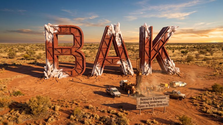
AuMEGA Metals Ltd (ASX: AAM | TSXV: AUM | OTCQB: AUMMF) has outlined its most expansive exploration program to date, entering 2026 with a fully funded treasury following a recently closed $30 million financing and a clear strategic mandate: make a meaningful new discovery along one of Canada's most underexplored gold corridors.
The AuMEGA Metals 2026 exploration program in Newfoundland targets approximately 10,000 metres of diamond drilling across three priority areas on the Cape Ray Shear Zone ("CRSZ") — a geological structure that already hosts Equinox Gold's multi-million-ounce Valentine Gold Project.
Alongside the drilling push, results from the 2025 field season have unveiled a compelling antimony anomaly at the Hermitage project, adding a polymetallic dimension to the Company's already substantial asset base.
"We are entering 2026 with a clear focus on discovery and resource growth across our district-scale land package… We will allocate capital to success and scale drilling where we see results that confirm our models." — Sam Pazuki, Managing Director & CEO, AuMEGA Metals
When big ASX news breaks, our subscribers know first
Three Strategic Pillars Driving the 2026 Campaign
The AuMEGA Metals 2026 exploration program in Newfoundland is built around three distinct but interconnected priorities, each designed to deliver value at a different stage of the discovery pipeline.
- Cape Ray West & Isle aux Morts Granite (IMG) — a newly emerging, high-priority discovery opportunity and the first area to be drilled in 2026.
- Bunker Hill — a rapidly advancing target area with a growing pipeline of drill-ready anomalies, with drilling scheduled for later in the 2026 season.
- Cape Ray Resource Corridor — relogging of historical drill core to refine mineralisation controls and identify new targets surrounding the existing Mineral Resource, with a drilling program to be scoped in the coming months.
| Priority Area | Program Type | Planned Metres | Timing |
|---|---|---|---|
| Cape Ray West / Isle aux Morts Granite | Diamond Drilling + Mapping + Till Sampling | Up to 5,000 m | First — drilling commencing now |
| Bunker Hill | Diamond Drilling + Mapping + Till Sampling | Up to 5,000 m | Later in 2026 field season |
| Cape Ray Resource Corridor | Relogging + Geological Modelling + Drilling | To be scoped | Pending relogging completion |
The program is intentionally scalable — capital will be directed toward success, with the flexibility to increase or reduce drilling based on results as the season progresses.
Cape Ray West & Isle aux Morts Granite: The Priority Discovery Target
Cape Ray West and the Isle aux Morts Granite have emerged as one of the most compelling new exploration opportunities within the AuMEGA portfolio. Recent work identified multiple high-priority target areas associated with favourable structural settings and geophysical features, supporting the potential for a large-scale mineralised system.
The AuMEGA Metals 2026 exploration program in Newfoundland at this area includes:
- Extension of till sampling and geological mapping across the full extent of the IMG
- Detailed 1:5,000-scale mapping and channel sampling over priority target areas
- An initial targeted diamond drilling program of up to 5,000 metres
This is the first target to be drilled in 2026, reflecting the Company's confidence in the structural and geophysical evidence assembled to date.
Bunker Hill: A Growing Multi-Kilometre Gold Trend
At Bunker Hill, AuMEGA has defined a growing suite of high-quality drill targets, including a multi-kilometre gold trend associated with the Branch Fault Corridor. The scale of the system and the limited historical drilling at this location underline the discovery potential.
Planned activities ahead of drilling include:
- Extending till sampling and mapping north of the Branch Fault Corridor to evaluate strike continuity
- Conducting additional regional-scale surveys east toward the Intersection Project to assess district-scale connectivity
- Completing detailed 1:5,000-scale geological mapping and channel sampling over the highest-priority anomalies
- Executing a focused diamond drilling program of up to 5,000 metres, targeting a smaller number of high-conviction drill targets rather than broad early-stage coverage
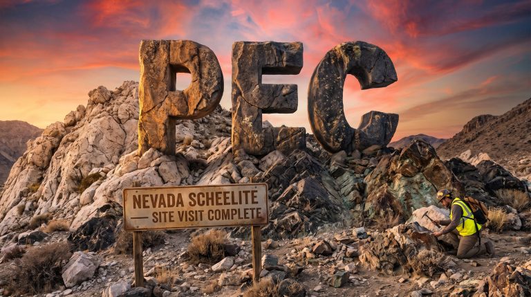
Hermitage: An Emerging Antimony Story With Gold Upside
Results from AuMEGA's inaugural high-resolution till geochemical survey at Hermitage (891 samples at 160 m × 80 m spacing) have delivered a standout antimony anomaly that materially exceeds publicly available regional benchmarks.
| Metric | Beaver Brook Antimony Mine (Regional Benchmark) | AuMEGA Hermitage Survey |
|---|---|---|
| Sampling Grid | 1 km × 1 km (regional) | 160 m × 80 m (high resolution) |
| Peak Antimony-in-till | ~40.9 ppm Sb | 200 ppm Sb |
| Anomaly Extent | — | At least 620 metres, open along strike |
| Survey Samples | — | 891 samples |
The anomaly is both strong and spatially coherent, with the southeastern portion of the grid indicating additional antimony anomalism, though continuity is not yet fully defined given the truncated nature of the survey in that area.
How Do the Gold Results Stack Up?
Gold results at Hermitage further enhance the project's appeal. The priority grid, centred on previously identified outcropping mineralisation grading 7.31 g/t and 2.10 g/t Au, returned peak till values of 53.5 ppb Au.
A separate regional line in the southeastern grid returned the survey's highest gold reading of 57.4 ppb Au, spatially associated with a well-defined geophysical feature interpreted as a lithological contact.
The coincident antimony and gold anomalism points to a broader polymetallic system at Hermitage. Furthermore, the Company has noted the project's potential to attract partnership or joint venture interest.
Understanding Till Geochemistry: Why Does Surface Sampling Matter?
What Is Till Geochemistry?
Till is glacially transported sediment — material that has been eroded from bedrock and carried downslope by ancient glaciers. When geologists sample till, they are searching for trace elements physically transported from buried mineral deposits to the surface.
By analysing the chemistry of till samples, exploration teams can effectively see through glacial cover and identify the likely location of mineralised bedrock below.
Why It Matters for Investors
In glaciated terrains like Newfoundland, thick till cover can obscure even significant gold or antimony systems from traditional surface mapping. A coherent, high-tenor anomaly in till — especially one that exceeds known benchmarks at an operating mine — provides a cost-effective, early-stage signal.
For AuMEGA, the Hermitage results suggest a mineralised system of meaningful scale warranting systematic follow-up.
What Did the 2025 Drilling Program Reveal?
As part of 2025 field activities, AuMEGA completed an electromagnetic ("EM") anomaly drilling program totalling 1,476.17 metres across six diamond drill holes. There were no significant gold results from this program — the EM response was attributed to elevated concentrations of sulphide minerals derived from metamorphic processes rather than mineralised hydrothermal fluids.
However, the one hole that returned notable results was CPRDD25-006:
| Hole ID | From (m) | Width (m) | Au Grade (g/t) | Cut-off Applied |
|---|---|---|---|---|
| CPRDD25-006 | 68.00 | 1.00 m | 2.19 g/t Au | 0.2 g/t & 0.5 g/t |
| CPRDD25-006 | 116.40 | 1.60 m | 1.17 g/t Au | 0.2 g/t |
| CPRDD25-006 | 117.00 | 1.00 m | 1.64 g/t Au | 0.5 g/t |
Five of the six holes returned no significant results, and no follow-up work at the EM target is planned. Nevertheless, the 2025 program provided valuable geological data that refined the Company's exploration model and directly informed prioritisation for the 2026 drilling campaign.
Separately, the Company has elected to exit its option agreement and relinquish its mineral licences for the Blue Cove Project, citing challenging terrain, a lack of material results, and a strategic decision to focus capital on the highest-priority areas within its broader portfolio.
The Existing Resource Base: A Foundation for Growth
AuMEGA is not starting from scratch. The Cape Ray Shear Zone already hosts a defined Mineral Resource that underpins the Company's exploration rationale:
| Resource Category | Tonnes (Mt) | Grade (g/t Au) | Contained Gold (Oz) |
|---|---|---|---|
| Indicated | 6.2 Mt | 2.25 g/t | 450,000 oz |
| Inferred | 3.4 Mt | 1.44 g/t | 160,000 oz |
| Total | 9.6 Mt | — | ~610,000 oz |
The 2026 resource corridor program — driven by relogging of historical drill core and geological model refinement — is aimed at identifying new drilling targets that could expand this resource base considerably.
A District-Scale Land Package With Significant Runway
AuMEGA controls a land package spanning over 110 kilometres of strike along the Cape Ray-Valentine Shear Zone, holding 44 mineral licences covering approximately 956 km² across project areas including Cape Ray, Bunker Hill, Intersection, Malachite, Isle aux Morts, Hermitage, and Long Range.
The Company also holds a 27-kilometre stretch of the highly prospective Hermitage Flexure. Its shareholder base includes prominent institutional investors and a strategic investment from B2Gold Corp, a significant intermediate gold producer.
This scale of tenure, combined with a district that continues to deliver new discoveries nearby, provides an extended pipeline of exploration opportunities well beyond the current field season.
Why Should Investors Watch AuMEGA Closely?
Several factors combine to make AuMEGA's 2026 campaign a significant inflection point:
- Fully funded: The recently closed $30 million financing provides the balance sheet strength to execute a multi-target, scalable drilling program without near-term capital concerns.
- Largest drill program since 2021: Up to 10,000 metres planned across two of the highest-priority targets, with a third program to be scoped as relogging progresses.
- New discovery potential: Cape Ray West and the Isle aux Morts Granite represent a genuinely new exploration opportunity, with structural and geophysical support for a large-scale mineralised system — currently untested by drilling.
- Polymetallic upside: The Hermitage antimony anomaly — returning 200 ppm Sb against a regional benchmark of ~40.9 ppm at Newfoundland's only operating antimony mine — adds a second commodity story to what is primarily a gold-focused portfolio.
- Resource growth pathway: Ongoing relogging and geological reinterpretation within the Cape Ray Resource Corridor is designed to identify extensions to the existing ~610,000 oz gold resource.
- District-scale position: With more than 110 kilometres of strike along one of Newfoundland's most significant gold structures, the exploration pipeline extends well beyond any single season.
The next major ASX story will hit our subscribers first
Glossary of Key Terms
Cape Ray Shear Zone (CRSZ): A major geological fault structure in southwest Newfoundland, Canada, recognised as the largest identified gold structure on the island. Hosts AuMEGA's project portfolio as well as Equinox Gold's Valentine Gold Project.
Orogenic Gold: A style of gold deposit formed in ancient mountain-building events, typically hosted in shear zones and associated quartz veins. Often characterised by high-grade, structurally controlled mineralisation.
Till Geochemistry: The analysis of glacially transported sediment (till) for trace elements. Used to detect buried mineralisation in areas of glacial cover.
ppm / ppb: Parts per million / parts per billion. Standard units for reporting trace element concentrations in geochemical surveys. For gold in till, ppb is typically used; for antimony, ppm.
g/t Au: Grams of gold per tonne of rock. The standard measure of gold grade in exploration and resource estimation.
Indicated Resource: A mineral resource estimated with sufficient confidence to support detailed mine planning, based on closely spaced drilling.
Inferred Resource: A mineral resource estimated with lower confidence, typically from wider-spaced drilling, where geological continuity is assumed but not fully confirmed.
Diamond Drilling: A drilling technique using a rotating diamond-tipped drill bit to extract cylindrical core samples of rock for geological analysis and assaying.
Electromagnetic (EM) Survey/Anomaly: A geophysical technique that measures the electrical conductivity of subsurface rocks. Conductive anomalies can indicate the presence of sulphide minerals, which are sometimes associated with gold mineralisation.
NSR (Net Smelter Return) Royalty: A royalty paid to a royalty holder calculated as a percentage of the gross revenue from metal sales, less certain processing and transportation costs.
Ready to Identify the Next Major Mineral Discovery Before the Market Does?
AuMEGA's fully funded 10,000-metre drilling campaign across the Cape Ray Shear Zone is precisely the kind of district-scale exploration event that has historically preceded significant market re-ratings — and Discovery Alert's proprietary Discovery IQ model is built to flag these moments the instant they're announced on the ASX. Explore historic examples of major mineral discoveries and their returns, then begin your 14-day free trial at Discovery Alert to ensure you're positioned ahead of the market when the next significant find is confirmed.