Bison Resources Ltd
- ASX Code: BSR
- Market Cap: $14,744,010
Bison Resources Breaks Ground on Nevada Gravity Survey, Sharpening the Path to Its Maiden Drill Program
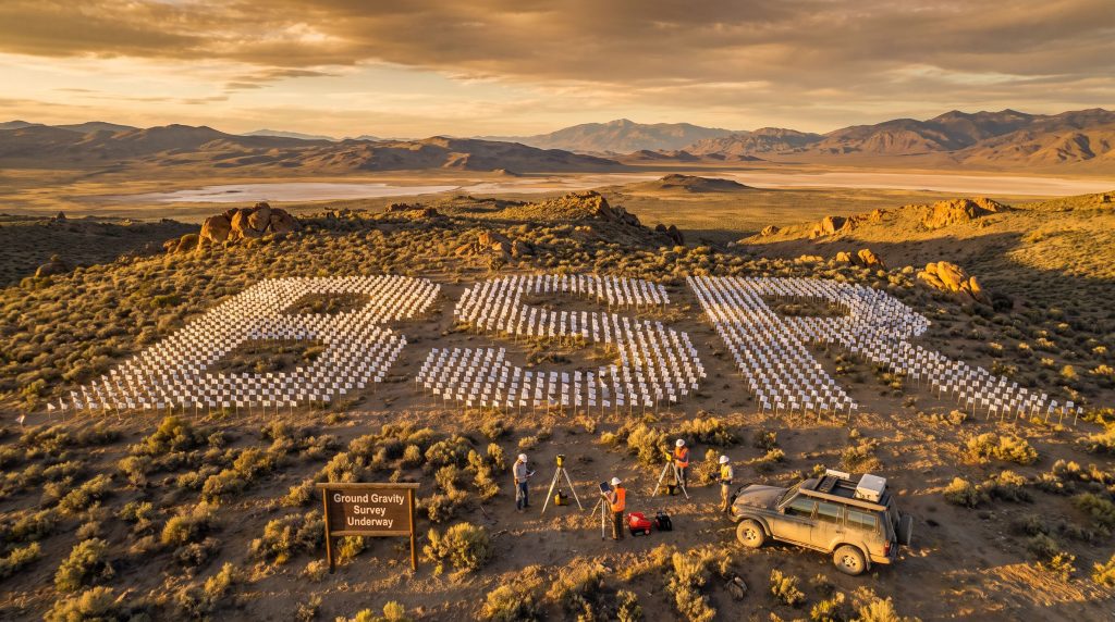
Bison Resources (ASX: BSR) has mobilised field crews to commence a ground-based gravity survey across its four Nevada projects, marking the most significant on-ground step in the Bison Resources Nevada gravity survey for maiden drill program. Conducted by geophysical specialist Zonge International, the survey covers all four project areas — Ruby Lake, Cherry Springs, Bald Peaks, and Medicine Range — on a 200m x 200m grid across a combined landholding of approximately 26.1 km² in Elko County, northeast Nevada.
According to the announcement, results are expected in October 2026, at which point Bison intends to integrate the gravity data with its existing airborne magnetic, geochemical, and spectral datasets to generate drill targets and advance toward a maiden drill program.
"This is an important first step for the Company's ground-based exploration program. The gravity survey will sharpen our understanding of the geology beneath all four Nevada Projects, and combined with our airborne magnetic and spectral datasets, will directly guide target generation for our maiden drill program," said Tim Mackellar, Chief Executive Officer of Bison Resources.
When big ASX news breaks, our subscribers know first
Why This Survey Matters: Setting the Stage for Drilling
For early-stage explorers, moving from desktop and airborne analysis to ground-based geophysics represents a meaningful escalation in commitment and precision. This gravity survey reflects that progression for Bison Resources, which has stated it is building the geological framework needed to help identify where drilling may have a higher probability of intersecting mineralisation.
According to the announcement, the survey's key objectives include:
- Geological and structural interpretation across all four project areas to help clarify the architecture that may control mineralisation
- Constraining intrusive bodies at the Cherry Springs and Ruby Lake projects through inversion modelling, identifying where high-density targets — potentially representing sulphide mineralisation — may be located
- Delineating blind mineralisation that is not visible at surface and cannot be detected through spectral or geochemical sampling alone
- Building a pipeline of drill targets to help guide a future maiden drill program at priority prospects
Once integrated with the recently acquired airborne magnetic data alongside existing geochemical and spectral datasets, the survey results are expected to give Bison a multi-layered view of the subsurface. Consequently, the company suggests this could support more informed drill-targeting decisions.
The Nevada Portfolio: Four Projects, One Prolific Address
Bison's four Nevada projects sit approximately 80 km southeast of Elko within the Carlin Trend, a gold-producing corridor with a long production history. The company is targeting carbonate-hosted precious metal deposits that it describes as sharing geological and structural characteristics with major gold-silver deposits established in the region.
| Project | Claims | Area (km²) | Key Features |
|---|---|---|---|
| Ruby Lake | 128 | ~10.7 | Kaolinite, goethite and haematite spectral anomalies around N/NE-trending fault intersections adjacent to the "Ruby Stock" intrusion |
| Cherry Springs | 82 | ~6.9 | Two key target areas: kaolinite/haematite at "Cherry Stock" intrusion margins; 500m x 500m goethite-haematite spectral anomaly along southern NE fault |
| Bald Peaks | 40 | ~3.3 | 800m kaolinite-jarosite anomaly; 1km goethite-haematite anomaly; 1.5km-strike As-Sb geochemical anomaly; pathfinder elemental suite indicative of a potential Carlin-type system |
| Medicine Range | 62 | ~5.2 | Analogous litho-structural setting to nearby Maverick Springs silver deposit; key lithological contact dissected by NE/NW structural corridor |
| Total | 312 | ~26.1 | Four-project portfolio across the Carlin Trend district |
Each project carries its own set of surface indicators, and the gravity survey is intended to provide a unifying layer of subsurface data across all four simultaneously.
Project in Focus: Bald Peaks and Its Neighbouring Projects
Among the four projects, Bald Peaks stands out for the density of surface indicators identified to date. According to the announcement, the project hosts:
- An 800-metre kaolinite-jarosite spectral anomaly trending north along the eastern fault
- A 1-kilometre goethite-haematite anomaly immediately to the south
- A 1.5 km-strike arsenic-antimony geochemical anomaly associated with decalcification of host carbonates, silicification, gossanous breccias, and jasperoidal alteration
- A pathfinder elemental association of As-Sb ± W-Hg-Tl, which the company considers indicative of a potential Carlin-type mineral system
The alteration styles and elemental suite identified at Bald Peaks are consistent with hydrothermal footprints commonly associated with Carlin-type gold systems. However, further work is required to confirm the extent and continuity of any mineralisation.
Bald Peaks is located directly adjacent to Torex Gold Resources' (TSX: TXG) Medicine Springs Silver Project and in proximity to Sun Silver's (ASX: SS1) 539 Moz AgEq Maverick Silver Project — a project the company describes as sharing geological and structural similarities with Bald Peaks.
Understanding Ground Gravity Surveys: A Primer for Investors
What Is a Ground Gravity Survey?
A gravity survey measures subtle variations in the Earth's gravitational field caused by differences in the density of rocks beneath the surface. Denser rock types, such as sulphide mineralisation or intrusive bodies, produce a measurably stronger gravitational pull than surrounding host rocks.
Why Does This Matter for Mineral Exploration?
Gravity surveys are considered useful in exploration for several reasons:
- Mapping intrusions — dense igneous bodies that are often spatially associated with precious and base metal mineralisation
- Identifying sulphide targets — sulphide minerals have higher density than typical host rocks, making them potentially detectable via gravity even where they have no surface expression, commonly referred to as "blind" targets
- Structural interpretation — gravity data can help define faults, contacts, and basins that influence where mineralising fluids travel and deposit metals
Why a 200m x 200m Grid?
A 200m x 200m grid spacing is considered a relatively high resolution for regional exploration at this stage. It is designed to provide sufficient detail to distinguish geological features relevant to drill targeting, without the cost associated with an ultra-close-spaced survey more typically used for resource definition work.
Key Technical Terms Explained
Inversion modelling is a computational technique that works backward from measured gravity data to construct a three-dimensional model of subsurface density distributions.
Carlin-type deposit refers to a sediment-hosted gold deposit style defined by fine-grained, disseminated gold within carbonate host rocks, typically associated with hydrothermal fluid pathways.
Pathfinder elements are chemical elements — such as arsenic, antimony, mercury, and thallium — that occur alongside gold in Carlin-type systems and can serve as indicators of mineralising processes.
Spectral anomaly describes an area identified via remote sensing where the mineralogy of surface rocks differs from the regional background, often indicating alteration caused by hydrothermal fluids.
Blind mineralisation refers to ore bodies with no surface expression, detectable only through subsurface geophysical or geochemical methods.
What Comes Next: The Road to Drilling
The gravity survey is described by the company as a critical input connecting its existing multi-dataset picture with a future maiden drill program. Furthermore, based on the announcement, the anticipated workflow from here includes:
- October 2026 — Gravity survey results received and processed
- Data integration — Gravity data merged with airborne magnetics, geochemical sampling, and spectral datasets to refine the geological model across all four projects
- Inversion modelling — Three-dimensional density models constructed to help constrain intrusive bodies at Cherry Springs and Ruby Lake, and to highlight high-density, potentially sulphide-bearing targets
- Drill target ranking — Integrated dataset used to rank and prioritise targets across the portfolio
- Maiden drill program — Field program mobilised at the highest-priority prospects, subject to results and further company decisions
The next major ASX story will hit our subscribers first
The Investment Case: Why Bison Resources Warrants Attention
Bison Resources is operating within an established and active precious metals district. The Carlin Trend has a long production history and continues to attract exploration and development activity from a range of companies. In addition, the Bison Resources Nevada gravity survey for maiden drill program represents a meaningful catalyst in the company's near-term timeline.
Several factors are relevant for investors monitoring the company's progress:
- Land position — 312 claims across approximately 26.1 km² within the Carlin Trend provides scale and multiple target areas at an early exploration stage
- Multi-dataset approach — the company has progressively layered spectral, geochemical, and airborne magnetic data ahead of ground geophysics, reflecting a staged exploration methodology
- Neighbouring projects — proximity to Torex Gold's Medicine Springs Silver Project and Sun Silver's Maverick Silver Project offers geological analogues, though this proximity does not guarantee similar results at Bison's projects
- Near-term catalyst — gravity survey results expected in October 2026 represent a defined data milestone that will inform the company's drill targeting decisions
- Progression toward drilling — the datasets acquired to date have been assembled with the stated aim of supporting a maiden drill program, with the company describing itself as one significant data step closer to that milestone
"This is an important first step for the Company's ground-based exploration program," Mackellar reiterated, underscoring the significance of the Bison Resources Nevada gravity survey for maiden drill program as a turning point in the company's exploration timeline.
Bison Resources has consequently positioned itself as a precious metals explorer within the Carlin Trend district, applying a staged, data-driven approach ahead of a planned maiden drill program. With gravity survey results expected in October 2026, the company's near-term progress will depend on how effectively the integrated dataset translates into defined drill targets.
Want to Follow Bison Resources' Journey Toward Its Maiden Drill Program?
With a ground gravity survey now underway across four Nevada projects and drill targets set to be defined from October 2026, Bison Resources (ASX: BSR) is at a pivotal stage in its Carlin Trend exploration story. Investors seeking to stay across the company's progress — from data integration through to maiden drilling decisions — can visit the official Bison Resources website to learn more about the projects, the portfolio, and the company's staged exploration approach.