King River Resources Ltd
King River Resources Uncovers a Hidden Gold Story at Mindoolah — And It's Bigger Than the Records Show
King River Resources (ASX: KRR) has released a significant exploration update for its Mindoolah Gold Project, revealing that the historical production record at this Murchison Province asset tells only a fraction of the real story. Using modern LiDAR drone surveying and volumetric reconciliation techniques, KRR's technical team has identified a striking discrepancy between what was officially recorded as mined and what was physically excavated from the ground.
This gap carries meaningful implications for the project's gold inventory and future exploration upside. The King River Resources Mindoolah Gold Project LiDAR results and stockpile drilling plans represent a pivotal moment for the company's understanding of this asset.
The numbers are hard to ignore. LiDAR surveys confirm that approximately 1.08 million tonnes of material were historically excavated across the project's open pits, yet government production records from 1986–1989 account for only 38,589 tonnes of reported ore — representing just 11% of the total material moved.
That leaves an unaccounted volume of approximately 339,000 tonnes. KRR estimates that at the historical mined grade of 2.44 g/t Au, as much as 23,541 ounces of gold may not be fully reconciled in the official production record.
Sitting on surface right now are 746,000 tonnes of historical stockpiles — material already confirmed to carry high-grade gold through selective grab sampling, including results of 10.0 g/t Au at Excelsior and 9.39 g/t Au at Mindoolah Main Reef. Systematic drill testing of these stockpiles is scheduled to begin in early June 2026, alongside a high-resolution magnetic survey to refine primary hard-rock targets beneath the pits.
Managing Director Graham Gadsby commented: "The results of our recent LiDAR and volumetric reconciliation at Mindoolah are a potential game-changer for the Project. By applying modern digital terrain modelling to historical excavations, we have identified a substantial discrepancy in the project's history. Physically, we can see that over one million tonnes of material were excavated, yet only 11% of that was ever officially reported as ore… Either way, the implications for the scale of mineralisation at Mindoolah are significant."
When big ASX news breaks, our subscribers know first
What the Numbers Actually Show
The core of this announcement is a physical reconciliation — comparing what LiDAR surveys measured in terms of excavated pit volumes against what the historical record says was processed.
Open Pit Volumes — Historical Excavations
| Pit | Volume (m³) | Assumed Density | Estimated Tonnes |
|---|---|---|---|
| Le Soleil | 149,505 | 1.8 | 269,109 |
| Bertram's | 38,284 | 1.8 | 68,911 |
| Excelsior | 239,780 | 1.85 | 443,593 |
| Cundy | 84,004 | 1.8 | 151,207 |
| Mindoolah Main Reef | 84,156 | 1.8 | 151,481 |
| Total | 595,729 | 1.82 (avg) | 1,084,301 |
Surface Stockpile Volumes — Currently on Site
| Stockpile | Volume (m³) | Assumed Density | Estimated Tonnes |
|---|---|---|---|
| Excelsior | 285,630 | 1.6 | 457,008 |
| Cundy | 79,511 | 1.6 | 127,218 |
| Mindoolah Main Reef | 75,195 | 1.6 | 120,312 |
| Le Soleil | 20,745 | 1.6 | 33,192 |
| Miscellaneous | 6,578 | 1.2 | 7,894 |
| Total | 467,659 | 1.59 (avg) | 745,623 |
The implied historical throughput — after deducting stockpile volumes from excavated pit volumes — equates to approximately 128,070 m³ of material, or roughly 338,678 tonnes. Against officially claimed production of just 38,589 tonnes, the reconciliation gap is stark.
It is important to note that the density values applied are assumed figures and have not been validated by a Competent Person. These estimates are provided for reconciliation purposes and should be read accordingly.
Understanding LiDAR Technology and Its Application
What Is LiDAR?
LiDAR stands for Light Detection and Ranging. It uses laser pulses — in this case mounted on a drone — to create an extremely precise three-dimensional map of the surface terrain. When flown over a mining area, it can measure the exact shape of open pits, stockpiles, and waste dumps with an accuracy of ±50mm.
Why Does This Matter at Mindoolah?
Historical open-pit and underground mines were often documented inconsistently, particularly in early eras of production. The King River Resources Mindoolah Gold Project LiDAR results have essentially allowed KRR to "measure" the physical history of mining at the project — how much material was moved, how much remains on surface, and how much the historical records failed to capture.
For investors, this matters because the discrepancy revealed by LiDAR is not just a bookkeeping anomaly. It suggests either that significantly more material was processed than officially reported, or that a substantial volume of potentially gold-bearing material was left on surface and never evaluated. Either interpretation points to a gold system that may be considerably larger than previously documented.
Key Technical Terms
- LiDAR (Light Detection and Ranging): Laser-based aerial survey technology that creates precise 3D surface maps
- Digital Terrain Model (DTM): A digital representation of topographic surface derived from LiDAR data
- Reverse Circulation Drilling (RC): A common drilling method in gold exploration that produces rock chip samples from depth
- g/t Au: Grams of gold per tonne of rock — the standard measure of gold grade
- Grab sample: A selective surface sample taken from exposed rock or stockpile material; high-grade grab samples are not representative of average grades across a stockpile
- Limonitic alteration: Iron oxide staining often associated with oxidised gold mineralisation
Five Prospects, Five Reasons to Watch
Mindoolah is not a single-target story. KRR has outlined exploration upside across five distinct prospects on the tenure, each with its own geological setting and largely untested depth potential.
1. Excelsior
The largest pit on the tenure and KRR's stated priority target. No drilling has ever been completed directly beneath the pit floor, and no east-west oriented drilling has been conducted — both significant omissions given the structural interpretation.
Surface stockpiles at Excelsior are the largest on the project, estimated at 285,630 m³ (457,008 tonnes), with grab samples returning up to 10.0 g/t Au. Mineralisation is hosted in quartz-veined granite, with contact zones between granite and felsic volcaniclastics identified approximately 100m west of the pit.
2. Mindoolah Main Reef
A 300m strike-length open pit with historical underground workings on its western margin that reportedly averaged 11.4 g/t Au during operations in 1907–1908. Surface stockpiles total approximately 75,195 m³ (120,312 tonnes), with a peak grab sample of 9.39 g/t Au.
Limonitic alteration has been observed throughout the dump material — a regional indicator for gold — and furthermore, the primary waste dump has never been systematically sampled.
3. Bertram's
Defined by a north-northeast-striking shear corridor in the Mindoolah Monzogranite. Historical drilling was sub-parallel to the interpreted lode orientation, likely understating true mineralised widths.
Grab samples from the pit walls and shaft spoils have returned some of the highest results on the project, including 31.70 g/t Au, 20.73 g/t Au, and 12.50 g/t Au. Notably, only a single historical drill hole has targeted beneath the pit floor.
4. Cundy
A 450m east-west trending pit incorporating the historical Pride of Mindoolah underground workings. Pit-wall investigations and LiDAR mapping suggest the primary mineralisation trends northeast-southwest — a different orientation to the existing pit alignment.
This indicates the historical workings may not have been optimally positioned to capture the high-grade core of the system. In addition, the historical waste dump is estimated at 79,511 m³ (127,218 tonnes) and has never been systematically sampled despite exhibiting pervasive limonitic alteration.
5. Le Soleil
Historical mining appears to have been highly selective, targeting shallow high-grade material with virtually no systematic depth testing. No drill holes have been reported beneath the existing open pit.
A significant intercept of 2m @ 2.38 g/t Au was returned from historical RC drilling, and a grab sample from shaft spoil material returned 3.2 g/t Au. KRR has engaged local contractor DZL Equipment Pty Ltd to consolidate and re-profile the Le Soleil stockpiles in preparation for systematic sampling and drilling.
High-Grade Grab Sample Highlights Across All Prospects
| Prospect | Sample ID | Au (g/t) | Context |
|---|---|---|---|
| Bertram's | MDS0225 | 40.23 | Underground 10m Level |
| Bertram's | MDS0286 | 31.70 | Open pit |
| Bertram's | MDS0228 | 20.73 | Open pit |
| Bertram's | MDS0227 | 12.50 | Pit wall — dyke structure |
| Excelsior Stockpile | MDS0143 | 10.00 | Surface stockpile |
| Mindoolah Main Reef | MDS0148 | 9.39 | Miscellaneous stockpile |
| Le Soleil | 329716 | 3.20 | Dump spoil |
Note: Isolated high-grade grab samples are not representative of average grades across surface stockpiles.
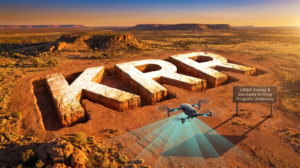
The June Exploration Programme — What's Coming and When
KRR has laid out a clear, near-term action plan designed to convert the volumetric findings into defined exploration value. The two major programmes are expected to operate concurrently, maximising operational efficiency on site.
| Programme | Timing | Objective |
|---|---|---|
| Stockpile Drill Programme | Early June 2026 | Test grade distribution and economic potential of 467,659 m³ of surface material |
| High-Resolution Magnetic Survey | First half of June 2026 | Refine primary mineralisation targets at depth (rescheduled from earlier timing due to third-party equipment delay) |
| Structural Integration | Ongoing into June | Merge magnetic data with LiDAR DTM to define deep targets at Excelsior and Mindoolah Main Reef |
Site preparation is already complete. During March 2026, KRR carried out comprehensive earthworks, cleaned up historical waste dumps, and improved site-wide accessibility — meaning the June programmes can proceed without logistical delays.
The magnetic survey data will be integrated with the LiDAR-derived DTM to target structural intersections beneath the Excelsior and Mindoolah Main Reef pits. These are areas where KRR believes the most significant hard-rock gold mineralisation may exist but has never been properly tested.
The Investment Case — Why This Announcement Changes the Conversation
The significance of this update is not simply in the grab sample grades, though those are compelling. The deeper point is that KRR has applied modern technology to a historically under-documented project and revealed that the conventional understanding of Mindoolah's scale has likely been wrong.
Consider the following key points:
-
The reconciliation gap is substantial. A difference of approximately 339,000 tonnes between physically excavated material and officially reported production from just one active mining period (1986–1989) is a material finding. The historical record accounted for only 11% of what was actually moved.
-
The project has a long production history. Historical records compiled by KRR document over 6,100 oz Au produced from the Mindoolah Mining Centre across multiple operations dating as far back as 1901, including underground grades averaging 11.4 g/t Au at Mindoolah Main Reef and 35.1 g/t Au at Boggy Days.
-
The exploration gaps are structural, not geological. At Excelsior, no one has ever drilled beneath the pit floor or in the east-west orientation required to properly test the interpreted mineralised structures. At Cundy and Bertram's, KRR believes historical pit orientations were misaligned with the true lode direction. These are solvable problems with modern, targeted drilling.
-
There is an immediate near-term catalyst. The King River Resources Mindoolah Gold Project LiDAR results and stockpile drilling plans will provide the first systematic, drill-based evaluation of the approximately 746,000 tonne stockpile inventory — data that does not currently exist.
-
The project is 100% owned. Mindoolah is held through KRR's wholly-owned subsidiary Auradoolah Pty Ltd, meaning the company retains full exposure to any value demonstrated through the upcoming programmes.
Historical Production Summary — Mindoolah Mining Centre
| Period | Operation | Ore Crushed (t) | Grade (g/t Au) | Gold Produced (oz) |
|---|---|---|---|---|
| 1907–1908 | Mindoolah Main Reef UG | 337.00 | 11.40 | 123.57 |
| 1907–1910 | Excelsior GML 1768 | 638.50 | 16.07 | 329.99 |
| 1940–41 | Le Soleil GML 1624 | 294.00 | 31.76 | 300.24 |
| 1986–1988 | Open Pit (Annual) | ~38,589 | 2.44 | ~3,023 |
| Total (all periods) | ~42,251 | 4.50 (avg) | ~6,107 |
Source: Balde Exploration Consultants (1985) and MINEDX (2026) as cited in KRR announcement.
Geological Context and Regional Significance
Mindoolah is located in the Murchison Province of Western Australia, approximately 70km north-west of Cue. This region has a well-established track record as a gold-producing area, with numerous operating and historical mines demonstrating the area's mineral endowment.
The geological setting comprises volcano-sedimentary greenstone sequences intruded by Archaean granitoids within the Youanmi Terrane. Gold mineralisation at Mindoolah is primarily hosted within quartz veining systems developed in felsic to intermediate intrusive rocks — a geological framework similar to other successful gold deposits throughout the Murchison Province.
The structural controls identified through the King River Resources Mindoolah Gold Project LiDAR results suggest that mineralisation follows predictable patterns related to contact zones between different rock types and structural intersections. This provides a systematic framework for future exploration targeting.
The next major ASX story will hit our subscribers first
Why Investors Should Keep a Close Eye on KRR
Mindoolah is shaping up as a project where the standard historical narrative has been fundamentally reassessed by new technical work. However, the next few months of drilling and geophysics will either validate or challenge that reassessment in a concrete, quantifiable way.
The combination of a large surface stockpile inventory with confirmed high-grade surface samples, a series of structurally underexplored pits with no systematic depth testing, and an imminent dual-programme exploration schedule creates a compelling pipeline of potential newsflow in the near term.
The Murchison Province has a well-established track record as a gold-producing region. Mindoolah's multi-prospect layout across historically high-grade workings places KRR in a position where systematic modern exploration — something that has genuinely not been applied to this project before — has the potential to redefine the asset's scale entirely.
Key Takeaway: King River Resources has used modern LiDAR technology to expose a significant gap between what historical records show was mined at Mindoolah and what was physically excavated from the ground. With approximately 746,000 tonnes of surface stockpiles confirmed on site, high-grade grab samples up to 10.0 g/t Au, and five structurally underexplored prospects — including an Excelsior pit that has never been drilled beneath its floor — the upcoming June 2026 programmes represent a genuine inflection point for this Murchison Province gold asset.
Want to Be First When the Next Major ASX Gold Discovery Hits?
Discovery Alert's proprietary Discovery IQ model scans ASX announcements in real time, instantly identifying high-potential mineral discoveries like those emerging across the Murchison Province — converting complex exploration data into clear, actionable investment insights. Explore how historic ASX discoveries have delivered extraordinary returns on Discovery Alert's dedicated discoveries page, then start your 14-day free trial to ensure you're positioned ahead of the market when the next significant find is announced.