July 28, 2026
The Technical Foundation of Modern Geological Sensing
Advances in electromagnetic spectrum analysis have transformed how mining companies identify subsurface mineral deposits across continental-scale territories. Modern exploration programs increasingly depend on orbital platforms that capture radiation signatures invisible to ground-based surveys, with satellite imagery in mineral exploration fundamentally altering the economics of early-stage mineral discovery.
The shift toward space-based geological assessment reflects both technological maturation and economic necessity. Traditional field surveys require substantial human resources and equipment mobilisation, often costing thousands of dollars per day in remote locations. Furthermore, satellite-based alternatives provide preliminary geological intelligence that enables exploration teams to focus their limited resources on the most promising targets.
Electromagnetic Spectrum Detection Capabilities
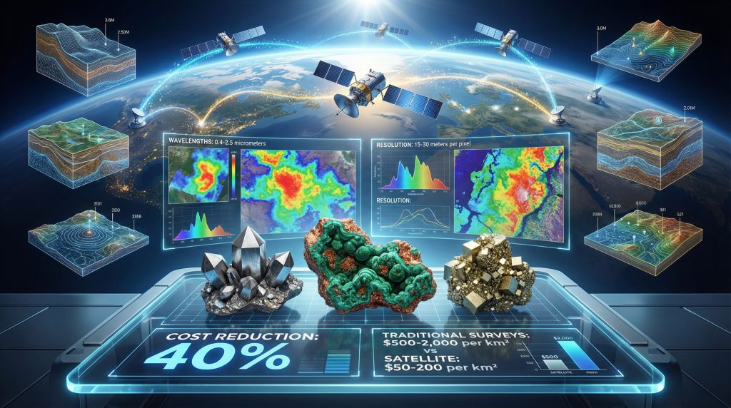
Multispectral sensors aboard commercial satellites record reflected solar radiation across carefully selected wavelength bands, each revealing different aspects of surface mineralogy. These systems capture data in the visible spectrum (0.4-0.7 micrometers), near-infrared (0.7-1.3 micrometers), and short-wave infrared regions (1.3-2.5 micrometers), where many rock-forming and alteration minerals exhibit distinctive absorption features.
Standard Satellite Specifications:
- Spatial resolution: 15-30 metres per pixel for regional assessments
- Spectral bands: 8-15 discrete wavelength channels
- Revisit frequency: 16-day orbital cycles for temporal monitoring
- Swath width: 60-185 kilometres for efficient area coverage
Hyperspectral systems represent the next technological tier, recording hundreds of narrow spectral bands that enable precise mineral identification at the molecular level. These advanced sensors can distinguish between clay mineral species (kaolinite versus montmorillonite) and identify specific iron oxide phases that indicate different stages of weathering and alteration.
| Platform | Spectral Channels | Resolution Range | Primary Applications |
|---|---|---|---|
| Landsat 9 | 11 bands | 15m-100m | Continental mapping |
| ASTER | 14 bands | 15m-90m | Regional alteration studies |
| WorldView-3 | 16 bands | 1.2m-7.5m | Detailed target analysis |
When big ASX news breaks, our subscribers know first
Computational Pattern Recognition in Geological Analysis
Machine learning algorithms process satellite imagery through sophisticated mathematical models that identify geological patterns beyond human visual interpretation capabilities. Convolutional neural networks, successfully implemented in mineral exploration since 2014, automatically recognise spectral signatures associated with specific mineral assemblages and geological structures.
Industry adoption of artificial intelligence reflects practical operational needs rather than technological novelty. Additionally, companies have utilised deep learning tools for over a decade to automate preliminary target screening, allowing scarce geological expertise to focus on high-priority prospects rather than regional reconnaissance.
Computational Processing Workflow:
- Atmospheric correction: Removal of water vapour and aerosol interference
- Geometric rectification: Precise geographic registration and orthorectification
- Spectral calibration: Conversion to surface reflectance values
- Feature extraction: Automated identification of geological patterns
- Classification algorithms: Statistical assignment of mineral probabilities
- Validation protocols: Comparison with known geological controls
Support vector machines and random forest algorithms excel at handling the high-dimensional spectral data typical of hyperspectral sensors. These mathematical approaches can process thousands of wavelength measurements simultaneously, identifying subtle spectral combinations that indicate specific mineral assemblages or alteration processes.
Spectral unmixing techniques mathematically separate mixed pixel signatures into constituent mineral components. Consequently, this computational approach reveals subsurface geology in areas where surface weathering or vegetation obscures direct mineral detection, extending satellite capabilities into challenging environmental conditions.
How Does Satellite Technology Detect Hydrothermal Systems?
Satellite sensors excel at mapping hydrothermal alteration zones that surround many economically important mineral deposits. These alteration halos often extend hundreds of metres to several kilometres from ore bodies, creating detectable spectral signatures that persist long after the original hydrothermal activity ceased.
Alteration Mineral Assemblages:
- Argillic zones: Clay mineral formations including kaolinite and montmorillonite
- Phyllic alteration: Sericite-quartz associations indicating moderate-temperature fluid activity
- Propylitic signatures: Chlorite-epidote mineral combinations from lower-temperature alteration
- Advanced argillic: Alunite-pyrophyllite assemblages from high-sulfidation systems
Each alteration type exhibits characteristic absorption features in specific wavelength regions, enabling systematic mapping of hydrothermal footprints across large areas. Short-wave infrared sensors prove particularly effective for detecting hydroxyl-bearing minerals (clays, micas, amphiboles) that form during fluid-rock interaction processes.
Moreover, hyperspectral satellite systems provide unprecedented detail in mineral identification, enabling geologists to distinguish between closely related clay species and alteration intensities.
Clay mineral detection relies on diagnostic absorption features at 1.4, 1.9, and 2.2 micrometers, where different species exhibit subtle but measurable spectral variations that enable species-level identification.
What Role Does 3D Analysis Play in Structural Geology?
Stereo satellite imagery generates precise three-dimensional terrain models that reveal structural controls on mineralisation. Digital elevation data exposes fault systems, fracture networks, and lithological contacts that focus ore-forming fluids, providing critical exploration vectors for target generation.
Lineament analysis identifies linear geological features including faults, dykes, and bedrock contacts that often control ore deposit locations. Statistical analysis of lineament orientations reveals regional stress patterns and structural domains that guide exploration strategy development. Furthermore, 3D geological modelling enhances these satellite-derived structural interpretations by integrating multiple data sources.
Topographic analysis also reveals geomorphological indicators of mineralisation, including resistant silicified zones that form elevated ridges and gossanous areas where sulfide oxidation creates distinctive iron-stained surfaces visible in satellite imagery.
Commodity-Specific Detection Methodologies
Different mineral commodities exhibit varying degrees of detectability through satellite-based methods, depending on their geological settings, surface expression, and spectral characteristics. Iron ore deposits demonstrate excellent satellite detection potential due to their distinctive red colouration and strong absorption features at specific wavelengths.
Iron Ore Characteristics:
- Strong absorption at 0.87 and 1.25 micrometers due to ferric iron
- Distinctive red-brown colouration in natural colour imagery
- High spectral contrast with surrounding rock types
- Minimal vegetation masking in many iron formation terranes
Copper mineralisation detection relies primarily on associated alteration assemblages rather than direct metal detection. Porphyry copper systems create extensive alteration zones with distinctive clay mineral and iron oxide signatures detectable across multiple spectral bands.
Gold exploration presents greater challenges since gold rarely exhibits direct spectral signatures. Detection methods focus on pathfinder minerals (pyrite, arsenopyrite, quartz) and structural controls (fault intersections, shear zones) that concentrate gold mineralisation.
Detection Success Factors by Commodity:
| Commodity | Primary Detection Method | Environmental Constraints | Validation Requirements |
|---|---|---|---|
| Iron Ore | Direct spectral signature | Vegetation cover | Minimal |
| Copper | Alteration mineralogy | Climate, topography | Moderate |
| Gold | Structural analysis | Overburden thickness | Extensive |
| Rare Earth Elements | Host rock identification | Complex geology | High |
Vegetation stress analysis provides an indirect exploration method for various commodities. Plants growing above metal-enriched soils often exhibit chlorophyll reduction and altered growth patterns visible in near-infrared imagery, particularly for elements toxic to vegetation including copper, zinc, and nickel.
Integrated Exploration Workflow Development
Modern mineral exploration programs integrate satellite imagery in mineral exploration with traditional geological methods through systematic multi-stage workflows that maximise cost-effectiveness and technical success rates. This integration approach recognises that remote sensing provides screening and targeting capabilities rather than definitive ore body delineation.
In addition, the integration of data-driven mining operations with satellite-based exploration creates comprehensive analytical frameworks that optimise resource allocation and decision-making processes.
Field validation remains absolutely necessary, but satellite data enables deployment of ground crews in a much more targeted and efficient manner.
Multi-Phase Integration Strategy:
Phase 1: Regional Reconnaissance
- Continental-scale mineral potential assessment
- Geological province characterisation
- Preliminary target ranking and prioritisation
Phase 2: Prospect-Scale Analysis
- High-resolution imagery acquisition
- Detailed spectral interpretation
- Structural geology refinement
Phase 3: Ground Validation
- Field verification of satellite anomalies
- Systematic geochemical sampling
- Geophysical survey integration
Since 2005, operational companies have completed over 300 alteration mapping projects across more than 75 countries, demonstrating the practical scalability of satellite-based exploration support. This operational track record indicates mature technology deployment rather than experimental applications.
Cloud-based data integration platforms increasingly combine satellite imagery with geological databases, geochemical results, and geophysical surveys in unified analytical environments. These systems enable rapid correlation analysis between different data types and facilitate collaborative interpretation among distributed exploration teams.
What Are the Current Technical Limitations?
Atmospheric interference presents persistent challenges for optical satellite systems. Cloud cover blocks solar radiation necessary for multispectral analysis, while water vapour absorption affects spectral measurements in specific wavelength regions critical for mineral identification.
Environmental Constraints:
- Cloud cover: Limits data acquisition to clear-sky conditions
- Seasonal variations: Affects illumination angles and atmospheric conditions
- Vegetation masking: Dense forest canopies obscure geological signatures
- Topographic shadows: Steep terrain creates data gaps in mountainous regions
Vegetation presents particularly challenging obstacles in tropical and temperate forest environments. Dense canopy cover prevents electromagnetic radiation from reaching bedrock surfaces, requiring alternative approaches including radar systems that penetrate vegetation or seasonal timing when deciduous vegetation is minimal.
Synthetic Aperture Radar (SAR) provides complementary capabilities in vegetation-masked terranes by penetrating forest canopies through longer wavelength electromagnetic radiation. However, SAR interpretation requires specialised expertise and provides structural information rather than direct mineral detection.
Emerging Technology Developments
Small satellite constellations represent a significant technological shift in Earth observation capabilities. Commercial operators deploy hundreds of small satellites that provide daily global coverage at sub-metre resolution, enabling near real-time monitoring of exploration activities and environmental changes.
Machine learning automation continues expanding across exploration workflows, from initial data acquisition through final target recommendations. Consequently, AI in drilling and blasting demonstrates similar transformative potential in operational mining phases.
Furthermore, these systems reduce human interpretation time whilst maintaining geological accuracy, addressing industry concerns about scarce technical expertise. Quantum sensor development promises substantial improvements in spectral resolution and signal-to-noise ratios, though commercial deployment timelines remain uncertain.
The next major ASX story will hit our subscribers first
Economic Analysis Framework for Satellite Applications
Cost-benefit analysis demonstrates substantial economic advantages for satellite-guided exploration programs compared to traditional approaches. Ground-based reconnaissance surveys typically require extensive logistical support and personnel deployment, particularly in remote locations where most undiscovered mineral deposits likely exist.
Traditional Exploration Costs:
- Personnel deployment: $2,000-5,000 per day per geological team
- Equipment mobilisation: $50,000-200,000 per regional campaign
- Logistics support: $1,000-3,000 daily for remote area operations
- Safety protocols: Additional 20-30% cost premium in challenging terrain
Satellite-based alternatives significantly reduce these operational expenses through preliminary screening that eliminates low-priority targets before expensive field deployment. Companies report 3-5x return on investment when satellite guidance prevents unsuccessful drilling programmes by identifying geological settings unfavourable for mineralisation.
Satellite Cost Structure:
- Image acquisition: $5-50 per square kilometre depending on resolution
- Processing and interpretation: $10-100 per square kilometre
- Ground validation: 60-80% reduction in field time requirements
Time-to-decision metrics provide additional economic value through accelerated exploration timelines. Research into satellite-based mineral mapping indicates that satellite data enables preliminary assessments within weeks rather than months required for ground-based regional surveys, improving project cash flow and reducing holding costs for exploration properties.
The shift toward artificial intelligence in target ranking and workflow automation stretches scarce technical labour resources by automating routine interpretation tasks. This efficiency gain proves particularly valuable given global shortages of experienced exploration geologists and increasing competition for technical expertise.
Environmental Monitoring and Regulatory Compliance
Satellite platforms provide continuous environmental baseline monitoring throughout exploration phases, tracking vegetation health, water quality indicators, and land use changes that support environmental impact assessments and regulatory compliance requirements.
Sustainability Applications:
- Biodiversity assessment: Habitat mapping and species distribution analysis
- Water resource monitoring: Surface water extent and quality indicators
- Vegetation health: Chlorophyll content and stress indicators
- Land use tracking: Human activity and infrastructure development
Government agencies increasingly require satellite-based environmental monitoring as standard permit conditions for exploration activities. This regulatory trend creates additional market drivers for space-based technologies beyond traditional geological applications.
Carbon footprint reduction represents another sustainability benefit through optimised field programmes that minimise helicopter transport and reduce on-ground equipment requirements. Companies can quantify these environmental improvements through satellite-documented travel reduction and equipment deployment optimisation.
Community engagement benefits from transparent monitoring capabilities that provide objective documentation of exploration activities and environmental conditions. For instance, satellite imagery offers visual evidence of responsible exploration practices and environmental stewardship that supports social licence to operate.
Future Market Dynamics and Technology Integration
The global satellite imagery in mineral exploration market continues expanding as technology costs decrease and analytical capabilities improve. Commercial space companies compete aggressively on price and service delivery, driving down access costs for exploration companies of all sizes.
Artificial intelligence automation will likely eliminate many routine interpretation tasks currently requiring specialised geological expertise. However, this technological advancement enables geologists to focus on higher-value analytical work and complex geological interpretation that requires human judgment and experience.
Integration with other exploration technologies including drone surveys, ground-penetrating radar, and geochemical databases creates comprehensive analytical platforms that leverage multiple data types for improved target generation and risk assessment. Additionally, mining industry innovation continues driving these technological convergences.
Market Projections:
- Continued cost reduction in satellite data acquisition
- Improved spectral resolution and temporal coverage
- Enhanced machine learning algorithms for geological interpretation
- Greater integration with traditional exploration methods
The practical emphasis on satellite imagery in mineral exploration reflects operational maturity rather than speculative technology deployment. Companies with over 1,300 completed mine-site surveys since 2005 demonstrate proven commercial viability and operational scalability.
Furthermore, emerging opportunities in asteroid mining advances may eventually extend these Earth-based satellite techniques to space-based resource exploration, representing the ultimate evolution of remote sensing technologies in mineral exploration.
This analysis is based on available technical information and industry reports. Exploration investments involve substantial risk, and satellite data provides preliminary indication rather than definitive proof of mineral deposits. Professional geological assessment remains essential for all exploration decisions.
Ready to Spot the Next Major Mineral Discovery?
Discovery Alert's proprietary Discovery IQ model delivers real-time alerts on significant ASX mineral discoveries, instantly empowering subscribers to identify actionable opportunities ahead of the broader market. Understand why historic discoveries can generate substantial returns by visiting Discovery Alert's dedicated discoveries page and begin your 14-day free trial today to position yourself ahead of the market.