June 29, 2026
How Advanced Sensor Technologies Transform Desert Mineral Detection
Egypt's comprehensive aerial geophysical survey initiative demonstrates the evolution of modern exploration science. The aerial survey deal with X-Calibur incorporates multiple detection methodologies that penetrate surface obstacles and reveal subsurface geological structures across six distinct geographical areas. This marks the country's first systematic aerial survey in over four decades, positioning Egypt to compete effectively with established African mining jurisdictions.
Modern airborne geophysical platforms integrate magnetometry sensors that detect magnetic field variations caused by different mineral compositions. These systems can identify iron ore deposits, volcanic-hosted massive sulfide systems, and structural controls that guide gold mineralisation. Furthermore, electromagnetic survey equipment penetrates desert sands to map conductive zones associated with copper-bearing sulfides and graphite deposits.
Key Detection Capabilities:
- Magnetometry: Identifies ferrous minerals and structural geology to depths exceeding 500 metres
- Radiometric analysis: Maps uranium, thorium, and potassium distributions indicating alteration zones
- Electromagnetic surveying: Detects conductive minerals including copper sulfides and graphite
- Gravimetric measurements: Reveals density contrasts associated with massive sulfide deposits
The integration of these technologies with Egypt's Nuclear Materials Authority aircraft demonstrates how institutional collaboration maximises survey effectiveness whilst minimising costs. Additionally, DroneTech's specialised equipment provides high-resolution data collection capabilities that complement broader-scale fixed-wing aircraft coverage.
When big ASX news breaks, our subscribers know first
Why Multi-Platform Integration Optimises Geological Intelligence
The Egyptian survey strategy employs complementary aircraft platforms to address varying terrain accessibility and data resolution requirements. Fixed-wing aircraft cover extensive areas rapidly, whilst helicopter-mounted sensors access mountainous terrain and provide detailed follow-up surveys. Consequently, drone-based systems deliver ultra-high-resolution data over specific targets identified during broader surveys.
Survey Platform Comparison:
| Platform Type | Coverage Rate | Data Resolution | Weather Sensitivity | Cost Efficiency |
|---|---|---|---|---|
| Fixed-wing aircraft | 500-800 km²/day | Medium-high | Low | Excellent |
| Helicopter systems | 100-200 km²/day | Very high | Medium | Moderate |
| Drone platforms | 20-50 km²/day | Ultra-high | High | Variable |
| Satellite remote sensing | 1000+ km²/day | Low-medium | Very low | Low per km² |
This multi-platform approach enables data quality validation through overlapping coverage whilst optimising operational costs. Historical geological data integration provides baseline context, allowing modern surveys to build upon four decades of accumulated knowledge rather than starting from zero.
Advanced data fusion algorithms process multiple sensor outputs simultaneously, creating comprehensive geological models that individual technologies cannot achieve. In addition, this integration reveals complex mineral systems where different commodities occur together, such as copper-gold porphyry systems or rare earth element-bearing carbonatites.
Which Geological Provinces Offer Maximum Investment Returns
Egypt's survey covers six geographical areas with distinct geological characteristics and mineralisation styles. Each province presents unique investment opportunities based on commodity types, infrastructure access, and development complexity.
Eastern Desert Precambrian Complex
The Eastern Desert contains Precambrian basement rocks hosting significant gold, copper, and rare earth element potential. Ancient mining sites indicate historical production, but 3D geological modelling techniques reveal substantially larger resources than previously recognised. For instance, orogenic gold deposits occur along shear zones, whilst volcanogenic massive sulfide systems contain copper-zinc mineralisation.
Archaeological evidence suggests extensive historical gold mining, with modern geochemical analysis indicating high-grade zones remain unexplored. However, porphyry copper systems associated with calc-alkaline intrusions present large-scale development opportunities requiring substantial capital investment but offering long-term production potential.
Western Desert Sedimentary Basins
Phosphate deposits within Cretaceous and Paleogene formations represent Egypt's most significant bulk commodity opportunity. Current production centres require expansion, whilst unexplored areas contain substantial additional resources. Moreover, iron ore formations associated with these sedimentary sequences offer domestic steel industry supply security.
Industrial minerals including limestone, gypsum, and silica sand occur throughout the province. These commodities support construction and manufacturing industries whilst requiring lower capital investment than metallic mineral operations. Furthermore, transportation infrastructure connecting to Mediterranean ports enhances export economics significantly.
Sinai Peninsula Geological Bridge
Sinai's unique position between African and Asian geological provinces creates distinctive mineralisation patterns. Copper deposits associated with Precambrian volcanic sequences offer high-grade resources suitable for small-to-medium scale operations. Additionally, manganese oxide deposits provide strategic metal supplies for steel production.
The peninsula's geological complexity results from multiple tectonic events that concentrated metals through successive mineralisation episodes, creating opportunities for polymetallic deposits containing several valuable commodities.
Construction materials including dimension stone and aggregates support regional infrastructure development whilst generating steady revenue streams. These commodities require minimal processing but benefit from proximity to major population centres.
How Institutional Reform Enables Investment Attraction
The Egyptian Mineral Resources Authority's transformation into an independent economic entity removes bureaucratic constraints that previously deterred international investment. This structural change provides operational flexibility essential for complex exploration partnerships and rapid decision-making processes.
EMRA's enhanced autonomy enables direct contract negotiations with exploration companies whilst maintaining technical oversight standards. The authority can now retain revenue from successful projects, creating financial incentives for effective resource development rather than depending entirely on government budget allocations.
Institutional Benefits:
- Streamlined permitting processes reducing project development timelines
- Enhanced contract flexibility accommodating various partnership structures
- Direct revenue retention creating performance incentives
- Autonomous decision-making capability responding quickly to market opportunities
The collaboration between EMRA, the Nuclear Materials Authority, and private companies demonstrates how institutional reform facilitates public-private partnerships. This framework leverages government assets and expertise whilst incorporating commercial technology and operational efficiency.
International mining companies require regulatory certainty and consistent policy implementation. EMRA's independent status provides confidence that agreements will be honoured across political transitions, reducing sovereign risk premiums that previously inflated project financing costs.
What Technology Integration Strategies Maximise Survey Value
Egypt's aerial survey deal with X-Calibur employs sophisticated data‐driven mining methodologies that combine modern high-resolution measurements with historical geological databases. This approach maximises return on investment by building upon existing knowledge rather than duplicating previous work.
Real-time data processing during flight operations enables immediate quality control and adaptive survey strategies. When sensors detect anomalous readings, flight paths can be modified to provide additional detail over promising areas. Consequently, this flexibility significantly improves exploration efficiency compared to rigid survey grids.
Data Integration Framework:
- Historical data compilation – Assembling four decades of geological surveys, mining reports, and academic research
- Satellite imagery analysis – Processing multi-spectral data revealing surface geological features and alteration zones
- Flight data acquisition – Systematic coverage using predetermined flight line spacing and sensor parameters
- Real-time processing – Immediate data quality assessment enabling adaptive survey modifications
- Comprehensive modelling – Integration of all datasets creating unified geological interpretations
Advanced algorithms identify subtle patterns across multiple datasets that individual analysis methods cannot detect. Machine learning systems recognise geological signatures associated with specific mineral deposit types, focusing attention on areas with highest discovery potential.
Cloud-based data storage and processing enable international collaboration whilst maintaining data security. Exploration companies worldwide can access survey results through secure platforms, accelerating investment decision timelines and reducing due diligence costs.
How Regional Competition Dynamics Influence Investment Flows
North African mining investment traditionally concentrated in Morocco's phosphate operations, Algeria's hydrocarbon sector, and South Africa's established mining districts. Egypt's modernised geological database positions the country to capture larger shares of exploration budgets allocated to the region.
International mining companies increasingly diversify geographic exposure to reduce political and operational risks. Egypt's survey results provide the geological confidence necessary for major capital commitments whilst the country's infrastructure and proximity to European markets offer competitive advantages.
Regional Investment Factors:
| Country | Primary Attractions | Investment Challenges | Infrastructure Quality |
|---|---|---|---|
| Morocco | Established phosphate industry | Limited mineral diversity | Excellent |
| Algeria | Hydrocarbon resources | Regulatory complexity | Good |
| Egypt | Geological diversity | Historical underinvestment | Developing |
| South Africa | Mineral variety | Political uncertainty | Excellent |
Supply chain diversification pressures following recent global disruptions create opportunities for new mineral suppliers. Egypt's survey data enables rapid resource assessment, potentially shortening development timelines compared to grassroots exploration programmes requiring multiple years of field work.
European Union critical mineral strategies emphasise supplier diversification away from single-source dependencies. Egypt's proximity to European markets and political stability relative to other African regions position the country favourably for strategic mineral supply agreements.
The next major ASX story will hit our subscribers first
Which Risk Mitigation Strategies Support Long-Term Investment
Egypt's established mining permitting guide provides legal frameworks protecting investor interests whilst ensuring environmental and social compliance. Recent institutional reforms demonstrate government commitment to sector development through concrete policy changes rather than rhetoric alone.
Infrastructure alignment between survey areas and existing transportation corridors reduces capital requirements for mine development projects. This strategic positioning accelerates project economics by eliminating expensive infrastructure construction phases that often delay mining operations.
Risk Mitigation Elements:
- Legal certainty through established mining laws and consistent regulatory interpretation
- Infrastructure compatibility reducing project development costs and timelines
- Political stability maintaining policy continuity across governmental transitions
- Technical expertise combining international best practices with local geological knowledge
The survey's comprehensive coverage eliminates exploration risk associated with incomplete geological understanding. Detailed subsurface mapping enables accurate resource estimates and confident feasibility assessments, reducing the probability of development surprises that inflate project costs.
Financial institutions require detailed geological data before approving mining project financing. Egypt's aerial survey deal with X-Calibur provides the technical documentation necessary for international development banks and commercial lenders to assess project viability accurately.
What Investment Strategies Optimise Risk-Adjusted Returns
Staged development approaches beginning with high-confidence deposits enable capital deployment optimisation whilst maintaining expansion optionality. Initial operations generate cash flow supporting exploration of additional targets identified through the aerial survey.
Joint venture partnerships between Egyptian institutions and international mining companies distribute risks whilst combining complementary capabilities. Local partners provide geological knowledge and regulatory expertise, whilst international companies contribute technology, capital, and market access.
Strategic Investment Approaches:
- Phased development minimising initial capital exposure whilst maintaining growth potential
- Commodity diversification across multiple deposit types reducing market price volatility impacts
- Infrastructure sharing among multiple projects reducing individual development costs
- Technology partnerships accessing advanced processing methods improving resource utilisation
Portfolio approaches investing in multiple Egyptian projects simultaneously provide risk diversification whilst capitalising on comprehensive geological knowledge. This strategy enables optimisation across projects, transferring successful methodologies and sharing infrastructure investments.
Private equity models focusing on resource development rather than long-term operations can accelerate project advancement. These approaches develop deposits to production-ready status before transferring to larger mining companies, capturing development premiums whilst reducing operational complexity.
How Survey Results Influence Long-Term Resource Security
Comprehensive geological databases enable strategic resource planning extending beyond individual mining projects. Egypt can identify critical minerals essential for domestic industries whilst developing export capabilities in surplus commodities.
The country's geographic position facilitates regional mineral processing and trading hub development. Enhanced resource knowledge combined with existing infrastructure creates opportunities for value-added processing rather than raw material export exclusively.
Resource Security Benefits:
- Import substitution for materials currently purchased from international suppliers
- Export diversification beyond traditional petroleum-based revenues
- Supply chain resilience through domestic critical mineral production
- Regional leadership in specialised mineral processing and trading
Advanced processing technologies can extract multiple commodities from single ore sources, maximising resource utilisation whilst minimising environmental impacts. This approach generates higher revenues per ton of material processed compared to traditional single-commodity operations.
Strategic stockpiling programmes for critical minerals provide economic security during global supply disruptions. Egypt's enhanced geological knowledge enables identification of deposits suitable for government reserve accumulation supporting national security objectives.
What Timeline Considerations Affect Development Planning
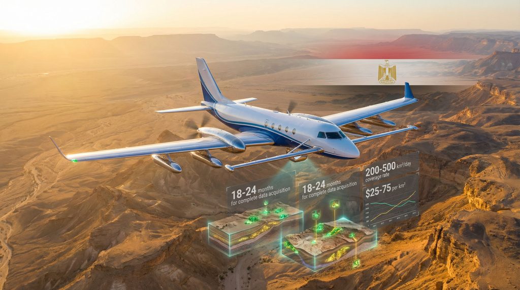
The multi-phase aerial survey requires 18-24 months for complete data acquisition and comprehensive analysis. However, preliminary results from priority areas become available within 12 months, enabling initial investment decisions for the most promising prospects.
Comprehensive geological databases significantly accelerate permitting processes by providing detailed environmental baseline data and resource characterisation. This preparation reduces typical project development timelines by 2-3 years compared to traditional exploration approaches.
Development Timeline Optimisation:
- Immediate phase (0-12 months) – Priority area survey completion and preliminary target identification
- Assessment phase (12-24 months) – Comprehensive data analysis and detailed target evaluation
- Development phase (24-48 months) – Project feasibility studies and permitting processes
- Construction phase (48-72 months) – Infrastructure development and production preparation
- Operational phase (72+ months) – Commercial production and expansion planning
Early engagement with international mining companies during survey execution enables rapid transition from geological assessment to project development. This parallel processing approach minimises delays between resource identification and commercial development.
Investment decision timelines accelerate significantly when comprehensive geological databases eliminate exploration uncertainty. Mining companies can focus on engineering and economic optimisation rather than fundamental geological risk assessment, reducing evaluation periods from years to months.
How Does This Initiative Impact the Future of Mining?
The aerial survey deal with X-Calibur represents a significant step in the mining industry evolution towards more sophisticated exploration methodologies. Furthermore, the integration of AI in mining operations with traditional aerial survey techniques demonstrates how technology is revolutionising resource discovery and development across the continent.
This analysis represents informed commentary on Egypt's aerial survey initiative and should not be considered investment advice. Mineral exploration involves substantial risks and potential returns vary significantly based on geological, technical, and market factors. Prospective investors should conduct independent due diligence and consult qualified professionals before making investment decisions.
Ready to Capitalise on Africa's Mining Transformation?
Discovery Alert's proprietary Discovery IQ model delivers real-time notifications on significant ASX mineral discoveries, empowering investors to identify actionable opportunities as advanced exploration technologies uncover new deposits across emerging markets. Explore historic examples of exceptional mining discovery returns and begin your 14-day free trial today to position yourself ahead of the market.