July 22, 2026
The Geological Profession Stands at a Crossroads It Did Not Choose
Every transformative technology in history has arrived with a promise and a warning folded into the same package. The steam engine reshaped labour. The computer rewired cognition. Now artificial intelligence is doing something subtler and, in some ways, more consequential: it is infiltrating the interpretive layer of scientific disciplines that have always relied on human judgement as their final safeguard. For the geological sciences, this moment demands something more than cautious enthusiasm.
It demands a structured, critical, and professionally governed response. The question of AI in geology and geologists stay in control of what it produces is no longer theoretical — it is unfolding inside drill programmes, hydrogeological assessments, resource estimation workflows, and academic literature synthesis tools.
When big ASX news breaks, our subscribers know first
What AI Can Actually Do Inside a Geological Workflow
Before assessing risks, it is worth being precise about where AI genuinely adds value, because overstating its capabilities is just as dangerous as dismissing them.
Machine learning classification methods can detect complex, multidimensional patterns across datasets of a scale and dimensionality that exceed what any human analyst can process manually. This is not a minor efficiency gain. In drill-core interpretation, grade modelling, orebody delineation, and geological mapping derived from remote sensing, AI in mineral exploration can surface non-linear relationships that would otherwise remain hidden within conventional statistical approaches.
Large language models, furthermore, offer geoscientists the ability to synthesise vast bodies of published literature rapidly, which can accelerate literature reviews and support reporting workflows. Pattern recognition algorithms applied to geophysical data can flag anomalies that warrant expert follow-up. Predictive modelling tools can assist with resource estimation by processing incomplete observational records in ways that complement traditional geostatistical methods.
The table below summarises the core AI application areas and their human oversight requirements:
| AI Application | Geological Use Case | Human Oversight Required |
|---|---|---|
| Machine learning classification | Drill-core interpretation and grade modelling | Yes, domain validation essential |
| Predictive modelling | Resource estimation and orebody delineation | Yes, QC and ground-truthing required |
| Large language models | Literature synthesis and reporting support | Yes, critical review of all outputs |
| Pattern recognition algorithms | Geological mapping from remote sensing | Yes, field verification mandatory |
| Anomaly detection | Geophysical data interpretation | Yes, expert judgement non-negotiable |
AI excels in geological contexts where data volumes are large, patterns are non-linear, and observations are incomplete. These are precisely the conditions that make traditional manual modelling most difficult, and also the conditions that most require experienced oversight.
Where AI Underperforms: The Conditions That Matter Most
The failure conditions are as instructive as the success conditions. AI reliability degrades sharply when deployed outside the conditions it was trained on. Sparse data environments, novel geological regimes, deep geological time with rare high-magnitude events, and situations where uncertainty is structurally irreducible all represent territory where algorithmic confidence can become actively misleading.
Geoscience is inherently interpretive. It works across deep time, incomplete observational records, and conditions that resist standardisation. These are not bugs in the geological workflow; they are fundamental features of the discipline. AI systems trained on well-characterised geological environments from one region may produce dangerously overconfident outputs when applied to undercharacterised terrain elsewhere.
Is AI a Replacement for Geological Expertise, or a Powerful Complement?
The augmentation argument is straightforward: AI makes geologists faster, not redundant. It extends interpretive reach without eliminating interpretive responsibility. The distinction matters enormously, because the alternative framing — that AI can eventually substitute for geological reasoning — leads organisations toward dangerous automation of decisions that require human accountability.
Evidence presented from seven case studies of AI deployment across African mining operations reveals a pattern that cuts across commodity type, mine scale, and application area. The finding is not that AI works everywhere or fails everywhere. The finding is that AI performs differently depending on the degree of uncertainty present in the geological environment and the level of operational control available. Furthermore, AI in mining operations demonstrates that the same principle applies across drilling and blasting contexts.
The four organisational factors that most consistently predict whether an AI deployment succeeds or fails in geoscience contexts are:
- Data reliability — the foundational constraint. Poor input data produces unreliable outputs regardless of model sophistication.
- Problem definition clarity — vague geological questions directed at AI systems produce ambiguous, unverifiable answers.
- Organisational readiness — the alignment of people, processes, and expectations before deployment, not after.
- Management alignment — the technology must fit the operating environment, not the other way around.
Most AI project failures in mining geoscience are organisational before they are technical. Data, people, processes, and expectations determine outcomes far more consistently than algorithmic design.
This finding has significant implications for how mining companies and exploration teams should approach AI procurement and implementation. The algorithm is rarely where the problem originates.
What Are the Ethical Risks of Using AI in Geoscience?
The ethical dimension of AI in geology and geologists stay in control of their outputs is underdiscussed relative to its technical dimension, yet it carries consequences that are just as material.
The Hallucination Problem and the Risk of Over-Trust
Large language models present a specific risk profile that makes them particularly dangerous when used without disciplined critical oversight. They can fabricate citations with apparent confidence. They can present internally coherent but factually incorrect geological information in a way that resembles credible synthesis. Critically, they tend toward opacity about their own reasoning processes.
Geoscience, as a discipline, treats uncertainty as a professional cornerstone. Expressing the limits of what can be inferred from available data is not a weakness in geological reporting; it is a professional requirement. AI systems, particularly LLMs, frequently invert this epistemic standard, projecting confidence where uncertainty should be explicit.
Large language models can display excessive confidence in their outputs while remaining opaque about their reasoning. In a discipline where uncertainty quantification is a professional obligation, this is a particularly dangerous combination.
The anthropomorphisation of AI outputs compounds this risk. When geoscientists begin treating AI-generated interpretations as if they originate from a reasoning agent with domain knowledge, the critical distance required for professional validation begins to erode. According to research published in ScienceDirect, this erosion of critical distance represents one of the most significant emerging risks in AI-assisted geoscientific workflows.
Data Privacy and the Confidentiality Risk
The privacy implications of LLM use in professional geoscience contexts are more acute than most practitioners appreciate. Survey data from across industries indicates that between 45% and 50% of employees admit to inputting confidential information into publicly accessible AI tools. In geological contexts, this means proprietary exploration datasets, resource estimates, drill results, and geological models may be processed by external systems without adequate consent frameworks.
The Broader Ethical Landscape
The table below maps the key risk categories facing geoscientists who deploy AI tools without adequate governance frameworks:
| AI Risk Category | Specific Concern | Mitigation Strategy |
|---|---|---|
| Hallucination | Fabricated citations and false analytical confidence | Critical review; verify all AI-sourced references independently |
| Data bias | Geographic and geological under-representation in training data | Audit training data provenance before deployment |
| Privacy breach | Confidential exploration data uploaded to public LLMs | Use local-hosted or open-weight models where appropriate |
| Agentic error propagation | Compounding mistakes in autonomous AI chains without transparency | Maintain human-in-the-loop checkpoints at each decision stage |
| Environmental cost | High energy and water consumption of large AI models | Select appropriately sized models matched to task requirements |
| Algorithmic colonisation | Geopolitical bias in data and model governance structures | Prioritise data sovereignty frameworks and local model options |
Agentic AI, where autonomous decision chains operate without human checkpoints, introduces a compounding error risk that is particularly difficult to audit after the fact. Each step in an agentic workflow can inherit and amplify the errors of previous steps without surfacing those errors transparently. In geological interpretation, where downstream decisions affect resource declarations, community engagement, and environmental approvals, this is not a theoretical concern.
What Does Responsible AI Use Look Like for Geoscientists?
The principle of consequential irreversibility provides a useful anchor for professional governance. Geological work has direct and often irreversible consequences for mineral resources, ecosystems, and communities. Algorithms are not accountable for those consequences. Qualified geoscientists are. This means the authority to sign off on any AI-assisted interpretation must remain with a qualified professional, regardless of how confident the AI output appears.
A responsible AI deployment checklist for practising geoscientists:
- Disclose which AI tools were used and for what specific purpose within the workflow
- Document model limitations and known risks associated with the tools applied
- Validate all AI outputs against field observations and independent domain expertise
- Ensure confidential exploration data is not uploaded to public-facing LLM platforms
- Apply appropriately sized models to reduce unnecessary environmental load
- Retain qualified geoscientist sign-off authority over all AI-assisted interpretations
Environmental considerations deserve more prominence in this conversation. The energy and water consumption associated with large AI models is substantial. Geoscientists who work professionally within environmental impact frameworks should apply the same analytical rigour to their AI tool selection that they apply to other resource consumption decisions.
South Africa's Critical Minerals Position and the Physical Foundation of the AI Economy
There is a dimension to the AI-geology relationship that rarely surfaces in technical discussions but carries enormous strategic weight. Every AI query, every smart sensor, every data centre relies on a physical supply chain that begins not in a server room but in the geological formations beneath the Earth's surface. Consequently, the growing critical minerals demand driven by the energy transition makes this supply chain increasingly strategic.
South Africa's position within that supply chain is extraordinary by any measure.
| Critical Mineral | South Africa's Global Share | Primary AI and Tech Application | Local Beneficiation Rate |
|---|---|---|---|
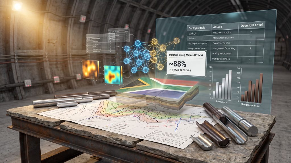
| Platinum Group Metals | Approximately 88% of global reserves | Fuel cells, sensors, AI hardware components | Approximately 3% processed locally |
| Manganese | Approximately 80% of global reserves | Battery storage, steel production | Approximately 14% processed locally |
The arithmetic of this situation is stark. South Africa sits at the geological foundation of the global AI hardware supply chain yet captures almost none of the value that flows from that position. High-value refining margins, specialised manufacturing employment, and geopolitical leverage in critical mineral governance all flow outward to China, the United States, and Europe.
The Beneficiation Gap and the Glass Substrate Opportunity
The cost calculus for closing part of this gap is more accessible than is commonly understood. Upgrading three existing local processing facilities to electronic-grade silica purity would cost less than the equivalent of one month of coal export revenue. Scaling Mintek's proven fly-ash rare earth element extraction process to industrial capacity would require approximately R2-billion, yet no budget allocation currently exists for either programme.
A less-discussed opportunity lies in the global chip industry's migration from silicon to glass core substrates. Glass substrates offer superior flatness, thermal stability, and reduce energy losses by approximately half compared to conventional silicon alternatives. A pilot glass substrate manufacturing line would cost roughly 1% of the approximately R1-trillion price of a silicon fabrication plant, making it a financially accessible entry point for a country that already possesses the relevant precision metallurgy expertise and high-purity silica deposits.
Selling Telemetry, Not Just Ore: A Sovereign Data Opportunity
Perhaps the most underexplored strategic opportunity involves South Africa's position as a holder of unique physical telemetry datasets. Global AI laboratories have exhausted much of the available structured digital content and are increasingly seeking real-world physical data to train next-generation models.
South Africa's deep-level mining operations have generated billions of hours of acoustic and seismic telemetry that has no equivalent anywhere else in the world. A sovereign analogue-to-digital data vault could license this resource to international AI laboratories in exchange for computing credits, hardware access, or structured technology transfer agreements, transforming a geological asset into a digital one.
The window for positioning within these emerging global supply chain and governance frameworks is estimated at approximately two years. The countries that shape these frameworks will capture their value. Those that delay will inherit their constraints.
The next major ASX story will hit our subscribers first
How Should Geologists Navigate the AI Transition Without Losing Professional Authority?
The framework for AI in geology and geologists stay in control requires clarity across three distinct operational tiers:
| Tier | Geologist Role | AI Role | Oversight Level |
|---|---|---|---|
| Data processing | Define parameters and data quality standards | Classify, sort, and identify patterns at scale | High, geologist sets all constraints |
| Interpretation support | Validate, contextualise, and critically challenge outputs | Surface candidate interpretations for review | High, geologist makes all final calls |
| Decision-making | Full accountability and professional sign-off | Provide probabilistic scenarios for consideration | Absolute, AI holds no decision authority |
Field validation cannot be automated. Techniques such as downhole geophysics, combined with direct physical observation, remain the bedrock of geological credibility. No machine learning output, however sophisticated its architecture, carries the epistemic weight of a geologist who has walked the ground, examined the core, and applied accumulated domain knowledge to an interpretive challenge.
Building AI literacy within the profession does not require surrendering geological judgement. It requires the opposite: developing enough technical understanding of how AI systems work to know precisely where their outputs should be trusted, where they should be challenged, and where they should be overridden. The AusIMM bulletin on AI in geological workflows reinforces this point, noting that confidence at every stage depends on the geoscientist remaining firmly in the interpretive lead.
Frequently Asked Questions: AI in Geology
Will AI Replace Geologists?
The evidence does not support a replacement thesis. AI augments the speed and scale of pattern detection but cannot replicate the interpretive reasoning, field experience, and professional accountability that define competent geological practice. The Geological Society of South Africa's AI in Geology conference proceedings reinforce this position consistently across multiple practitioner perspectives.
What Is the Biggest Risk of Using AI in Geological Interpretation?
The combination of over-trust and hallucination represents the most immediate professional risk. When geoscientists accept AI-generated outputs without rigorous critical review, and when those outputs contain fabricated citations or overconfident interpretations, the downstream consequences for resource declarations and environmental assessments can be severe.
How Should Geologists Disclose AI Use in Professional Reports?
Disclosure should specify which tools were used, for what purpose, what their known limitations are, and how their outputs were validated. Transparency is not optional; it is a professional obligation where AI-assisted interpretation informs consequential decisions. This applies equally to workflows involving interpreting drill results for investor reporting purposes.
What Types of Geological Problems Is AI Best Suited to Solve?
AI performs best in high-data-volume environments where patterns are non-linear, datasets are multi-source, and observations are incomplete in structured ways. Grade modelling, geophysical anomaly detection, and remote sensing classification are well-suited application areas.
How Does AI Perform When Applied to Geological Conditions It Wasn't Trained On?
Performance degrades significantly. This is one of the most practically important limitations for geoscientists working in undercharacterised regions or novel geological settings, and it is why field verification remains non-negotiable.
What Is Consequential Irreversibility in the Context of Geoscience AI?
It is the principle that geological decisions carry real-world consequences for resources, ecosystems, and communities that cannot always be undone. Because algorithms cannot be held professionally accountable for those consequences, a qualified geoscientist must retain sign-off authority over all AI-assisted work.
Key Takeaways: Navigating the AI-Geology Relationship
The evidence assembled across technical applications, African mining case studies, ethical risk frameworks, and South Africa's strategic mineral position converges on a clear professional imperative. AI in geology adds genuine value, but only within governance structures that preserve human interpretive authority.
The geological profession is not facing a simple choice between adoption and resistance. It is facing a design challenge: how to embed AI capabilities into workflows in ways that amplify geological insight without eroding the professional standards that give geological outputs their credibility and legal standing.
Those who engage critically with AI — setting the questions, auditing the outputs, building the governance frameworks, and retaining interpretive authority — will shape how the technology develops within the discipline. The alternative, allowing AI tools to embed themselves into geological workflows without structured professional oversight, risks having the technology shaped around the profession rather than by it. The geological society has a foundational role to play in ensuring that geoscientists remain the architects of this transition, not simply its raw material.
Readers seeking additional perspectives on AI in geology and the evolving role of artificial intelligence across the mining and geoscience sectors may find value in related reporting from Engineering News, including coverage of the Geological Society of South Africa's AI in Geology conference proceedings at engineeringnews.co.za.
Want to Track the Next Major ASX Mineral Discovery Before the Broader Market Does?
Discovery Alert's proprietary Discovery IQ model scans ASX announcements in real time, instantly converting complex geological and commodity data across more than 30 minerals into clear, actionable insights — so investors can act on significant mineral discoveries the moment they are announced. Explore historic examples of major discovery returns and begin a 14-day free trial to position yourself ahead of the market.