August 20, 2026
The Subsurface Intelligence Revolution: How AI Is Reshaping Geophysics
The history of technological adoption in earth sciences follows a consistent arc. New tools arrive, professionals push back, and then the discipline quietly reorganises itself around the capability. Seismic reflection profiling, digital processing, 3D visualisation, satellite remote sensing — each was met with scepticism before becoming foundational. The arrival of AI in geophysics is following the same trajectory, but at a pace that compresses decades of adjustment into just a few years.
What makes this moment genuinely different from previous shifts is the scale of the data problem now confronting geophysicists. Modern exploration campaigns do not generate manageable volumes of interpretable information — they generate terabytes of multi-source data spanning seismic, magnetic, gravitational, electromagnetic, and geochemical surveys simultaneously.
Layered on top of this is a growing archive of historical exploration records accumulated over decades of activity across multiple geological provinces. The interpretive gap between data availability and human analytical capacity has become structurally unbridgeable without computational assistance.
When big ASX news breaks, our subscribers know first
Understanding the Structural Mismatch Between Data and Interpretation Capacity
This is the foundational problem driving adoption of AI in geophysics. It is not a preference for automation — it is a practical necessity created by the convergence of high-resolution acquisition technology, deep drilling programmes, and the digitisation of legacy exploration archives.
The traditional geophysical workflow was built around expert pattern recognition, iterative forward modelling, and time-intensive data cleaning. These methods remain scientifically valid — but they were designed for data volumes that no longer represent the industry norm. A single 3D seismic survey can now contain more interpretable information than a team of experienced geophysicists could meaningfully process within an economically relevant timeframe.
AI does not eliminate the need for geological expertise in this environment. However, what it does is compress the time required for the routine analytical tasks that currently occupy the majority of a practitioner's working hours, creating space for the higher-order reasoning that only human scientific judgement can provide. Senior geophysicists working in exploration settings have noted that the profession is experiencing a fundamental role transition — from primary data processor to critical interpreter and AI-system supervisor.
What Is AI in Geophysics? Core Methods and Applications
The term "AI in geophysics" encompasses a broad family of computational methods with quite different characteristics, strengths, and limitations. Understanding this distinction matters for geophysicists evaluating which tools are appropriate for specific subsurface problems.
| AI Method | Primary Application in Geophysics | Key Benefit |
|---|---|---|
| Machine Learning (ML) | Seismic facies classification, well-log analysis | Pattern recognition at scale |
| Deep Learning / Neural Networks | Fault detection, horizon picking, subsurface imaging | High-resolution interpretation |
| Physics-Informed Neural Networks (PINNs) | Full-waveform inversion, tomographic modelling | Physically constrained outputs |
| Foundation Models (multimodal) | Multi-physics data fusion | Cross-dataset generalisation |
| Supervised Classification | Lithology prediction from downhole logs | Faster reservoir characterisation |
A common misconception, particularly among professionals outside the field, is that AI applied to subsurface science operates similarly to consumer-facing products such as chatbots or image generators. In reality, it serves an entirely different function — identifying subtle patterns and structural relationships within enormous, multi-dimensional datasets that would require prohibitive time and resources to detect through manual analysis alone.
The Physics-AI Hybrid Paradigm
The most technically significant development in AI in mineral exploration is not machine learning in isolation. It is the emergence of Physics-Informed Neural Networks, or PINNs — architectures that embed established physical laws directly into machine learning model design.
Pure data-driven models present a serious problem in geophysical contexts: subsurface training data is expensive to obtain, and models trained on limited or geographically narrow datasets risk generating outputs that are statistically plausible but geologically implausible. PINNs address this by constraining model outputs using wave propagation equations, electromagnetic principles, and gravity physics — ensuring results are both computationally efficient and scientifically defensible.
"Physics-Informed AI represents a fundamental methodological advance because it combines the adaptive pattern recognition of machine learning with the scientific credibility of established physical laws. This hybrid approach is particularly critical in exploration contexts where poor predictions carry direct financial and environmental consequences."
Furthermore, this combination of data adaptability and physical constraint is now viewed by practitioners at major exploration organisations as the most promising near-term trajectory — not as a replacement for conventional physical modelling, but as a powerful complement to it. Research published by AGU Publications underscores the growing scientific credibility of physics-informed approaches in applied geophysics.
Where Is AI Being Deployed Across the Geophysics Discipline?
Seismic Interpretation and Subsurface Imaging
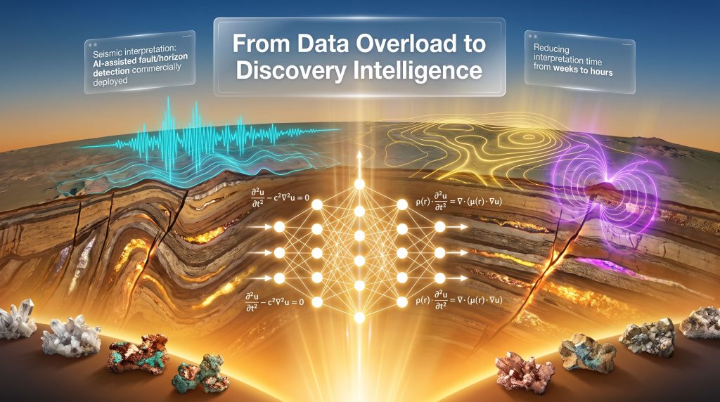
AI-assisted seismic interpretation represents the most commercially mature application currently in deployment. Deep learning models trained on large 3D seismic volumes can identify fault systems and stratigraphic traps — including subtle structural anomalies frequently missed in manual review — reducing interpretation timelines from weeks to hours.
Full-waveform inversion, a computationally intensive technique for building high-resolution subsurface velocity models, is being significantly accelerated through neural network integration. Improved velocity model accuracy translates directly into more precise drilling target definition, which has measurable consequences for both discovery probability and capital efficiency.
Well-Log Analysis and Reservoir Characterisation
Machine learning algorithms applied to wireline log data can estimate lithology, porosity, and fluid saturation with reduced dependence on core samples, which are expensive to acquire and analyse. Supervised classification models trained on legacy well databases are extending geological understanding into areas where no new drilling has occurred — effectively multiplying the value of existing data.
This capability is particularly significant for junior exploration companies operating with constrained budgets, where the cost of comprehensive coring programmes may be prohibitive. AI-driven log analysis creates an alternative pathway to reservoir characterisation that leverages historical data assets, and is increasingly paired with downhole geophysics techniques to further sharpen subsurface interpretation.
Earthquake Science, Seismic Hazard, and Phase Picking
AI-based seismic phase pickers have demonstrably outperformed traditional threshold-based detection algorithms in noisy recording environments, enabling identification of lower-magnitude events and producing more complete regional seismic catalogues. More complete catalogues improve statistical models of fault behaviour, which flows directly into probabilistic seismic hazard assessment used in infrastructure planning and engineering design.
It is worth noting an important distinction that is frequently blurred in public discussions: AI has substantially improved earthquake detection and hazard assessment capabilities. Earthquake prediction — the deterministic forecasting of event time, location, and magnitude — remains scientifically unresolved and faces fundamental physical constraints that current AI architectures have not overcome.
Multi-Physics Data Fusion for Critical Mineral Exploration
Among the most strategically significant current applications is the AI-driven integration of diverse geophysical datasets for mineral exploration targeting. Combining seismic, magnetic, gravity, magnetotelluric, and geochemical surveys through fusion frameworks enables identification of deposit signatures that no single survey type would reveal independently.
An underappreciated aspect of this capability is its application to historical exploration archives. Decades of analogue technical reports, geochemical databases, and legacy drill logs represent an enormous intelligence asset that has largely remained inaccessible in unstructured formats. Natural language processing and pattern recognition tools are now extracting structured geological insights from these archives at scale — generating new targeting intelligence without requiring new field acquisition expenditure.
Environmental Applications: Groundwater, Carbon Storage, and Engineering Geophysics
The value of AI in geophysics extends well beyond resource extraction. Resistivity and electromagnetic survey data, interpreted through AI frameworks, are being applied to groundwater resource mapping in water-stressed regions across sub-Saharan Africa, the Middle East, and Central Asia — directly addressing humanitarian resource security challenges.
Time-lapse seismic monitoring of subsurface CO₂ plume behaviour in carbon capture and storage projects represents another growing application area. Verifying that injected CO₂ remains within designated geological formations requires precise interpretation of subtle seismic changes over time — a task where AI-assisted analysis improves both speed and consistency.
The Real Limitations of AI in Geophysics: A Balanced Assessment
Data Quality Dependency
Critical Warning: AI systems applied to geophysical problems are only as reliable as the data used to train and operate them. Heterogeneous datasets with inconsistent acquisition parameters, mislabelled training examples, or unrepresentative sampling will produce unreliable outputs regardless of model sophistication or computational scale.
Geophysical datasets are frequently collected across different acquisition vintages, instrument configurations, and noise environments. Models trained on data from one geological province routinely underperform when applied to different terranes or survey geometries. Transfer learning approaches are being actively researched to improve cross-domain portability, but generalisation across geological settings remains a genuine and unresolved limitation.
The Geological Reasoning Gap
AI systems identify statistical patterns in data. They cannot interpret why those patterns exist in a geological context. Complex subsurface environments involving multi-phase deformation histories, diagenetic overprinting, fluid migration pathways, and tectonic overprinting require forms of scientific reasoning that current AI architectures cannot replicate.
This limitation is not a temporary technical deficiency that will be resolved by more powerful hardware. It reflects a fundamental difference between pattern matching and geological understanding. Human field experience, structural geological reasoning, and the capacity to evaluate geological plausibility under conditions of high uncertainty remain essential professional competencies that AI cannot substitute.
Uncertainty Quantification
A less frequently discussed but critically important challenge is the communication of model uncertainty. AI outputs presented without confidence measures create serious risks in exploration and hazard assessment contexts, where decision-makers need to understand not only what a model predicts but how reliable that prediction is likely to be. Developing AI systems that communicate uncertainty in ways that support, rather than override, expert judgement is an active and unresolved research priority.
Consequently, 3D geological modelling frameworks are increasingly being integrated with AI outputs to provide the spatial context needed for robust uncertainty communication to technical and non-technical stakeholders alike.
The Circularity Problem: AI Demands What Geophysics Must Discover
One of the more intellectually compelling dimensions of AI's relationship with geophysics is structural rather than technical. The data centre infrastructure underpinning large-scale AI computation requires substantial electricity, cooling water, copper for electrical systems, rare earth elements for server components, and semiconductor materials for processing chips. These are precisely the resource categories that geophysicists are being asked to use AI to locate more efficiently.
This creates a closed feedback loop: AI accelerates critical minerals demand while simultaneously providing geophysicists with more sophisticated tools to discover those minerals. It positions geophysics not merely as an applied scientific discipline but as a foundational component of the technology supply chain — with strategic relevance that extends well beyond traditional resource economics.
The global shift toward renewable energy infrastructure is intensifying this dynamic. Solar arrays, wind turbines, battery storage systems, and electrified transport networks require lithium, cobalt, nickel, copper, and rare earth elements at volumes that traditional exploration methods, operating at conventional speed, are unlikely to deliver within energy transition timelines. AI-assisted exploration is emerging as a practical mechanism for bridging this supply gap through faster, more evidence-based targeting — reducing unnecessary drilling while improving discovery probability.
The next major ASX story will hit our subscribers first
A Framework for Responsible AI Integration in Geophysics
Practical Steps for Geophysicists Adopting AI Tools
The professional question facing geophysicists is no longer whether AI has a legitimate role in the discipline. It is how to deploy it responsibly, transparently, and with appropriate understanding of its limitations. The following framework reflects the emerging consensus among research practitioners and industry specialists:
- Establish data quality baselines before deploying AI tools — model outputs are only as reliable as input data integrity
- Select AI methods appropriate to the specific geological problem — not all subsurface challenges benefit equally from the same algorithmic approach
- Apply physics-informed constraints wherever possible to prevent geologically implausible model outputs
- Maintain critical geological reasoning as the primary interpretive framework — AI outputs should inform, not override, expert judgement
- Quantify and communicate uncertainty in AI-assisted interpretations to support sound decision-making by geologists, engineers, and investors
- Invest in ongoing professional development to remain current with rapidly evolving AI methodologies and their geophysical applications
The Competency Profile of the Future Geophysicist
| Traditional Competency | AI-Enhanced Capability | Combined Value |
|---|---|---|
| Seismic interpretation | AI-assisted fault and horizon detection | Faster, higher-confidence structural mapping |
| Well-log analysis | ML-driven lithology prediction | Broader reservoir characterisation coverage |
| Geological reasoning | Pattern recognition across large datasets | Improved exploration targeting |
| Uncertainty assessment | Probabilistic AI output evaluation | More robust risk communication |
| Field data acquisition | AI-optimised survey design | Reduced acquisition cost and environmental impact |
Frequently Asked Questions: AI in Geophysics
Can AI replace geophysicists?
No. AI systems lack the geological reasoning, contextual field experience, and scientific judgement required to interpret complex subsurface environments. The most effective applications pair AI's computational speed and pattern recognition with the expertise of experienced geophysicists — each compensating for the limitations of the other.
What makes Physics-Informed AI different from standard machine learning?
Physics-Informed Neural Networks incorporate established physical laws — wave propagation equations, electromagnetic constraints, gravity models — directly into model architecture. This prevents the generation of geologically implausible outputs in scenarios where training data is limited, which is the norm rather than the exception in subsurface science.
How is AI changing mineral exploration economics?
By enabling more targeted drill programmes, AI-assisted exploration is reducing cost-per-discovery and decreasing the number of exploratory holes required to reach a viable target. Fewer drill holes mean lower capital expenditure, reduced land disturbance, lower water consumption, and smaller carbon footprints. Furthermore, interpreting drill results is becoming more efficient as AI tools help geoscientists extract greater value from each hole drilled — creating alignment between economic efficiency and environmental responsibility.
Is AI being used in earthquake prediction?
AI has significantly improved earthquake detection, seismic phase picking, and probabilistic hazard assessment. Deterministic earthquake prediction — specifying the precise time, location, and magnitude of a future event — remains scientifically unachieved and faces fundamental physical constraints that current AI methods have not resolved. For a broader overview of where the science currently stands, the Geoscience World review of generative AI in exploration geophysics provides a useful reference point.
The Professional Imperative: Engaging With AI Before It Defines the Profession
Professional scepticism toward AI is scientifically appropriate and should be preserved. However, productive scepticism requires engagement, not avoidance. The geophysics profession has both the technical literacy and the disciplinary responsibility to critically evaluate AI tools, identify their limitations, and establish the standards under which they should be applied.
Exploration companies that have integrated AI-assisted interpretation workflows are already reporting measurable reductions in time-to-target and cost-per-discovery. The competitive landscape within the industry is shifting in response, and geophysicists who develop AI competency alongside their scientific expertise will be positioned at the forefront of a profession undergoing structural transformation.
Conferences such as the South African Geophysical Association's SAGA 2026 gathering, scheduled for Cape Town in October 2026, represent an important mechanism for the profession to develop shared frameworks, challenge tool limitations, and build the standards that responsible AI deployment requires. Bringing together researchers, industry practitioners, and technology specialists in structured forums is how professions establish collective intelligence about emerging methodologies.
| Dimension | Current State | Near-Term Trajectory |
|---|---|---|
| Seismic interpretation | AI-assisted fault/horizon detection commercially deployed | Higher-resolution imaging, faster inversion |
| Mineral exploration | Multi-source data fusion improving drill targeting | AI-optimised exploration programmes at scale |
| Earthquake science | AI phase picking and detection widely adopted | Improved hazard assessment, probabilistic forecasting |
| Groundwater and environment | Early-stage AI integration in resistivity interpretation | Broader deployment in water-stressed regions |
| Physics-AI integration | PINNs actively researched and applied | Standard component of geophysical AI workflows |
| Professional adoption | Transitioning from scepticism to structured evaluation | AI literacy becoming a baseline professional competency |
Intelligence Augmented by Expertise
The disciplines that will define the next era of subsurface science are not artificial intelligence and geophysics operating independently — they are the practitioners capable of working fluidly at their intersection. AI will identify patterns at computational scales no human analyst can match. Physics will constrain solutions to those that are scientifically defensible. Geoscientists will provide the geological understanding that transforms statistical outputs into actionable knowledge.
The question facing geophysics as a profession has moved beyond whether AI belongs in the discipline. The relevant question now is how quickly practitioners can build the skills, frameworks, and professional standards needed to deploy it responsibly, critically, and to maximum scientific effect.
This article references publicly available industry developments and professional conference announcements. It does not constitute financial or investment advice. Forward-looking statements regarding technology adoption timelines and exploration outcomes involve inherent uncertainty and should not be relied upon as forecasts.
Want to Catch the Next Major ASX Mineral Discovery the Moment It's Announced?
Discovery Alert's proprietary Discovery IQ model scans ASX announcements in real time, instantly transforming complex multi-commodity exploration data into actionable investment insights — just as AI-assisted targeting is accelerating the pace of significant mineral discoveries. Explore how historic discoveries have generated substantial returns on Discovery Alert's dedicated discoveries page, and begin your 14-day free trial today to position yourself ahead of the broader market.