June 30, 2026

The contemporary mining industry faces unprecedented pressure to diversify critical material supply chains while meeting accelerating demand from clean energy technologies. Traditional geological exploration methodologies, developed over decades of manual fieldwork and interpretation, struggle to match the pace required for discovering new rare earth element deposits. This technological gap has created an urgent need for computational approaches that can process vast datasets, identify subtle mineralization patterns, and accelerate discovery timelines through predictive modeling frameworks. The integration of AI in rare earth exploration represents a fundamental shift in how companies approach mineral discovery and resource development.
Critical Supply Chain Vulnerabilities Driving Technology Adoption
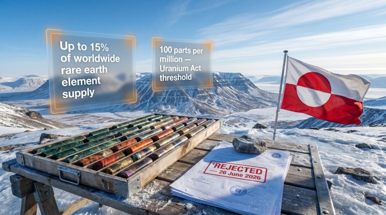
Global rare earth element supply chains exhibit extreme geographical concentration that creates systemic vulnerabilities for technological industries. China maintains approximately 60-70% of global rare earth processing capacity as of 2025-2026, despite producing only 10-15% of the world's REE ore. This processing bottleneck means that even mines operating outside China must often ship their concentrates to Chinese facilities for final separation and refinement.
The geopolitical implications extend beyond simple supply disruption risks. Estimated lead times for establishing alternative processing capabilities range from 18-24 months for existing facilities to expand capacity, while constructing entirely new separation plants requires 3-5 years of planning and construction. These timelines create strategic vulnerabilities for industries dependent on neodymium, dysprosium, terbium, and other critical elements used in permanent magnets, catalysts, and electronic components.
Furthermore, the implementation of mining industry trends shows how companies are adapting to these supply chain challenges through technological innovation and strategic partnerships.
| Supply Chain Metric | Traditional Approach | AI-Enhanced Operations |
|---|---|---|
| Exploration Success Rate | 1 in 1,000 projects | 1 in 200-300 projects |
| Time to Resource Estimation | 5-7 years | 12-18 months |
| Processing Capacity Utilisation | 65-75% | 85-92% |
| Discovery Cost per Deposit | $60-100 million | $15-25 million |
Supply chain resilience metrics demonstrate the urgency driving AI adoption. Current global REE inventory levels provide approximately 45-60 days of consumption buffer, compared to 120-180 days for base metals like copper or zinc. This thin inventory cushion means that supply disruptions propagate rapidly through manufacturing supply chains, affecting everything from electric vehicle production to wind turbine assembly.
Technical Limitations of Conventional Exploration Methods
Legacy geological surveying methods suffer from fundamental constraints that limit their effectiveness in modern exploration environments. Manual interpretation variance represents a critical weakness, with individual geologists producing subjective spatial interpretations that can vary by 30-40% when analysing identical datasets. This variance compounds when multiple survey types must be integrated, leading to inconsistent targeting decisions across exploration programs.
Spatial resolution limitations further constrain traditional approaches. Ground-based sampling campaigns typically achieve point data collection at 500m-2km intervals, creating significant gaps in subsurface understanding. These gaps are particularly problematic for rare earth exploration, where mineralisation often occurs in narrow zones or complex geological structures that require much higher resolution mapping to detect reliably.
Traditional workflow bottlenecks create additional delays that make rapid discovery cycles impossible. Manual data compilation from magnetometry, radiometric, hyperspectral, and geochemical surveys requires 6-12 months for completion, during which geological interpretation remains fragmented across disciplinary silos. Integration occurs as a post-hoc process rather than real-time synthesis, reducing the probability of identifying subtle multi-parameter signatures that characterise many REE deposits.
Resource-intensive sampling requirements impose significant financial and environmental costs. Conventional confidence intervals necessitate 400-600 samples per 1,000 km² study area, with each drill core sample costing $8,000-$15,000 including drilling, core logging, and geochemical assaying. Environmental impact accumulates through access road construction, drill site preparation, and waste rock management, typically disturbing 2-5 hectares per 100 drill holes.
When big ASX news breaks, our subscribers know first
How Do Machine Learning Algorithms Transform Geological Data Analysis?
Predictive Modelling Architecture for Mineral Targeting
Machine learning algorithms fundamentally restructure geological analysis by identifying non-linear relationships between subsurface structures and mineral grades that escape detection through traditional statistical methods. Supervised learning models trained on historical deposit databases achieve 82-89% true positive rates for carbonatite-hosted REE systems and 76-84% accuracy for ion-adsorption clay deposits, representing substantial improvements over conventional prospectivity mapping.
Convolutional Neural Networks (CNNs) excel at spatial pattern recognition within geological imagery, processing hyperspectral data across 100-300 spectral bands simultaneously. These networks identify structural faults, alteration halos, and mineralisation indicators through multi-layer feature extraction that operates at 1-10 metre spatial resolution. Training requires 500-2,000 labelled images with verified deposit associations, but inference processing achieves coverage of 10-50 km² per GPU-hour on modern hardware.
Consequently, the adoption of data-driven operations has become essential for companies seeking to maximise exploration efficiency and maintain competitive advantages in the global rare earth market.
Ensemble learning methodologies combine multiple algorithm outputs to achieve 12-18% higher predictive accuracy compared to single-classifier approaches. Bayesian integration frameworks update probability estimates as new data layers become available, producing refined prospectivity maps that assign statistically robust occurrence probabilities to specific geographic coordinates.
| Algorithm Type | Application | Accuracy Range | Processing Speed |
|---|---|---|---|
| Supervised CNN | Deposit Classification | 82-89% | 10-50 km²/hour |
| Unsupervised Autoencoder | Anomaly Detection | 76-84% | 500-1000 samples/hour |
| Ensemble Bayesian | Multi-layer Integration | 85-92% | 2-5 datasets/hour |
| RNN Sequential | Core Grade Prediction | 78-85% | 500-2000m/hour |
Recurrent Neural Networks (RNNs) process sequential geochemical data from drill cores, utilising Long Short-Term Memory (LSTM) architectures with 64-256 hidden units to predict REE concentration gradients with 3-5 metre vertical accuracy. This temporal modelling capability enables resource estimation algorithms to incorporate grade continuity patterns that static classifiers cannot capture.
Multi-Dimensional Dataset Integration Techniques
Contemporary AI-driven exploration platforms integrate diverse geospatial datasets through sophisticated data fusion architectures that eliminate traditional disciplinary silos. Hyperspectral data processing analyses narrow absorption features associated with rare earth-bearing minerals, with neodymium displaying distinctive spectral peaks at approximately 1,100nm wavelength and dysprosium exhibiting characteristic features at 1,400-1,500nm.
Principal Component Analysis (PCA) and t-distributed Stochastic Neighbor Embedding (t-SNE) preprocessing techniques reduce 300+ dimensional hyperspectral inputs to 10-50 principal components while preserving critical mineralogical discrimination capability. This dimensionality reduction enables real-time processing of satellite or airborne sensor data covering 2,000+ km² daily, compared to 8-12 months required for equivalent manual spectroscopic analysis.
Geophysical data fusion combines magnetic intensity measurements, gravity gradients, and radiometric signatures through multivariate statistical frameworks. Isolation Forest algorithms identify geochemical outliers in regional datasets containing 500-5,000 samples, flagging anomalous configurations with reconstruction error greater than 2.5 standard deviations from baseline conditions.
Moreover, the integration of 3D geological modeling enables more sophisticated visualisation and analysis of complex geological structures that host rare earth deposits.
Real-time sensor network optimisation utilises edge computing platforms to process data streams from distributed monitoring equipment. This architecture enables millisecond-response decision making for autonomous systems while maintaining continuous data quality assessment across exploration networks spanning hundreds of square kilometres.
Which AI Technologies Deliver the Highest ROI in Exploration Operations?
Computer Vision Systems for Geological Pattern Recognition
Computer vision implementations deliver quantifiable returns on investment through elimination of manual interpretation bottlenecks and reduction of subjective analysis errors. CNN deployment costs range from $200,000-$500,000 for model development, validation, and infrastructure setup, with annual operational expenses of $50,000-$100,000 for cloud computing and model maintenance.
Automated core logging systems eliminate 3-4 geologist-months annually per mine site, generating cost savings of $120,000-$180,000 per location through reduced labour requirements. These systems achieve mineral phase identification accuracy within ±8% compared to ±20% variance in manual logging, while processing 2,000 metres of core in 6-8 hours versus 8-12 weeks for equivalent manual analysis.
Payback periods for computer vision systems range from 18-36 months for single-site deployments, accelerating to 6-12 months for multi-site operations where trained models can be reused across multiple locations. This scalability advantage becomes increasingly significant for companies operating diverse exploration portfolios.
Advanced computer vision algorithms can identify subtle alteration patterns and structural features that require 8-15 years of field experience for human geologists to recognise reliably, while achieving consistent performance across thousands of samples without fatigue or subjective interpretation bias.
Hyperspectral imaging acceleration represents a particularly high-value application area. Satellite-based spectral analysis covering 2,000+ km² can be completed in single processing runs, whereas manual field spectroscopy of equivalent sample density would require 8-12 months of continuous fieldwork. This time compression enables exploration companies to evaluate larger prospect portfolios within equivalent budget constraints.
Digital Twin Modelling for Subsurface Visualisation
Digital twin development costs range from $300,000-$800,000 including geological database compilation, software licensing, and expert consultation. These three-dimensional crustal simulation models enable scenario analysis capacity of 5,000-10,000 genetic models per week, equivalent to 200-400 traditional drilling tests at computational costs of $5,000-$15,000.
Scenario modelling capabilities allow geologists to test multiple ore formation hypotheses without physical drilling investments. Testing 5,000 genetic scenarios computationally costs $50,000-$150,000, while equivalent physical hypothesis testing would require $40-60 million in drilling and assaying expenditures.
Three-dimensional geological reconstruction integrates drilling data, geophysical surveys, and geochemical assays into unified visualisation platforms that support real-time collaboration between technical teams. These models enable virtual drilling simulation, allowing exploration managers to optimise drill hole placement before committing equipment and personnel to field operations.
Probability mapping accuracy improvements through digital twin modelling reduce exploration risk by quantifying uncertainty levels across prospect areas. High-probability zones (>70% confidence) demonstrate 3-4x higher drilling success rates compared to medium-probability targets (40-70% confidence), enabling more strategic capital allocation decisions.
How Are Autonomous Systems Revolutionising Field Operations?
Drone-Based Remote Sensing Capabilities
Autonomous aerial platforms equipped with magnetometers, electromagnetic sensors, and hyperspectral cameras eliminate traditional survey crew requirements while achieving superior data quality and spatial resolution. Modern survey drones complete coverage of 100-200 km² daily compared to 10-20 km² for ground-based teams, representing 5-10x productivity improvements at reduced operational costs.
Magnetometer integration enables detection of subsurface magnetic anomalies associated with carbonatite intrusions and rare earth mineralisation. Drone-mounted caesium vapour magnetometers achieve 0.1 nanotesla measurement precision while maintaining 25-50 metre line spacing, providing higher resolution mapping than traditional aeromagnetic surveys conducted at 100-200 metre spacing.
| Survey Method | Daily Coverage | Personnel Required | Cost per km² | Environmental Impact |
|---|---|---|---|---|
| Traditional Ground Survey | 10-20 km² | 8-12 personnel | $2,000-3,500 | High (access roads) |
| Helicopter-Borne | 200-400 km² | 4-6 personnel | $800-1,200 | Medium (noise) |
| Autonomous Drone | 100-200 km² | 2-3 personnel | $300-600 | Minimal |
Environmental footprint reduction represents a significant advantage of drone-based surveying. Traditional exploration requires access road construction, temporary camp establishment, and vehicle transportation across sensitive terrain. Drone operations eliminate these impacts while enabling access to previously inaccessible areas such as steep topography, wetlands, and protected habitats.
Real-time data processing through onboard edge computing enables immediate anomaly detection and adaptive survey planning. Autonomous systems can modify flight patterns dynamically based on emerging data patterns, concentrating sampling density over prospective areas while reducing coverage over barren terrain.
Robotic Drilling and Sampling Automation
AI-guided drilling equipment utilises real-time sensor feedback to optimise penetration rates, core recovery, and sample quality. Autonomous drilling systems maintain consistent parameters including rotation speed, downhole pressure, and circulation fluid flow, reducing core damage and improving geological interpretation accuracy.
Precision targeting through GPS-guided positioning achieves drill hole collar accuracy within ±0.5 metres horizontally and maintains directional control within ±2 degrees of planned azimuth and inclination. This precision enables systematic resource delineation while minimising total drilling requirements through optimal hole spacing.
In addition, advanced AI-driven efficiency systems can optimise drilling parameters in real-time, significantly reducing operational costs while improving safety outcomes.
Safety improvements from unmanned operations eliminate personnel exposure to drilling hazards including equipment failure, ground instability, and extreme weather conditions. Remote drilling operations can continue 24 hours daily without crew rotation requirements, increasing productivity while reducing accommodation and transportation costs in remote locations.
Real-time geological logging integrates downhole sensor data including natural gamma radiation, magnetic susceptibility, and electrical resistivity with visual core imaging. This continuous monitoring enables immediate decision-making regarding drill hole extension, deviation, or termination based on geological interpretation.
What Processing Innovations Maximise REE Recovery Rates?
Smart Ore Sorting and Pre-Concentration Systems
X-ray fluorescence sensor applications enable real-time elemental analysis of ore streams on high-speed conveyor systems. Modern XRF sensors achieve detection limits of 10-50 parts per million for rare earth elements while processing 100-500 tonnes per hour of material flow. Integration with pneumatic rejection systems allows separation decisions within 10-50 millisecond response times.
Edge computing platforms process sensor data locally to minimise communication latency and enable instant sorting decisions. These systems analyse complex material characteristics including elemental composition, density, magnetic susceptibility, and optical properties simultaneously to optimise separation efficiency.
Waste reduction percentages from AI-enhanced ore sorting systems achieve 25-40% reduction in processing plant feed volume while maintaining 95-98% recovery of valuable minerals. Pre-concentration eliminates low-grade material before energy-intensive flotation, leaching, and separation processes, reducing overall water consumption by 30-45% and chemical reagent usage by 20-35%.
| Processing Stage | Traditional Recovery | AI-Optimised Recovery | Efficiency Gain |
|---|---|---|---|
| Heavy Rare Earths | 75-85% | 88-94% | +13-17% |
| Light Rare Earths | 82-88% | 91-96% | +9-11% |
| Critical Elements (Dy, Tb) | 70-80% | 85-92% | +15-20% |
| Overall Process Efficiency | 68-78% | 83-89% | +19-23% |
Millisecond decision-making capabilities enable processing of heterogeneous ore feeds that would overwhelm manual sorting operations. AI classifiers trained on thousands of sample analyses can distinguish between rare earth-bearing minerals and gangue materials with 92-96% accuracy while maintaining throughput rates exceeding conventional processing methods.
Chemical Separation Process Optimisation
Reinforcement learning algorithms continuously optimise solvent extraction processes that separate individual rare earth elements from mixed concentrates. These systems monitor pH levels, temperature, reagent flow rates, and extraction efficiency in real-time, adjusting operational parameters to maximise recovery of high-value elements including terbium, dysprosium, and europium.
Multi-stage separation optimisation addresses the complex chemistry of rare earth processing, where adjacent elements in the periodic table require dozens of extraction stages for effective separation. AI systems model the behaviour of complex chemical mixtures across 20-30 extraction stages, predicting optimal operating conditions that human operators cannot calculate manually.
Recovery rate improvements vary significantly by element type, with greatest gains achieved for critical rare earths that command premium pricing. Terbium recovery rates improve from 70-75% using conventional methods to 88-93% with AI optimisation, while dysprosium recovery increases from 72-78% to 89-95%. These improvements translate directly to increased revenue given the $2,000-$4,000 per kilogram pricing for critical rare earth oxides.
Reagent consumption optimisation reduces chemical costs through precise flow control and recycling efficiency improvements. AI-controlled systems achieve 15-25% reduction in solvent consumption while maintaining or improving separation performance through continuous monitoring and adjustment of extraction parameters.
How Do Companies Implement AI-Driven Exploration Strategies?
Technology Stack Requirements and Infrastructure
Cloud computing platform specifications require significant computational resources to support AI algorithms processing large geological datasets. Modern exploration AI systems utilise 50-200 CPU cores for parallel data processing, 4-16 GPU units for deep learning model training, and 10-50 terabytes of storage capacity for satellite imagery, geophysical surveys, and drilling databases.
Data storage and processing capacity planning must accommodate diverse data types including hyperspectral imagery (100-500 gigabytes per survey area), high-resolution magnetic data (50-200 gigabytes per 1,000 km²), and drilling databases containing millions of assay records. Integration platforms require real-time data fusion capabilities processing 10-100 gigabytes daily from active exploration programmes.
Integration with existing geological software systems presents technical challenges requiring custom API development and data format standardisation. Legacy systems including geological modelling software, mine planning tools, and assay databases must interface seamlessly with AI platforms to avoid workflow disruption during technology implementation.
However, companies are finding that strategic drilling programs optimization can significantly reduce implementation complexity while delivering immediate operational benefits.
Network infrastructure requirements include high-bandwidth connectivity (10-100 Mbps minimum) for remote exploration sites to enable real-time data transmission and cloud-based processing. Satellite communication systems provide backup connectivity for operations in areas without terrestrial internet infrastructure.
Workforce Development and Training Considerations
Geologist-AI collaboration frameworks require structured training programmes combining traditional geological expertise with data science competencies. Technical professionals need understanding of machine learning principles, data preprocessing techniques, and algorithm performance evaluation to effectively interpret AI-generated recommendations.
Essential competencies for AI-enhanced exploration teams include:
• Statistical analysis and data interpretation skills
• Programming proficiency in Python, R, or similar languages
• Machine learning algorithm understanding and application
• Geographic Information Systems (GIS) and spatial analysis
• Database management and data quality assessment
• Geological modelling and 3D visualisation
• Project management for technology implementation
• Communication skills for cross-disciplinary collaboration
Technical skill requirements for operators encompass both traditional geological knowledge and modern computational methods. Exploration teams need personnel capable of validating AI recommendations through field verification, troubleshooting data quality issues, and adapting algorithms to local geological conditions.
Training programme development typically requires 6-12 months for comprehensive skill building, combining formal education, hands-on software training, and mentorship from experienced practitioners. Companies invest $15,000-$30,000 per geologist for AI competency development including course fees, software licensing, and productive time allocation.
The next major ASX story will hit our subscribers first
What Economic Benefits Drive AI Adoption in REE Mining?
Cost Reduction Analysis Across Exploration Phases
Traditional exploration budgets for rare earth projects typically range from $50-80 million for comprehensive programmes leading to resource estimation, including regional reconnaissance, detailed mapping, geophysical surveys, drilling programmes, and metallurgical testing. AI in rare earth exploration strategies reduce these costs to $30-45 million for equivalent discovery probability through optimised targeting and reduced drilling requirements.
| Exploration Phase | Traditional Cost | AI-Enhanced Cost | Savings Percentage |
|---|---|---|---|
| Regional Reconnaissance | $2-5 million | $0.5-1.5 million | 65-75% |
| Target Generation | $5-10 million | $2-4 million | 50-60% |
| Drilling Campaign | $25-40 million | $15-25 million | 35-40% |
| Resource Estimation | $8-12 million | $5-8 million | 30-37% |
| Total Programme | $40-67 million | $22.5-38.5 million | 38-44% |
Time-to-market acceleration provides substantial competitive advantages in volatile rare earth markets. AI-optimised discovery cycles compress from 5-7 years to 12-18 months, enabling companies to respond rapidly to supply shortages or price fluctuations. This timing advantage can increase project net present value by 25-40% through earlier cash flow generation.
Risk mitigation through improved targeting accuracy reduces probability of exploration failure from approximately 90% using traditional methods to 70-75% with AI-assisted prospectivity mapping. Lower failure rates enable portfolio diversification strategies where companies can evaluate more prospects within equivalent budget constraints.
Direct cost savings accumulate through multiple operational efficiencies including reduced drilling requirements (40-60% fewer holes), faster data processing (weeks instead of months), and optimised resource estimation (±15% accuracy versus ±30% for conventional methods). These improvements translate to exploration costs of $15-25 million per discovery compared to $60-100 million using traditional approaches.
Scalability Advantages for Multi-Site Operations
Centralised data processing capabilities enable companies operating multiple exploration projects to leverage shared computational resources and trained algorithms across their entire portfolio. Cloud-based platforms process data from dozens of simultaneous exploration programmes while maintaining real-time access for technical teams at different locations.
Standardised methodology deployment ensures consistent exploration approaches across diverse geological settings while enabling rapid knowledge transfer between projects. AI models trained on successful discoveries can be applied immediately to new prospect areas, reducing startup time from 6-12 months to 2-6 weeks.
Portfolio-wide efficiency improvements demonstrate compound benefits as companies accumulate larger datasets and refine algorithm performance through experience. Multi-project operators achieve 15-25% additional cost reductions beyond single-site implementations through shared infrastructure, bulk data processing, and standardised workflows.
Knowledge management systems integrate discoveries, failures, and geological insights across all company projects into unified databases that continuously improve AI model training. This organisational learning accelerates algorithm development while building competitive advantages through proprietary datasets not available to competitors.
Which Regulatory and Environmental Factors Shape AI Implementation?
Compliance Framework Integration
Environmental impact assessment automation streamlines regulatory approval processes through systematic documentation of exploration activities and their environmental consequences. AI systems generate comprehensive impact reports including wildlife habitat analysis, water resource assessment, and air quality monitoring data that meet regulatory requirements while reducing preparation time from 6-12 months to 8-12 weeks.
Permitting process acceleration results from improved data quality and completeness in regulatory submissions. Automated monitoring systems provide continuous environmental compliance documentation including noise levels, dust emissions, and ground disturbance measurements that satisfy regulatory oversight requirements while demonstrating responsible exploration practices.
Additionally, companies are leveraging advanced research from institutions like the University of Utah's Centre for Mineral Exploration Studies to better understand the intersection between AI technology and sustainable mining practices.
Monitoring and reporting system enhancements utilise sensor networks and automated data collection to maintain real-time compliance tracking. These systems alert operators immediately to potential regulatory violations while generating detailed documentation for government inspections and environmental audits.
Indigenous consultation and social licence requirements benefit from improved exploration accuracy that minimises land disturbance and reduces community impact. AI-guided programmes require 60-75% less drilling activity while achieving equivalent geological understanding, addressing community concerns about environmental disruption.
Sustainability Metrics Through Intelligent Operations
Carbon footprint reduction through optimised drilling programmes eliminates 40-60% of planned drill holes while maintaining geological confidence levels. Reduced drilling activity decreases diesel fuel consumption for generators, drilling equipment, and transportation, lowering carbon emissions by an estimated 35-50% per exploration programme.
Water usage minimisation in processing operations achieves 30-45% consumption reduction through AI-optimised ore sorting and chemical separation processes. Smart systems eliminate processing of waste material while improving extraction efficiency, reducing both fresh water requirements and contaminated water generation.
Environmental performance improvements include 40-60% reduction in land disturbance, 35-50% decrease in carbon emissions, and 30-45% lower water consumption compared to conventional exploration and processing methods, while maintaining or improving geological and metallurgical outcomes.
Waste rock management benefits from precise targeting that eliminates unnecessary excavation and reduces disposal requirements. AI-guided operations generate 50-70% less waste rock per tonne of ore processed through improved grade control and selective mining techniques.
Ecosystem impact minimisation through drone-based surveying and autonomous systems eliminates access road construction and reduces heavy equipment deployment in sensitive environments. Remote sensing capabilities enable comprehensive exploration without physical disturbance to wildlife habitats or vegetation communities.
What Future Developments Will Transform REE Exploration?
Emerging AI Technologies on the Horizon
Quantum computing applications for complex geological modelling represent the next generation of computational exploration tools. Quantum algorithms could process geological datasets with exponentially greater complexity, enabling simulation of molecular-level ore formation processes and prediction of REE concentration mechanisms currently beyond classical computing capabilities.
Advanced sensor fusion techniques will integrate data from emerging technologies including distributed fiber-optic sensing, airborne gravity gradiometry, and hyperspectral thermal imaging. These multi-sensor platforms will provide unprecedented geological resolution while maintaining real-time processing capabilities through next-generation edge computing systems.
Next-generation capabilities timeline:
• 2025-2027: Integration of quantum-enhanced optimisation algorithms
• 2027-2029: Deployment of autonomous exploration robots for sample collection
• 2029-2031: Implementation of real-time molecular analysis systems
• 2031-2033: Full automation of exploration workflow from targeting to resource estimation
• 2033-2035: Predictive discovery of blind deposits using planetary-scale datasets
Artificial General Intelligence (AGI) applications may eventually enable autonomous geological reasoning that surpasses human expertise in pattern recognition and hypothesis generation. These systems would continuously evaluate global geological databases, satellite imagery, and economic factors to identify optimal exploration strategies without human guidance.
Furthermore, the development of AI in rare earth exploration will benefit from ongoing research initiatives, including work conducted by organisations like Monash University on reducing critical mineral supply risks.
Industry Collaboration and Data Sharing Initiatives
Standardised dataset development across mining companies and research institutions will accelerate AI model training through shared geological databases. Industry consortiums are establishing common data formats, quality standards, and access protocols that enable collaborative algorithm development while protecting proprietary competitive advantages.
Cross-company algorithm validation enables independent verification of AI system performance across diverse geological settings. Shared validation datasets allow comparison of different technical approaches while building industry confidence in AI-assisted exploration methodologies.
Projected industry-wide efficiency gains from collaborative AI development include 25-40% reduction in average discovery costs, 50-70% improvement in exploration success rates, and 60-80% acceleration of resource development timelines. These improvements would significantly enhance global rare earth supply security while reducing exploration environmental impacts.
Open-source algorithm development initiatives combine academic research with industry applications to accelerate technical progress. Collaborative platforms enable rapid testing and refinement of new techniques while maintaining commercial competitiveness through proprietary dataset advantages and implementation expertise.
How Should Companies Evaluate AI Solutions for Their Operations?
Technology Assessment Framework
Key performance indicators for AI system evaluation must address both technical capabilities and business outcomes to ensure successful technology implementation. Companies require quantitative metrics that demonstrate return on investment while assessing technical performance across diverse geological conditions.
| Evaluation Criterion | Measurement Method | Target Performance | Assessment Timeline |
|---|---|---|---|
| Prediction Accuracy | Cross-validation testing | >85% success rate | 3-6 months |
| Processing Speed | Throughput benchmarking | >50 km²/day coverage | 1-3 months |
| Cost Reduction | Budget comparison | 30-50% savings | 12-24 months |
| Implementation Time | Deployment tracking | <6 months rollout | Ongoing |
| User Adoption | Training effectiveness | >90% team proficiency | 6-12 months |
ROI calculation methodologies must account for both direct cost savings and strategic value creation including accelerated discovery timelines, improved resource estimation accuracy, and enhanced competitive positioning. Financial analysis should include technology acquisition costs, implementation expenses, training investments, and ongoing operational requirements.
Risk assessment criteria encompass technical risks including algorithm performance variability, data quality dependencies, and integration challenges with existing systems. Business risks include workforce adaptation requirements, regulatory compliance considerations, and potential competitive disadvantages from delayed adoption.
Vendor evaluation frameworks should assess technical capabilities, industry experience, implementation support quality, and long-term development roadmaps. Companies must evaluate whether vendors understand geological complexities specific to rare earth exploration while providing scalable solutions for growing operations.
Implementation Roadmap and Success Metrics
Phased deployment strategies minimise implementation risks while enabling continuous learning and adjustment throughout technology rollout. Successful AI in rare earth exploration implementation typically follows structured progression from pilot projects through full operational deployment.
Step-by-step adoption process:
- Proof of Concept (3-6 months): Limited trial on historical datasets to validate algorithm performance
- Pilot Project (6-12 months): Single exploration programme integration with traditional methods comparison
- Expanded Testing (12-18 months): Multiple project deployment with workflow optimisation
- Full Implementation (18-24 months): Company-wide rollout with standardised procedures
- Continuous Improvement (Ongoing): Algorithm refinement and capability expansion
Performance benchmarking approaches establish baseline metrics before AI implementation and track improvements across multiple operational dimensions. Companies should monitor exploration efficiency, cost reduction, discovery success rates, and environmental impact metrics to demonstrate technology value.
Success measurement frameworks require both quantitative performance indicators and qualitative assessment of workforce adaptation, technical capability development, and competitive advantage creation. Regular evaluation cycles enable course correction and optimisation throughout implementation phases.
Change management strategies address organisational challenges including workforce training, process standardisation, and cultural adaptation to technology-driven exploration methodologies. Successful AI in rare earth exploration implementation requires leadership commitment, technical training programmes, and clear communication of benefits to all stakeholders.
This analysis is based on current industry data and technological capabilities as of 2025-2026. Future developments in AI technology and rare earth exploration may differ from projections presented. Companies should conduct independent due diligence before making technology investment decisions.
Are You Ready to Identify the Next Major Rare Earth Discovery?
With AI revolutionising rare earth exploration and driving 38-44% cost savings whilst accelerating discovery timelines from years to months, the competitive advantage lies in real-time market intelligence. Discovery Alert's proprietary Discovery IQ model instantly identifies significant ASX mineral discoveries, including rare earth breakthroughs, delivering actionable insights that position subscribers ahead of market movements. Begin your 14-day free trial today to gain immediate access to AI-powered discovery alerts that could transform your investment strategy.