June 25, 2026
How Peru Is Using Artificial Intelligence to Unlock Its Next Generation of Mineral Discoveries
The global race to secure critical mineral supply chains is reshaping how governments think about geological knowledge. For decades, national geological surveys operated as archives, cataloguing what was already known rather than actively predicting what remains undiscovered. That model is breaking down. As near-surface deposits become harder to find in historically prospected territories, the ability to extract signal from noise across massive geological datasets is becoming a genuine competitive advantage — one that separates mineral-rich nations that are well-positioned from those that remain poorly understood.
Peru's geological agency INGEMMET has moved decisively in this direction, and what it presented at the International Congress of Prospectors and Explorers, proEXPLO 2026, marks a meaningful shift in how the country manages its subsurface knowledge. Perú usa inteligencia artificial para identificar nuevas zonas con potencial minero, and the institutional architecture behind that capability is worth examining in depth.
When big ASX news breaks, our subscribers know first
INGEMMET and the Institutional Foundation Behind the Innovation
The Instituto Geológico, Minero y Metalúrgico del Perú, known as INGEMMET, serves as the country's primary technical and scientific authority for geological data generation, administration, and interpretation. Its Metalogenia Program specifically focuses on understanding the spatial distribution of mineral deposits and the geological processes responsible for their formation, making it the logical home for any national-scale application of predictive modelling.
What makes INGEMMET's current trajectory significant is not simply the adoption of new software. The institution is undergoing a functional repositioning from a descriptive data custodian to a prescriptive analytical authority. Where its historical output consisted largely of geological maps and sample catalogues, the program is now producing probabilistic favourability assessments that actively guide where exploration capital should flow.
This repositioning matters enormously for the broader investment ecosystem. When a credible government geological body publishes scientifically validated priority zones, it reduces the information asymmetry that typically disadvantages smaller exploration companies relative to multinationals with large in-house geoscience teams. Furthermore, AI-enhanced mineral exploration approaches like this one are increasingly demonstrating their value across the global mining sector.
The Architecture of AI-Driven Geological Favourability Modelling
Understanding how these systems actually function helps investors and geologists alike assess the reliability of the outputs. The methodology developed by INGEMMET integrates three core categories of geological evidence:
- Direct field data: surface geological surveys, structural mapping, and lithological characterisation
- Geochemical analysis: systematic sampling of soils, sediments, stream sediments, and rock outcrops to detect elemental anomalies
- Mathematical modelling: machine learning algorithms trained to detect correlations between known mineralised systems and unexplored terrain sharing similar geological signatures
The computational advantage in this workflow is dimensionality. Where skilled human geologists can effectively interpret relationships across perhaps five to ten geological variables simultaneously, trained algorithms can interrogate fifty to several hundred intercorrelated variables — including subtle lithostratigraphic, geophysical, and geochemical signatures that do not manifest as obvious anomalies in any single dataset.
Which Algorithms Are Driving the Analysis?
The most commonly applied algorithms in this category of work include:
- Weights of Evidence (WofE): a Bayesian statistical approach that calculates the relative contribution of individual geological features to the probability of mineralisation
- Random Forest and Gradient Boosting: ensemble learning methods that combine multiple decision trees to classify terrain by favourability category
- Support Vector Machines (SVM): effective for separating classes in high-dimensional geological feature spaces
- Convolutional Neural Networks (CNN): increasingly used for pattern recognition in satellite imagery and airborne geophysical datasets
The concept underpinning all of these approaches is mineral systems modelling, which treats ore deposit formation as a set of necessary and sufficient geological conditions rather than a collection of isolated anomalies. When the system has been trained on the full geological signatures of known economic deposits, it can project statistically analogous conditions onto unmapped terrain.
Mineral favourability modelling is conceptually analogous to credit risk scoring: the model learns from historical outcomes to assign probabilities to new cases, acknowledging that high probability does not guarantee discovery, just as strong credit scores do not eliminate default risk.
Comparing Conventional and AI-Augmented Exploration
| Capability | Conventional Exploration | AI-Augmented Exploration |
|---|---|---|
| Data volume processed | Limited by human analytical capacity | Thousands of variables processed simultaneously |
| Pattern recognition | Expert-dependent, interpretive | Automated anomaly detection across full datasets |
| Analysis cycle time | Months to years per study area | Weeks for regional coverage |
| Uncertainty quantification | Qualitative, expert-driven | Probabilistic, model-derived confidence intervals |
| Public accessibility | Typically restricted or delayed | Open-access via Geptamin platform |
| Bias risk | Anchoring on historically productive zones | Training data bias toward known deposit types |
Peru's Central Coastal Belt: A Geological Frontier Under New Scrutiny
The geographic focus of INGEMMET's AI initiative spans the central coastal belt of Peru, encompassing parts of Áncash, Lima, Ica, and northern Arequipa. This corridor follows the western margin of the Andean magmatic arc — a linear zone of ancient and recurring hydrothermal activity with documented polymetallic enrichment across multiple geological epochs.
Each sub-region carries distinct geological character:
- Áncash: historically active in polymetallic mining, with well-documented skarn and porphyry systems providing rich training data for the models
- Lima coastal sectors: areas with comparatively limited historical exploration coverage, representing genuine frontier ground where model predictions carry higher novelty value
- Ica: geological structures favourable for both skarn-type and porphyry copper mineralisation, with thermal aureoles associated with Mesozoic intrusive bodies
- Northern Arequipa: a transitional zone between the Andean magmatic arc and the coastal batholith, characterised by complex structural overprinting
One critically underappreciated aspect of this belt is its cobalt potential. Cobalt in the Andean context does not typically occur as primary cobalt mineralisation. Instead, it concentrates as a geochemical associate within copper-bearing polymetallic systems, particularly where sulphide mineral assemblages include cobaltite and carrollite phases, or where secondary enrichment processes have concentrated cobalt in oxide caps above primary sulphide zones.
This distinction matters for grade expectations: exploration companies targeting cobalt in this belt should approach it as a by-product credit within copper systems rather than a standalone cobalt deposit model. In addition, understanding the broader cobalt mining landscape globally provides essential context for evaluating these Andean opportunities.
The Critical Mineral Context: Why Cobalt and Copper Drive This Initiative
The selection of copper and cobalt as the primary target metals is not arbitrary. Both sit at the intersection of conventional industrial demand and accelerating energy transition requirements.
Copper's structural importance:
- A battery-electric vehicle contains approximately three to four times more copper than a conventional internal combustion vehicle
- Utility-scale solar and wind installations require significantly higher copper intensities per megawatt of generating capacity than conventional thermal plants
- Transmission grid upgrades needed to handle distributed renewable generation represent one of the largest structural demand drivers for copper over the next two decades
Cobalt's supply concentration problem:
- More than 70% of global cobalt mine production currently originates from a single country — the Democratic Republic of Congo — creating acute concentration risk across battery supply chains
- Cobalt is a critical input in nickel-manganese-cobalt (NMC) and nickel-cobalt-aluminium (NCA) cathode chemistries, which dominate high-energy-density battery applications
- The International Energy Agency has projected that cobalt demand could increase dramatically by 2040 under accelerated energy transition scenarios, with the precise multiple depending heavily on the rate of adoption of lower-cobalt battery chemistries such as lithium iron phosphate (LFP)
Disclaimer: Long-term commodity demand projections involve substantial uncertainty. Actual cobalt demand will depend on battery chemistry evolution, recycling infrastructure development, substitution technologies, and the pace of electrification across different regions. These projections should not be interpreted as guaranteed market outcomes.
A lesser-known dynamic in the cobalt market is the growing strategic interest from vehicle manufacturers and battery producers in pre-purchasing cobalt through offtake agreements with geographically diversified producers. If Peru were to develop economic cobalt resources within its coastal copper belt, the timing would align with a period of intense supply chain diversification pressure. Consequently, understanding copper market trends and the supply crunch dynamics at play globally further underscores why Peru's AI initiative carries such strategic weight.
The proEXPLO 2026 Study: Scope, Methodology, and Significance
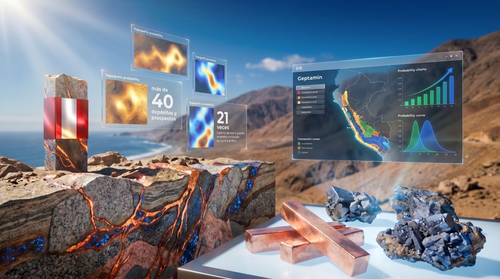
At proEXPLO 2026, Alonso Marchena, head of INGEMMET's Metalogenia Program, presented findings from a study that analysed a dataset of more than 40 deposits and prospects across the central coastal region. This corpus provided the empirical foundation for training and validating the predictive models, combining sites with established exploration histories alongside areas carrying theoretical but undocumented mineralisation potential.
The significance of this dataset size lies in model robustness. Training a mineral favourability model on a small number of deposits creates high risk of overfitting, where the model learns to recognise the idiosyncrasies of individual deposits rather than the generalised geological signatures of a deposit class.
What the Methodology Reveals
Several aspects of this methodology deserve attention from a technical standpoint:
- The quality of model predictions in sparsely sampled areas will reflect the density of training data from adjacent well-sampled zones, meaning predictions carry higher uncertainty where historical exploration coverage was thin
- The model's effectiveness at identifying genuinely novel targets depends partly on how the training dataset balances known economic deposits against lower-grade or structurally complex prospects
- Confirmation drilling remains the irreplaceable final step: no favourability model, regardless of sophistication, substitutes for physical sample collection from drill core
For instance, soil sampling techniques and rock chip analysis remain foundational to validating any AI-generated anomaly before committing to a full drilling programme.
The next major ASX story will hit our subscribers first
Geptamin: Open-Access Geological Intelligence
One of the most practically significant aspects of INGEMMET's initiative is the publication of AI-generated favourability maps through Geptamin, the institution's open-access digital platform. This decision carries implications that extend well beyond administrative transparency.
For exploration companies evaluating entry into Peru, the availability of state-generated, scientifically validated priority zones provides a first-pass filter that previously required either expensive proprietary studies or accumulated institutional knowledge. Junior exploration companies, which typically operate with limited technical budgets, benefit disproportionately from this information equalisation.
From an investment strategy perspective, the practical workflow for a junior explorer using Geptamin data might follow a logical sequence:
- Download favourability maps for the target region within the central coastal belt
- Overlay existing concession holdings and available ground to identify coverage gaps in high-favourability zones
- Cross-reference with infrastructure accessibility data (roads, ports, power grid proximity)
- Screen for social licence considerations (community agreements, water availability, protected area boundaries)
- Design a cost-effective first-pass sampling programme targeting the highest-ranked undrilled anomalies
This data-driven triage approach compresses the time required to move from regional reconnaissance to drill-ready target, which directly reduces the pre-discovery capital burn that kills many junior exploration programmes. Furthermore, well-structured drilling programs in resource exploration remain essential for converting these AI-identified targets into investable resource estimates.
Peru's Regional and Global Standing in AI-Augmented Exploration
Peru's position as the second country in Latin America — after Brazil — to systematically deploy AI for national-scale mineral potential identification reflects both institutional capacity and strategic prioritisation.
| Country | AI Integration in Exploration | Leading Institution | Primary Target Minerals |
|---|---|---|---|
| Brazil | Regional pioneer | CPRM (Serviço Geológico) | Rare earths, nickel, lithium |
| Peru | Second in region | INGEMMET | Copper, cobalt |
| Chile | In development | SERNAGEOMIN | Lithium, copper |
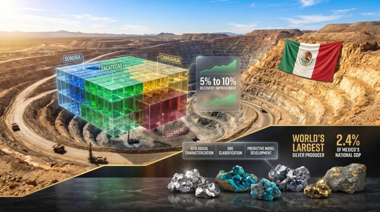
| Mexico | Early stage | SGM | Silver, zinc |
| Colombia | Exploratory | SGC | Gold, platinum |
Globally, Australia, Canada, and the United States have integrated machine learning and large-scale data analytics into national geological survey programmes for several years. The principal differences relative to Peru involve scale of investment, integration of airborne geophysical data coverage, and the depth of private-sector technology partnerships.
What Peru demonstrates, however, is that meaningful progress is achievable within the resource constraints typical of Latin American public institutions when data collection infrastructure already exists and institutional scientific capacity is adequate to the analytical task.
What AI Cannot Do: Limitations Investors and Geologists Should Understand
No honest assessment of this technology is complete without addressing its boundaries. Several limitations are structurally embedded in the approach and will not be resolved by algorithmic improvement alone:
- Data density dependency: model quality degrades in zones with sparse historical sampling; predictions carry inherently wider confidence intervals in areas where INGEMMET's historical data coverage is thin
- Deposit type specificity: models trained predominantly on one deposit type may systematically underweight geological indicators associated with less-represented styles
- Scale limitations: AI favourability models operate at regional to district scale — they identify zones warranting closer investigation, not precise drill collar locations
- The discovery paradox: the model cannot predict the existence of deposit types that are not represented in its training data
- Confirmation requirement: physical verification through drilling, sampling, and metallurgical testing remains irreplaceable as the mechanism for converting probabilistic predictions into resource estimates
These limitations do not diminish the value of the approach. They define the appropriate position of AI-generated favourability assessments within a broader exploration decision framework rather than as standalone discovery tools.
Strategic Implications for Peru's Role as a Critical Mineral Supplier
Peru already holds a commanding position in global metals production, ranking among the world's top producers of copper, zinc, and silver. The identification of new copper and cobalt resources within the central coastal belt would not transform Peru's production profile overnight, given the typical 10 to 15-year development timeline from exploration discovery to commercial production. However, the strategic significance operates on a different timeline.
Early-stage resource identification work conducted today determines which projects enter the development pipeline in the 2030s. Given that the global mining industry is already facing a growing gap between future copper demand projections and committed supply, discoveries made in the current decade will have disproportionate strategic importance.
For investors monitoring Peru's exploration sector, the Perú usa inteligencia artificial para identificar nuevas zonas con potencial minero initiative represents a data-driven catalyst for increased junior exploration activity in the coastal belt. Historically underexplored zones now identified as high-priority targets are precisely the kind of ground that junior companies with low acquisition costs and high risk tolerance are positioned to investigate first.
The broader signal is that Peru is investing in the infrastructure of geological knowledge at a moment when that knowledge has never been more commercially valuable. Whether or not every high-favourability zone ultimately hosts economic mineralisation, the systematic reduction of uncertainty across a large and historically underexplored corridor represents genuine value creation for the country's mining sector as a whole.
Want to Catch the Next Major ASX Mineral Discovery the Moment It's Announced?
As AI continues to reshape how the world identifies critical mineral deposits, Discovery Alert's proprietary Discovery IQ model is already doing the same for ASX investors — delivering real-time alerts on significant mineral discoveries the moment they hit the exchange, turning complex geological data into actionable investment opportunities. Explore how historic ASX mineral discoveries have generated extraordinary returns, and begin your 14-day free trial today to position yourself ahead of the broader market.