July 8, 2026
The Intelligence Layer Becomes the Battleground: Why Mining's Future Is Being Won in Data, Not Steel
For most of the twentieth century, competitive advantage in mining equipment was defined by mechanical superiority. Bigger buckets, stronger drivetrains, and more durable steel separated market leaders from followers. That era is not simply fading — it is being systematically dismantled. The companies that will dominate global mining over the next two decades are not racing to build the largest machines. They are racing to own the most complete and continuously updated understanding of what is happening inside a mine at any given moment.
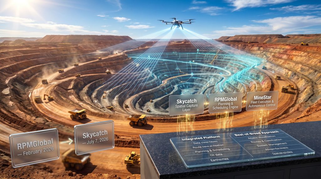
This shift from mechanical dominance to data dominance explains why the Caterpillar Skycatch acquisition, announced on 7 July 2026, carries strategic weight well beyond what a standard technology purchase might suggest. It is the second major intelligence-layer acquisition Caterpillar has executed in 2026, and together with the earlier acquisition of RPMGlobal, it reveals an architectural vision that is reshaping what it means to be a mining equipment company.
When big ASX news breaks, our subscribers know first
Building the Stack: Two Acquisitions, One Strategic Architecture
Understanding the Caterpillar Skycatch acquisition in isolation misses its most important dimension. The deal only makes complete sense when viewed alongside the RPMGlobal transaction that preceded it. Furthermore, data-driven mining operations have been gaining momentum across the sector, and Caterpillar's strategic sequencing reflects precisely this broader industry direction.
| Acquisition | Announced | Core Capability |
|---|---|---|
| RPMGlobal | February 2026 | Mine planning, production scheduling, and operational software |
| Skycatch | July 7, 2026 | High-frequency spatial data capture, AI-powered processing, near-real-time digital twins |
The sequencing is deliberate and structurally logical. RPMGlobal's platform provides the decision-making engine — the layer that determines where material should move, when equipment should be deployed, and how production schedules should be structured. Skycatch provides the sensory nervous system: a continuously refreshed, high-precision spatial picture of what the mine site actually looks like right now.
Without accurate spatial inputs, even sophisticated planning software operates on assumptions rather than reality. Without a planning engine to act on spatial data, high-resolution site maps have limited operational value. By acquiring in this order, Caterpillar has assembled a planning-to-perception pipeline that neither acquisition could have delivered independently.
What Skycatch Actually Does: Beyond Conventional Drone Surveying
There is a common misconception that Skycatch is simply a drone survey company with better hardware. The distinction between Skycatch's platform and conventional aerial survey methods is more fundamental than that, and it sits at the core of why the Caterpillar Skycatch acquisition matters operationally.
High-Frequency Spatial Data at Mining Scale
Traditional mine surveying relies on periodic cycles. Survey crews or contracted drone operators capture site geometry at weekly, fortnightly, or monthly intervals. The resulting data is precise at the moment of capture but begins ageing immediately. By the time survey outputs reach planning teams, ground conditions may have changed substantially due to blasting, excavation, material dumping, or equipment positioning.
Skycatch's platform is engineered specifically to overcome this temporal gap. It captures high-frequency, large-scale spatial data across active mine sites, compressing what was previously a multi-day data collection and processing cycle into something approaching operational real-time. Consequently, planning decisions can be made against a site geometry that reflects current conditions rather than conditions from several days or weeks prior.
AI Processing as the Interpretive Layer
Raw spatial data volume is not the competitive differentiator on its own. The distinguishing capability is what happens to that data after capture. Skycatch's embedded AI layer processes incoming spatial datasets to identify, measure, and interpret operational features across the mine site. In addition, AI-powered mining efficiency gains of this nature are increasingly central to how leading operators are justifying technology investment.
This includes:
- Volumetric calculations of stockpiles and excavations
- Detection of material movement patterns and equipment positioning
- Identification of surface changes between data capture cycles
- Generation of slope and grade geometry updates for haul road management
- Flagging of anomalies that deviate from planned site configurations
The AI processing layer converts raw geospatial inputs into structured operational intelligence — outputs that planning systems and fleet management platforms can act on directly without requiring manual interpretation by survey engineers.
The Near-Real-Time Digital Twin: A Paradigm Shift in Operational Visibility
The product of Skycatch's capture and processing pipeline is what the company terms a near-real-time digital twin: a continuously updated three-dimensional model of the active mine site that reflects current ground conditions with high spatial accuracy. This concept aligns closely with broader advances in 3D geological modelling, which is likewise transforming how operators and stakeholders visualise subsurface and surface conditions.
The ability to maintain a living, continuously updated site model rather than relying on periodic survey snapshots changes the fundamental speed at which operators can respond to changing ground conditions, equipment positioning dynamics, and material movement realities.
In a large open-cut copper or iron ore operation, this visibility gap between planned and actual site geometry is one of the most persistent sources of production variance. Blasts that do not fragment as modelled, stockpile volumes that diverge from estimates, and haul road grades that shift with ongoing excavation all create misalignment between the schedule and what is physically achievable on a given shift. A near-real-time digital twin makes these divergences visible as they occur, not after the fact.
The Integration Architecture: How Skycatch Feeds Into Caterpillar's Ecosystem
The strategic value of the Caterpillar Skycatch acquisition is amplified significantly by how the technology slots into Caterpillar's existing platform architecture. Rather than operating as a standalone product, Skycatch's spatial data layer is designed to integrate directly into both RPMGlobal's planning engine and Caterpillar's MineStar fleet management platform.
[Skycatch Spatial Capture Layer]
         ↓
[AI Processing & Digital Twin Generation]
         ↓
[RPMGlobal Planning & Scheduling Engine]
         ↓
[MineStar Fleet Execution & Autonomous Control]
         ↓
[Continuous Feedback Loop → Site Model Update]
RPMGlobal Integration: Grounding Plans in Current Reality
One of the most underappreciated problems in mine operations is the divergence between the site geometry that exists in a planning system and the geometry that actually exists in the field. Planning software optimises against the model it has been given. When that model is outdated, the resulting schedules and material movement targets are optimised against a fiction.
Skycatch's spatial data feeding directly into RPMGlobal's scheduling workflows removes this divergence systematically. Short-interval scheduling, which governs equipment allocation and material movement targets at the shift and sub-shift level, becomes materially more accurate when the underlying site geometry is updated continuously rather than weekly.
The RPMGlobal CEO has indicated that near-real-time spatial visibility enables miners to adjust plans as conditions change and improve the alignment between planning and execution, delivering more predictable outcomes across operations. (African Mining Market, 7 July 2026)
MineStar Integration: Spatial Awareness for Autonomous Fleets
Caterpillar's MineStar system, which manages both staffed and autonomous haulage fleets, benefits from accurate spatial data at the fleet control layer in ways that go beyond productivity optimisation. For autonomous haulage systems specifically, precise and current site geometry is a safety-critical input.
Autonomous trucks navigate defined operational domains. When surface conditions change due to blasting, new bench cuts, or material deposition, the operational domain boundaries must be updated to reflect current reality. A near-real-time digital twin that feeds updated geometry into MineStar means that autonomous fleet parameters can be adjusted in response to site changes far more responsively than was previously possible.
Operational Impact: Safety, Productivity, and Predictability
Caterpillar's Resource Industries leadership has framed the strategic rationale for the acquisition around three interconnected operational outcomes. These are not marketing abstractions. Each maps to a concrete mechanism enabled by near-real-time spatial intelligence. Moreover, mining automation trends across the industry demonstrate that these outcomes are increasingly achievable at scale.
Safety
- Continuously updated site models enable more responsive geofencing and exclusion zone management around active blasting areas, unstable slopes, and adjacent equipment zones
- Slope stability monitoring becomes more granular when surface change detection is performed at high frequency rather than through periodic manual survey
- Autonomous equipment operating within dynamically updated spatial boundaries faces reduced exposure to edge cases created by undetected ground condition changes
Productivity
- Short-interval scheduling accuracy improves when planners work against current site geometry
- Material movement optimisation requires accurate volumetric data; stockpile and excavation volumes that are updated continuously reduce the error margin in truck allocation models
- Reduced rework caused by plans built on outdated site conditions translates directly into recovered productive hours per shift
Predictability
For mining CFOs and project owners, predictability is arguably more commercially valuable than efficiency gains alone. A consistent daily tonnage outcome, even at a slightly lower absolute rate, delivers superior supply chain confidence and reduces the production variance that creates friction in offtake arrangements.
Near-real-time site visibility reduces the variance between forecast and actual daily production by tightening the feedback loop between what the plan expects and what the site can actually deliver on any given shift.
Competitive Scenarios: How This Deal Reshapes the Mining Technology Landscape
The strategic implications of the Caterpillar Skycatch acquisition extend well beyond Caterpillar's own competitive position. The deal is likely to accelerate a consolidation dynamic across the broader mining technology sector.
Scenario A: Caterpillar Establishes Closed-Ecosystem Lock-In
For mine operators already running predominantly Caterpillar fleets, the emerging platform architecture creates a compelling proposition. Planning, spatial awareness, and fleet execution operating on a unified data layer with native low-latency integration reduces the internal IT burden of managing multi-vendor systems. Once a mine's workflows are embedded in this architecture, migrating to competing platforms becomes operationally disruptive and economically costly.
Scenario B: Competing OEMs Accelerate Counter-Acquisitions
Komatsu, Sandvik, and Epiroc each operate fleet management and autonomous haulage platforms that would benefit from equivalent spatial intelligence capabilities. The categories most likely to attract acquisition interest include:
- Subsurface sensing and grade tracking systems
- Predictive maintenance AI platforms with equipment-agnostic compatibility
- Real-time ore quality measurement and characterisation technologies
- Short-interval scheduling tools with multi-OEM fleet connectivity
Scenario C: Independent Vendors Face Integration-Depth Pressure
Standalone mine planning software vendors and spatial analytics providers operating as point solutions face a structural challenge. As integrated platforms demonstrate tighter data continuity and lower implementation complexity, niche vendors will be differentiated not on feature capability but on whether their solutions integrate deeply with whatever primary platform a customer has adopted.
The Caterpillar Skycatch acquisition, viewed alongside the RPMGlobal deal, suggests a top-down architecture strategy: build the decision layer first, then add the perceptual layer to feed it. This is a structured, deliberate sequencing rather than opportunistic deal-making, and few competitors are currently positioned to replicate this integration depth at equivalent scale.
The next major ASX story will hit our subscribers first
Decision Framework: Integrated Platforms vs. Best-of-Breed for Mine Operators
For mine operators evaluating technology investment pathways, the Caterpillar ecosystem's expansion raises a genuine strategic question about platform architecture.
| Evaluation Dimension | Integrated Platform | Best-of-Breed Approach |
|---|---|---|
| Data Interoperability | Native, low-latency | Requires middleware or APIs |
| Vendor Concentration Risk | Higher | Distributed across vendors |
| Feature Depth | Broad, improving | Potentially deeper in niche areas |
| Implementation Complexity | Lower within unified architecture | Higher across multi-vendor environments |
| Long-Term Cost Trajectory | Bundled, potentially declining | Variable, licensing-dependent |
| Switching Cost | High once embedded | Lower with modular architecture |
Integrated platforms deliver superior return on investment when:
- Fleet utilisation is high and data latency carries direct cost consequences per shift
- The site is transitioning to autonomous or semi-autonomous haulage requiring spatial accuracy as a safety input
- The operator seeks to reduce internal IT overhead from managing multi-vendor data integration
- The dominant equipment fleet is already Caterpillar-based, minimising cross-OEM compatibility challenges
Best-of-breed approaches may retain relevance when:
- The operation runs a mixed-fleet environment where no single OEM dominates
- Existing long-term software contracts and embedded workflows create high near-term transition costs
- Operational scale does not justify the cost of a full integrated ecosystem
A Decade of Development Behind the Deal
One dimension of the Caterpillar Skycatch acquisition that deserves more attention than it typically receives is the depth of operational refinement that Skycatch brought to the table. Over approximately ten years of mining-specific development, Skycatch built its spatial data capabilities in direct response to the operational constraints of active mine sites.
This is meaningfully different from general-purpose geospatial technology adapted for mining use cases. A decade of iteration in mining-specific environments — dealing with dust, vibration, network connectivity limitations, and operational complexity of large open-cut sites — produces a technology architecture that is far more deployment-ready than a general-purpose platform retrofitted for mining.
The ability to process large volumes of spatial data at dramatically improved speeds, one of Skycatch's defining operational characteristics, reflects years of optimisation against the data volumes generated by large-scale mine sites. Furthermore, advances in AI in drilling and blasting demonstrate how domain-specific refinement consistently outperforms general-purpose solutions adapted after the fact.
From Caterpillar's perspective, acquiring Skycatch's capabilities compresses what would otherwise be years of internal R&D into an immediately deployable asset, with an existing customer base and established operational validation.
Frequently Asked Questions: Caterpillar Skycatch Acquisition
What did Caterpillar acquire from Skycatch?
Caterpillar acquired Skycatch's full technology suite, including its high-frequency spatial data capture platform, AI-powered processing infrastructure, and the near-real-time digital twin generation capabilities designed for active mining environments.
How does Skycatch differ from standard drone survey companies?
Unlike periodic drone survey services that produce static point-in-time datasets, Skycatch's platform is engineered for high-frequency, continuous data capture with integrated AI processing, creating a dynamically updated operational site model rather than a snapshot.
How will Skycatch integrate with MineStar and RPMGlobal?
Skycatch's spatial data layer is designed to feed current site geometry into both the RPMGlobal mine planning and scheduling engine and the MineStar fleet management and autonomous haulage platform, creating a unified data pipeline from site perception through to physical execution.
Was the acquisition price disclosed?
Financial terms of the Caterpillar Skycatch acquisition were not publicly disclosed at the time of the 7 July 2026 announcement. However, industry analysts have noted that the deal reflects Caterpillar's broader commitment to expanding its mining technology portfolio.
What was Caterpillar's prior major mining technology acquisition?
Caterpillar completed the acquisition of RPMGlobal, an Australian mine planning and scheduling software company, in February 2026 — approximately five months before the Skycatch deal was announced.
Does this affect existing Skycatch customers?
Skycatch's founder indicated that the acquisition is designed to strengthen the company's capacity to serve its existing customer base while expanding the value it can deliver through Caterpillar's broader platform ecosystem. (African Mining Market, 7 July 2026)
Key Takeaways
- The Caterpillar Skycatch acquisition is the second piece of a deliberate two-part intelligence architecture built over the first half of 2026, with RPMGlobal providing the planning logic and Skycatch providing the spatial perceptual layer to feed it
- Near-real-time digital twins represent a structural departure from periodic survey workflows, not an incremental improvement to existing methods
- The closed-loop integration of spatial data, planning software, and fleet execution creates switching cost dynamics that could entrench Caterpillar's platform position for customers who adopt the full ecosystem
- Competing OEMs face a compressed window to develop or acquire equivalent spatial intelligence capabilities before the integration depth advantage widens further
- For mine operators, the strategic question is no longer whether to adopt intelligent site management systems, but whether to pursue a vertically integrated ecosystem or maintain multi-vendor flexibility based on fleet composition and operational scale
Disclaimer: This article contains forward-looking analysis and scenario projections based on publicly available information as of July 2026. It does not constitute financial advice. Readers should conduct independent due diligence before making investment or procurement decisions.
Want to Spot the Next Major ASX Mining Discovery Before the Market Does?
As the intelligence layer reshapes mining's competitive landscape, Discovery Alert's proprietary Discovery IQ model scans ASX announcements in real time — instantly identifying significant mineral discoveries and turning complex data into actionable insights for investors at every level. Explore historic discoveries and their remarkable returns, then begin your 14-day free trial at Discovery Alert to position yourself ahead of the market.