July 31, 2026
Inside the U.S. Gold CK Gold Exploration Drilling Program: Geophysics, Targets, and the District-Scale Opportunity
Junior gold exploration rarely unfolds in a straight line. For every deposit that progresses cleanly from resource definition to feasibility to construction, there are dozens that reveal unexpected geological complexity, inspire revised targeting strategies, or uncover evidence that the mineralised system extends well beyond its originally defined boundaries. It is at precisely this junction — where a defined, permitted asset meets a broader geological opportunity — that the U.S. Gold CK Gold exploration drilling program currently sits. Understanding what the program is designed to test, how the geophysical work underpins it, and what the results could mean for the Silver Crown Mining District requires moving past the press release and into the technical mechanics.
When big ASX news breaks, our subscribers know first
CK Gold: The Foundational Asset in Context
The CK Gold Project, the flagship asset of U.S. Gold Corp. (Nasdaq: USAU), occupies ground within the Silver Crown Mining District of southeast Wyoming. The project carries full permitting status and a completed Feasibility Study prepared by Halyard-Micon International, Inc., distinguishing it from the large majority of junior gold exploration companies whose assets remain at earlier development stages.
Beyond CK Gold, U.S. Gold Corp. holds two additional exploration properties: the Keystone project on the Cortez Trend in Nevada and the Challis Gold Project in Idaho. The broader portfolio provides asset diversification, though CK Gold represents the company's most advanced and technically de-risked position.
What makes CK Gold technically distinctive is the physical character of its mineralisation. The gold and copper system at the project carries an elevated magnetic signature — a property that arises from magnetite alteration associated with the mineralising hydrothermal system. This characteristic is not merely an academic footnote; it is the direct reason why magnetometry is such an effective detection tool across this district and why the 2026 geophysical campaign has generated targets worth drilling.
A Decade of Drilling: The CK Gold Database in Numbers
Building a drillhole database capable of supporting a Feasibility Study takes years of systematic work. The CK Gold program has accumulated that history across several distinct campaigns, each with its own technical objectives.
| Program Period | Holes / Footage | Primary Methods | Core Objectives |
|---|---|---|---|
| 2017-2018 RC Programs | 12,040 ft (3,670 m) combined | Reverse Circulation | Magnetic and IP anomaly testing |
| 2020 Campaign | 30 holes / 21,810 ft (6,647 m) | Rotary, RC, Diamond Core | Metallurgical composites, geotechnical data, resource expansion |
| 2021 Campaign | 48 holes / 40,930 ft (12,475 m) | RC, Rotary, Core | Hydrologic and geotechnical subsurface refinement, southeast exploration |
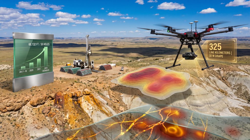
| Total U.S. Gold Database (to 2025) | 59 holes / 60,132 ft | Multiple | Feasibility Study resource base |
| 2026 Program (planned) | TBD | TBD | Below-pit depth testing, new external geophysical targets |
Several points from this progression deserve attention from a geological and investment perspective. Furthermore, understanding how drilling programs evolve across multiple campaigns helps contextualise the scale of the work completed to date.
-
The 2020 campaign was notable for its methodological versatility — running rotary, reverse circulation, and diamond core drilling simultaneously across a single program. Each technique serves a different purpose: rotary and RC allow rapid, cost-efficient subsurface sampling, while diamond core provides oriented, continuous samples suited to detailed geotechnical and metallurgical analysis.
-
The 2021 campaign remains the single largest drilling effort in U.S. Gold's CK Gold history at 48 holes and over 40,900 feet. Its primary focus on hydrologic and geotechnical refinement reflects the engineering rigour required to advance a project through permitting and toward a bankable feasibility study.
-
The 59-hole, 60,132-foot database incorporates work from prior operators including ASARCO, Henrietta Mines, Saratoga, and Strathmore, whose historical programs form the geological foundation upon which U.S. Gold's modern exploration layer was constructed.
Geophysical Surveying as Exploration Intelligence
From Ground-Level to Drone-Mounted: The Evolution of Magnetometry at CK Gold
The 2017 ground magnetometer survey established the first systematic anomaly map for the CK Gold area. That baseline identified the spatial relationships between surface magnetic signatures and known mineralisation, confirming the utility of magnetic surveying as a targeting tool across this district.
By 2026, drone-mounted magnetometry had advanced considerably as a field technique. Zonge International, Inc. of Reno, Nevada, conducted the updated survey covering 325 line kilometres at an average drape height of 32 metres. The increased spatial resolution achievable at 32-metre drape height compared to ground-based surveying, combined with the expanded coverage area, produced a substantially enhanced anomaly map.
The new data confirmed and enlarged anomalies first identified in 2017 while revealing additional structural corridors and magnetite-altered zones not previously characterised. Critically, the anomalous areas align along a dominant northwesterly structural fabric — a pattern that controls the orientation and geometry of mineralised zones and directly informs the design of drill section orientations for the upcoming program.
How Drone Magnetometry Works: A Step-by-Step Breakdown
For investors and readers less familiar with the method, understanding what a drone magnetometer survey actually measures helps contextualise its exploration value.
- A magnetometer instrument is mounted on a survey drone, which flies systematic parallel flight lines across the target area at a consistent elevation above ground surface.
- The instrument continuously records variations in the local magnetic field intensity caused by differences in the magnetic susceptibility of subsurface rocks.
- Magnetite-bearing or magnetite-altered rocks generate elevated readings relative to background; structural disruptions such as faults can produce linear anomaly patterns.
- Raw data is processed to remove diurnal drift and regional field gradients, producing a residual magnetic anomaly map.
- Anomalies are ranked by amplitude, spatial geometry, and their relationship to known mineralisation or structural trends, generating a prioritised list of drill targets.
Technical note for investors: The value of drone magnetometry over ground-based surveys is not simply convenience. Flying at a consistent 32-metre drape height maintains uniform sensor-to-source distance across variable topography, reducing data artefacts and improving the reliability of depth estimates for anomaly sources.
The Oligocene White River Formation: Why Cover Can Be a Positive Indicator
One of the more counterintuitive insights from the CK Gold geophysical work concerns the anomalies located southeast of the historical Copper King Mine. These targets are obscured beneath the Oligocene White River Formation, a younger sedimentary sequence that conceals the underlying basement geology.
In conventional thinking, covered anomalies might be viewed as harder to evaluate. However, exploration geologists often interpret geological cover differently: because the overlying sediments shield the basement rocks from surface weathering and oxidation, the magnetic contrast between mineralised and unmineralised rock is preserved rather than reduced. This means covered anomalies can carry greater amplitude than surface-exposed equivalents where weathering has partially destroyed the magnetite phase.
This distinction matters practically. An anomaly with high amplitude beneath cover may represent a more intact, less oxidised mineralising system than a surface-exposed equivalent of lower amplitude. Wright Geophysics has been contracted to complete advanced interpretation of the drone magnetometer dataset, and the upcoming gravity survey by Zonge International (scheduled for late July 2026) will provide complementary density data to help rank these covered targets. In addition, 3D geological modelling will play a critical role in synthesising the geophysical and drilling datasets into coherent subsurface interpretations.
Gravity Surveying: The Complementary Dataset
Why Gravity and Magnetics Are Used Together
No single geophysical method captures the full picture of subsurface geology. Magnetometry is sensitive to magnetic susceptibility contrasts but cannot distinguish between rock types of similar magnetic character. Gravity surveying measures density contrasts between rock packages, providing an independent line of evidence that, when integrated with magnetic data, significantly improves geological interpretation quality.
| Method | Physical Property Measured | Primary Application at CK Gold |
|---|---|---|
| Drone Magnetometry | Magnetic susceptibility | Identifying magnetite-altered zones, structural trends |
| Gravity Survey | Rock density | Identifying host rock packages, evaluating historical workings |
At CK Gold specifically, the gravity survey is designed to help identify rock packages similar in density character to those hosting copper-gold mineralisation and to evaluate the subsurface expression of known historical mining areas. The combined gravity and magnetic dataset will feed into Wright Geophysics' integrated geological models, which will be used to sequence and prioritise the drilling targets. For context on the broader project profile, the CK Gold Project overview provides useful background on the asset's technical and historical context.
Two Drilling Objectives and Why the Distinction Matters
The planned U.S. Gold CK Gold exploration drilling program has two clearly stated objectives, and the difference between them is significant from both a geological and investor perspective.
Objective 1: Testing mineralisation below the existing pit shell
The current Feasibility Study and resource model define a finite volume of known mineralisation within the proposed pit boundary. Drilling below the pit shell tests whether the gold-copper system continues at depth beyond what has already been characterised. Success here would not constitute a new discovery — it would represent an extension of a known system. Confirmation of depth continuity could support future resource-to-reserve conversion and potential pit expansion scenarios in updated mine planning.
Objective 2: Testing new targets outside the current pit footprint
Geophysical anomalies identified through the 2026 drone survey fall outside the existing pit boundary. These represent genuinely new exploration ground within the Silver Crown Mining District. Success at these external targets would not simply refine the known deposit — it would test whether the district hosts additional mineralised centres independent of the currently defined resource.
Why this distinction matters: Drilling below the pit shell is an optimisation exercise on a known system. Drilling outside the pit footprint is true exploration. The two objectives require different risk frameworks, different geological interpretations, and will have very different implications for how investors should interpret the results if successful.
The next major ASX story will hit our subscribers first
Resource-to-Reserve Conversion: The Technical Bridge
What It Takes to Convert a Resource to a Reserve
One of the most frequently misunderstood concepts in junior mining investment is the difference between a mineral resource and a mineral reserve. Resources represent mineralisation that has been geologically characterised to a defined confidence level. Reserves represent the portion of those resources that is economically extractable under a defined mine plan and commodity price assumption.
The conversion pathway follows a defined sequence:
- Geophysical surveys identify anomalous targets warranting follow-up.
- Drilling confirms the presence, grade continuity, and geometry of mineralisation.
- Assay data and geological models are updated to incorporate new drilling results.
- Engineering and economic analysis determines which portions of the updated resource meet the extraction threshold.
- Qualifying mineralisation is reclassified as mineral reserve in a technically compliant study.
The 2026 geophysical program and planned drilling are positioned at step one of this pathway for the new external targets, and at steps one through two for the below-pit extension objective. Investors should note that interpreting drill results correctly is essential before any resource update can be declared, and that geophysical surveys alone are insufficient for resource reclassification.
Furthermore, understanding concepts such as true vs apparent widths is critical when evaluating whether intercepts genuinely reflect the geometry of the mineralised zone or are artefacts of drill angle relative to ore body orientation.
The Silver Crown Mining District: Historical Validation of a Productive System
The Silver Crown Mining District carries documented evidence of high-grade gold and copper production from earlier operators, including the historical Copper King Mine. This prior production history is geologically meaningful because it confirms that the hydrothermal system operating across this district has previously generated economically significant metal concentrations.
When anomalies identified in the 2026 drone survey align structurally with the trend of the Copper King Mine, that spatial relationship is not coincidental from a geological standpoint. It suggests that the same northwest-trending structural architecture that controlled high-grade mineralisation at the historical mine may be guiding the geometry of newly identified anomalies.
This is precisely the context in which management has framed the exploration program's ambition: expanding the focus from the defined CK Gold deposit to the broader Silver Crown Mining District, targeting areas of former high-grade mining conducted by the original district developers.
What District-Scale Exploration Means for a Development-Stage Company
Most single-asset developers direct exploration capital almost exclusively toward the defined deposit until construction financing is in place. Allocating capital to district-scale geophysical and drilling programs while a feasibility study is already published represents an atypical sequencing decision. A completed definitive feasibility study typically signals a company is preparing to advance toward construction, making this district-wide exploration push a notable strategic choice.
| Exploration Approach | Timing Relative to Feasibility | Capital Focus | Risk and Upside Profile |
|---|---|---|---|
| Standard Single-Asset | Post-construction commencement | Defined deposit only | Lower near-term exploration risk |
| District-Scale Pre-Construction | Pre-construction, alongside feasibility | District-wide targets | Higher optionality, broader potential upside |
For investors, the key analytical question is whether management's decision to pursue district-scale geophysical work at this stage reflects genuine geological conviction about the Silver Crown Mining District's broader potential, or whether it represents capital allocation away from advancing the defined project. The answer likely depends on the outcome of the U.S. Gold CK Gold exploration drilling program itself — and on whether the geophysical anomalies identified in the 2026 survey translate into confirmed mineralisation when the drill bit provides the final verdict. For further detail on the company's recent exploration activities, the official press release provides additional technical context directly from U.S. Gold Corp.
Disclaimer: This article is for informational purposes only and does not constitute financial or investment advice. Exploration results, resource estimates, and project timelines are subject to material risks and uncertainties. Readers should conduct their own due diligence before making any investment decisions. Further information on U.S. Gold Corp. and the CK Gold Project can be found at Crux Investor.
Want to Be First When the Next Major Mineral Discovery Hits the ASX?
Discovery Alert's proprietary Discovery IQ model delivers real-time alerts on significant ASX mineral discoveries, instantly turning complex geological data into actionable investment insights — explore the historic returns major discoveries have generated and begin your 14-day free trial at Discovery Alert to position yourself ahead of the broader market.