June 17, 2026

The Hidden Architecture of African Mining: Why Geological Data Is the New Strategic Frontier
Across the global mining industry, a quiet but profound reordering is underway. The competitive advantage in critical mineral exploration no longer belongs exclusively to companies with the deepest drilling budgets or the most aggressive land acquisition strategies. Increasingly, it belongs to whoever controls the most comprehensive, highest-quality geological data. In a world where AI-powered platforms can transform historical survey records into high-confidence drill targets within months, Congo geological archives digitization has become one of the most strategically significant processes in modern resource governance.
This shift places Africa at an inflection point. The continent holds an extraordinary share of the world's critical mineral endowment, yet its geological information landscape remains among the most fragmented on earth. Nowhere is this tension more visible, or more consequential, than in the Democratic Republic of Congo's ongoing effort to recover and digitize its colonial-era geological archives — a process that cuts to the heart of what it means for a resource-rich nation to exercise genuine sovereignty over its own subsurface. The extraordinary DRC mineral wealth at stake makes this a globally significant undertaking.
When big ASX news breaks, our subscribers know first
What Is Actually Held Inside the Tervuren Archive?
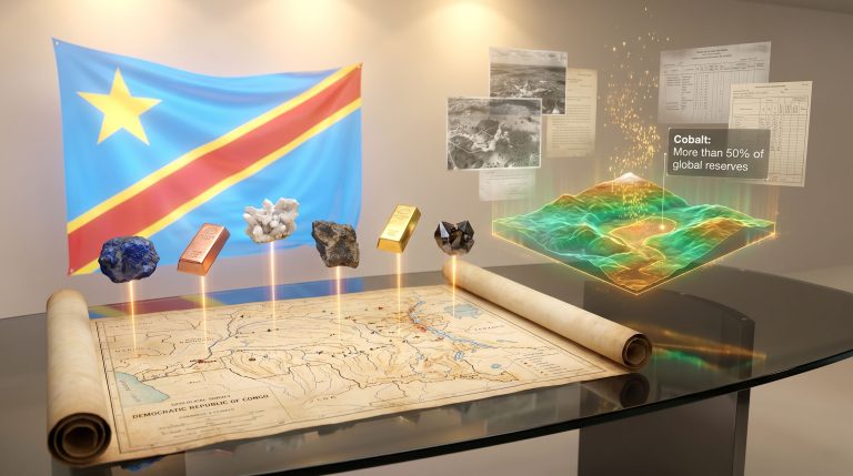
The AfricaMuseum in Tervuren, Belgium, houses one of the most geologically significant collections in the world, largely invisible to the public discourse around African mining. The archive spans approximately 500 linear metres of shelving and contains millions of individual files: colonial-era survey reports, cartographic records, field photographs, geochemical sampling data, and detailed mineral occurrence documentation compiled across decades of Belgian administration of the Congo.
What makes this collection remarkable is not its historical character but its prospective relevance. Many of the minerals documented in these records were considered economically marginal at the time of their survey. Cobalt, coltan, lithium, and certain copper formations were catalogued with limited commercial urgency during the colonial era. Today, those same minerals sit at the centre of global battery supply chains, clean energy infrastructure, and the electrification of transport systems worldwide.
The strategic calculus is stark: the cost of replicating this body of fieldwork through new ground surveys would run into the billions of dollars. For exploration companies and governments alike, the archive represents a compressed form of geological intelligence that simply cannot be recreated within any commercially viable timeframe. Furthermore, efforts to digitise these records are already under way through EU-funded programmes, though access disputes continue to complicate progress.
"The records stored in Tervuren are not a museum curiosity. They are a pre-existing exploration dataset covering one of the most mineral-rich territories on the planet, catalogued at a time when the minerals they describe had not yet become indispensable to the modern economy."
How AI Exploration Has Redefined What Historical Geological Records Are Worth
Understanding why the Congo geological archives digitization debate has become so commercially charged requires grasping a fundamental shift in exploration technology. For most of the twentieth century, geological archives were valued primarily as reference material: useful background, but secondary to fresh fieldwork and new drilling programmes.
That relationship has been inverted by machine learning platforms designed specifically for mineral exploration. These systems ingest large-scale geoscientific datasets — including historical drill logs, airborne geophysical surveys, geochemical sample records, and surface geology maps — and identify mineralisation patterns that would be statistically invisible to conventional analysis. The role of AI in mineral exploration is therefore central to understanding why historical archives now carry such extraordinary commercial value.
The critical insight is that data density and historical depth directly improve predictive accuracy. Richer archives produce better-trained models, which generate higher-confidence exploration targets, which reduce the capital required to make a discovery.
The Manono Lithium Program: A Case Study
This is the technical logic underpinning a U.S.-based AI exploration company's $50 million lithium programme currently active in the DRC. The programme encompasses 30,000 square kilometres of airborne survey coverage and includes intensive drilling and sampling across permit areas exceeding 3,000 square kilometres in the Manono region — one of the world's most significant known lithium formations.
Access to the Tervuren archive's historical baseline data would materially enhance the predictive models underpinning this programme by providing subsurface reference points across adjacent and underexplored zones.
| Data Type | Role in AI Exploration | Strategic Value |
|---|---|---|
| Colonial survey maps | Baseline geological framework | High — identifies underexplored zones |
| Historical drill logs | Subsurface lithology reference | Very High — reduces drilling uncertainty |
| Geochemical sample records | Mineralisation pattern training data | High — improves deposit prediction models |
| Airborne geophysical data | Structural geology interpretation | Very High — enables large-scale target screening |
| Photographic field records | Surface geology validation | Moderate — contextualises anomaly interpretation |
The Three-Way Contest: Kinshasa, Brussels, and Private Capital
On June 9, 2026, DRC Mines Minister Louis Watum Kabamba reached a formal agreement with Belgian and European officials in Brussels, establishing a roadmap and joint working group for the digitization and phased transfer of the country's geological archives. The agreement represents a diplomatic milestone, but it also crystallises the complexity of the competing interests involved. This broader Congo minerals partnership framework adds yet another layer of strategic complexity to the archive dispute.
The DRC Government's Position
Kinshasa's objective is unambiguous: transform the digitized records into publicly accessible national infrastructure governed by the country's national geological service. The intention is not to create preferential data access for any single commercial actor but to establish a geological knowledge base that serves the full range of researchers and investors operating in the country.
This approach is what Congolese officials describe as geoscientific sovereignty — the state's capacity to independently understand, map, and manage its own subsurface resources.
A July 2025 agreement between the Congolese government and the AI exploration company referenced above included commitments to digitize archival materials and make geoscientific data freely available through Congo's national geological service. However, the company subsequently found its access to the Tervuren collection restricted, creating a direct conflict between the bilateral framework agreed with Kinshasa and Belgium's institutional governance position. The stalled access dispute has consequently drawn international attention to the competing frameworks at play.
Belgium's Position
Belgian authorities classify the AfricaMuseum collection as a public asset. Their position is that privileged access by any foreign private company requires a direct contractual relationship with the Belgian state, not simply an arrangement with a third-country government. A separate EU-funded digitization programme is already operational, with digital copies to be transferred to Congolese authorities on a phased timeline. This framework prioritises institutional oversight over accelerated commercial access.
The Private Sector Perspective
From the exploration industry's standpoint, rapid archive digitization is not a heritage matter. It is exploration infrastructure. Every month of delay in making historical geological records accessible represents a tangible cost in exploration efficiency, target identification timelines, and capital allocation decisions.
"The fundamental tension here is not about document custody. It is about whether geological data — particularly in the critical minerals sector — should function as a public good, a state-controlled strategic asset, or a competitive input accessible to well-capitalised private actors. All three framings are coherent. Only one of them can govern any given dataset at any given moment."
Africa's Geological Data Gap: The Numbers Behind the Investment Shortfall
The DRC's archive dispute is the most visible symptom of a structural problem that suppresses mining investment across the entire African continent. The gap between geological endowment and exploration capital is stark and quantifiable.
| Metric | Africa | Global Benchmark |
|---|---|---|
| Share of global land area | 22% | Proportional expectation: ~22% |
| Share of global mining exploration spending (2024) | ~10% | ~22% (proportional) |
| Botswana territory remaining geologically uncharacterised | ~70% | — |
| Kenya airborne survey mineral occurrences identified | 970 | — |
According to World Bank analysis, limited geological data availability is among the primary factors elevating perceived investment risk in African mining jurisdictions. Investors operating in data-sparse environments apply higher risk premiums, demand more favourable fiscal terms, and commit smaller initial capital allocations — all of which reduce the fiscal returns that host governments ultimately capture from their own mineral wealth.
The information asymmetry is self-reinforcing. Without comprehensive geological knowledge, governments cannot price exploration licences accurately, cannot identify strategic reserve zones, and cannot negotiate with investors from a position of genuine informational parity. The result is a structural market failure that benefits well-resourced private actors at the expense of sovereign resource governance. Indeed, broader mining geopolitics increasingly turn on exactly this kind of information asymmetry.
How Peer Nations Are Responding
Several African governments have begun treating geological data production as a sovereign infrastructure investment rather than a service to be delegated to the private sector:
-
Botswana established a state-owned geological enterprise in 2025 to consolidate historical records and conduct systematic new exploration across approximately 70% of its territory that remains geologically uncharacterised.
-
Kenya completed a national airborne geophysical survey that identified 970 discrete mineral occurrences, directly improving the country's investment-readiness profile and reducing the risk premium demanded by exploration investors.
-
Nigeria has expanded bilateral and multilateral partnerships focused on geological mapping standardisation and cross-border data-sharing frameworks.
The common thread across these initiatives is a recognition that geological knowledge is not a byproduct of mining activity. It is a prerequisite for designing the regulatory and licensing environments that make mining activity strategically beneficial for the host state. Furthermore, current exploration industry trends suggest that jurisdictions investing in public geological data are measurably outperforming those that do not in attracting exploration capital.
From Digitization Agreement to Functional Geological Intelligence: The Technical Gaps
Reaching a diplomatic agreement on archive repatriation is the simplest part of the process. The technical and institutional challenges that follow are considerably more demanding, and they determine whether the exercise generates operational value or merely symbolic progress.
Step-by-step, effective Congo geological archives digitization requires:
-
Prioritisation — Not all archival materials carry equivalent strategic value. Areas with active exploration interest, proximity to known deposits, and coverage of critical minerals warrant accelerated processing. Damaged or deteriorating records require conservation-grade digitization before standard processing can proceed.
-
Format standardisation — Raw digitized files must be georeferenced, tagged with consistent metadata, and converted into formats compatible with modern GIS platforms and national geological databases before they can function as exploration inputs.
-
Database integration — Standardised records must be integrated into a unified national geological intelligence platform with interoperability built into its architecture, enabling data to be queried, layered, and cross-referenced against new survey results.
-
Public data infrastructure — Baseline geological data must be made accessible to multiple investors simultaneously to prevent informational monopolies and improve the government's competitive negotiating position in licensing rounds.
-
Institutional capacity development — Data transfer without corresponding workforce development in geological data science, GIS analysis, and AI-assisted interpretation risks producing archives that remain practically inaccessible. This is arguably the most consequential gap in the entire repatriation process.
"The most significant risk in the DRC's archive recovery initiative is not that data remains physically located in Belgium. It is that digitized records are transferred to institutions that lack the technical infrastructure and trained personnel to convert them into actionable geological intelligence. Repatriation without capacity development produces symbolic sovereignty, not operational advantage."
The next major ASX story will hit our subscribers first
What Genuine Geoscientific Sovereignty Looks Like as Policy Architecture
For the DRC and for African resource states more broadly, the Tervuren dispute points toward a longer-term policy challenge that extends well beyond the recovery of colonial-era documents. Building genuine geoscientific sovereignty requires a structured policy architecture across four dimensions:
-
Legislative framework: National geological data laws that define ownership, establish public access rights, and mandate disclosure requirements for exploration companies operating within the jurisdiction.
-
Institutional mandate: A well-resourced national geological service with statutory authority over data collection standards, quality control, and public release protocols.
-
Data governance model: Clear, publicly articulated rules distinguishing the publicly available geological baseline from commercially sensitive exploration results generated by private licensees.
-
International cooperation framework: Bilateral and multilateral agreements that facilitate data sharing across borders while protecting the sovereign data rights of host states.
Countries that build this architecture gain durable structural advantages: the capacity to price exploration licences accurately, to identify strategic reserve zones before licensing rounds commence, and to engage investors from a position of genuine informational equality rather than dependence.
| Stakeholder | Strategic Implication |
|---|---|
| DRC Government | Archive repatriation must be paired with institutional capacity development to generate real operational value |
| African Governments Broadly | National geological data programmes are sovereign infrastructure investments, not optional development add-ons |
| Mining Investors | Jurisdictions with comprehensive public geological data offer measurably lower exploration risk |
| Development Finance Institutions | Geological survey funding and data infrastructure should be prioritised alongside traditional infrastructure finance |
| EU and Bilateral Partners | Archive repatriation frameworks must include capacity-building components to ensure transferred data is effectively utilised |
Frequently Asked Questions: Congo Geological Archives Digitization
What geological records are held at Belgium's AfricaMuseum in Tervuren?
The AfricaMuseum holds an extensive collection of colonial-era geological documentation relating to the DRC, including approximately 500 linear metres of survey reports, maps, and field records, hundreds of thousands of photographs, and millions of individual files covering mineral occurrences across the country's territory. Coverage includes cobalt, coltan, lithium, copper, and tin deposits, many of which are now classified as critical minerals for the global energy transition.
Why does the DRC want its geological archives returned?
The DRC seeks access to these records primarily to strengthen its capacity to govern its own mineral resources. Comprehensive geological data allows the government to make more informed licensing decisions, attract a broader range of investors, improve royalty and tax frameworks, and reduce structural dependence on foreign geological expertise. The initiative is framed explicitly as an exercise in geoscientific sovereignty.
What is the current status of the digitization agreement between Congo and Belgium?
As of June 2026, the DRC and Belgium have agreed on a formal roadmap and established a joint working group to oversee the digitization and phased transfer of geological archives. A separate EU-funded digitization programme is already in progress, with digital copies to be transferred gradually to Congolese authorities across a multi-year timeline.
Why did Belgian authorities decline to grant a private company direct access to the archives?
Belgian authorities classify the AfricaMuseum collection as a public asset and maintain that access by foreign private companies requires a direct contractual relationship with the Belgian state. The position reflects a public interest governance framework rather than opposition to digitization. Belgium supports the EU-funded programme and phased institutional transfer to Congolese authorities.
How does AI change the strategic value of historical geological archives?
AI-powered exploration platforms can process large volumes of historical geological data to identify mineralisation patterns and generate exploration targets with a speed and precision that conventional geological analysis cannot replicate. This means historical archives now function as primary competitive inputs for mineral exploration programmes, fundamentally increasing both their strategic and commercial value compared to their pre-AI era utility.
How does Africa's geological data gap affect mining investment?
World Bank analysis identifies limited geological data availability as a primary driver of elevated investment risk perception across African mining jurisdictions. Despite accounting for 22% of global land area, Africa attracted only approximately 10% of global mining exploration spending in 2024. Closing this information gap is increasingly recognised across the development finance community as a prerequisite for improving Africa's long-term competitiveness as a mining investment destination.
Ready to Invest Ahead of the Next Major Critical Mineral Discovery?
Discovery Alert's proprietary Discovery IQ model delivers real-time alerts on significant ASX mineral discoveries — instantly translating complex geoscientific data into actionable investment opportunities, much like the strategic intelligence advantage described above. Explore historic discoveries and their extraordinary returns, then begin your 14-day free trial at Discovery Alert to position yourself ahead of the broader market.