
June 10, 2026
The Data Has Always Been There — The Bottleneck Was Access
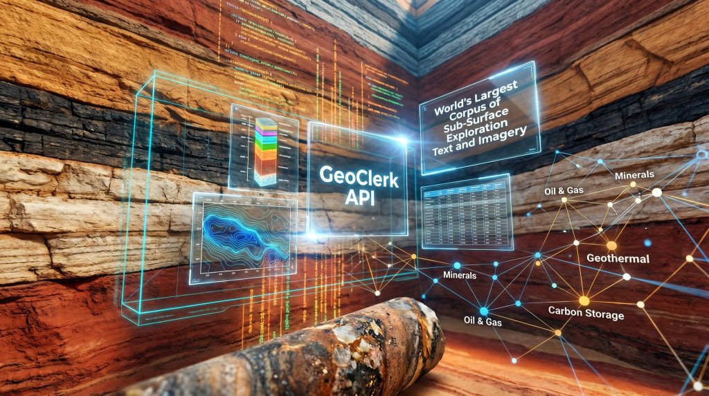
Geoscience has a peculiar problem. Unlike many knowledge-intensive industries that suffer from data scarcity, the sub-surface exploration sector is drowning in information it cannot efficiently reach. Decades of drilling campaigns, seismic surveys, geochemical sampling programs, and stratigraphic mapping exercises have produced an extraordinary body of technical knowledge — and the GeoClerk API for sub-surface exploration text and imagery has emerged as a direct response to this challenge.
Most of this knowledge remains buried in OCR-scanned PDFs, unindexed image archives, and non-standardised legacy file formats scattered across government repositories and private holdings.
The scale of this archived intelligence is genuinely vast. Mineral exploration basics, oil and gas, geothermal energy, groundwater management, and carbon capture and storage have each generated their own siloed documentation trails over many decades. Individually, these archives represent important scientific and commercial value. Collectively, they constitute what is arguably the largest untapped knowledge infrastructure in the resources sector.
Yet for most of that history, accessing this intelligence required a human being sitting at a screen, running manual searches, opening documents one by one, and synthesising findings across sessions that could stretch from days into weeks. The constraint was never the absence of relevant data. It was the absence of any scalable mechanism to retrieve it.
That constraint has now been directly addressed.
When big ASX news breaks, our subscribers know first
Understanding the GeoClerk API for Sub-Surface Exploration Text and Imagery
From Human-Speed Search to Machine-Speed Intelligence
GeoClerk has spent years building what it describes as the world's largest corpus of sub-surface exploration text and imagery into a genuinely searchable resource. The platform already allowed geoscientists to locate documents by location, keyword, or image type far faster than traditional manual methods permitted. However, even with that capability in place, one structural limitation remained: every search still required a person to initiate it.
The launch of the GeoClerk API, reported by Global Mining Review on 10 June 2026, removes that final constraint entirely. The API opens the same corpus to programmatic and agentic access, allowing software applications and AI reasoning systems to query the archive directly, continuously, and at a scale no individual analyst could replicate.
The research that used to fill an analyst's week can now run in the background in minutes, according to GeoClerk's Head of Product Tim Hall-Johnston. The API hands the platform's search capabilities directly to code and AI agents, without changing how geoscientists fundamentally approach exploration.
This is not a marginal efficiency improvement. It represents a categorical shift in how exploration intelligence can be consumed and operationalised.
What the GeoClerk API Actually Does: A Technical Breakdown
At its core, the GeoClerk API for sub-surface exploration text and imagery provides code-callable access to the platform's corpus via standard HTTP requests. Rather than navigating a web interface, engineering teams and AI systems interact with the archive through structured API calls that support three primary search modalities, individually or in any combination:
- Spatial filtering — queries defined by geographic coordinates, bounding boxes, or named geological regions
- Full-text search — keyword and semantic retrieval across exploration documents, reports, and narrative records
- Image-type classification — filtering by geoscience visual categories such as cross-sections, lithostratigraphic columns, geophysical maps, and data tables
The integration architecture is designed for speed of adoption. The API ships with a complete OpenAPI specification, making onboarding straightforward for engineering teams already comfortable with REST-based systems. A ready-to-use Postman collection further reduces the testing overhead that typically delays data infrastructure integrations. Authentication uses standard Bearer API-key protocols, consistent with widely adopted REST security practices.
According to the product announcement, engineering teams should expect integration timelines measured in hours rather than the weeks commonly associated with geoscience data system onboarding.
Data Types Accessible Through the API
| Data Category | Description | Applicable Disciplines |
|---|---|---|
| Exploration text documents | Full-text indexed reports, assessments, and technical papers | Minerals, oil and gas, geothermal, groundwater |
| Geoscience imagery | Classified maps, cross-sections, 3D models, stratigraphic diagrams | All sub-surface disciplines |
| Geochemical datasets | Structured geochemical data extracted from legacy reports | Minerals exploration, carbon storage |
| Stories and contextual records | Narrative exploration intelligence from historical archives | Greenfields investigation |
| Well and borehole references | Subsurface well log and core sample documentation | Oil and gas, geothermal, groundwater |
Why the Human Throughput Ceiling Became Unsustainable
The Structural Problem With Sub-Surface Archive Research
To appreciate why programmatic access matters, it helps to understand the specific nature of the workflow problem that preceded it.
A geoscientist conducting archive research manually operates under several compounding constraints. Each query must be initiated, monitored, and interpreted by a person. Results from different search sessions must be manually cross-referenced. When archives are updated — new documents indexed, new imagery classified — there is no automated mechanism to surface that new material against existing research criteria.
Furthermore, the analyst must return to the archive and repeat the process entirely. For exploration teams running recurring research protocols — scanning the same geographic areas on a regular cycle, or monitoring specific commodity corridors for new historical findings — this creates a significant and ongoing drain on skilled analyst time.
The tasks themselves are not intellectually demanding. They are repetitive, mechanical, and consume capacity that would be far better directed toward interpretation, interpreting drill results, modelling, and decision support.
Key Insight: The fundamental bottleneck in modern sub-surface exploration intelligence is not data scarcity. It is the speed at which human operators can interface with data that already exists.
What Programmatic Access Changes at the Operational Level
When the same query that previously required an analyst to spend an afternoon clicking through an archive can instead be executed as a scheduled API call in seconds, the downstream effects compound quickly.
| Capability Dimension | Manual Search | GeoClerk API (Programmatic) |
|---|---|---|
| Query execution speed | Minutes to hours per query | Sub-second at scale |
| Repeatability | Analyst-dependent | Fully automated on schedule |
| Concurrent query volume | Single user, sequential | Unlimited parallel requests |
| AI agent compatibility | Not applicable | Native agentic support |
| Dashboard integration | Manual export required | Direct pipeline feed |
| Greenfields scan coverage | Geographically limited | Entire corpus, any region |
Agentic AI Workflows and the GeoClerk API
Why Agentic Access Is the Most Significant Capability Shift
Programmatic access for human-controlled software pipelines is valuable. Agentic access, where large language models and autonomous reasoning systems query the corpus as active participants in multi-step workflows, is transformative.
The GeoClerk API is explicitly architected for agentic use cases. An AI agent integrated with the API can execute spatial searches, retrieve documents, classify imagery, extract geochemical records, and pass structured outputs to downstream reasoning processes — all without requiring human intervention at each step. Furthermore, this positions the API squarely within the broader industry migration toward AI in mineral exploration workflows.
Three operational patterns emerge as particularly significant:
- Continuous corpus monitoring — Agents can be configured to query the archive on a defined schedule, automatically surfacing documents newly matching predefined spatial or thematic criteria as the corpus expands
- Automated document triage — Relevant material can be screened, scored for relevance, and ranked before a human analyst engages with it, dramatically reducing the cognitive load of archive review
- Direct pipeline integration — Query outputs feed into internal dashboards, business intelligence platforms, and decision-support systems without manual export or formatting steps
Operational Shift: When an AI agent can query a sub-surface archive continuously and at scale, the research cycle compresses from analyst-weeks to automated minutes. This fundamentally changes not just the speed of exploration intelligence consumption, but the strategic questions organisations can afford to ask.
Four Core Workflow Applications the GeoClerk API Unlocks
Practical Use Cases Across the Exploration Lifecycle
1. Automated Repetitive Research
Teams running standard spatial or keyword searches on a recurring basis can schedule these queries programmatically. The archive monitors itself against predefined criteria, with no analyst required in the loop for routine execution.
2. Live Intelligence Feeds for Internal Dashboards
Exploration intelligence can be piped directly into organisational tools — business intelligence platforms, internal project portals, or operational dashboards — as new material is indexed. This eliminates the lag between archive updates and team awareness.
3. Data Screening and Material Triage at Scale
Large document sets matching broad geographic or thematic parameters can be filtered, ranked, and surfaced automatically. This is particularly valuable during early-stage project scoping, when teams need to quickly assess the density and character of historical exploration activity across a prospective region.
4. Systematic Greenfields Investigation
Organisations can programmatically scan entire basins, geological provinces, or commodity-specific archives to identify exploration gaps, overlooked historical results, or under-tested geological hypotheses. In regions where manual archive review would require months of analyst time, this capability enables a level of systematic coverage that was previously impractical.
Industry Verticals Served and the Broader Technology Stack
Where the GeoClerk API Sits Within the Geoscience Workflow
The API functions as a structured interface layer between raw archived data and the downstream applications that act on exploration intelligence. Conceptually, the workflow architecture looks like this:
- Raw sub-surface data sources (seismic surveys, well logs, core samples, geochemical analyses)
- Archive ingestion and indexing (OCR processing, image classification, spatial tagging)
- GeoClerk API layer (programmatic and agentic query interface)
- Downstream applications (dashboards, AI agents, exploration pipelines, reporting tools)
Disciplines and Verticals Served
| Industry Vertical | Primary Use Case | Most Relevant Data Types |
|---|---|---|
| Minerals exploration | Greenfields targeting, historical drill result retrieval | Geochemical datasets, core reports, maps |
| Oil and gas | Basin screening, well correlation, legacy data recovery | Well logs, seismic references, text reports |
| Geothermal energy | Resource assessment, thermal gradient analysis | Subsurface temperature data, geological reports |
| Groundwater management | Aquifer characterisation, historical bore data | Hydrogeological reports, stratigraphic sections |
| Carbon storage (CCS) | Storage site assessment, geological seal evaluation | Structural maps, formation reports |
The Multi-Modal Search Advantage
One technically important aspect of the GeoClerk API that deserves specific attention is its unified multi-modal search architecture. Most legacy geoscience data systems treat spatial, textual, and image-based retrieval as separate problems, requiring analysts to operate across multiple platforms and manually reconcile outputs.
The GeoClerk API consolidates all three modalities into a single callable endpoint. This means a single query can simultaneously filter by geographic bounding box, search for specific terminology within document text, and restrict results to particular image classification categories. In addition, techniques such as downhole geophysics and 3D geological modelling become far more powerful when cross-referenced against this kind of unified archive access.
Strategic Implication: The ability to query exploration imagery, geochemical records, and narrative reports simultaneously, filtered by geography, compresses what was previously a multi-system research process into a single callable function. Over time, this creates a compounding information advantage for organisations that integrate programmatic archive access early.
The next major ASX story will hit our subscribers first
The Broader Significance: Geoscience Data Infrastructure Enters the Machine-Readable Era
A Structural Transition, Not an Incremental Feature Update
The GeoClerk API launch reflects something larger than a single product release. It marks a meaningful step in the migration of geoscience knowledge management infrastructure from human-operated search interfaces toward machine-readable data layers capable of supporting autonomous reasoning systems.
This transition has been building across adjacent industries for years. Financial data infrastructure moved to programmatic access long ago, enabling algorithmic analysis at scales no human analyst team could match. Healthcare research platforms have increasingly adopted API-first architectures to support systematic literature review at scale. The geoscience sector, constrained by the complexity of its data types and the legacy formats in which much of its knowledge is stored, has lagged behind.
The availability of API-accessible, spatially indexed, multi-modal archives is becoming a critical dependency for AI-augmented exploration workflows. Research published on ResearchGate examining integrated workflows for identifying surface and subsurface lineaments in the Gawler Craton reinforces how important systematic, scalable data access has become for modern exploration targeting.
As large language models and autonomous reasoning agents become embedded in how exploration teams operate, the organisations that have already integrated programmatic archive access into their pipelines will compound an informational advantage over those still relying on manual retrieval. The GeoClerk platform itself continues to expand its corpus, meaning the strategic value of API integration compounds over time alongside the underlying data.
For exploration professionals, the practical implications are straightforward: analyst time previously consumed by repetitive search tasks becomes available for higher-order interpretation. Time-to-insight on greenfields targets compresses. And the scalable intelligence infrastructure grows in strategic value as the underlying corpus continues to expand.
Disclaimer: This article discusses technological capabilities and operational applications based on publicly available product announcements. It does not constitute financial or investment advice. Readers should conduct independent due diligence before making any commercial or investment decisions related to companies or technologies discussed.
Ready to Act on the Next Major ASX Mineral Discovery Before the Market Does?
Discovery Alert's proprietary Discovery IQ model scans ASX announcements in real time, instantly transforming complex mineral data into actionable insights for traders and investors across all experience levels — explore historic discoveries and the returns they generated, then begin a 14-day free trial at Discovery Alert to secure a genuine market-leading edge.