July 21, 2026
The Hidden Engine of Global Mineral Supply: Why Grassroots Prospecting Still Matters
The history of mining is not written in boardrooms or stock exchanges. It begins far earlier, in remote valleys, on ancient shield terrains, and along forgotten river drainages where a geologist or independent prospector decides to stop, pick up a rock, and ask why it looks different from everything else nearby. That single act of field curiosity is the true origin of every copper mine, gold deposit, and lithium project that has ever entered production. Understanding grassroots prospecting for mineral exploration means understanding where the entire value chain begins, long before the drilling rigs arrive and well before the investment community takes notice.
When big ASX news breaks, our subscribers know first
The Exploration Pipeline: Where Grassroots Work Sits and Why It Is Undervalued
Mineral exploration follows a structured progression from initial target identification through resource definition, feasibility assessment, and ultimately mine construction. Within that sequence, grassroots prospecting occupies the earliest and arguably most consequential position. It is the phase responsible for generating the raw material of the entire system: new targets.
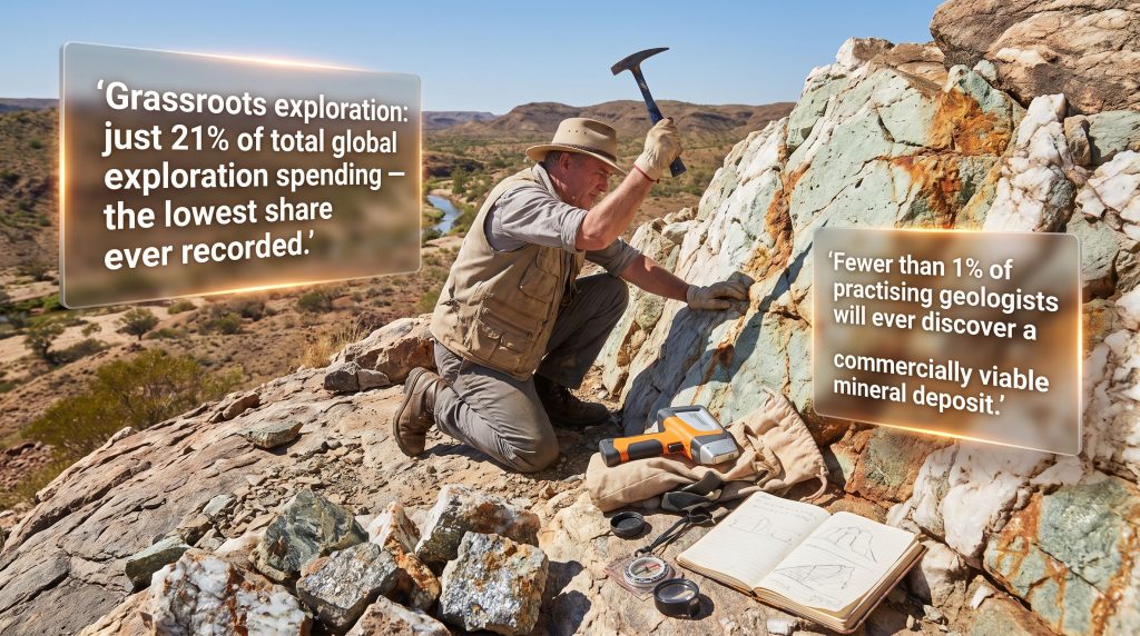
Yet despite its foundational role, early-stage discovery work has been systematically underfunded for years. The mineral exploration importance of this phase cannot be overstated, yet grassroots exploration now accounts for just 21% of total global exploration spending, the lowest share ever recorded in industry spending datasets. Major mining companies direct only around 19% of their budgets toward generative new discovery programs, with the overwhelming majority of capital allocated to expanding already-known deposits rather than funding entirely new frontiers.
Why the Majors Step Back from Greenfield Discovery
The reluctance of large mining corporations to fund early-stage exploration is not irrational. It reflects a structural reality about capital allocation within large organisations:
- Brownfield expansion at an existing operation carries far lower geological uncertainty than a blank-canvas greenfield program
- Institutional shareholders typically reward near-term resource growth over long-duration, high-risk discovery spending
- The timeline from grassroots discovery to mine production routinely spans 10 to 20 years, making it difficult to justify within standard capital planning cycles
- Majors have discovered it is often cheaper to acquire a junior explorer that has already de-risked a project than to fund the equivalent discovery internally
This creates a well-defined discovery gap that junior explorers and independent prospectors fill by necessity. Most junior exploration companies will never open a mine. They either exhaust their capital without success or, if their project develops sufficient geological credibility, attract acquisition interest from a larger company. That acquisition model is the mechanism through which grassroots value ultimately flows into the global mining supply chain.
Greenfields vs. Brownfields: A Strategic Decision That Shapes Everything That Follows
Before a single sample bag is filled, every prospector and exploration team faces a fundamental strategic choice about what kind of terrain to target.
Exploring Established Districts: The Brownfields Advantage
Brownfields exploration operates within or adjacent to terrain that already has a documented mineral endowment. The geological logic is compelling: most deposits are not isolated anomalies but products of large, fertile mineral systems capable of generating multiple deposits across a substantial area. Exploring within a proven system means the prospectivity question has already been answered at a regional scale.
Practical advantages reinforce the geological case. Brownfields areas typically have road access, existing infrastructure, and rich databases of prior drilling, geochemical sampling, and geophysical survey data. Historical information reduces targeting uncertainty and shortens the time needed to identify drill-worthy targets. The trade-off is competitive: claim acquisition in well-known districts is significantly more difficult, and the most obvious targets have frequently already been tested.
Frontier Territory: The Greenfields Proposition
Greenfields exploration targets terrain with no established mining history. Targets are typically selected through large-scale structural geology interpretation, metallogenic belt analysis, and regional geophysical datasets, sometimes supplemented by gut instinct developed over years of field experience.
The logistical realities of greenfields work are considerable. Remote access may require float planes, helicopter charters, or canoe portaging through wilderness terrain. Information density is low, requiring programs to cast a wide geographic net before anomalies emerge. Capital requirements per unit of geological knowledge gained are substantially higher than in brownfields settings.
Side-by-Side: How the Two Approaches Compare
| Factor | Greenfields | Brownfields |
|---|---|---|
| Discovery Potential | Highest | Moderate to High |
| Data Availability | Minimal | Substantial |
| Claim Accessibility | Easier to acquire | Highly competitive |
| Logistical Complexity | High (remote terrain) | Lower (road access typical) |
| Capital Required | Higher | Lower |
| Overall Risk Level | Highest | Moderate |
How Grassroots Prospecting for Mineral Exploration Actually Unfolds
The process is neither linear nor simple. It combines desktop research, data integration, field validation, and iterative interpretation across a series of increasingly focused stages.
Stage 1: Continental to District-Scale Target Selection
Before any boots touch the ground, effective prospecting begins with a thorough desktop review. This includes:
- Published geological literature and tectonic history assessments for the target region
- Satellite imagery platforms including Landsat and Sentinel-2, which enable remote detection of hydrothermal alteration patterns across vast areas
- GIS software integration through platforms such as ArcGIS, QGIS, and Google Earth to overlay multiple datasets spatially
- Government geological survey databases containing bedrock maps, regional geophysical grids, and historical prospecting reports
One of the most underutilised resources available to grassroots prospectors is direct engagement with local district geologists. These professionals carry detailed regional knowledge and maintain a mandate to support mineral exploration activity. They can suggest prospective claims, explain local geological frameworks in detail, and in some cases accompany prospectors on site visits. For newly licensed prospectors, this connection can be genuinely transformative.
Stage 2: Geophysical and Geochemical Data Integration
Once a target region is selected, the next task involves compiling and interpreting all available geoscientific data. Furthermore, the range of methods available at this stage has expanded considerably in recent decades:
- Airborne magnetic and gravity survey interpretation to identify subsurface structural features and lithological contrasts
- Stream sediment sampling and bulk leach extractable gold (BLEG) surveys to detect dispersed geochemical signatures downstream of mineralisation
- Remote sensing analysis to identify hydrothermal alteration zones through spectral reflectance characteristics
- Structural lineament mapping through regional datasets to identify fluid conduit pathways
Stage 3: Target Generation and Ranking
Compiled data feeds into a formal target generation process. Modern programs increasingly incorporate machine learning tools for predictive geoscience, though these remain supplementary to geological interpretation rather than replacements for it. Targets are typically ranked using tiered frameworks, and understanding mineral deposit tiers is essential for prioritising which prospects warrant immediate field investigation.
Stage 4: Ground Validation
This is where the physical demands of grassroots prospecting become real. Field teams conduct:
- Systematic outcrop traverses and rock mapping across priority target zones
- Rock chip and grab sampling, with soil sampling methods including grids and trench-based channel sampling
- Portable XRF analysis for rapid in-field elemental screening
- Structural observations to connect surface geology to deposit-scale targeting models
Field Reality Check: Grab samples are inherently unreliable as standalone evidence. Under field conditions, collecting a truly representative sample from an outcrop is functionally impossible. A compelling grab sample assay demonstrates geological potential, but it must always be interpreted within a broader multi-line evidence framework before any investment conclusion is drawn.
Channel sampling through resistant rock types, particularly lithium-bearing pegmatites, requires cutting directly into the outcrop with a rock saw. While physically demanding and time-consuming, it remains the most reliable surface sampling method available for structurally complex targets where grab sampling would be unrepresentative.
Stage 5: Prospect Advancement to Drill Targeting
Reconnaissance work graduating to higher-density systematic sampling marks the transition from prospecting to formal exploration. Detailed structural mapping, deposit-scale geological modelling, and multi-parameter data synthesis converge at this stage to define specific drill targets. Consequently, interpreting drill results becomes the critical next competency as the grassroots phase formally concludes and a substantially larger capital commitment begins.
What Field Prospectors Actually Carry
The equipment list for grassroots field work is deceptively straightforward, but specific tools matter greatly depending on the deposit type being targeted.
Core Field Kit:
- GPS unit and satellite communication device
- Rock hammer and geological compass
- Hand lens and hardness pick with magnet
- Heavy-duty sample bags (minimum one to two dozen per field day)
- Field notebook, pencils, and permanent markers
- Weather-appropriate layered clothing and properly broken-in boots
Deposit-Specific Equipment:
- Scintillometer (Geiger counter) for uranium targets and certain rare earth element prospects
- Hydrochloric acid for field identification of calcite through effervescence reaction
- Geotool, a hybrid hammer-hoe instrument that excels at stripping moss and organic debris from outcrop surfaces to reveal fresh rock beneath
- Rock saw and hammer and chisels for channel sampling of resistant lithologies
Reading the Rocks: What Prospectors Are Actually Looking For
Knowing what constitutes a meaningful geological signal in the field is the knowledge gap that separates productive prospectors from those who simply cover ground without result.
Hydrothermal Signatures
The overwhelming majority of economically significant mineral deposits form through hydrothermal fluid processes. This means the most reliable prospecting indicators are the traces those fluids leave behind:
- Vein networks, breccia zones, and stockwork mineralisation as physical evidence of past fluid migration pathways
- Hydrothermal alteration halos, where rock texture, mineralogy, hardness, and colour have been chemically transformed by interaction with mineralising fluids
- The critical insight here is that alteration halos typically extend well beyond the zone of economic mineralisation, making them useful vectors even when the prospector is not yet standing on ore
Structural Controls
Fluid movement through the crust is not random. It is governed by structural architecture, and understanding structure in the field is essential for predicting where mineralisation will concentrate:
- Fault zones, shear corridors, fracture networks, and fold hinge zones function as fluid conduits and depositional traps
- Fault breccia and fault gouge within larger fault zones are recognisable field features that signal historical fluid activity
- Connecting surface structural observations to regional geophysical lineaments is a fundamental skill for deposit-scale targeting
Terrain Prospectivity: Not All Rock Types Are Equal
Ancient shield terrains and orogenic belts carry substantially higher deposit-forming potential than younger, flat-lying sedimentary sequences. The reason is geological complexity and time: rocks with longer, more tectonically active histories have been subjected to a greater number of mineralising events and fluid circulation episodes.
Greenstone belts deserve particular attention. These remnants of ancient seafloors and volcanic arc sequences are among the most consistently mineralised geological environments on Earth, hosting significant concentrations of gold, base metals, and other commodities across multiple continents.
One technical evolution worth understanding is the shift in gold exploration from measuring grades in ounces per ton to grams per tonne, a unit 34 times smaller. This transition reflects the dramatic improvement in mineral processing technology that has rendered previously sub-economic, low-grade deposits commercially viable. Deposits that old-time prospectors walked past as worthless may now represent genuine opportunities under modern processing economics.
Historical Workings as a Positive Signal
Old shafts, trenches, and drill collar locations are among the most practically useful indicators a field prospector can encounter. Prior activity confirms geological interest in an area, even if the original program was abandoned. Changes in commodity prices, improvements in processing technology, and advances in scientific understanding of ore systems mean that many historically dismissed targets deserve rigorous re-evaluation under a modern geological lens.
The next major ASX story will hit our subscribers first
The Legal Framework: How Mineral Rights and Claim Staking Work
The regulatory architecture governing grassroots mineral exploration is remarkably consistent across most mining jurisdictions, built on principles that have remained largely unchanged for over a century.
The foundational concept is the legal separation of mineral rights from surface land ownership. A landowner does not automatically hold rights to the minerals beneath their property, and a prospector who stakes a claim holds exploration rights but does not own the surface. Outside of parks and nature preserves, the majority of public land in most jurisdictions is available for staking. Working on private land requires explicit permission from the surface owner.
Obtaining a prospecting licence typically involves completing a short certification course and paying a modest fee, a deliberately low barrier to entry that allows individuals of limited financial means to participate in the system. However, understanding the broader mining claims framework is important before committing capital to any specific jurisdiction.
Ontario Regulatory Definition: Grassroots prospecting is formally defined in Ontario as making traverses, noting outcrops and minerals of interest, and collecting and assaying hand samples. Assessment work credits of up to 200% of eligible labour costs are available when submitted within 24 months of completion.
Permit Requirements by Activity Type
| Activity | Permit Required? |
|---|---|
| Geological mapping and traverses | No |
| Rock and soil sampling | No |
| Mechanical trenching | Yes |
| Drilling | Yes |
| Geophysical surveys | Varies by jurisdiction |
The overall system is deliberately structured so that claims are easy to stake but genuinely hard to maintain. Annual renewal requires demonstrable activity, whether cash payments, documented field time, or verified exploration expenditure such as assaying costs or geophysical survey receipts. This design prevents the passive accumulation of mineral rights by well-capitalised interests with no intention of active exploration.
Turning a Discovery into a Fundable Project
The transition from a promising field result to a transaction-ready prospect is where most grassroots programs stall. A single good assay, regardless of how spectacular the number, is never sufficient to attract serious buyer interest.
Building a Multi-Line Evidence Package
What technical buyers and junior mining companies actually evaluate is the convergence of independent evidence streams:
- Assay results interpreted in geological context, not presented in isolation
- Geophysical anomalies that are spatially consistent with the surface geology and sampling results
- Structural interpretation linking the surface expression to a coherent deposit model
- Historical context demonstrating the district's geological endowment
When multiple independent lines of evidence point toward the same conclusion, the geological risk profile changes fundamentally. Each additional confirming data stream reduces uncertainty in a way that any single dataset, however strong, cannot achieve alone.
Deal Structures in Early-Stage Property Transactions
Early-stage mineral property deals take several forms:
- Outright purchase: Transfer of claim title in exchange for a lump-sum payment
- Joint venture: Shared risk and work commitment structure, typically with one party earning a defined interest by funding exploration expenditure
- Option agreement: Staged buy-in through phased cash payments and mandatory exploration spending milestones over an agreed timeframe
The majority of early-stage deals originate through personal networks and industry word-of-mouth rather than formal processes. Local and regional mining conventions, prospectors associations, and district geologist networks are the most productive channels for prospectors seeking to connect their work with potential buyers.
The Real Odds of Discovery and What They Mean for the Industry
The statistical reality of mineral exploration is stark and rarely discussed openly. Fewer than 1% of practising geologists will discover a commercially viable mineral deposit over the course of their entire careers. The probability of any single grassroots target advancing to a producing mine is estimated at less than one in one thousand.
Industry Reality Check: These probabilities do not discourage participation because the reward structure is profoundly asymmetric. A single major discovery can generate returns that dwarf the cumulative cost of hundreds of failed exploration programs, making portfolio-based discovery strategies rational for companies with the financial capacity to sustain them.
The psychological profile that tends to produce successful prospectors is distinctive: sustained persistence in the face of repeated failure, a genuine capacity for field intuition developed over years of outcrop observation, and a tolerance for ambiguity that most professional environments actively discourage. For a deeper understanding of the art and science behind these methods, Big Rock Exploration's overview of grassroots field geology offers a useful practitioner perspective.
The Structural Risk of Declining Discovery Investment
The decline of grassroots exploration spending to a record low 21% of total industry budgets carries consequences that extend well beyond individual companies. Every mine currently in production was discovered through a grassroots program at some point in history. As investment in new discovery declines, the pipeline of future projects narrows, creating a long-duration supply risk that commodity markets have not yet fully priced.
The critical minerals demand cycle, driven by battery technologies, electric vehicle adoption, and energy transition requirements for materials including lithium, cobalt, nickel, and rare earth elements, is creating renewed economic justification for greenfield exploration programs. Whether that incentive translates into a sustained recovery in grassroots exploration spending remains an open question, but the geological opportunity is unambiguous.
Frequently Asked Questions: Grassroots Prospecting for Mineral Exploration
What is grassroots prospecting in mineral exploration?
Grassroots prospecting is the earliest phase of mineral exploration, conducted primarily through field observation, geological mapping, and hand-scale sampling in terrain with limited or no prior exploration history. Its purpose is to identify geological targets that justify more capital-intensive follow-up investigation.
How is grassroots prospecting different from advanced exploration?
Grassroots prospecting precedes formal exploration programs. It uses low-cost, human-scale field methods to generate initial targets. Advanced exploration involves systematic drilling, resource estimation, and engineered technical studies requiring substantially larger financial commitments and formal regulatory oversight.
Do you need a licence to prospect for minerals?
In most jurisdictions, a prospecting licence is required before staking a mineral claim. Licences are typically obtained through a short certification course and a modest fee payment. Specific requirements vary by country, state, or province.
What is the difference between greenfields and brownfields mineral exploration?
Greenfields exploration targets terrain with no established mining history, seeking entirely new discoveries in unexplored terrain. Brownfields exploration operates at or near known deposits, using existing geological knowledge to identify extensions or satellite mineralisation within proven mineral systems.
What geological features indicate potential mineralisation during prospecting?
Key indicators include hydrothermal alteration zones, vein and breccia networks, structural features such as fault zones and shear corridors, coincident geophysical anomalies across multiple survey types, and evidence of prior prospecting activity including historical workings and drill collars.
Why has investment in grassroots mineral exploration declined?
Major mining companies increasingly favour expanding known deposits over funding high-risk greenfield discovery programs. Grassroots exploration spending has fallen to just 21% of total industry budgets, driven by capital efficiency pressures and investor preference for near-term resource growth over long-duration discovery risk.
The Irreplaceable First Step: Why Field-Based Discovery Cannot Be Automated Away
Remote sensing technologies, machine learning algorithms, and large geoscientific databases have collectively transformed what a small prospecting team can achieve before leaving for the field. Regional target selection that once required months of manual work can now be completed in days. Airborne geophysical coverage of entire geological provinces is available through public databases at no cost.
Yet none of these tools eliminate the need for someone to walk a traverse, read a fresh outcrop surface, and make a field interpretation about what the rocks are telling them. The geologist's eye, trained through years of fieldwork and pattern recognition across multiple geological environments, remains the most sensitive and contextually intelligent instrument in the exploration toolkit.
Every major mine that feeds the global economy today, every copper deposit, gold camp, and lithium brine system, started the same way: with grassroots prospecting for mineral exploration, someone on foot in remote terrain who recognised something worth investigating. As critical minerals demand grows and the global discovery pipeline narrows, the economic and strategic value of that first step has never been greater. In addition, those wishing to explore the full mineral exploration and development cycle in greater detail will find the mineral development cycle overview a thorough and practical resource.
Want to Know When the Next Major Mineral Discovery Hits the ASX?
Discovery Alert's proprietary Discovery IQ model scans ASX announcements in real time, instantly identifying significant mineral discoveries — the kind of early-stage opportunities that grassroots prospecting ultimately produces — and delivering actionable alerts before the broader market reacts. Explore how historic discoveries have generated extraordinary returns, then begin your 14-day free trial at Discovery Alert to position yourself at the very front of the market.