Magnum Mining and Exploration Ltd
- ASX Code: MGU
- Market Cap: $16,065,186
Magnum Mining's Piracanjuba North Keeps Growing And The Results Are Hard To Ignore
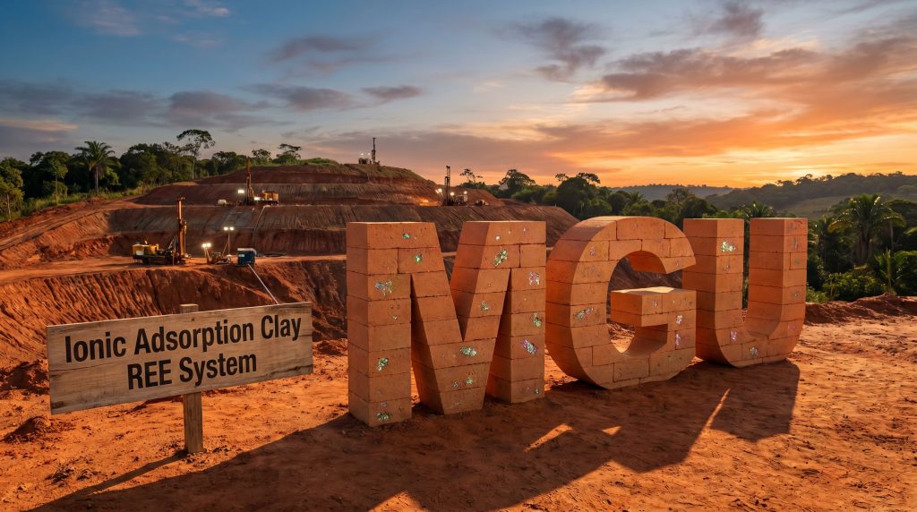
Magnum Mining and Exploration Ltd (ASX: MGU, OTCQB: MGUFF) has released a second batch of auger drilling assays and desorption screening results from Piracanjuba North, part of its 100%-controlled Azimuth Rare Earth Element (REE) Project in Goiás, Brazil. The Magnum Mining Piracanjuba North rare earth drilling results in Brazil, according to the ASX announcement dated 8 July 2026, show that all 122 holes reported to date have returned anomalous Total Rare Earth Oxide (TREO) values, while the interpreted geophysical footprint has been expanded from 85 km² to 116 km².
With six drill rigs now active and approximately 3,251 m drilled across 314 collars by 30 June 2026, Magnum Mining and Exploration Ltd is progressing towards an Exploration Target in early August 2026 and aims for a maiden JORC Mineral Resource Estimate in November 2026, subject to ongoing results.
"As further assay results have been received from drilling at Piracanjuba North, our confidence in this target has continued to grow… the ongoing stream of results continue to demonstrate the key characteristics we look for in a favourable ionic adsorption clay REE system – scale, desorption, favourable REE element mix, infrastructure and state/community support," said Antonio Vitor Junior, Managing Director of Magnum Mining and Exploration Ltd.
When big ASX news breaks, our subscribers know first
100% Hit Rate Across 122 Holes – What The Numbers Show
The second batch added 98 new vertical auger holes to the Piracanjuba North dataset. According to Magnum Mining and Exploration Ltd, every one of the 122 holes reported so far has intersected anomalous TREO.
The key focus is not only on total REE content but also on:
- Desorbable TREO (D-TREO)
- Desorbable magnet rare earth oxides (D-MREO)
- Desorbable Terbium + Dysprosium (D-TbDy)
These metrics are important because they relate to how much of the REE content can potentially be released from the clay using relatively mild leaching conditions, and how much of that content is made up of magnet and heavy rare earths relevant to permanent magnet supply chains.
Selected Headline Results From The Second Batch
The table below presents the best desorption intervals from the second batch of results:
| Hole ID | Target | Interval | TREO (ppm) | D-TREO (% of TREO) | MREO (ppm) | D-MREO (% of MREO) | D-TbDy (ppm) |
|---|---|---|---|---|---|---|---|
| PIR-AH-0010 | PN-4 | 2 m from 8 m | 1,409 | 48% | 373 | 57% | 33 |
| PIR-AH-0083 | Regional | 2 m from 6 m | 1,671 | 41% | 553 | 46% | 8 |
| PIR-AH-0077 | PN-1 | 2 m from 12 m | 1,588 | 34% | 507 | 31% | 32 |
| PIR-AH-0095 | PN-1 | 2 m from 6 m | 1,121 | 45% | 320 | 60% | 17 |
| PIR-AH-0012 | PN-4 | 1 m from 8 m | 1,566 | 37% | 311 | 71% | 7 |
| PIR-AH-0091 | Regional | 2 m from 8 m | 1,266 | 36% | 189 | 73% | 22 |
| PIR-AH-0035 | PN-6 | 2 m from 8 m | 821 | 62% | 170 | 76% | 31 |
| PIR-AH-0092 | Regional | 2 m from 8 m | 738 | 63% | 221 | 80% | 14 |
| PIR-AH-0066 | PN-4 | 2 m from 6 m | 882 | 35% | 216 | 52% | 12 |
| PIR-AH-0106 | PN-1 | 2 m from 8 m | 721 | 49% | 231 | 59% | 8 |
These intervals sit within longer mineralised profiles. For example:
- PIR-AH-0010 (PN-4): 12 m from surface at 690 ppm TREO, with 37% D-TREO
- PIR-AH-0083 (Regional): 12 m from surface at 1,045 ppm TREO, with 22% D-TREO
- PIR-AH-0077 (PN-1): 14 m from surface at 587 ppm TREO, with 31% D-TREO
The company highlights that most holes ended in mineralisation, and 17 holes in the second batch terminated with ≥200 ppm D-TREO at the bottom of hole. This was a key reason for mobilising a diamond rig to test deeper parts of the weathered profile.
What These Results Mean For Investors
For investors, these results indicate:
- Consistent anomalous REE presence across the drilled area
- Repeated shallow zones where a sizeable fraction of REE content can be desorbed under unoptimised ammonium sulphate / pH 4 conditions
- Early evidence that magnet and heavy rare earth content might form a material component of the REE mix in multiple zones within Piracanjuba North
What Is Ionic Adsorption Clay And Why Does It Matter?
Understanding Ionic Adsorption Clay (IAC) REE Deposits
Ionic adsorption clay (IAC) deposits are a style of rare earth mineralisation where REE are weakly attached to clay minerals in the weathered layer of the earth. In contrast to hard-rock REE deposits that often require:
- Crushing
- Grinding
- Complex chemical treatment
IAC systems typically allow REE to be removed using a relatively simple salt solution that effectively rinses the REE off the clay surfaces. In practice, laboratories often use ammonium sulphate solution at a controlled pH to test how easily REE can be desorbed.
Key Concepts Explained In Simple Terms
- TREO (Total Rare Earth Oxide): The total amount of all rare earth oxides in a sample, measured in ppm (parts per million).
- MREO (Magnet Rare Earth Oxide): The part of TREO made up of elements commonly used in permanent magnets, mainly Neodymium (Nd), Praseodymium (Pr), Terbium (Tb) and Dysprosium (Dy).
- D-TREO / D-MREO / D-TbDy: The portion of total TREO, magnet REO and Tb+Dy that can be desorbed using the laboratory leach conditions. Reported as ppm and as a percentage of the total.
- TbDy (Terbium + Dysprosium): High-value heavy rare earths used in NdFeB magnets to improve performance and temperature tolerance.
- IAC system: A deposit where rare earths are mostly held in clays within a near-surface weathered profile and can be freed by leach solutions rather than by breaking hard rock.
Why These IAC Features Matter For Investors
Magnum Mining and Exploration Ltd notes that in IAC-style systems, the most relevant early indicators are not just high TREO numbers. Instead, the focus is on:
- What proportion of REE is desorbable under mild leach conditions
- Whether magnet and heavy REE such as Nd, Pr, Tb and Dy form a material part of the desorbable content
- Whether the responses repeat consistently across different parts of the weathered profile and across the project area
If these factors continue to hold across more drilling, they can support the technical basis for an Exploration Target, a future JORC-compliant Mineral Resource Estimate, and further metallurgical work aimed at improving recoveries beyond these initial, non-optimised conditions.
Magnum Mining and Exploration Ltd explicitly states that current desorption figures are screening tests only and do not yet represent final metallurgical recovery or economic outcomes.
Footprint Expanded To 116 km² And Multiple Target Centres
The ASX announcement reports that the interpreted radiometric thorium anomaly at Piracanjuba North has been revised from 85 km² to 116 km². This reinterpretation was based on existing airborne radiometric data and completed by geoscientist Fabricio Santos, MSc, then reviewed by the company's Competent Person.
The company cautions that this 116 km² area is a geophysical target footprint only. It is:
- Not a drill-defined mineralised footprint
- Not an Exploration Target
- Not a Mineral Resource or Ore Reserve
Within this broader footprint, Magnum Mining and Exploration Ltd now defines several centres of interest, as outlined below.
Multi-Centre Target Framework At Piracanjuba North
| Centre | Approx. area | Drilling completed | New assay coverage (2nd batch) | Key result (best desorption interval) | Current interpretation |
|---|---|---|---|---|---|
| PN-4 | ~4.0 km² | 67 holes / 774.6 m | 35 holes / 199 intervals | PIR-AH-0010: 2 m from 8 m at 1,409 ppm TREO, 681 ppm D-TREO (48%), 212 ppm D-MREO (57%), 33 ppm D-TbDy (59%) | Most advanced area; strongest current D-TREO centre |
| PN-1 | ~6.7 km² | 97 holes / 969.8 m | 38 holes / 224 intervals | PIR-AH-0077: 2 m from 12 m at 1,588 ppm TREO, 533 ppm D-TREO (34%), 157 ppm D-MREO (31%), 32 ppm D-TbDy (38%) | Material MREO, HREE and D-TbDy follow-up vector to the northwest of PN-4 |
| PN-6 | ~3.1 km² | 21 holes / 285.0 m | 2 holes / 8 intervals | PIR-AH-0035: 4 m from 6 m at 890 ppm TREO, 502 ppm D-TREO (56%), 142 ppm D-MREO (71%), 25 ppm D-TbDy (70%) | Newly identified centre; bottom-of-hole interval open below 10 m |
| Regional Pira N | 1,000 m grid | 46 holes / 451.0 m | 23 holes / 100 intervals | PIR-AH-0083 and PIR-AH-0091 show wide-spaced D-TREO / D-MREO / D-TbDy responses | Regional vectoring outside PN-4; continuity yet to be tested |
The PN-6 result from PIR-AH-0035 is particularly relevant because the best desorption response occurs at the bottom of the auger hole, indicating potential for additional REE-bearing clays at greater depth. This aligns with the company's decision to bring in a diamond rig for deeper profile testing.
On the regional 1,000 m grid, PIR-AH-0083 and PIR-AH-0091 are about 1.0 km apart. Magnum Mining and Exploration Ltd classifies these as vectoring holes, meaning they highlight directions for further drilling rather than proving continuity between them at this stage.
Six Rigs And Three Grid Scales – Building The Dataset
To accelerate data collection, Magnum Mining and Exploration Ltd has expanded its drill fleet at Piracanjuba North to six rigs:
| Rig type | Count | Primary role | Technical value |
|---|---|---|---|
| Mechanised auger rigs | 4 | Shallow reconnaissance, step-out and semi-detailed drilling | Increases lateral coverage and tests repeatability of REE responses across the weathered profile |
| Winch-assisted auger rig | 1 | Deeper regolith and saprolite testing when standard augers reach refusal | Extends vertical coverage and helps define deeper follow-up needs |
| Diamond drill rig | 1 | Deeper geological validation and sample collection for technical studies | Supports regolith architecture, bulk density, mineralogy, geometallurgy and future 3D models |
By 30 June 2026, this fleet had completed 314 collars for 3,251.1 m of drilling. Furthermore, the company is working across three grid scales:
- 1,000 m x 1,000 m: Regional grid to support an Exploration Target
- 400 m x 400 m: New intermediate grid designed to bridge regional and detailed work and assist with target ranking
- 200 m x 200 m: Closer-spaced drilling intended to support a future JORC Mineral Resource Estimate
According to Magnum Mining and Exploration Ltd, the 400 m grid is helping to rank targets, select step-out directions, and refine areas for denser drilling.
The operational data suggests that a large number of holes terminate while still reporting anomalous D-TREO at end of hole. This supports the decision to employ deeper auger and diamond drilling to better understand the full thickness of the mineralised weathered profile, changes in clay types and REE distribution with depth, and inputs required for any future Mineral Resource work.
Project Timeline Pulled Forward – Upcoming Catalysts
Magnum Mining and Exploration Ltd reports that the drilling programme, targeting around 10,000 m, remains on track to support key technical milestones.
Key Project Milestones
| Milestone | Previous target date | Updated target date |
|---|---|---|
| Exploration Target for Piracanjuba North | September 2026 | Early August 2026 |
| Maiden JORC Mineral Resource Estimate | November 2026 | November 2026 (unchanged) |
The decision to bring the Exploration Target date forward reflects the pace of drilling and sample turnaround, the consistency of anomalous TREO and desorption responses across multiple centres, and the availability of technical data from increasingly dense drilling grids.
Next steps outlined in the ASX announcement include:
- Continuing systematic drilling across PN-4, PN-1, PN-6 and the regional 1,000 m grid
- Prioritising follow-up work around PIR-AH-0035 at PN-6, where the strongest D-HREO and D-TbDy response is at the bottom of hole
- Testing the PIR-AH-0083 to PIR-AH-0091 trend with intermediate holes to examine repeatability of desorption responses along plateau/regolith settings
- Integrating pending assays, desorption screening, QA/QC results, geological logging and sample recovery data into the working database
- Advancing deeper profile work with auger and diamond drilling to inform any potential Exploration Target and a future JORC Mineral Resource Estimate
For investors following Magnum Mining and Exploration Ltd, these dates and activities provide specific near-term reference points for assessing project progress.
The next major ASX story will hit our subscribers first
Location, Infrastructure And District Context
Piracanjuba North is part of the Azimuth 125 REE District, which comprises 64 mineral rights covering approximately 104,964 ha (1,049.64 km²) in Goiás, Brazil. The project lies along the Azimuth 125° Lineament, described by the company as
Want To Know More About Magnum Mining's Azimuth REE Project?
With a 100% hit rate across 122 holes, a growing 116 km² geophysical footprint, and an Exploration Target now expected in early August 2026, Magnum Mining and Exploration Ltd (ASX: MGU) is rapidly advancing one of the more compelling ionic adsorption clay REE projects in Brazil. Investors looking to learn more about the company, the Piracanjuba North drilling programme, and upcoming milestones including a maiden JORC Mineral Resource Estimate targeted for November 2026, can visit the official Magnum Mining website at www.mmel.com.au.