July 30, 2026
The Silent Revolution Happening Above Open-Cut Pits
Picture a 50-hectare open-cut pit operating at full capacity. Haul trucks circling. Blasting schedules dictating crew movement. Ground conditions changing with every bench advance. Somewhere in that environment, a traditional survey crew would once have spent several days collecting spatial data, exposing personnel to active operational hazards with every measurement taken. Today, a single UAV operator can complete the same survey in a matter of hours, without a single person setting foot near a live highwall.
Mine surveys through drones have crossed from experimental technology into routine operational practice faster than most legacy mining operations anticipated. However, the shift is about more than efficiency. It represents a fundamental rethinking of how spatial intelligence is gathered, processed, and embedded into mining decisions.
When big ASX news breaks, our subscribers know first
Why Conventional Surveying Methods Are Reaching Their Limits
The traditional toolkit for mine surveying, built around total stations, GPS rovers, and manned aerial platforms, was designed for a different operational tempo. These methods work reasonably well when access is safe, schedules are flexible, and the cost of slow data collection is absorbed into operational budgets.
Those conditions are increasingly rare. Modern open-cut operations compress blast-to-bench timelines, demand faster reconciliation between planned and actual material movement, and operate under tighter safety protocols that restrict personnel access to active zones. The fundamental problem with ground-based surveying is not accuracy; it is that the pace of safe data collection cannot keep up with the pace of operational change.
Several specific scenarios illustrate where conventional methods struggle most:
- Active highwall proximity: Surveying near unstable rock faces exposes crew members to rockfall and sudden slope failure, particularly in operations with elevated geotechnical risk profiles.
- Pit floor access during active production: Coordinating survey windows around truck movement, blasting events, and equipment operation consumes significant planning overhead and often results in incomplete datasets.
- Large-area surveys with complex terrain: Collecting ground control across hundreds of hectares using total station setups is time-consuming and costly, particularly where repeat surveys are needed at high frequency.
- Inaccessible void edges and shaft collars: Manual survey of these zones frequently requires specialised rope access or confined-space entry procedures, creating significant safety risk for relatively small amounts of spatial data.
What Mine Surveys Through Drones Can Actually Deliver
UAV survey platforms do not replace every surveying function, but they address a wide and growing range of operational needs that were previously expensive, slow, or hazardous to fulfil. Understanding what drone surveys can deliver, and where their limits remain, is essential for making informed technology adoption decisions. Furthermore, the broader context of mining automation trends demonstrates how UAV adoption fits within a larger operational shift across the industry.
Stockpile Volumetrics and Inventory Reconciliation
Stockpile volume measurement is arguably the most commercially mature application of mine surveys through drones. The workflow is well-established: a UAV equipped with a calibrated RGB camera executes a programmed flight pattern over the stockpile area, capturing overlapping imagery that is processed through photogrammetry software to generate a digital surface model. Volume calculations are extracted by comparing the DSM against a reference base surface.
When RTK GNSS positioning is combined with correctly placed ground control points, this process can achieve:
- Horizontal positional accuracy of approximately 2 to 5 cm
- Vertical accuracy of under 10 cm under optimised conditions
- Volumetric measurement accuracy within 1 to 3% of ground-truth reference measurements
For operations managing multiple stockpiles across large lease areas, the ability to conduct rapid, repeatable volumetric surveys significantly reduces reconciliation discrepancies between surveyed inventory and production records.
Pit Mapping, Bench Progress, and Haul Road Assessment
Drone surveys generate georeferenced orthomosaics and digital elevation models that provide a complete spatial record of pit progress at any given point in time. Sequential surveys separated by days or weeks enable change detection workflows, where material movement between survey epochs is quantified and mapped. In addition, data-driven mining operations increasingly depend on this kind of high-frequency spatial intelligence to support faster decision-making.
This capability supports several operational functions:
- Blast design verification: Confirming that post-blast bench geometry matches design parameters before committing drill patterns for the next stage.
- Haul road condition monitoring: Identifying surface deterioration, rutting, or drainage failures before they create equipment damage or safety incidents.
- Geotechnical change detection: Detecting displacement or cracking in bench faces and highwall profiles that may indicate developing instability.
Highwall and Inaccessible-Area Inspection
One of the most safety-critical applications of mine surveys through drones is the replacement of personnel in proximity to structurally uncertain ground. Close-range UAV inspection of highwalls, void edges, slot cuts, and open shaft collars delivers high-resolution imagery and point cloud data that geotechnical engineers can interpret without placing anyone at physical risk.
Replacing personnel near active highwalls with UAV inspection platforms directly addresses one of mining's persistent fatality categories. Geotechnical failures at highwall faces account for a disproportionate share of serious injuries and fatalities in surface mining globally, and the ability to conduct detailed visual and structural assessments remotely fundamentally changes the risk profile of these tasks.
Environmental Monitoring and Rehabilitation Tracking
Multispectral and thermal UAV payloads extend the application envelope well beyond spatial measurement. Multispectral sensors capture vegetation index data (NDVI and related metrics) that quantifies the health and density of rehabilitated vegetation cover across mine lease areas. Thermal sensors identify water seepage patterns, spontaneous combustion risk zones in coal stockpiles, and heat anomalies in processing infrastructure.
For operations with active rehabilitation obligations, repeat drone surveys generate time-series datasets that demonstrate measurable environmental performance to regulators and community stakeholders in a format that is far more persuasive than written reports alone.
Accuracy Variables: What Controls Survey Quality in Mining Environments?
Understanding the technical factors that determine drone survey accuracy is essential for any operation considering integrating this technology into formal reporting or decision-making workflows.
| Accuracy Factor | Impact on Survey Output | Best Practice |
|---|---|---|
| RTK/PPK GNSS positioning | Eliminates post-processing GCP dependency | Use RTK-enabled platforms where possible |
| Ground Control Points (GCPs) | Anchors photogrammetric model to real-world coordinates | Minimum 5 to 10 GCPs per survey area |
| Image overlap percentage | Higher overlap improves model completeness and reduces voids | 75 to 85% front and side overlap recommended |
| Flight altitude | Lower altitude increases resolution but reduces coverage area | Optimise for resolution vs. area requirements |
| Camera orientation | Nadir preferred for mapping accuracy | Oblique angles useful for structural inspection |
| Terrain complexity | Steep or shadowed terrain increases processing difficulty | LiDAR preferred in deep pits or dense vegetation |
RTK versus PPK positioning is a distinction worth understanding clearly. RTK (Real-Time Kinematic) applies GNSS corrections in real time during the flight, enabling the drone to log survey-grade positions as imagery is captured. PPK (Post-Processed Kinematic) applies corrections after the flight by comparing the drone's GNSS log against a base station recording. Both methods achieve comparable accuracy; PPK is often operationally preferred in remote mining environments where real-time data link connectivity to a base station is unreliable.
When LiDAR Outperforms Photogrammetry
RGB photogrammetry is sufficient for the majority of open-cut mine survey applications, but there are specific conditions where LiDAR becomes the technically superior choice:
- Vegetated terrain: LiDAR pulses penetrate canopy cover to capture ground returns beneath tree cover, which optical sensors cannot do.
- Deep pit shadows: In deep pits with limited sun angle exposure, optical sensors produce poorly lit imagery that degrades photogrammetric model quality. LiDAR is independent of lighting conditions.
- Dusty atmospheric conditions: Suspended particulates from blasting, haul road traffic, and crushing operations degrade optical image clarity during and shortly after operations.
The cost gap between LiDAR and RGB sensor payloads has narrowed significantly in recent years, and mid-range UAV platforms capable of carrying LiDAR sensors are increasingly accessible to mining operations without specialist aerial survey contractors. Platforms designed for mining survey applications illustrate how purpose-built configurations are expanding access to LiDAR capability across a broader range of operations.
The Step-by-Step Workflow for a Drone Mine Survey
Understanding the complete operational workflow helps mine teams evaluate what internal capability they need versus what to engage specialist UAV survey contractors for.
Phase 1: Mission Planning and Pre-Flight Preparation
- Define the survey objective: volumetrics, inspection, compliance mapping, or change detection
- Select flight parameters: altitude, image overlap, camera type, and waypoint routing
- Establish and survey GCP positions across the area before flight
- Complete airspace authorisation checks and site-specific safety risk assessments
- Confirm weather and atmospheric conditions are within operational limits
Phase 2: Data Acquisition
- Execute automated 2D mapping missions or custom waypoint routes for complex terrain
- Deploy RTK or PPK GNSS positioning throughout the flight
- Capture supplementary oblique imagery for highwall or structural documentation where required
- Manage battery cycles, weather windows, and equipment performance across large areas
Phase 3: Photogrammetric Processing
- Import raw imagery and positional logs into photogrammetry software (Agisoft Metashape, Pix4Dmapper, DJI Terra, or Bentley ContextCapture)
- Align images, optimise camera calibration, and incorporate GCP coordinates
- Generate point clouds, digital elevation models, orthomosaics, and 3D mesh outputs
- Run quality control checks: point cloud density, model accuracy reports, and GCP residuals
Phase 4: Measurement, Analysis, and Delivery
- Extract stockpile volumes, cross-sections, contour lines, and distance measurements
- Compare current outputs against previous datasets for change detection
- Export deliverables in mine planning-compatible formats (DXF, LAS, GeoTIFF)
- Archive datasets for longitudinal analysis and regulatory record-keeping
How Drone Surveys Compare to Traditional Methods: A Practical Benchmark
| Survey Method | Typical Timeframe | Personnel Required | Relative Cost | Hazard Exposure |
|---|---|---|---|---|
| Ground total station survey | Days to weeks | 2 to 4 surveyors | High | High |
| Manned fixed-wing aerial survey | Hours to days | Pilot + survey crew | Very high | Moderate |
| Helicopter-mounted LiDAR | Hours | Pilot + operator | High | Low |
| UAV RGB photogrammetry | Hours to half-day | 1 to 2 operators | Low to Moderate | Very low |
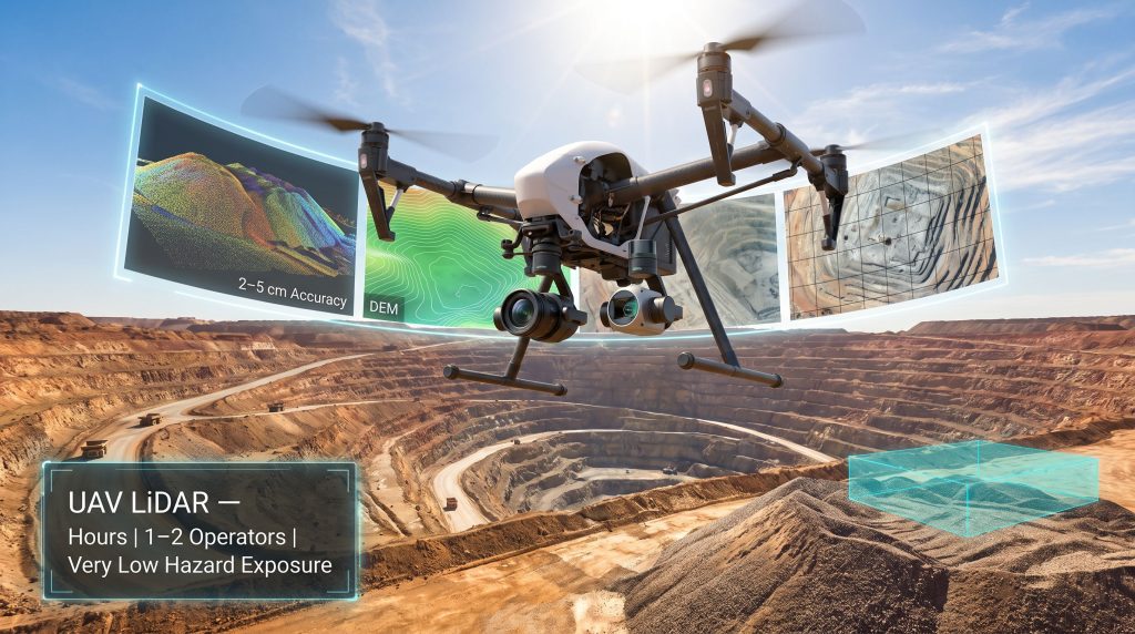
| UAV LiDAR | Hours | 1 to 2 operators | Moderate | Very low |
A 50-hectare open-cut pit that would require three to five days of ground survey work can be captured by a UAV system in a single flight session, with processed deliverables available within hours. That compression of the data acquisition cycle changes what is operationally possible in terms of blast sequencing decisions, geotechnical response, and material movement tracking.
The next major ASX story will hit our subscribers first
The Emerging Frontier: Airborne Geophysical Sensors on UAV Platforms
One of the least widely understood developments in mine survey technology is the integration of geophysical sensors onto UAV platforms. Magnetometers mounted on drone platforms have moved from research contexts into operational deployment, enabling low-altitude airborne magnetometry surveys that were previously only achievable using manned fixed-wing aircraft or helicopters.
This matters for several reasons that go well beyond conventional mine surveying. Downhole geophysics has long provided subsurface resolution that surface methods cannot match; however, UAV-mounted sensors are beginning to close that gap at a fraction of the cost:
- Subsurface anomaly detection: UAV-mounted magnetometers can detect variations in the magnetic susceptibility of subsurface geology at a spatial resolution that manned airborne surveys cannot achieve at equivalent cost.
- Fault and structure mapping: Magnetic gradient data collected at low altitude reveals structural features, dykes, and mineralisation corridors that inform resource model refinement and exploration targeting.
- Cost-effective exploration surveying: Conventional manned airborne geophysics is expensive and requires significant mobilisation overhead. UAV-based magnetometry brings the same fundamental geophysical capability to projects that cannot justify aircraft survey costs.
The practical implication is that UAV platforms are now capable of bridging the gap between ground-based geophysics, which is high-resolution but slow and expensive across large areas, and manned airborne surveys, which cover large areas quickly but at high cost and with limited spatial resolution close to the ground.
This convergence of surveying and exploration geophysics functions within a single UAV deployment represents a qualitative shift in how early-stage and operating mines can approach spatial data collection. The potential to layer magnetometric data over photogrammetric surveys in a single flight program adds interpretive depth that neither dataset provides in isolation.
Sensor Selection: Matching Payload to Purpose
Choosing the right sensor configuration is as important as choosing the right platform. The dominant sensor categories each serve distinct functions:
RGB cameras remain the standard for photogrammetric mapping, stockpile volumetrics, and general pit progress surveys. High-resolution imagery enables detailed orthomosaic production and visual inspection at low cost and with broad software support.
LiDAR sensors provide superior performance in challenging optical conditions. Their ability to generate dense, survey-grade point clouds without dependency on lighting conditions makes them the preferred choice for deep pit mapping, vegetated areas, and post-blast environments.
Multispectral sensors extend into environmental monitoring, capturing NDVI and related indices that support rehabilitation progress tracking and vegetation health assessment under ESG reporting requirements.
Thermal sensors identify heat anomalies in processing infrastructure, spontaneous combustion risk zones within coal stockpiles, and water seepage patterns across tailings storage facilities.
Geophysical sensors, including magnetometers and radiometric instruments, are increasingly available in configurations compatible with mid-range commercial UAV platforms, opening exploration-phase data acquisition to operations without access to specialist airborne survey contractors.
Regulatory and Operational Constraints Worth Understanding
Several non-technical factors govern how drone survey programmes are deployed in practice:
- BVLOS authorisation: Most high-productivity mine survey applications require beyond-visual-line-of-sight operations. Regulatory frameworks for BVLOS flight vary significantly across jurisdictions including Australia, Canada, South Africa, and Chile, and obtaining approval adds lead time to programme deployment.
- Airspace integration with mine aviation: Mines using manned helicopters for personnel transport or water bombing need robust airspace deconfliction protocols before UAV survey programmes can operate concurrently.
- Data management at scale: A single day's photogrammetric survey across a large mine lease can generate hundreds of gigabytes of raw imagery and point cloud data. Mine IT infrastructure must be capable of handling this data volume through the processing pipeline and into long-term archival.
- Regulatory acceptance of outputs: In most jurisdictions, drone survey outputs conducted under the supervision of a licensed surveyor using appropriate ground control are accepted for tenement compliance and regulatory reporting. However, cadastral-grade boundary demarcation still typically requires integration with licensed survey control networks.
Frequently Asked Questions: Mine Surveys Through Drones
How Accurate Are Drone Surveys for Stockpile Volume Measurement?
With RTK GNSS positioning and correctly placed ground control points, drone surveys achieve volumetric accuracy within 1 to 3% of ground-truth measurements, with horizontal and vertical positional accuracy in the range of 2 to 5 cm.
How Long Does a Drone Survey of a Mine Site Take?
A 50-hectare open-cut pit can typically be surveyed in a single flight session, compressing what would otherwise be a multi-day ground survey programme into a matter of hours.
Can Drones Survey Underground Mine Environments?
GPS-denied UAV platforms equipped with LiDAR and simultaneous localisation and mapping (SLAM) technology are increasingly used for underground void mapping, drive profiling, and stope surveying without requiring GNSS signal.
What Software Processes Drone Survey Data in Mining Applications?
Common platforms include Agisoft Metashape, Pix4Dmapper, DJI Terra, and Bentley ContextCapture. Outputs are typically exported in formats compatible with Surpac, Vulcan, Leapfrog, and AutoCAD Mine. For operations exploring how drone survey data integrates with mine planning software, detailed workflow guidance is available from specialist providers.
Are Drone Survey Outputs Legally Accepted for Regulatory Mine Reporting?
In most jurisdictions, yes, provided surveys are conducted by or under the supervision of a licensed surveyor using calibrated equipment and appropriate ground control.
What Comes Next: Autonomous Programmes and Digital Twin Integration
The trajectory of mine surveys through drones points toward three converging developments that will reshape how spatial data functions within mining operations.
Autonomous persistent survey programmes remove the requirement for operator-initiated flights. Drones that execute scheduled survey missions autonomously following blast events or production milestones, and transmit processed data directly into mine planning systems, are moving from prototype to commercial deployment. AI-powered mining efficiency tools are increasingly being paired with these autonomous programmes to accelerate data interpretation and decision-making.
Digital twin integration is transforming survey outputs from historical records into live operational inputs. High-frequency drone survey data feeds continuously updated spatial models that support predictive geotechnical modelling, equipment routing optimisation, and production forecasting. The closer the survey frequency approaches real time, the more operational value each dataset carries.
Multi-sensor fusion platforms will combine RGB, LiDAR, thermal, multispectral, and geophysical instruments in configurations that execute multiple survey objectives in a single flight programme. Consequently, this convergence of sensor types eliminates the need to schedule separate survey campaigns for different data types, further compressing the operational tempo of spatial intelligence collection. 3D geological modelling capabilities will, furthermore, benefit directly as richer multi-sensor inputs raise the resolution and reliability of subsurface interpretation.
This article is intended for general informational purposes only. Accuracy specifications and operational outcomes referenced represent typical published industry benchmarks and will vary based on specific equipment configurations, environmental conditions, and operator competency. This article does not constitute professional surveying, engineering, or investment advice. Readers should engage qualified professionals before making operational or procurement decisions based on information contained herein.
Further technical context on drone surveying methodologies and sensor comparisons is available through Mining Magazine at miningmagazine.com, which covers emerging technology applications across global mining operations.
Want to Catch the Next Major ASX Mineral Discovery the Moment It's Announced?
Discovery Alert's proprietary Discovery IQ model scans ASX announcements in real time, instantly alerting subscribers to significant mineral discoveries before the broader market reacts — explore historic discoveries and their returns to understand the opportunity, then start your 14-day free trial at Discovery Alert to position yourself ahead of the market.