July 17, 2026
Modern mineral exploration faces unprecedented challenges when valuable deposits remain completely hidden beneath surface overburden, particularly in environments where traditional geological mapping proves ineffective. Advanced subsurface imaging technologies have emerged as critical tools for accessing previously unexplorable mineralisation systems, fundamentally transforming how mining companies approach discovery in complex geological settings.
The integration of satellite-enabled processing platforms with high-resolution seismic technology represents a paradigm shift in exploration methodology, enabling precise structural interpretation in environments where conventional approaches fail to penetrate adequate depths or provide sufficient resolution for confident drilling decisions. Furthermore, the Fleet Space ExoSphere Ecuador project at Fruta del Norte exemplifies this technological advancement in action.
Understanding Ecuador's Fruta del Norte Complex Geological Environment
Defining Blind Mineral System Characteristics
Fruta del Norte exemplifies what exploration geologists classify as a blind mineral system, where economic gold-silver mineralisation occurs beneath more than 200 metres of rock overburden without corresponding surface expression. Unlike exposed vein systems or oxidised mineral zones visible on mountainsides, blind systems require depth-penetrating technologies to locate and define their geometry.
The absence of surface mineralisation indicators creates compound exploration challenges. Zero visible outcrop signatures exist to guide initial target generation. Dense jungle canopy further obscures potential geological features, whilst complex fault-controlled mineralisation requires precise structural interpretation.
Remote mountain terrain limits conventional survey access significantly. This geological framework demands exploration approaches capable of imaging subsurface structures with metre-scale precision while integrating multiple datasets for comprehensive structural understanding.
Cordillera del Cóndor Structural Geology Framework
The Cordillera del Cóndor mountain range along Ecuador's southeastern border with Peru hosts complex structural geology dominated by deep fault networks. Fruta del Norte's gold-silver system demonstrates structurally controlled mineralisation, where ore distribution directly follows fault line geometry at significant depths.
Key Geological Parameters:
| Characteristic | Specification |
|---|---|
| Depth to mineralisation | 200+ metres beneath surface |
| Structural control | Deep fault network geometry |
| Surface expression | Complete absence of indicators |
| Environmental setting | Dense jungle canopy coverage |
| Terrain classification | Remote mountain range access |
Traditional structural exploration mapping relies on surface exposure of fault features through outcrop analysis, gossans, or mineral staining. At Fruta del Norte, the complete absence of these surface indicators creates an exploration environment where subsurface imaging becomes essential rather than supplementary to discovery processes.
Moreover, advanced 3D geological modelling becomes critical for understanding these complex structural relationships beneath the surface overburden.
Operational Constraints in Remote Mountain Environments
The Cordillera del Cóndor presents multiple operational challenges that compound geological complexity. Limited infrastructure exists in remote mountain terrain, whilst environmental sensitivity requires minimal surface disturbance.
Access Limitations:
• Limited infrastructure in remote mountain terrain
• Environmental sensitivity requiring minimal surface disturbance
• Logistical constraints for equipment deployment
• Extended mobilisation timelines for conventional survey methods
Environmental Considerations:
• Dense jungle ecosystem protection requirements
• Reduced exploration footprint mandates
• Seasonal weather constraints affecting field operations
• Wildlife habitat preservation protocols
These constraints necessitate exploration technologies capable of delivering high-resolution subsurface information with minimal environmental impact and reduced operational footprint compared to conventional drilling-intensive approaches.
When big ASX news breaks, our subscribers know first
Fleet Space ExoSphere Technology Integration and Capabilities
Core Platform Architecture and Processing Infrastructure
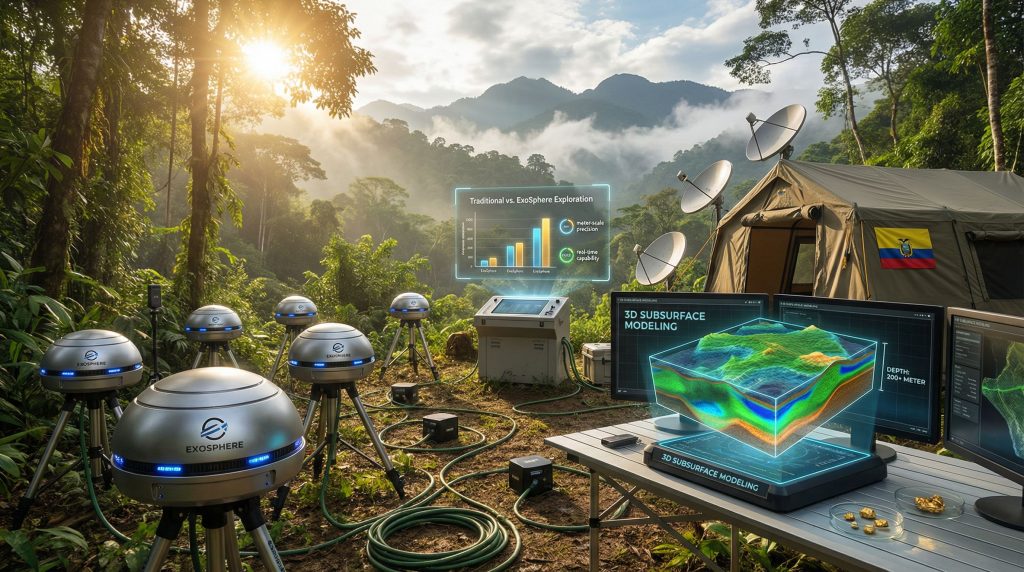
Fleet Space ExoSphere Ecuador represents a satellite-enabled geoscience system designed for three-dimensional subsurface structural imaging in challenging environments. The platform integrates multiple geophysical datasets through space-based processing infrastructure, enabling real-time data standardisation and multi-physics interpretation.
ExoSphere Technical Components:
• Satellite-enabled processing: Multi-sensor data fusion through space-based computation
• 3D subsurface modelling: High-resolution structural interpretation from combined datasets
• Real-time processing: Rapid data standardisation workflows enabling accelerated interpretation cycles
• Multi-physics integration: Combination of seismic, electromagnetic, and potentially gravity measurements
The platform's architecture addresses traditional exploration limitations by providing integrated interpretation capabilities that exceed single-dataset analysis approaches commonly employed in conventional mineral exploration programmes. In addition, this represents a significant step forward in the broader mining industry evolution towards technology-driven discovery methods.
HiSeis Active Seismic Technology Integration
Fleet Space's 2025 acquisition of HiSeis Pty Ltd. significantly enhanced ExoSphere's active seismic capabilities, adding what industry sources describe as world-leading active seismic solutions for mineral exploration applications.
HiSeis Integration Specifications:
| Capability | Performance Standard |
|---|---|
| Resolution precision | Metre-scale accuracy |
| Depth penetration | 200+ metre imaging capability |
| Data processing | Standardised integration protocols |
| Survey deployment | High-resolution mobile acquisition |
The active seismic component enables ExoSphere to generate detailed structural models of deeply buried fault networks by measuring subsurface acoustic wave propagation characteristics. This technology proves particularly effective in fault-controlled mineralisation systems where structural geometry directly influences ore body distribution.
Multi-Physics Data Integration Methodology
ExoSphere's multi-physics approach combines independent geophysical datasets to enhance subsurface interpretation confidence and reduce exploration uncertainty. This integration methodology addresses limitations inherent in single-source data analysis.
Cross-Validation Benefits:
• Enhanced confidence in structural interpretations through multiple measurement confirmation
• Identification of features visible only in specific geophysical datasets
• Reduced interpretation errors through triangulation approaches
• Comprehensive subsurface characterisation beyond individual method limitations
The resulting integrated models provide exploration teams with validated structural interpretations suitable for precision drilling target generation in complex geological environments. Consequently, teams can conduct more effective drilling results interpretation with higher confidence levels.
Operational Implementation and Survey Methodology
Customised Survey Design for Complex Terrain
Fleet Space and Lundin Gold implemented a site-specific survey approach tailored to Fruta del Norte's unique geological and environmental constraints. This customisation reflects industry best practices for advanced exploration technology deployment in challenging terrain.
Survey Implementation Sequence:
- High-resolution active seismic acquisition across the project area using mobile HiSeis equipment
- Data integration with existing geological mapping and assay databases
- Multi-layered subsurface modelling through ExoSphere's satellite processing platform
- Structural interpretation focused on deeply buried fault network geometry
- Drilling target prioritisation based on integrated structural analysis
This methodology enables exploration teams to generate actionable intelligence from previously uninterpretable subsurface environments, transforming blind mineral systems into well-defined drilling targets.
Quality Assurance and Validation Protocols
The Fleet Space ExoSphere Ecuador deployment incorporated comprehensive quality assurance measures to validate ExoSphere interpretations against existing geological understanding. Cross-referencing with pre-existing geological interpretations formed a crucial component of this validation approach.
Validation Approach:
• Cross-referencing with pre-existing geological interpretations
• Integration with assay data from previous drilling campaigns
• Regional structural context verification
• Multi-dataset triangulation for enhanced interpretation confidence
This validation framework reduces interpretation errors common in single-source data analysis and provides exploration teams with verified structural models suitable for high-confidence drilling decisions.
Risk Reduction Through Advanced Structural Imaging
ExoSphere deployment at Fruta del Norte demonstrates multiple risk reduction mechanisms critical for exploration success in blind mineral systems. Advanced imaging clarifies fault geometry, reducing drilling miss-probability significantly.
Geological Risk Mitigation:
• Advanced imaging clarifies fault geometry, reducing drilling miss-probability
• Precise structural models enable confident target selection
• Enhanced understanding of mineralisation controls guides programme design
Financial Risk Management:
• Focused drilling programmes minimise exploration expenditure on low-probability targets
• Reduced drilling metres required through precision targeting
• Optimised resource allocation through priority ranking systems
Environmental Impact Reduction:
• Minimised drilling footprint through targeted campaigns
• Reduced surface disturbance in sensitive jungle terrain
• Limited access road requirements through precision targeting
These risk reduction benefits prove particularly valuable in remote, environmentally sensitive locations where operational costs and environmental impact considerations significantly influence exploration programme economics.
Industry Impact and Agile Geoscience Methodology
Transformation of Exploration Standards and Practices
The successful deployment of Fleet Space ExoSphere Ecuador at Fruta del Norte represents broader industry transformation toward what Fleet Space CEO Flavia Tata Nardini terms "Agile Geoscience" methodology. This approach fundamentally reimagines mineral exploration through integration of precision, speed, and multi-dataset analysis.
Agile Geoscience Characteristics:
• Accelerated processing: Reduction from weeks or months to near real-time interpretation cycles
• Enhanced integration: Multi-physics dataset fusion replacing sequential single-source analysis
• Precision targeting: Advanced imaging reducing exploration uncertainty in complex environments
• Scalable deployment: Technology application across diverse geological settings and mineralisation styles
This methodology represents a paradigm shift away from traditional exploration approaches that relied primarily on surface geological mapping and conventional drilling for subsurface characterisation. However, it also integrates seamlessly with modern data-driven mining operations strategies.
Applications Beyond Ecuador: Global Deployment Potential
The Fruta del Norte case study demonstrates technology applicability extending far beyond Ecuador's specific geological environment. For instance, Fleet Space's Exosphere technology has shown promising results across various global mining projects.
Broader Application Categories:
| Environment Type | Technology Application |
|---|---|
| Blind mineral systems | Concealed mineralisation discovery |
| Near-mine expansion | Resource extension at existing operations |
| Covered terrain | Exploration beneath sedimentary overburden |
| Greenfield exploration | New discovery in challenging environments |
The global transferability of ExoSphere technology suggests significant potential impact on exploration success rates in previously unexplorable geological settings worldwide.
Digital Transformation Trends in Mining Exploration
The integration of satellite-enabled processing with advanced geophysical acquisition represents broader digital transformation trends reshaping the mining industry. Movement toward technology-enabled exploration is replacing conventional approaches across the sector.
Industry Evolution Indicators:
• Movement toward technology-enabled exploration replacing conventional approaches
• Multi-source data integration becoming standard practice
• Precision exploration methodologies displacing broad-area traditional surveys
• Environmental responsibility driving reduced-impact exploration technologies
These trends suggest that advanced exploration technologies like ExoSphere may become industry standard rather than specialised applications, particularly for challenging geological environments. Furthermore, the integration of AI in mining innovation continues to accelerate these developments.
Economic and Strategic Implications for Mining Operations
Exploration Efficiency and Cost Optimisation
ExoSphere deployment demonstrates quantifiable operational advantages in exploration programme efficiency and cost management. Precision targeting minimises exploration well quantities whilst real-time processing capabilities shorten exploration cycles.
Efficiency Improvements:
• Reduced drilling requirements: Precision targeting minimises exploration well quantities
• Accelerated timelines: Real-time processing capabilities shorten exploration cycles
• Enhanced success probability: Advanced imaging increases drilling intersection rates
• Optimised resource allocation: Priority targeting focuses expenditure on highest-probability opportunities
These efficiency gains prove particularly valuable in remote, high-cost operational environments where traditional exploration approaches require extensive infrastructure development and prolonged field campaigns.
Strategic Advantages for Mining Company Operations
The Fruta del Norte case study illustrates strategic benefits extending beyond immediate exploration cost savings. Systematic exploration of areas adjacent to existing mine workings becomes more feasible through advanced structural understanding.
Near-Mine Exploration Enhancement:
• Systematic exploration of areas adjacent to existing mine workings
• Resource extension opportunities through advanced structural understanding
• Mine life optimisation through additional resource identification
• Operational integration with existing mining infrastructure
Risk Management Improvements:
• Enhanced confidence in exploration investment decisions
• Reduced geological uncertainty through comprehensive subsurface imaging
• Minimised environmental compliance risks through reduced operational footprint
• Accelerated permitting processes through demonstrated low-impact approaches
These strategic advantages provide mining companies with competitive positioning benefits in challenging exploration environments.
Technology Adoption Economics
The economic case for advanced exploration technology adoption involves multiple cost-benefit considerations. Investment justification factors demonstrate clear advantages for modern approaches over traditional methods.
Investment Justification Factors:
| Cost Category | Traditional Approach | ExoSphere Technology |
|---|---|---|
| Survey deployment | Extensive mobilisation | Streamlined acquisition |
| Processing timeline | Weeks to months | Real-time capability |
| Drilling requirements | High-density programmes | Targeted precision drilling |
| Environmental impact | Extensive surface disturbance | Minimal operational footprint |
| Success probability | Variable outcomes | Enhanced intersection rates |
The economic analysis suggests that advanced exploration technologies provide favourable return on investment, particularly in challenging environments where conventional methods demonstrate limited effectiveness.
The next major ASX story will hit our subscribers first
Future Implications and Technology Evolution
Emerging Technology Integration Opportunities
The success of ExoSphere at Fruta del Norte suggests multiple avenues for continued technology development and integration. Machine learning algorithms for pattern recognition in complex datasets represent a significant advancement opportunity.
Artificial Intelligence Enhancement:
• Machine learning algorithms for pattern recognition in complex datasets
• Automated interpretation capabilities reducing human analysis requirements
• Predictive modelling for exploration target prioritisation
• Enhanced processing efficiency through intelligent data analysis
Advanced Sensor Development:
• Improved geophysical measurement precision and resolution
• Extended depth penetration capabilities for deeper mineral systems
• Enhanced sensitivity for subtle geological feature detection
• Integration of emerging geophysical measurement technologies
What Does the Future Hold for Mining Exploration?
The Fleet Space ExoSphere Ecuador deployment provides insights into potential long-term industry transformation patterns. A shift from surface-based to subsurface-focused exploration methodologies appears increasingly likely.
Exploration Paradigm Evolution:
• Shift from surface-based to subsurface-focused exploration methodologies
• Access to previously unexplorable geological environments through advanced imaging
• Enhanced discovery potential in covered terrain and blind mineral systems
• Integration of space-based processing with terrestrial data acquisition
Environmental and Social Impact Considerations:
• Reduced exploration environmental footprint through precision targeting
• Minimised community impact in sensitive geographical areas
• Enhanced regulatory compliance through low-impact operational approaches
• Improved stakeholder acceptance of exploration activities
Implementation Considerations for Mining Companies
Successful adoption of advanced exploration technologies requires comprehensive implementation planning. Satellite communication capabilities for real-time data processing form a fundamental requirement for effective deployment.
Technical Infrastructure Requirements:
• Satellite communication capabilities for real-time data processing
• Skilled technical personnel for advanced data interpretation
• Integration protocols with existing geological databases and workflows
• Quality assurance systems for technology validation
Strategic Planning Elements:
• Cost-benefit analysis for technology adoption across project portfolios
• Training and workforce development for advanced technology utilisation
• Integration planning with existing exploration methodologies
• Performance measurement systems for technology effectiveness assessment
Additionally, successful implementations have been demonstrated at projects such as Gold Fields' Salares Norte operation, where similar satellite-enabled exploration technologies have enhanced resource definition capabilities.
The Fleet Space ExoSphere Ecuador deployment at Fruta del Norte demonstrates that advanced exploration technologies can successfully address complex geological challenges whilst providing operational and economic advantages. This case study suggests that satellite-enabled, multi-physics exploration platforms may become essential tools for accessing blind mineral systems and advancing discovery in previously unexplorable environments.
Disclaimer: This analysis is based on publicly available information regarding Fleet Space Technologies' ExoSphere platform deployment. Mining exploration involves inherent geological, technical, and financial risks. Investment decisions should consider comprehensive due diligence and professional geological assessment. Technology performance may vary based on geological conditions and operational parameters.
Want to Capitalise on the Next Technological Breakthrough in Mining Exploration?
Discovery Alert's proprietary Discovery IQ model delivers instant notifications on significant ASX mineral discoveries, empowering subscribers to identify emerging opportunities in advanced exploration technologies before they reach mainstream awareness. Begin your 14-day free trial today at Discovery Alert and position yourself ahead of the market as mining companies increasingly adopt breakthrough exploration methodologies.