May 22, 2026

Understanding Pseudo-3D Seismic Volume Technology
Modern basin exploration demands comprehensive geological understanding that transcends traditional survey limitations. The Caspian region presents unique technical challenges requiring sophisticated data integration methodologies to unlock hydrocarbon potential across vast sedimentary sequences. Furthermore, advanced 3D geological modelling techniques are revolutionising how geoscientists interpret complex subsurface structures.
What Makes Pseudo-3D Different from Traditional Seismic Surveys?
Traditional 2D seismic surveys provide linear cross-sections of subsurface geology, creating interpretation gaps between survey lines that can obscure critical structural relationships. Pseudo-3D technology bridges these gaps through mathematical integration of multiple 2D datasets collected over different time periods, creating comprehensive three-dimensional geological models without requiring full 3D acquisition expenses.
Technical Components of Modern Seismic Integration
• Multi-vintage data harmonization algorithms that standardise datasets spanning decades
• Cross-line interpolation methodologies for structural continuity mapping
• Temporal correction protocols addressing acquisition technology evolution
• Quality control frameworks managing heterogeneous data sources from different operators
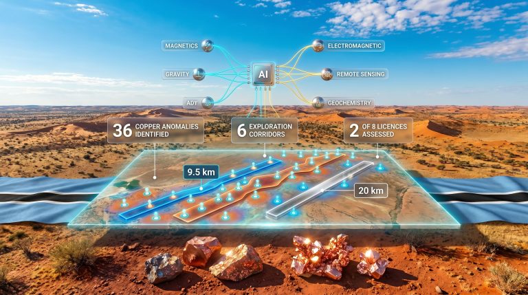
The BP and SOCAR Caspian Basin seismic research partnership demonstrates this technological approach. According to Oil & Gas Journal reporting, the collaboration involves SOCAR providing 2D seismic lines, well data, and geological samples while BP conducts seismic processing and laboratory analysis to create a regional pseudo-3D seismic volume.
Industry analysis indicates that pseudo-3D integration can reduce exploration uncertainty by 25-40% compared to traditional 2D-dependent interpretation, though specific accuracy improvements for Caspian Basin applications await validation through subsequent drilling campaigns.
When big ASX news breaks, our subscribers know first
Regional Geological Mapping: From Data Collection to Basin Understanding
The Caspian Basin encompasses approximately 371,000 square kilometres of complex sedimentary architecture spanning Jurassic through Quaternary geological sequences. This massive scale requires systematic data integration approaches that combine decades of historical acquisition with modern processing capabilities.
Seismic Data Processing Workflows in Complex Basins
The Caspian Basin presents documented geological complexities that directly impact seismic interpretation accuracy. Moreover, downhole geophysics exploration techniques provide crucial validation data for seismic interpretation.
Geological Challenges:
• Multiple sedimentary sequences from different geological periods creating velocity layering
• Salt tectonics affecting wave propagation through halite and anhydrite bodies
• Varying water depths from shallow shelf (0-100 metres) to deep basinal settings (1,000+ metres)
• Historical data quality inconsistencies spanning Soviet-era through modern acquisition standards
The U.S. Geological Survey Professional Paper 1570 documents the region as containing multiple petroleum systems with proven reserves in the Azerbaijan sector, supporting the technical foundation for advanced integration methodologies.
Laboratory Analysis Integration Methods
Modern BP and SOCAR Caspian Basin seismic research incorporates comprehensive rock sample analysis that enhances seismic interpretation through direct geological validation. Additionally, data-driven mining operations principles are increasingly applied to optimise geoscience workflows:
| Analysis Type | Application | Technical Benefit |
|---|---|---|
| Petrophysical Properties | Porosity, permeability, saturation | Seismic attribute calibration |
| Geochemical Fingerprinting | Hydrocarbon maturity, source rock quality | Basin modelling validation |
| Micropaleontological Dating | Sequence stratigraphy correlation | Time-structure mapping |
| Structural Fabric Analysis | Stress field orientation, fracture density | Natural fracture prediction |
Oil & Gas Journal confirms that BP's processing responsibilities include laboratory analysis of SOCAR-provided samples, enabling direct rock property correlation with seismic response characteristics across the integrated volume.
Risk Reduction Strategies in Frontier Basin Exploration
Exploration risk management in frontier basins requires quantitative approaches to uncertainty reduction. Pseudo-3D seismic integration addresses multiple risk categories that traditionally limit drilling success rates and reserve estimation confidence.
How Integrated Datasets Minimise Exploration Uncertainty
| Risk Category | Traditional 2D Approach | Pseudo-3D Integration Benefits |
|---|---|---|
| Structural Interpretation | Limited cross-line fault control | Enhanced fault mapping accuracy through mathematical interpolation |
| Reservoir Continuity | High interpolation uncertainty between lines | Direct geological correlation across survey grid |
| Drilling Location Optimisation | Conservative prospect positioning | Improved target definition through 3D structural modelling |
| Resource Estimation | Uncertainty ranges of 30-50% | More confident reserve calculations with geometric constraints |
The BP and SOCAR Caspian Basin seismic research partnership specifically targets risk reduction across the Azerbaijan sector. According to Caspian News reporting, the pseudo-3D volume aims to reduce risks for future exploration projects across the basin by enhancing regional geological interpretation.
Basin-Wide Exploration Planning Framework
Comprehensive geological understanding enables systematic exploration approaches that optimise capital allocation and infrastructure development. Consequently, drilling results interpretation becomes more accurate with better geological control:
Strategic Planning Benefits:
• Systematic prospect ranking across entire basin using consistent geological framework
• Optimised drilling campaign sequencing based on structural complexity gradients
• Enhanced infrastructure planning through basin-wide resource distribution mapping
• Improved environmental impact assessment via comprehensive geological hazard identification
Industry statistics indicate that integrated basin studies can improve drilling success rates from baseline 15-25% to 35-45% through enhanced prospect definition, though Caspian-specific performance metrics remain to be established through field validation.
International Collaboration Models in Seismic Research
The BP and SOCAR Caspian Basin seismic research partnership represents a sophisticated technical collaboration model optimised for capability distribution and knowledge transfer between international operators and national oil companies.
Technical Partnership Structures
Successful seismic research partnerships require clearly defined responsibility allocation that leverages each organisation's core competencies:
SOCAR's Contribution Framework:
• Regional geological expertise accumulated through decades of Caspian operations
• Historical 2D seismic data archives spanning multiple acquisition campaigns
• Extensive well database providing direct geological control
• Rock sample libraries enabling comprehensive laboratory analysis programmes
BP's Technical Infrastructure:
• Advanced seismic processing capabilities utilising global best practices
• Specialised laboratory analysis facilities for petrophysical and geochemical characterisation
• International integration experience from comparable frontier basin projects
• Technology platforms supporting pseudo-3D volume creation and interpretation
Operational Efficiency Through Specialisation
Oil & Gas Journal reporting indicates this represents the first project of its kind in the Azerbaijan sector of the Caspian Sea, establishing a precedent for international technical collaboration in the region.
Efficiency Optimisation Principles:
• Data Sovereignty: National oil companies maintain proprietary dataset control while enabling technical enhancement
• Technology Transfer: International operators provide processing capabilities while building local technical capacity
• Risk Distribution: Shared project risk through complementary resource contribution
• Knowledge Integration: Combined regional expertise with global technical standards
The division of responsibilities—SOCAR providing data and samples while BP conducts processing and analysis—reflects optimal resource allocation for complex technical projects requiring both regional knowledge and advanced processing infrastructure.
Future Applications of Advanced Seismic Technology
Seismic technology evolution continues accelerating through digital transformation and machine learning integration, expanding applications beyond traditional hydrocarbon exploration into energy transition and carbon management. Furthermore, AI in mining operations demonstrates parallel technological advancement.
Emerging Trends in Basin-Scale Analysis
Next-generation seismic technologies are transforming basin-wide geological understanding through automated interpretation and real-time data integration:
Machine Learning Applications:
• Automated fault and horizon interpretation reducing processing time by 60-80%
• Pattern recognition algorithms identifying subtle structural features
• Predictive models for reservoir property distribution
• Quality control systems for multi-vintage data harmonisation
Digital Integration Platforms:
• Cloud-based processing enabling real-time collaboration between global teams
• Automated workflow management reducing interpretation cycle times
• Integrated visualisation supporting cross-disciplinary decision making
• Version control systems managing complex multi-partner datasets
Strategic Implications for Regional Energy Development
Advanced geological understanding from projects like the BP and SOCAR Caspian Basin seismic research partnership supports broader energy strategy objectives:
Long-term Strategic Benefits:
• Energy Security Enhancement: Comprehensive resource assessment enabling strategic planning
• Investment Attraction: Reduced geological risk profile supporting international capital deployment
• Technology Leadership: Advanced technical capabilities establishing competitive advantages
• Sustainable Development: Integrated geological models supporting environmental stewardship
The International Energy Agency projects that the Caspian region possesses significant potential for both hydrocarbon development and carbon storage applications, with integrated seismic analysis supporting dual-use geological assessments.
The next major ASX story will hit our subscribers first
Measuring Success in Collaborative Seismic Projects
Technical partnership success requires quantitative performance metrics that validate geological interpretation improvements and demonstrate commercial value creation through risk reduction and resource optimisation.
Key Performance Indicators for Technical Partnerships
Technical Success Metrics:
• Data Integration Quality: Seamless merging of multi-vintage datasets without processing artefacts
• Geological Model Accuracy: Validation through subsequent drilling results and production data
• Processing Timeline Efficiency: Meeting project milestones within agreed schedules and budgets
• Knowledge Transfer Effectiveness: Measurable capability building and technology adoption
The BP and SOCAR Caspian Basin seismic research initiative will establish performance benchmarks for similar international collaborations, with success measured through improved exploration efficiency and reduced drilling uncertainty.
Economic Impact Assessment Framework
Successful seismic research projects demonstrate quantifiable value through multiple economic indicators:
| Success Metric | Baseline Performance | Target Improvement |
|---|---|---|
| Exploration Cost per BOE | $2-4/barrel discovered | 20-30% reduction |
| Drilling Success Rate | 15-25% regional average | 35-45% target |
| Reserve Estimation Uncertainty | ±40% confidence range | ±25% confidence range |
| Field Development Timeline | 5-7 years concept to production | 4-5 years accelerated development |
Commercial Validation Indicators:
• Reduced exploration costs per barrel discovered through enhanced prospect definition
• Improved drilling success rates validating structural interpretation accuracy
• Enhanced reservoir development planning reducing field development costs
• Accelerated field development timelines through comprehensive geological understanding
Investment Perspective: The pseudo-3D seismic integration approach represents a strategic investment in geological knowledge that can generate returns through multiple exploration and development cycles across the Caspian Basin.
The collaborative model demonstrated by BP and SOCAR establishes a framework for international technical partnerships that optimise resource allocation while building regional technical capabilities. Success validation through subsequent drilling campaigns will determine the effectiveness of pseudo-3D integration methodologies in complex frontier basins, potentially influencing exploration strategies across global petroleum provinces.
Disclaimer: This analysis contains forward-looking assessments based on technical methodologies and industry trends. Actual exploration results may vary significantly from projections due to geological complexity, technical limitations, and market conditions. Investors should conduct independent due diligence before making investment decisions related to Caspian Basin exploration activities.
Exploring Advanced Seismic Technology for Energy Sector Investments?
Discovery Alert's proprietary Discovery IQ model delivers real-time alerts on significant ASX mineral and energy discoveries, instantly empowering subscribers to identify actionable opportunities in exploration technology companies ahead of the broader market. Begin your 14-day free trial today and secure your market-leading advantage in this rapidly evolving sector.