June 25, 2026
Modern mining operations face an unprecedented challenge in subsurface characterisation. Traditional geological sampling methods, developed over decades of industry practice, now struggle to meet the speed and precision demands of contemporary extraction operations. The fundamental limitation lies not in the quality of geological data, but in the temporal gap between data collection and operational decision-making.
This technological evolution represents a critical inflection point for the mining industry evolution. As extraction operations push deeper into complex geological formations and economic pressures demand higher operational efficiency, the industry's reliance on periodic sampling and delayed analysis creates substantial operational blind spots. The emergence of continuous geological monitoring systems addresses this fundamental constraint through integrated sensor networks and cloud-based analytical platforms.
Real-Time Geological Intelligence: Beyond Traditional Sampling Methods
Real-time geological insight in mining transforms the fundamental approach to subsurface characterisation through continuous data streams rather than discrete sampling intervals. This technological shift represents a progression from traditional drilling logs and core analysis to integrated sensor networks that capture geological properties during active drilling operations.
The core distinction lies in data processing hierarchy. Modern systems organise information through four distinct levels: raw sensor signals form the foundational data layer, processed measurements create the information tier, integrated geological models constitute the knowledge level, and actionable recommendations represent operational wisdom. This structured approach enables mining operations to convert drilling measurements into strategic guidance within operational timeframes.
Key technological components include:
- Measure While Drilling (MWD) sensor integration within drilling equipment
- Cloud-based analytics platforms for automated data processing
- Machine learning algorithms for geological pattern recognition
- Integration protocols with established mine planning software systems
The evolution from traditional geological assessment represents more than technological advancement. Historical sampling methods required physical core extraction, laboratory analysis, and manual interpretation, creating decision-making delays measured in days or weeks. Contemporary real-time systems deliver geological characterisation within minutes of drilling completion, enabling immediate operational adjustments based on subsurface conditions.
Furthermore, hyperspectral imaging technologies enhance real-time capabilities through UAV-mounted spectral sensors that generate 3D geological modelling within minutes of data capture. These systems integrate edge processing capabilities to deliver immediate surface mineral mapping without requiring data transmission to remote processing centres.
When big ASX news breaks, our subscribers know first
Economic Drivers Behind Geological Monitoring Investment
Mining companies increasingly prioritise real-time geological insight in mining due to fundamental operational efficiency requirements and safety risk mitigation strategies. The economic justification extends beyond technological advancement to address core operational challenges that directly impact project profitability and personnel safety.
Primary operational efficiency drivers include:
- Reduced drilling time through predictive rock characterisation capabilities
- Optimised explosive loading based on real-time rock strength measurements
- Minimised equipment downtime via proactive geological hazard detection
- Enhanced resource recovery through precise ore boundary identification
Rock strength identification enables dynamic blast design adjustments that optimise fragmentation whilst reducing secondary breaking requirements. This capability addresses a critical operational bottleneck where inadequate rock characterisation leads to oversized material that requires additional processing and increases operational costs.
In addition, fracture and void detection capabilities provide early warning systems for structural hazards that pose significant safety risks and operational disruptions. Real-time monitoring reveals subsurface discontinuities before mining operations encounter them, enabling proactive hazard mitigation strategies rather than reactive emergency responses.
Safety and risk mitigation benefits encompass:
- Early detection of unstable ground conditions through continuous monitoring
- Real-time fracture identification preventing catastrophic structural failures
- Continuous surveillance of void spaces and water infiltration zones
- Automated alert systems for geotechnical anomalies requiring immediate attention
The integration with existing mine planning software, such as Deswik, ensures that real-time geological data enhances rather than disrupts established operational workflows. This compatibility addresses a critical implementation barrier where new technologies must demonstrate value within existing operational frameworks rather than requiring complete system replacements.
Moreover, drilling accuracy insights support precision positioning for excavation equipment, reducing operational waste and improving resource recovery rates. Real-time visibility into drilling deviations enables immediate corrective measures during execution, maintaining blast plan integrity and ensuring optimal fragmentation outcomes.
Technological Infrastructure Enabling Real-Time Analysis
The foundation of real-time geological insight in mining rests on integrated sensor networks that capture, transmit, and process geological data during active drilling operations. These systems combine hardware sensors, data transmission protocols, and cloud-based analytical platforms to deliver continuous geological characterisation.
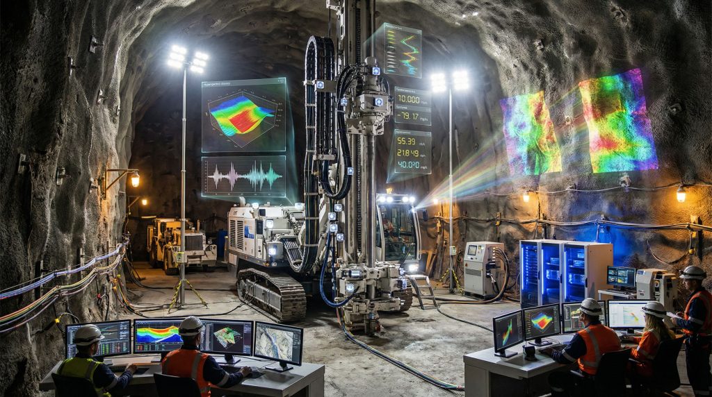
Measure While Drilling (MWD) Systems
MWD technology represents the primary data acquisition component for real-time geological analysis. These systems integrate specialised sensors directly within drilling equipment to capture rock properties during the drilling process rather than requiring separate measurement procedures.
MWD sensor capabilities include:
- Rock hardness measurements through drilling resistance analysis
- Density calculations based on drilling penetration rates
- Porosity estimation through acoustic signal analysis
- Drilling deviation tracking for precision positioning
- Real-time bit performance monitoring for equipment optimisation
Data transmission from drill bit to surface collection systems occurs through established protocols that maintain signal integrity in challenging underground environments. The sensor integration within drilling equipment eliminates the need for separate geological measurement procedures, reducing operational time and improving data consistency.
Seismic Monitoring Networks
Permanent seismometer installations across mine sites provide continuous subsurface monitoring capabilities that complement drilling-based measurements. These networks utilise GPS-synchronised data collection systems for precise event location and travel-time perturbation analysis for detailed subsurface mapping.
Seismic monitoring systems integrate with blasting schedules to enhance geological interpretation through controlled energy sources. The combination of natural seismic events and induced seismic activity from blasting operations provides comprehensive subsurface characterisation that extends beyond immediate drilling areas.
Advanced seismic capabilities encompass:
- Real-time fracture propagation tracking during blasting operations
- Subsurface void detection through acoustic anomaly identification
- Ground stability assessment via continuous deformation monitoring
- Water infiltration zone mapping through velocity perturbation analysis
Cloud-Based Analytics Platforms
Modern geological monitoring systems rely on cloud-based processing infrastructure to handle the computational demands of real-time data analysis. These platforms utilise automated data ingestion protocols that accept multiple sensor types and apply machine learning algorithms for pattern recognition and predictive modelling.
The cloud infrastructure enables scalable processing capacity that adjusts to operational demands without requiring on-site computational resources. However, integration with mine planning software systems ensures that geological insights enhance existing operational workflows rather than creating parallel data-driven mining operations management requirements.
Processing capabilities include:
- Automated signal filtering for raw sensor data quality control
- Algorithm analysis converting measurements into geological properties
- 3D model generation from integrated sensor datasets
- Decision algorithms producing actionable operational recommendations
Data Processing Hierarchy: From Signals to Strategic Decisions
Real-time geological insight in mining operates through a structured data processing framework that transforms raw sensor measurements into actionable operational guidance. This hierarchical approach ensures that geological information supports strategic decision-making at multiple organisational levels.
| Processing Stage | Input Data | Processing Method | Output Products | Operational Application |
|---|---|---|---|---|
| Data Level | Raw sensor signals from drilling equipment | Signal filtering and quality control | Clean measurement streams | Equipment performance monitoring |
| Information Level | Processed sensor values | Algorithm analysis and calibration | Rock properties (hardness, density, porosity) | Geological characterisation |
| Knowledge Level | Combined geological datasets | 3D model generation and integration | Subsurface geological structures | Mine planning optimisation |
| Wisdom Level | Integrated geological models | Decision algorithms and recommendations | Strategic operational guidance | Blast design and safety protocols |
The data level focuses on signal quality control and measurement validation to ensure that subsequent processing stages operate on reliable input data. Raw sensor signals undergo filtering algorithms that remove noise and calibration procedures that maintain measurement accuracy across different geological conditions.
Information level processing converts clean sensor measurements into meaningful geological properties through established algorithms and calibration models. This stage produces quantified rock characteristics including hardness, density, porosity, and structural discontinuities that form the foundation for geological interpretation.
Knowledge level analysis combines individual measurements into comprehensive geological models that represent subsurface structures in three-dimensional space. These models integrate drilling data, seismic measurements, and surface geological mapping to create unified representations of geological conditions across mining areas.
Consequently, wisdom level processing applies decision algorithms to geological models, generating specific operational recommendations for blast design, equipment positioning, and safety protocols. This stage transforms geological understanding into actionable guidance that directly supports operational decision-making.
Cloud processing advantages include:
- Scalable computational resources that adjust to operational demands
- Automated data backup and recovery systems for critical geological information
- Integration APIs that connect with established mine planning software platforms
- Real-time collaboration capabilities for distributed geological teams
The processing pipeline operates continuously during drilling operations, delivering updated geological models and recommendations as new data becomes available. This continuous updating capability ensures that operational decisions reflect the most current geological understanding rather than historical assessments.
Operational Applications Across Mining Disciplines
Real-time geological insight in mining delivers measurable improvements across multiple operational disciplines through targeted applications that address specific operational challenges. These applications demonstrate practical value by optimising existing processes rather than requiring fundamental operational changes.
Blast Design and Fragmentation Optimisation
Dynamic explosive loading based on real-time rock strength measurements represents a fundamental advancement in blast design methodology. Traditional approaches rely on historical geological data and assume uniform rock properties across blast areas, while real-time systems enable explosive loading adjustments for specific geological conditions within individual blast holes.
Blast optimisation capabilities include:
- Variable explosive loading based on measured rock hardness and density
- Timing sequence adjustments for complex geological structures and fracture systems
- Fragmentation prediction through integrated geological and explosive models
- Post-blast analysis capabilities for continuous blast design improvement
Rock strength variations within blast areas significantly impact fragmentation outcomes and downstream processing requirements. Real-time geological data enables blast engineers to adjust explosive loads for specific rock conditions, reducing oversized material production and minimising secondary breaking requirements.
Moreover, timing sequence optimisation addresses geological structure impacts on explosive energy propagation. Real-time fracture detection and structural mapping enable precise timing adjustments that optimise explosive energy utilisation whilst preventing adverse interactions with existing geological discontinuities. For instance, AI in drilling applications further enhance these capabilities through automated parameter adjustments.
Grade Control and Resource Management
Continuous geological characterisation during extraction operations enables real-time ore/waste boundary delineation that improves resource recovery rates and reduces dilution. This capability addresses a critical operational challenge where geological uncertainty leads to conservative extraction strategies that sacrifice resource recovery for operational certainty.
Resource management applications encompass:
- Real-time ore grade estimation during extraction operations
- Waste rock identification through geological property analysis
- Stockpile optimisation based on real-time material characterisation
- Mill feed blending optimisation through mineralogical property assessment
Real-time grade estimation enables immediate material routing decisions that maximise ore recovery whilst minimising waste processing costs. Geological characterisation during extraction provides immediate feedback on material quality, enabling operational adjustments that optimise resource utilisation.
Furthermore, stockpile management benefits from continuous material characterisation that enables strategic blending to meet processing plant requirements. Real-time geological data supports inventory management decisions that optimise mill throughput and recovery rates.
Geotechnical Risk Management and Safety
Proactive hazard identification through continuous geological monitoring addresses critical safety challenges that pose significant risks to personnel and equipment. Real-time systems detect geological conditions that indicate potential hazards before they manifest as operational emergencies.
Safety applications include:
- Slope stability monitoring through continuous deformation and fracture tracking
- Underground support system optimisation based on real-time stress measurements
- Water management through permeability mapping and infiltration zone identification
- Emergency response protocol activation based on automated geological hazard detection
Continuous slope monitoring enables early detection of instability indicators that precede catastrophic failures. Real-time fracture propagation tracking and deformation measurement provide warning capabilities that enable proactive stabilisation measures rather than emergency responses.
In addition, underground operations benefit from real-time stress monitoring that optimises support system design for specific geological conditions. Continuous measurement of ground stress and fracture development enables support system adjustments that maintain operational safety whilst minimising infrastructure costs. Downhole geophysics techniques complement these monitoring capabilities with enhanced subsurface characterisation.
Mining Method Optimisation Through Real-Time Geological Data
Different extraction methods derive distinct operational benefits from real-time geological insight in mining, with applications tailored to specific operational requirements and geological challenges inherent to each mining approach.
Surface Mining Operations
Open-pit and surface mining operations utilise real-time geological data for bench design optimisation, equipment positioning, and slope stability management. The continuous geological characterisation capability enables dynamic operational adjustments that optimise extraction efficiency whilst maintaining safety standards.
Surface mining applications include:
- Bench height optimisation based on real-time rock strength and fracture analysis
- Haul road placement guided by geotechnical condition assessment
- Pit slope angle adjustments using continuous stability monitoring systems
- Dragline and shovel positioning optimisation through geological hazard mapping
Bench design optimisation addresses the challenge of balancing operational efficiency with safety requirements. Real-time rock strength measurements enable dynamic bench height adjustments that maximise extraction efficiency whilst maintaining slope stability within acceptable safety parameters.
Equipment positioning benefits from continuous geological hazard mapping that identifies areas requiring specialised handling or additional safety measures. Real-time geological data enables proactive equipment routing that avoids unstable ground conditions whilst maintaining operational productivity.
Underground Mining Systems
Underground extraction operations face unique geological challenges related to ground support, ventilation, and structural stability that benefit significantly from continuous geological monitoring capabilities.
Underground mining applications encompass:
- Tunnel stability assessment through integrated seismic and stress monitoring
- Cave mining progress tracking via controlled subsidence analysis
- Ventilation system optimisation based on geological structure and permeability mapping
- Support system design optimisation using real-time ground stress measurements
Tunnel advance rates improve through predictive geological characterisation that enables support system pre-positioning and hazard mitigation preparation. Real-time geological data reduces tunnel development delays by enabling proactive responses to challenging geological conditions.
Cave mining operations benefit from continuous subsidence monitoring that tracks cave progression and identifies areas requiring operational adjustments. Real-time geological analysis enables cave drawing optimisation that maximises recovery whilst maintaining operational safety.
Block cave mining specific benefits:
- Cave propagation monitoring through seismic event analysis and location tracking
- Draw bell formation optimisation based on rock mass characterisation
- Hang-up prediction through stress redistribution modelling
- Secondary breaking requirement prediction via fragmentation analysis
The next major ASX story will hit our subscribers first
Implementation Challenges and Strategic Considerations
The adoption of real-time geological insight in mining faces several technical, economic, and organisational challenges that require strategic planning and phased implementation approaches to achieve successful deployment.
Technical Integration Complexity
Legacy equipment compatibility represents a significant implementation barrier, as existing drilling and extraction equipment may lack the sensor integration capabilities required for real-time geological monitoring. Retrofitting established equipment involves technical complexity and potential operational disruptions during installation phases.
Technical challenges include:
- Data standardisation across multiple equipment manufacturers and sensor types
- Network infrastructure requirements for continuous high-bandwidth data transmission
- Processing power demands for real-time analysis of large geological datasets
- Environmental durability requirements for sensors operating in harsh mining conditions
Network infrastructure requirements extend beyond basic connectivity to encompass reliable, high-bandwidth systems capable of continuous data transmission from remote mining locations. The computational demands of real-time geological analysis require either substantial on-site processing capabilities or dependable cloud connectivity for remote processing.
Environmental conditions in mining operations pose significant challenges for sensitive electronic equipment. Sensor systems must maintain accuracy and reliability whilst operating in environments characterised by vibration, dust, temperature extremes, and potential water exposure.
Economic Implementation Considerations
Capital investment requirements for comprehensive real-time geological monitoring systems represent significant financial commitments that require careful evaluation against operational benefits and return timelines.
Economic factors encompass:
- Initial equipment and sensor costs versus projected operational savings
- Implementation timeline impacts on operational productivity during deployment
- Training and personnel development costs for advanced system operation
- Ongoing maintenance and technology upgrade requirements for system sustainability
Return on investment calculations must account for both direct operational savings and indirect benefits such as improved safety performance and enhanced resource recovery. The economic justification varies significantly based on mine scale, geological complexity, and commodity prices.
Training requirements represent ongoing costs that extend beyond initial system deployment. Personnel at multiple organisational levels require skill development to effectively utilise real-time geological information for operational decision-making.
Organisational Change Management
Successful implementation requires organisational adaptation to data-driven decision-making processes and integration of real-time information into established operational workflows.
Change management considerations include:
- Workflow integration planning to incorporate geological data into existing operational procedures
- Decision-making authority adjustments to enable rapid responses to real-time geological information
- Cross-functional collaboration enhancement between geological, engineering, and operational teams
- Performance measurement system modifications to reflect real-time operational capabilities
Cultural adaptation to continuous data availability requires operational teams to shift from periodic assessment approaches to continuous monitoring and rapid response protocols. This transition impacts multiple organisational levels from equipment operators to senior management.
Industry Leadership and Technology Advancement
The development of real-time geological insight in mining involves collaboration between technology providers, mining equipment manufacturers, and software developers to create integrated solutions that address operational requirements across diverse mining environments.
Technology Provider Ecosystem
Major equipment manufacturers are advancing real-time geological insight capabilities to enhance operational efficiency and safety in mining operations. Cloud-based platform developers focus on creating scalable analytical infrastructure that can process geological data streams from multiple sensor types whilst maintaining compatibility with existing mine planning software systems.
Technology provider categories include:
- Sensor manufacturers specialising in MWD systems and geological monitoring equipment
- Software developers creating integrated geological analysis and visualisation platforms
- Cloud infrastructure providers offering mining-specific data processing and storage solutions
- Consulting firms providing implementation expertise and system integration services
Sensor technology advancement focuses on improving measurement accuracy, environmental durability, and integration capabilities with existing drilling equipment. Modern sensors incorporate wireless data transmission capabilities that reduce installation complexity whilst maintaining measurement precision.
Software platform development emphasises user interface design that enables geological professionals to efficiently interpret real-time data streams and generate operational recommendations. Integration APIs ensure compatibility with established mine planning and resource modelling software systems.
Mining Industry Adoption Patterns
Early adopter mining companies demonstrate measurable operational improvements through strategic implementation of real-time geological monitoring systems, creating adoption momentum across the broader industry.
Adoption characteristics include:
- Large-scale mining operations leading implementation due to economic justification capabilities
- Commodity-specific adoption patterns based on geological complexity and operational requirements
- Regional variations in adoption rates influenced by regulatory requirements and technology infrastructure
- Technology transfer from surface to underground operations as systems demonstrate operational value
Surface mining operations typically demonstrate faster adoption rates due to equipment accessibility and less complex installation requirements compared to underground environments. The operational benefits become apparent more quickly in surface operations, supporting economic justification for expanded implementation.
Underground adoption follows successful surface implementations as technology providers adapt systems for challenging underground environments and demonstrate operational value in complex geological conditions. However, geological data management remains crucial for maximising these technological investments.
Future Technological Evolution and Predictions
The trajectory of real-time geological insight in mining points toward increasingly sophisticated integration with artificial intelligence, autonomous equipment systems, and comprehensive mine-wide data ecosystems that enable predictive operational management.
Artificial Intelligence Integration
Machine learning algorithm advancement enables predictive geological modelling that anticipates subsurface conditions based on historical data patterns and real-time measurements. These capabilities extend beyond reactive geological characterisation to proactive operational planning based on geological predictions.
AI integration possibilities include:
- Predictive geological modelling that forecasts subsurface conditions ahead of mining operations
- Automated operational optimisation through AI-driven decision algorithms
- Pattern recognition capabilities that identify geological anomalies requiring specialised handling
- Predictive maintenance systems that utilise geological stress indicators to optimise equipment utilisation
Autonomous equipment coordination with geological data represents a significant advancement opportunity where mining equipment responds automatically to real-time geological conditions without human intervention. This integration enables immediate operational adjustments based on geological measurements.
Internet of Things (IoT) Expansion
Comprehensive sensor network expansion throughout mining operations creates integrated data ecosystems that provide holistic operational awareness beyond geological monitoring to encompass equipment performance, environmental conditions, and safety parameters.
IoT integration encompasses:
- Comprehensive sensor networks covering all aspects of mining operations
- Integrated data platforms that combine geological, operational, and environmental monitoring
- Predictive analytics capabilities that optimise operations across multiple data streams
- Remote operational monitoring that enables expert geological analysis from distant locations
Cross-mine data sharing enables regional geological understanding that benefits multiple operations within geological districts. Shared geological databases enhance predictive capabilities by incorporating data from adjacent mining operations with similar geological conditions.
Blockchain and Data Security
Geological data security and verification represent critical requirements as real-time monitoring systems become integral to operational safety and resource management. Blockchain technology offers potential solutions for data integrity verification and secure sharing protocols.
Future security considerations include:
- Data integrity verification systems that ensure geological measurement accuracy
- Secure data sharing protocols that enable inter-company geological collaboration
- Audit trail capabilities for regulatory compliance and operational documentation
- Intellectual property protection for proprietary geological analysis methodologies
This analysis reflects current industry trends and should not be considered investment advice. Mining operations involve inherent risks, and technological implementations require careful evaluation of specific operational requirements and economic conditions.
Want to Stay Ahead of Mining Technology Developments?
Stay informed about breakthrough mining technologies like real-time geological monitoring through Discovery Alert's comprehensive market intelligence, powered by its proprietary Discovery IQ model. The service delivers instant notifications when ASX-listed companies announce significant technological advances, operational improvements, or mineral discoveries that could drive substantial market movements. Begin your 14-day free trial at Discovery Alert today to position yourself ahead of industry developments and identify actionable investment opportunities in the evolving mining technology sector.