August 10, 2026
The Invisible Voyage: How Global Shipping Is Adapting to War-Zone Trade Lanes
The global energy trade has always depended on geography. Crude oil does not move in straight lines determined by economics alone — it moves through chokepoints, narrow straits, and politically loaded waterways where the physical and the geopolitical collide. Saudi oil tankers disguising destinations to avoid Houthi attacks represent one of the most technically sophisticated adaptations to maritime threat that the commercial shipping industry has ever produced — and it is happening largely out of public view.
When big ASX news breaks, our subscribers know first
Why the Red Sea Has Become the World's Most Contested Energy Corridor
The Bab el-Mandeb Strait, a narrow passage connecting the Red Sea to the Gulf of Aden, is one of those geographical features that carries weight far beyond its modest dimensions. At its narrowest point, the strait spans approximately 29 kilometres — a chokepoint through which an estimated 12 to 15 percent of global seaborne trade transits annually. For the energy sector specifically, this corridor functions as the primary westward artery for Gulf crude producers targeting European and Mediterranean buyers.
Saudi Arabia's Yanbu port, positioned on the Red Sea coast, serves as Saudi Aramco's main export terminal for westward-bound crude shipments. Its geographical position has historically been a logistical advantage — close to the Suez Canal and well-positioned for European delivery windows. That same geography has now become a liability, fundamentally altering crude oil logistics across the region.
In late July 2026, Yemen's Houthi movement, backed by Iran, formally declared a blockade targeting vessels with commercial ties to Saudi Arabia and followed through with attacks on Saudi-linked tankers operating in the Red Sea. The group subsequently announced plans to extend strike operations into the northern Red Sea, a development that compressed what had previously been a relatively safer buffer zone for tankers loading at Yanbu.
The Houthi maritime campaign represents one of the most sustained non-state actor threats to a major global energy shipping lane in modern history, raising questions about the long-term viability of the Red Sea corridor as a reliable export pathway for Gulf producers.
What Saudi Oil Tankers Are Actually Doing to Avoid Detection
The response from shipping operators has been layered, technically inventive, and, until recently, largely invisible to standard tracking infrastructure. The central tactic involves the exploitation of a fundamental weakness in the Automatic Identification System, the vessel tracking technology mandated under international maritime law.
AIS continuously broadcasts a vessel's identity, position, speed, and — critically — its declared destination. That destination field is self-reported by the vessel's crew. There is no automated verification mechanism that cross-references a declared destination against a vessel's actual route or cargo arrangements. Shipping operators have begun entering Egyptian ports or the Suez Canal as their stated destinations, even when a tanker is physically loading crude at Yanbu terminal.
This creates a deliberate and difficult-to-detect informational gap. From the perspective of anyone monitoring AIS feeds — including, potentially, Houthi targeting systems — the vessel appears to be a commercially neutral ship bound for Egyptian infrastructure, not a Saudi-linked crude carrier. Furthermore, these oil market disruptions have forced operators to innovate at a pace rarely seen in peacetime commercial shipping.
The Three-Layer Concealment Architecture
Saudi oil tankers disguising destinations to avoid Houthi attacks are not relying on a single tactic. The operational playbook currently in use combines multiple layers of concealment:
| Tactic | Operational Mechanism | Primary Risk Reduction |
|---|---|---|
| Destination Spoofing | Listing Ain Sukhna or Suez Canal as destination while loading at Yanbu | Avoids Saudi-vessel profiling by Houthi monitoring systems |
| AIS Blackout (Sailing Dark) | Disabling tracking transponders during Red Sea transit | Eliminates real-time positional data available to hostile actors |
| Cape of Good Hope Diversion | Bypassing the Red Sea entirely via Africa's southern tip | Removes vessel from the threat zone at significant cost |
| Egyptian Port Rerouting | Physical rerouting of cargo flows through Ain Sukhna and Sidi Kerir | Reduces Yanbu-direct exposure and legitimises Egyptian destination listing |
Specific vessels have been identified using these methods. The Sea Majesty approached the Suez Canal with draft readings — the depth a vessel sits in the water, which directly reflects cargo load — consistent with a full crude cargo, despite having transited the Red Sea without broadcasting its position.
Cargo intelligence platforms Vortexa and Kpler used satellite imagery and vessel data analysis to identify Yanbu as the probable loading origin, even though the vessel had listed Egypt's Ain Sukhna as its destination throughout. A second tanker, the Maran Thetis, followed a near-identical pattern, idling in the Gulf of Aden before reappearing on tracking systems fully laden. Additional vessels including the Front Empire and DHT Gazelle have been documented following similar operational patterns.
How Intelligence Platforms Are Reconstructing Hidden Voyages
The fact that these concealment strategies are being documented at all speaks to the significant sophistication of modern maritime intelligence infrastructure. Standard AIS monitoring would reveal nothing unusual about a tanker listing Ain Sukhna as its destination. However, what has changed is the analytical toolkit available to cargo tracking firms.
The reconstruction of a disguised Saudi crude voyage typically follows this sequence:
- A tanker enters the Red Sea and disables its AIS transponder, disappearing from standard tracking feeds.
- Satellite imagery, including synthetic aperture radar capable of detecting vessel presence regardless of transponder status, captures the vessel in proximity to Yanbu port.
- The tanker reappears on tracking systems near the Suez Canal approaches, fully laden.
- Draft analysis — measuring how deeply the vessel now sits in the water compared to its last known state — confirms a full cargo has been taken on during the blackout period.
- Port proximity modelling and historical call pattern analysis identify Yanbu as the statistically dominant loading origin.
- The Saudi port call is never reflected in official AIS records, but the shadow voyage has been reconstructed with high confidence.
This methodology creates a verifiable parallel record of vessel movements that circumvents AIS manipulation. However, it requires substantial data infrastructure, operates with some latency, and is not universally available to port state control authorities or insurance underwriters in real time.
The broader implication here is significant. The International Maritime Organization has previously flagged AIS manipulation as a compliance concern, but enforcement capacity in conflict-adjacent waters remains practically limited. Consequently, the gap between what regulators can mandate and what they can verify in active threat environments is, at present, considerable. Bloomberg Business has reported on tankers entering the Red Sea to load Saudi oil increasingly signalling the Suez Canal as their destination — a pattern entirely consistent with the concealment architecture described above.
Egypt's Infrastructure: The Linchpin of Saudi Arabia's Rerouting Strategy
Egypt's role in this evolving logistics architecture is not incidental. Ain Sukhna, located on Egypt's Gulf of Suez coastline, operates extensive crude storage facilities and connects directly into pipeline networks feeding the Suez Canal system. More significantly, Ain Sukhna serves as the Red Sea terminus of the Sumed Pipeline — the Suez-Mediterranean Pipeline — which runs approximately 320 kilometres overland to Sidi Kerir on Egypt's Mediterranean coast.
This infrastructure configuration gives Saudi Arabia a genuinely viable land-based bypass for the most dangerous section of the Red Sea corridor. Rather than loading at Yanbu and transiting through the Bab el-Mandeb Strait, crude can be physically redirected northward through Egyptian pipeline infrastructure and loaded onto Mediterranean-bound tankers at Sidi Kerir, well clear of Houthi operational reach.
Saudi Aramco has progressively shifted a portion of Asia-bound crude flows toward this Mediterranean collection point, offering buyers the option to collect cargoes at Sidi Kerir rather than accepting Red Sea delivery. This arrangement simultaneously serves the destination-masking strategy and provides a genuine logistical alternative that reduces maritime exposure.
Comparing Saudi Arabia's Export Route Options in 2026
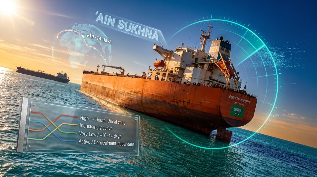
| Route | Transit Risk | Added Time | Cost Premium | Current Utilisation |
|---|---|---|---|---|
| Yanbu to Bab el-Mandeb to Suez Canal | High | Baseline | Baseline | Restricted / Disguised |
| Yanbu to Sumed Pipeline to Sidi Kerir | Low | Moderate | Moderate | Increasingly active |
| Yanbu to Cape of Good Hope | Very Low | +10 to 14 days | High | Selective use |
| AIS-masked Ain Sukhna listing | Medium | Minimal | Low | Widely active |
The Market Consequences: Freight, Insurance, and Supply Chain Economics
The financial consequences of this disruption extend well beyond Saudi Arabia's logistics budget. When tankers reroute via the Cape of Good Hope, each vessel spends an additional 10 to 14 days at sea per voyage. Across a fleet of diverted tankers, this effectively removes meaningful vessel capacity from active spot markets for extended periods, tightening overall tanker supply and placing upward pressure on freight rates across multiple trade lanes. These oil price movements are reverberating throughout global energy markets.
War risk insurance premiums for Red Sea and Gulf of Aden transits have risen substantially, adding a cost layer to every cargo that passes through the corridor. These premiums are ultimately passed through the supply chain, contributing to elevated delivered crude prices for buyers in importing regions.
Several broader market dynamics are worth tracking:
- Sustained AIS manipulation normalises a practice that creates opacity for cargo insurers, who price risk partly on verified vessel movement data.
- Freight rate volatility in the Suezmax and VLCC segments is amplified when a significant proportion of vessels on key trade lanes are effectively unavailable for standard market transactions.
- Egyptian port infrastructure is experiencing increased throughput pressure as a greater volume of Saudi crude flows redirect through Ain Sukhna and Sidi Kerir.
- The Sumed Pipeline's strategic importance has increased materially, making its operational continuity a critical variable in Saudi export resilience.
Disclaimer: The freight market and insurance premium dynamics described here reflect conditions as documented through mid-2026. Market conditions in active conflict-adjacent environments can shift rapidly, and forward projections carry inherent uncertainty.
The next major ASX story will hit our subscribers first
The Vulnerability Nobody Is Discussing
The current Saudi rerouting strategy rests on a single critical assumption: that Egyptian infrastructure remains outside the Houthi targeting framework. Ain Sukhna and Sidi Kerir have functioned as a de facto safe zone partly because of Egypt's distinct political positioning within the regional conflict architecture and partly because the Houthis have not yet extended declared strike operations to cover the northern Red Sea with operational consistency.
That assumption is fragile. The Houthis have explicitly stated their intention to expand maritime operations northward. Egypt depends heavily on Suez Canal transit revenues for foreign exchange earnings, creating a political incentive for Cairo to maintain a degree of neutrality. However, political incentives do not determine the operational decisions of a non-state military actor whose doctrine has already expanded repeatedly beyond its initially declared parameters.
If Houthi forces target vessels approaching Ain Sukhna or operating in the northern Red Sea approaches to the Suez Canal, the protective logic of the entire destination-masking strategy collapses. At that point, the Cape of Good Hope becomes not a selective contingency but the primary viable route for Saudi westward crude exports — with all the associated cost, time, and market-tightening consequences that implies. Anadolu Agency has documented Houthi claims that eight Saudi oil tankers have already been diverted via the Cape of Good Hope, suggesting the worst-case scenario is already partially materialising.
Beyond Saudi Arabia: An Industry-Wide Recalibration
It is important to recognise that saudi oil tankers disguising destinations to avoid Houthi attacks are not operating in isolation. The broader commercial shipping industry has undergone a systemic recalibration of Red Sea risk protocols that extends across vessel classes and cargo types. In addition, the geopolitical trade tensions driving these disruptions show little sign of resolution in the near term.
Dry bulk carriers, container vessels, and product tankers have all been documented employing destination masking or AIS blackout tactics across the Red Sea corridor. This normalisation of concealment practices creates compounding transparency challenges:
- Port state control authorities cannot efficiently enforce AIS compliance in active conflict zones.
- Cargo insurers are pricing risk on the basis of incomplete or deliberately obscured movement data.
- The aggregated opacity across hundreds of vessels makes real-time supply chain visibility increasingly difficult for end-buyers and energy market analysts.
- Regulatory frameworks designed for peacetime commercial shipping are structurally inadequate for the enforcement demands of conflict-adjacent maritime operations.
The precedent being set extends beyond the current conflict. Every month that AIS manipulation operates as an accepted industry workaround in the Red Sea reinforces its legitimacy as a tactic in future maritime threat environments. Furthermore, the crude oil market dynamics underpinning these decisions will continue to evolve as conflict conditions either escalate or resolve. The IMO and port state control bodies face a growing challenge in reasserting the integrity of the international vessel tracking system once conflict conditions ease.
Frequently Asked Questions
Why are Saudi oil tankers listing Egypt as their destination instead of Saudi ports?
Tanker operators are using the self-reported nature of AIS destination data to broadcast Egyptian ports as their declared endpoints rather than Saudi terminals. Egyptian ports like Ain Sukhna represent operationally plausible waypoints in the Saudi export chain, making the deception difficult to identify from AIS data alone while reducing the likelihood of being profiled as a Saudi-linked vessel by groups monitoring maritime traffic.
What does sailing dark mean and why are tankers doing it?
Sailing dark refers to disabling a vessel's AIS transponder so that it does not appear on standard tracking feeds. Tankers adopt this approach during the most exposed portions of their Red Sea transit to deny real-time positional information to hostile actors who might use it to plan strike operations.
What is the Sumed Pipeline and why does it matter?
The Sumed Pipeline runs approximately 320 kilometres from Ain Sukhna on Egypt's Red Sea coast to Sidi Kerir on the Mediterranean. It provides a land-based crude transit alternative that completely bypasses the Suez Canal and the Bab el-Mandeb Strait, enabling Saudi Arabia to deliver crude to Mediterranean collection points without exposing tankers to Houthi-controlled threat zones.
How do tracking firms identify vessels that have gone dark?
Intelligence platforms combine satellite imagery, synthetic aperture radar data, vessel draft analysis, and port call probability modelling to reconstruct the movements of vessels that have disabled their transponders. By correlating draft changes, last-known positions, and satellite-confirmed proximity to specific terminals, analysts can identify likely loading origins with considerable confidence even when official AIS records show no Saudi port call.
Could Houthi attacks reach Egyptian ports or the northern Red Sea?
The Houthi group has stated its intent to expand maritime operations into the northern Red Sea. While Egyptian port infrastructure has not been targeted in active strike operations to date, any northward extension of Houthi targeting doctrine would fundamentally alter the risk profile of the current rerouting strategy and force a far greater reliance on Cape of Good Hope diversions.
Want to Stay Ahead of the Commodity Market Disruptions Reshaping Global Trade?
Discovery Alert's proprietary Discovery IQ model scans ASX announcements in real time, instantly identifying significant mineral discoveries across more than 30 commodities — transforming complex market signals into clear, actionable investment opportunities for both short-term traders and long-term investors. Explore how historic mineral discoveries have generated substantial returns and begin your 14-day free trial today to position yourself ahead of the next major market move.